Skip to content
THELAZYNICK

Republic of Ireland · 20 researched places

Wicklow: things to do & places to visit

Wicklow rewards a little restraint. Glendalough, a mountain walk, a garden and three viewpoints might fit on a list, but that does not make them a good day together. Choose the valley you want to spend time in, then let the weather and daylight decide how much walking belongs around it.

Glendalough is the strongest starting point for monastic history and lake walks. Elsewhere, house gardens, coastal hills and reservoir paths offer a different pace. The quieter-looking option is not automatically an easier walk: gradients, soft ground, closures and the return journey still matter. These guides separate a viewpoint from a hike, a house ticket from its grounds, and a regional park from the actual trail entrance. That distinction is often what turns an ambitious itinerary into a relaxed one.

Numbered guide to the places below, with a map for each stop. Numbers help you browse; they are not a visitor ranking. Dated closures are shown on the cards and take priority over sightseeing suggestions.

20 places

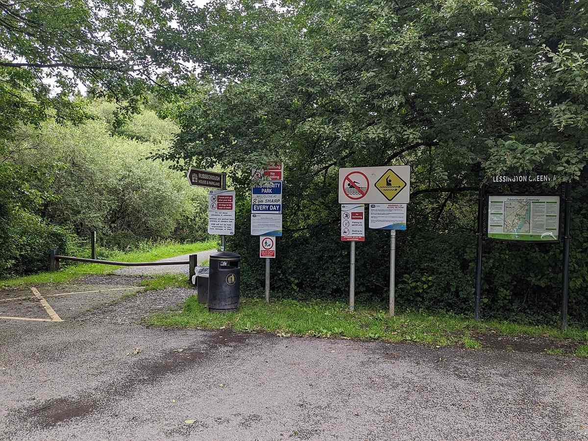
The signed Blessington Greenway entrance at Russellstown Bay
The Blessington Greenway entrance at Russellstown Bay beside Russborough, July 2023. Historical signs are not current access guidance. Resized from the credited source; conditions and access may have changed. 2ManyCats4Me · CC BY-SA 4.0

nature

1. Blessington Lakes Greenway Trailhead

A linear lakeside and woodland walk towards Russborough, with road sections and crossings to include in the plan.

Worth your time? Choose it for a lower-level outdoor outing and a view of the Blessington Lakes landscape. Decide on an out-and-back or organise the return from the far end before setting out. A shorter lakeside section can be the whole visit.

Show location map

Reference point; check the guide for the correct visitor entrance. Map © OpenStreetMap contributors.

View location map ↗ · Reference pin; confirm the visitor entrance.

Read the guide →

The summit cross on Bray Head in black and white
Bray Head cross, February 2022. Resized from the credited source; conditions and access may have changed. Nowriver · CC BY-SA 4.0

nature

2. Bray Head Cross Loop

A hill walk from Bray’s seafront to the cross, with coastal views and a distinct route from the closed through Cliff Walk.

Worth your time? Choose it for a hill outing when your group is comfortable on steep, uneven ground. Keep the promenade as a shorter fallback. The loop is a walking objective in its own right, not a way to bypass barriers on the Bray–Greystones route.

Show location map

Reference point; check the guide for the correct visitor entrance. Map © OpenStreetMap contributors.

View location map ↗ · Reference pin; confirm the visitor entrance.

Read the guide →
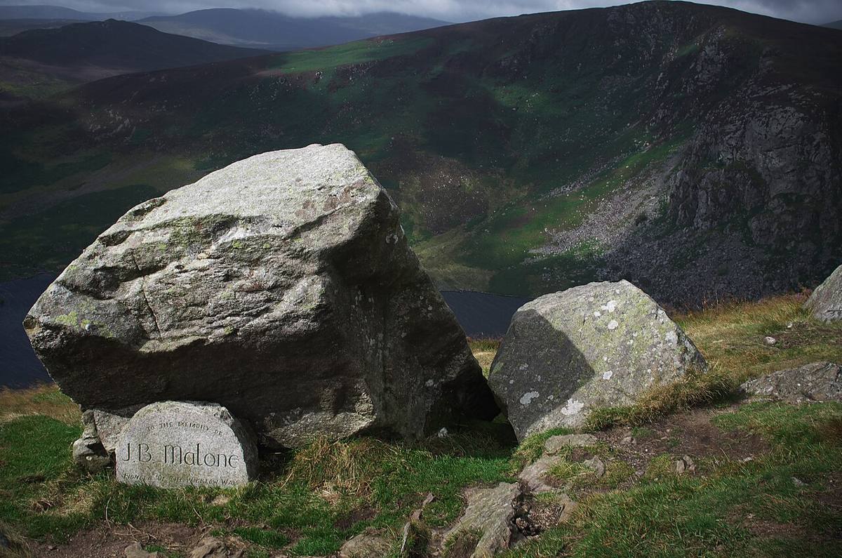
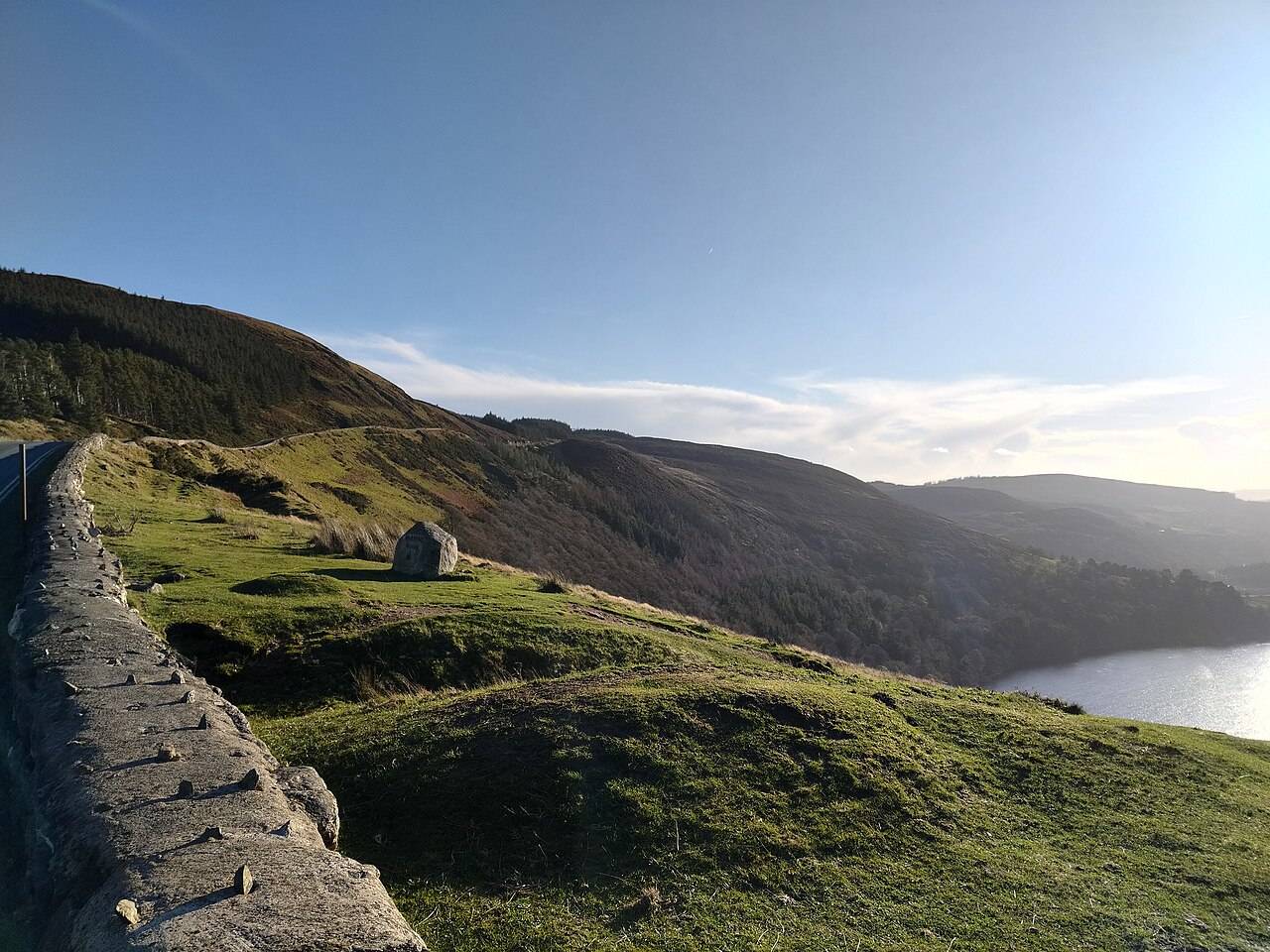
The J.B. Malone memorial stone above Lough Tay
The J.B. Malone memorial stone, August 2014. Resized from the credited source; conditions and access may have changed. Rob Hurson · CC BY-SA 2.0

nature

3. Djouce via the Wicklow Way (J.B. Malone)

An exposed Wicklow mountain outing with a Wicklow Way approach and a summit that needs its own navigation plan.

Worth your time? Choose Djouce for a committed walking day with people comfortable on open mountain ground. Give it priority over adding several nearby viewpoint pins. A boardwalk on part of the approach does not make the entire summit route straightforward.

Show location map

Reference point; check the guide for the correct visitor entrance. Map © OpenStreetMap contributors.

View location map ↗ · Reference pin; confirm the visitor entrance.

Read the guide →
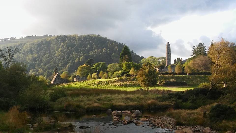
St Kevin’s Church and the round tower at Glendalough
St Kevin’s Church and the round tower, photographed in October 2016. Resized from the credited source. Gwendal Le Mouël (GwenofGwened) · CC BY-SA 4.0

attraction

4. Glendalough Monastic City

The Monastic City brings the round tower, churches and graveyard into one concentrated heritage visit. Slow down at ground level: the relationship between the buildings is more interesting than collecting the same tower photograph from every angle.

Worth your time? Choose this for a first Glendalough visit or a history-led afternoon. It is a meaningful destination even when a mountain walk does not suit the weather or your group. Keep the visit respectful: this is a historic religious landscape, not a climbing area or a backdrop that belongs exclusively to photographers.

Show location map

Reference point; check the guide for the correct visitor entrance. Map © OpenStreetMap contributors.

View location map ↗ · Reference pin; confirm the visitor entrance.

Read the guide →
St Kevin’s Church and the round tower at Glendalough
Monastic buildings near the visitor centre; its entrance is separate. Resized from the credited source. Gwendal Le Mouël (GwenofGwened) · CC BY-SA 4.0

attraction

5. Glendalough Visitor Centre

Start here if you want context for the monuments, an indoor introduction or advice before choosing a walk. The staffed visitor centre is a different visit from the freely accessible ruins and lakes.

Worth your time? The centre helps make a scattered site understandable: interpretation gives the valley a sequence and makes it easier to decide which buildings and landscape features deserve your time. It suits a history-led visit, especially when the group wants something more focused than photographing the tower.

Show location map

Reference point; check the guide for the correct visitor entrance. Map © OpenStreetMap contributors.

View location map ↗ · Reference pin; confirm the visitor entrance.

Read the guide →
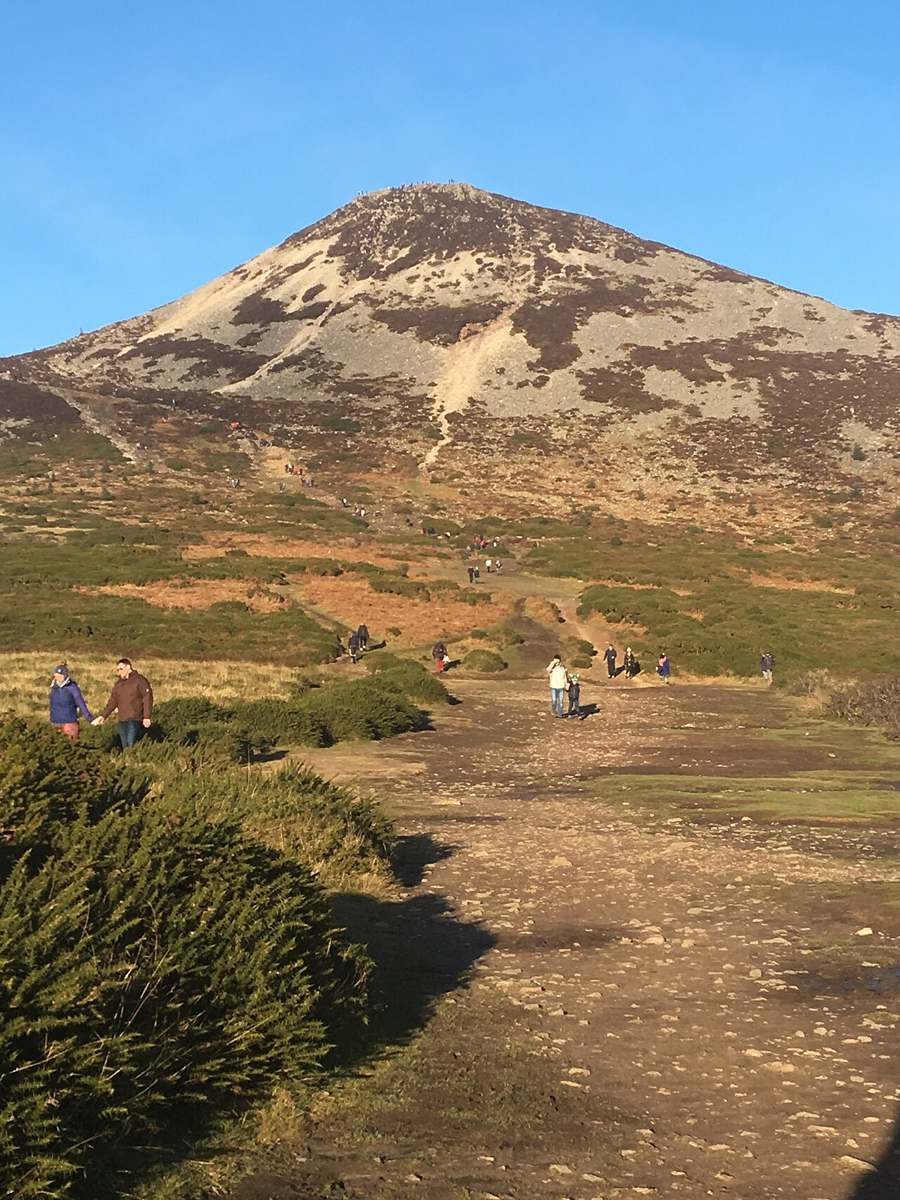
Great Sugar Loaf seen from the Red Lane approach
Great Sugar Loaf from the southern Red Lane approach, January 2018. Resized from the credited source; conditions and access may have changed. 1ivia · CC BY 2.0

nature

6. Great Sugar Loaf Summit

A distinctive rocky summit above Kilmacanogue, requiring a hill-walking plan rather than a quick viewpoint stop.

Worth your time? Choose it when the climb itself is the activity you want. Allow for the descent, weather and the journey to the start, and keep a lower-level alternative for anyone who would rather avoid the rocky finish. A short-looking route can still demand care.

Show location map

Reference point; check the guide for the correct visitor entrance. Map © OpenStreetMap contributors.

View location map ↗ · Reference pin; confirm the visitor entrance.

Read the guide →
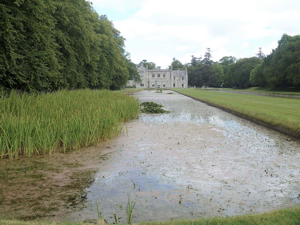
Killruddery House beyond its long formal pond
Killruddery House and a formal pond, August 2017. Resized from the credited source; conditions and access may have changed. Michael Dibb · CC BY-SA 2.0

heritage

7. Killruddery House & Gardens

Formal gardens, long ponds and a working estate on Bray’s edge, with house tours booked separately.

Worth your time? Choose Killruddery for a garden-led day with a possible house tour. Decide whether you want outdoor time, an interior visit or food in the yard, then check those parts individually. A shorter garden visit can work well without a crowded sightseeing schedule.

Show location map

Reference point; check the guide for the correct visitor entrance. Map © OpenStreetMap contributors.

View location map ↗ · Reference pin; confirm the visitor entrance.

Read the guide →
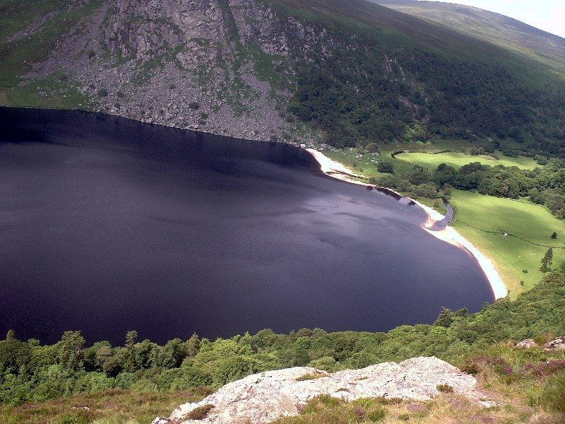
Dark water and a pale shore at Lough Tay seen from above
Lough Tay viewed from above, August 2005. The lake and shore are private; this photograph grants no access. Resized from the credited source; conditions and access may have changed. Matt099 · CC BY-SA 3.0

nature

8. Lough Tay (Guinness Lake) Viewpoint

A mountain-road view over dark water, a pale shore and the Luggala landscape, with the lake itself on private land.

Worth your time? Choose it for a brief landscape pause when visibility and a suitable stopping place make it worthwhile. Keep it flexible within a Wicklow day rather than making a single weather-dependent photograph the reason for the whole journey.

Show location map

Reference point; check the guide for the correct visitor entrance. Map © OpenStreetMap contributors.

View location map ↗ · Reference pin; confirm the visitor entrance.

Read the guide →
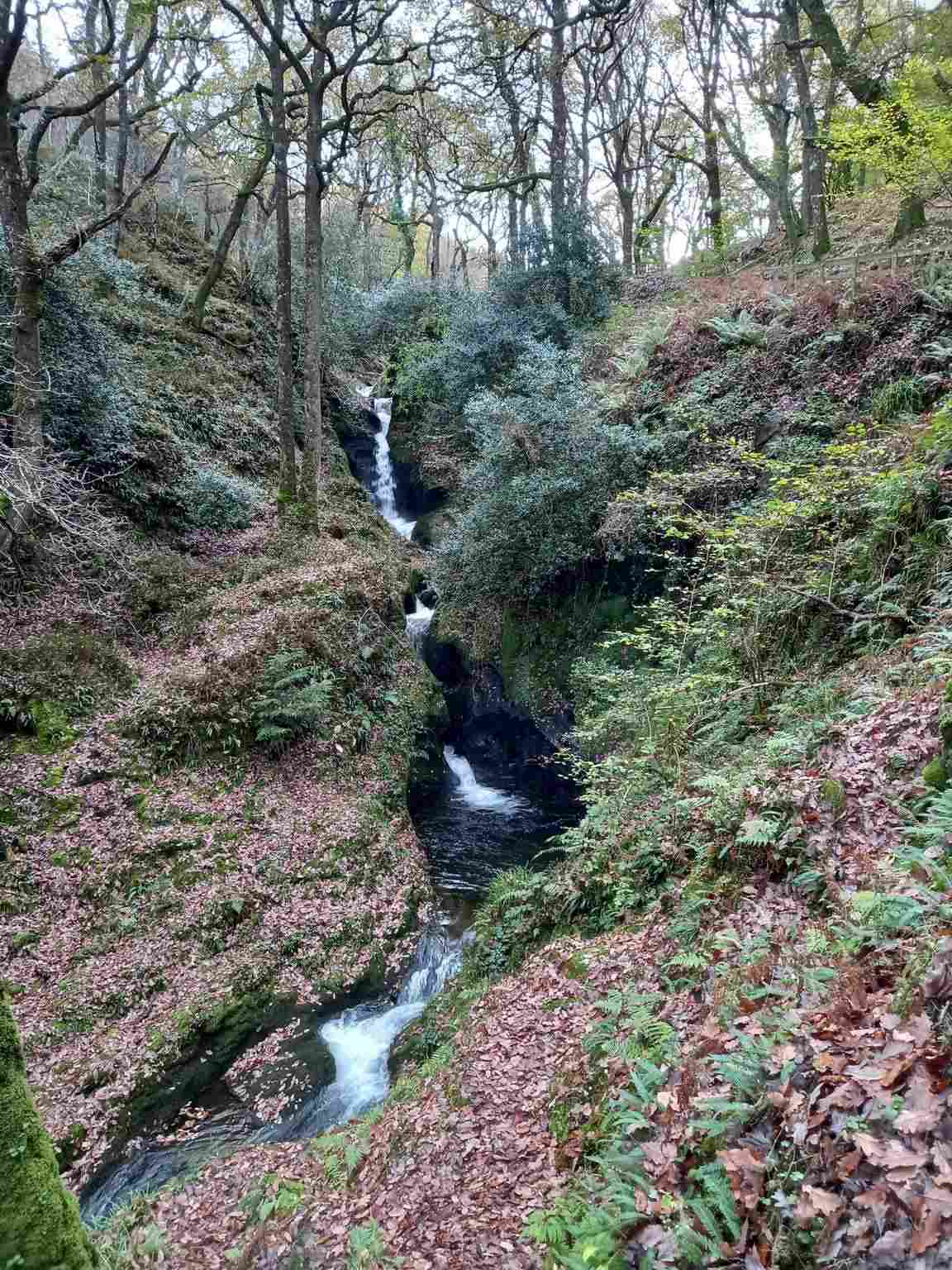
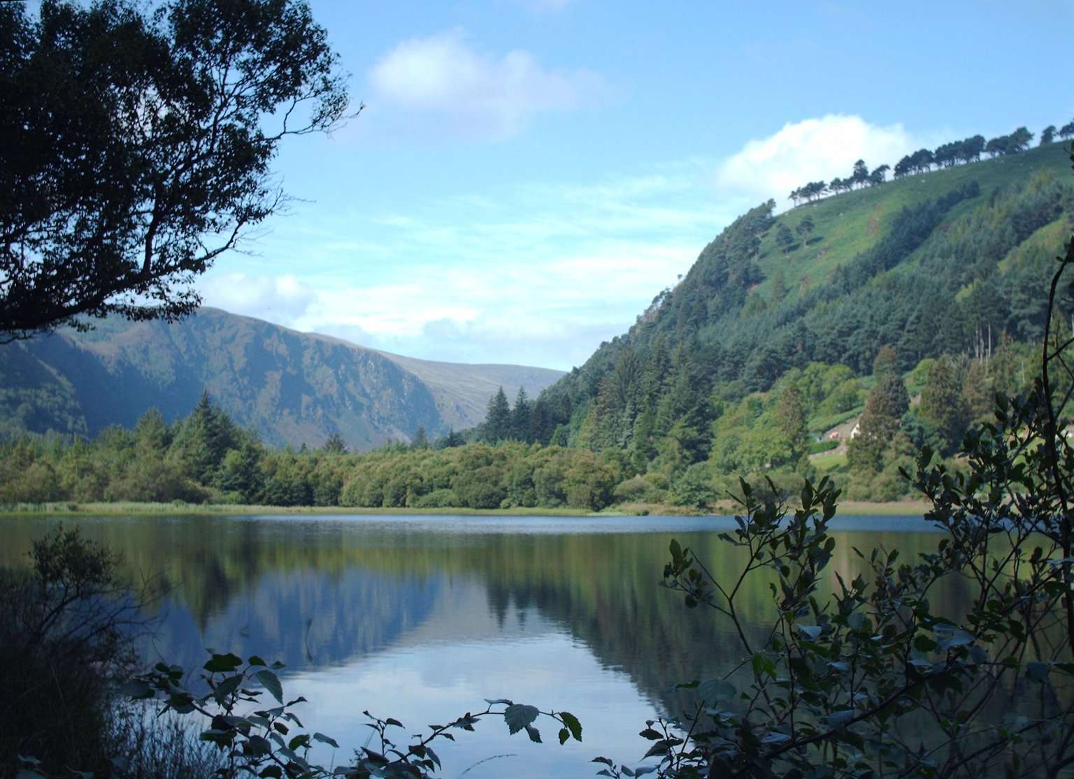
Lower Lake in the Glendalough valley

attraction

9. Lower Lake and Green Road

The Lower Lake and Green Road give you a woodland-and-water alternative to the high trails. Choose a short out-and-back or a signed circuit that fits your group, with room to pause rather than treating the lake as a transfer corridor.

Worth your time? This is a useful way to combine monastic history and landscape in one day. Its appeal is flexibility: you can spend longer noticing the valley or shorten the outing before it becomes a race for transport. A lower-level route still needs suitable footwear and a current access check.

Show location map

Reference point; check the guide for the correct visitor entrance. Map © OpenStreetMap contributors.

View location map ↗ · Reference pin; confirm the visitor entrance.

Read the guide →
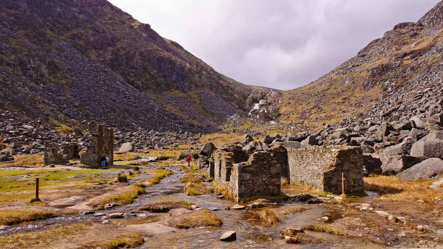
Ruined buildings at Glendalough’s Miners’ Village
The Miners’ Village, photographed in 2010; follow current access notices. Resized from the credited source. Joe King · CC BY-SA 3.0

attraction

10. Miners’ Road out-and-back

The Miners’ Road gives the Upper Lake a different story: a walk towards the remains of working lives at the head of the valley. Follow the signed lower route and return the same way rather than drifting into a mountain circuit.

Worth your time? Choose this if you want scenery with an identifiable historical destination. The ruined buildings provide a reason to pause at the end of the outward section. Leave enough time to look around from permitted ground and to enjoy the return rather than treating the ruins as the finish line.

Show location map

Reference point; check the guide for the correct visitor entrance. Map © OpenStreetMap contributors.

View location map ↗ · Reference pin; confirm the visitor entrance.

Read the guide →
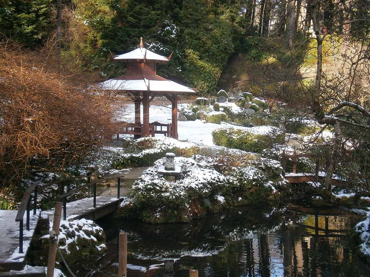
Poulanass Waterfall among woodland at Glendalough
Poulanass Waterfall, photographed in 2025; a photograph does not establish current trail access. Resized from the credited source. Barrowbob · CC BY-SA 4.0

attraction

11. Poulanass Waterfall woodland walk

Poulanass offers moving water and woodland close to the Upper Lake visitor area. It is a shorter walking choice, but the climb and wet footing make it different from a flat lakeside pause.

Worth your time? Use the signed pink route if its current condition and grade suit the group. It can be a main short walk or an optional addition after a lake visit. It should not become an automatic final stop when everyone has already used their energy or return-time margin.

Show location map

Reference point; check the guide for the correct visitor entrance. Map © OpenStreetMap contributors.

View location map ↗ · Reference pin; confirm the visitor entrance.

Read the guide →
A Japanese-style garden corner at Powerscourt with snow
A garden corner at Powerscourt, February 2013. Resized from the credited source; conditions and access may have changed. Frabjousone · CC BY-SA 4.0

heritage

12. Powerscourt House & Gardens

Italian terraces, a Japanese garden and wooded corners make Powerscourt a garden visit with a mountain backdrop.

Worth your time? Choose it for designed landscapes and an unhurried outdoor visit. Pick a few garden areas to explore properly rather than using every feature as a checkpoint. Leave a separate slot for food if you want to linger on the terrace.

Show location map

Reference point; check the guide for the correct visitor entrance. Map © OpenStreetMap contributors.

View location map ↗ · Reference pin; confirm the visitor entrance.

Read the guide →
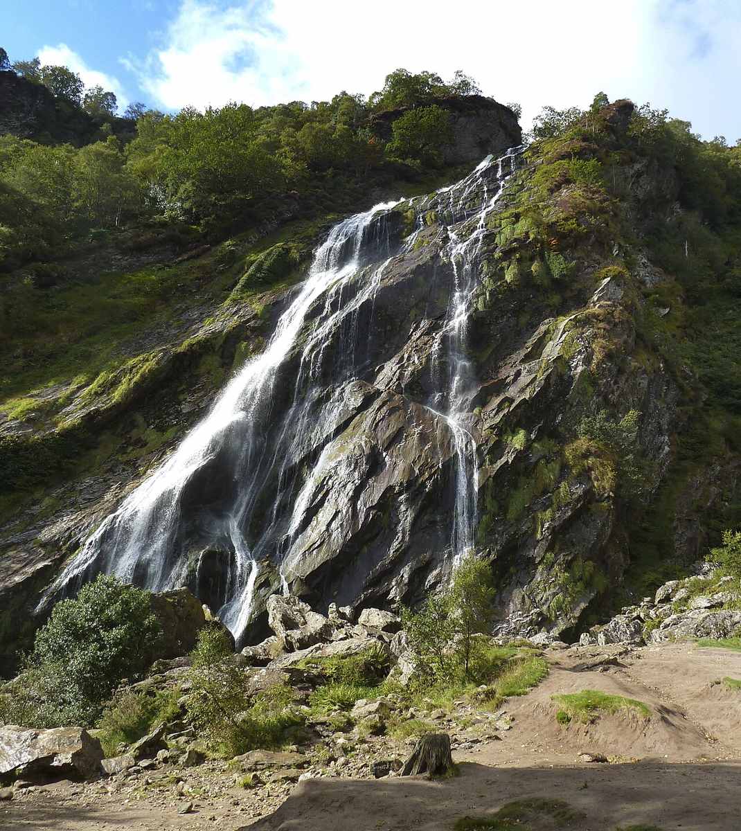
Powerscourt Waterfall cascading over a rocky face
Powerscourt Waterfall, September 2011. Resized from the credited source; conditions and access may have changed. Draceane · CC BY-SA 3.0

nature

13. Powerscourt Waterfall

A wooded waterfall outing with picnic space, separate from the formal gardens at Powerscourt.

Worth your time? Choose this when you want one clear landscape focus and time outside. It fits a slower outing better than a brief detour between several mountain stops. Make the waterfall the main visit if your group would rather picnic than tour formal gardens.

Show location map

Reference point; check the guide for the correct visitor entrance. Map © OpenStreetMap contributors.

View location map ↗ · Reference pin; confirm the visitor entrance.

Read the guide →
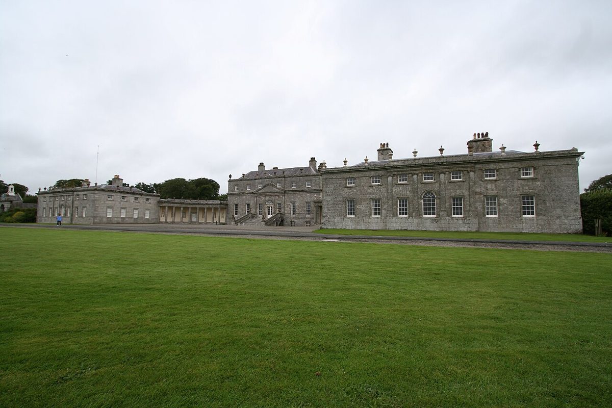
The Palladian facade of Russborough House across the lawn
Russborough House facade, August 2007. Resized from the credited source; conditions and access may have changed. Ramón · CC BY-SA 2.0

heritage

14. Russborough House & Parklands

A Palladian house and parkland outing near Blessington, with separate choices for interior tours and outdoor activities.

Worth your time? Choose the house when art and interiors are the priority, or the park ticket for a more outdoor, family-led day. Decide on the main experience first; combining every estate activity can leave too little time to enjoy the one you came for.

Show location map

Reference point; check the guide for the correct visitor entrance. Map © OpenStreetMap contributors.

View location map ↗ · Reference pin; confirm the visitor entrance.

Read the guide →
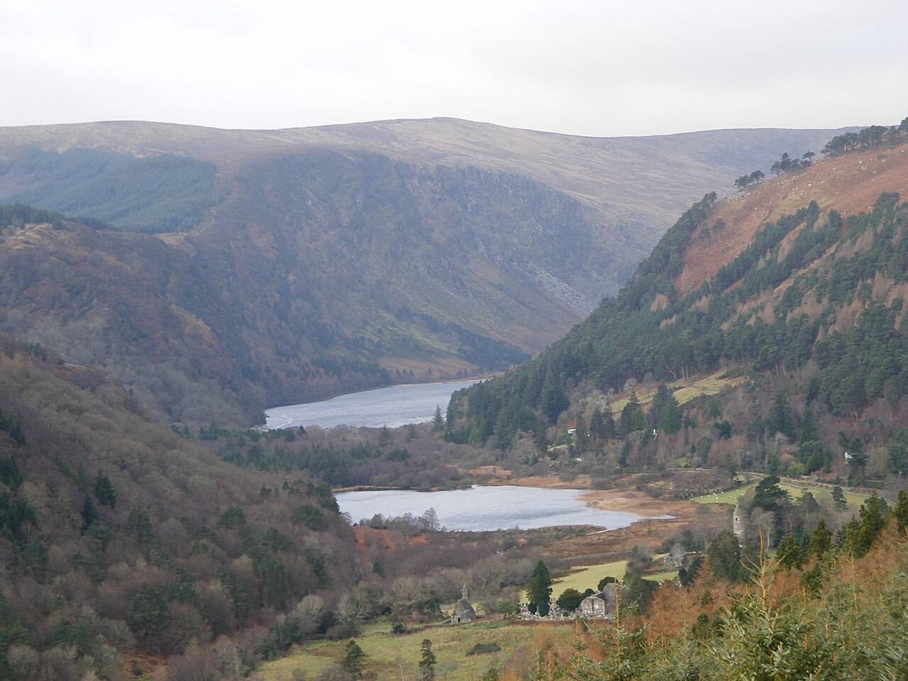
Wide view of the Glendalough valley and its two lakes

attraction

15. Spinc Short Route from the Upper Lake

The blue Spinc Short Route is a hillwalk with a strong view of the Upper Lake. “Short” distinguishes it from longer Spinc routes; it does not turn the outing into an easy lakeside stroll.

Worth your time? Choose it as the main walking objective of the day, with suitable preparation and a route-specific weather decision. If the conditions or the group do not fit, use a lower-valley plan. You do not need to combine a successful hike with every other Glendalough attraction.

Show location map

Reference point; check the guide for the correct visitor entrance. Map © OpenStreetMap contributors.

View location map ↗ · Reference pin; confirm the visitor entrance.

Read the guide →
Wide view of the Glendalough valley and its two lakes

attraction

16. Upper Lake viewpoint

The Upper Lake is a place to stop and look, not merely the starting gate for a hike. The long view into the valley gives a first visit a strong landscape focus without requiring a climb onto the Spinc.

Worth your time? Choose a permitted shoreline viewpoint and let the weather shape the length of the stop. A short lake visit can be the right finish after the monastery. If you want the Miners’ Road as well, treat that as another walking commitment with its own return allowance.

Show location map

Reference point; check the guide for the correct visitor entrance. Map © OpenStreetMap contributors.

View location map ↗ · Reference pin; confirm the visitor entrance.

Read the guide →

Lough Tay and the surrounding Wicklow Mountains

nature

17. Wicklow Mountains National Park

Wicklow Mountains National Park is a broad upland landscape with many possible entrances and walks. A regional pin is an orientation aid, not a trailhead.

Worth your time? Choose one named route or valley for the day. You will get more from a well-matched walk than from trying to join distant mountain viewpoints into an improvised circuit.

Show location map

Reference point; check the guide for the correct visitor entrance. Map © OpenStreetMap contributors.

View location map ↗ · Reference pin; confirm the visitor entrance.

Read the guide →
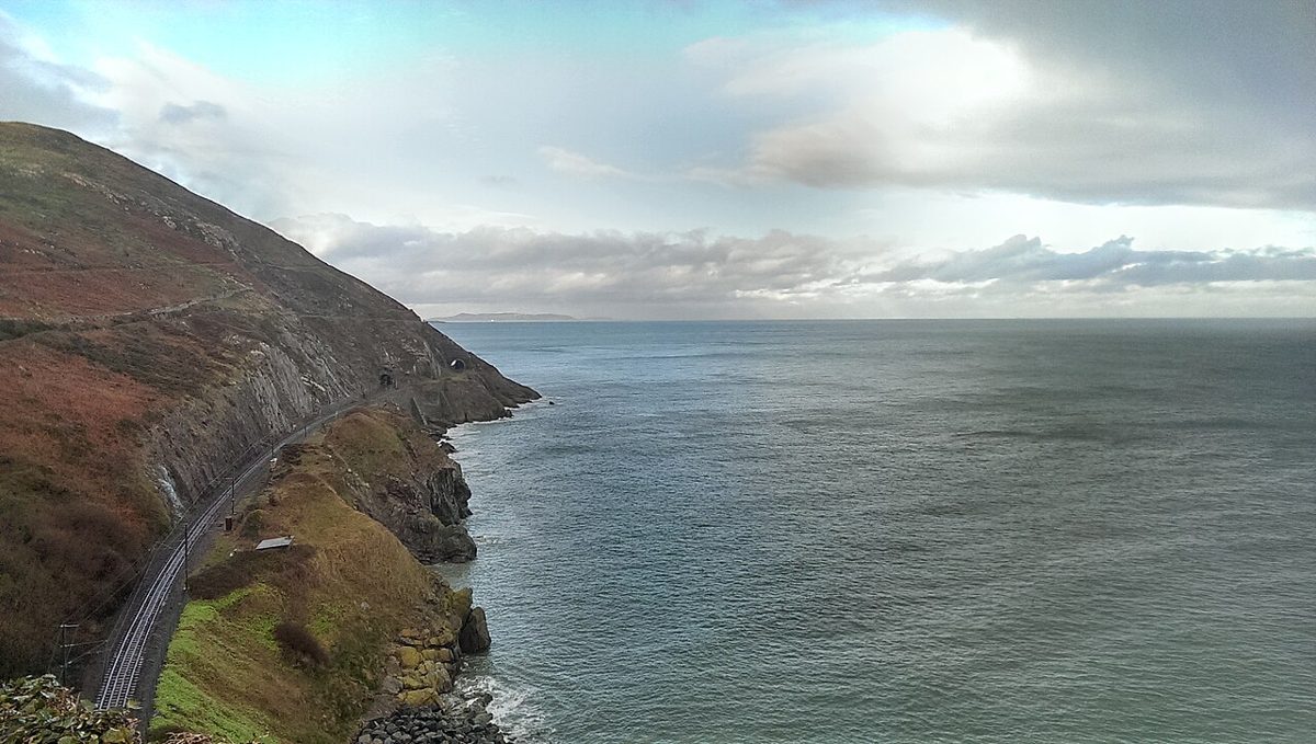
A historical view along the Bray to Greystones coastal route
The Bray–Greystones coastal landscape, January 2019. Historical view: the through Cliff Walk is now closed. Resized from the credited source; conditions and access may have changed. Tim Redmond · CC BY-SA 4.0

nature

18. Bray to Greystones Cliff Walk Trailhead

A reference for the closed Bray–Greystones Cliff Walk, with the information needed to avoid planning an unavailable through route.

Worth your time? Do not build a day around walking through to Greystones on this path. Use this page to understand the closure and choose a separately described open alternative. Keep any rail return plan independent of the closed route.

Bray–Greystones Cliff Walk remains closed; do not enter the closed through route.

Show location map

Reference point; check the guide for the correct visitor entrance. Map © OpenStreetMap contributors.

View location map ↗ · Reference pin; confirm the visitor entrance.

Read the guide →
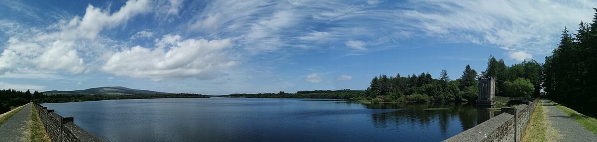
A wide panorama of the Upper Vartry Reservoir
Upper Vartry Reservoir panorama, June 2020. This landscape image does not confirm current trail access. Resized from the credited source; conditions and access may have changed. Kataphraktos · CC BY-SA 4.0

nature

19. Vartry Reservoir Loop, Roundwood

Route-by-route planning for the reservoirs near Roundwood: the Lower Vartry listing currently carries a closure notice.

Worth your time? Check a named circuit before choosing Vartry for a walking day. The Lower and Upper trails have separate information and cannot be treated as one interchangeable loop. Until the exact route is confirmed, keep another open walk available.

Lower Vartry trail is listed closed; Upper Vartry has separate route information. Confirm the exact open circuit before visiting.

Show location map

Reference point; check the guide for the correct visitor entrance. Map © OpenStreetMap contributors.

View location map ↗ · Reference pin; confirm the visitor entrance.

Read the guide →
A group of Ganesha sculptures at the former Victor’s Way park
Ganesha sculptures at Victor’s Way, May 2014. Historical photograph: the sculpture park is permanently closed to visitors. Resized from the credited source; conditions and access may have changed. Rob Hurson ( https://www.flickr.com/photos/robhurson/ ) · CC BY-SA 2.0

heritage

20. Victor's Way (Indian Sculpture Park)

A historical reference for Victor’s Way near Roundwood; the operator says the sculpture park is permanently closed.

Worth your time? Use this page to avoid relying on older visitor listings. Do not arrange a trip to enter the sculpture park. Choose an open Wicklow destination whose current admission and access can be confirmed instead.

The operator announces permanent closure; no visitors accepted.

Show location map

Reference point; check the guide for the correct visitor entrance. Map © OpenStreetMap contributors.

View location map ↗ · Reference pin; confirm the visitor entrance.

Read the guide →

Researched guides with original summaries of linked public visitor accounts. These are limited perspectives, not personal visits or visitor-average scores. Opening and access notices take priority over older accounts. How we rate · Suggest a correction.

Explore all 32 counties →

More Ireland tools & field guides

Copper Coast 7-Stop Audio & Driving GuideChoose your stops, hear the English or Hindi audio, and print a coastal day.Dublin Places & Local CollectionsCompare visitor places, local collections and public transport planning notes.Glendalough Field GuidePlan the monastic valley, lakes and a walk that fits your day.Ireland Salary & Budget CalculatorUnderstand take-home pay and plan an Irish monthly budget.