Give the Mizen Peninsula two different kinds of day: the signal station and Barleycove, then a slower route through Schull, Brow Head and Crookhaven. Check the managed site’s season, coastal conditions and the full return journey before setting out.
Open a suggested day in the trip planner, review the stops, then choose whether to apply it. Your atlas shortlist and named saved trips stay separate.
What is in each plan?
Mizen Head and Barleycove coastal day: Give Mizen Head’s bridge and signal station the main part of the outing, then choose a Barleycove beach pause if conditions suit. Crookhaven is optional, with the full return journey kept outside the visit totals. Transfers and meals are extra; optional stops are not selected.
Schull, Brow Head and Crookhaven coastal day: Begin with Schull’s town and harbour, consider Brow Head only when the approach and conditions suit, then slow down in Crookhaven. Barleycove stays optional; the full peninsula drive and return are additional. Transfers and meals are extra; optional stops are not selected.
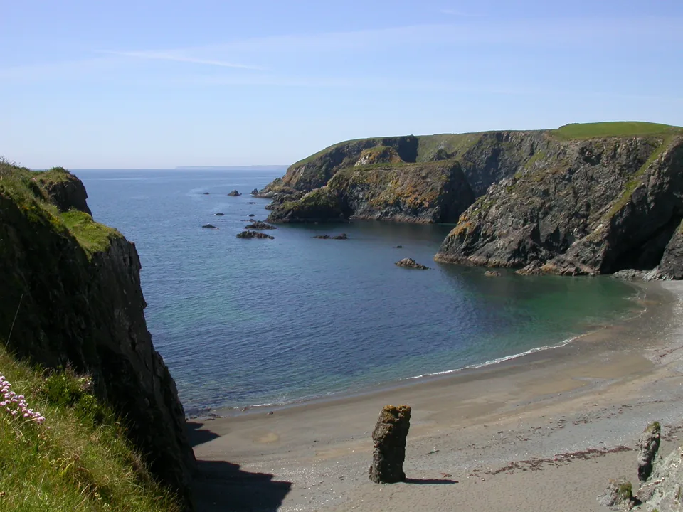
The Mizen Peninsula rewards a stay that separates a main visit from a long list of roadside stops. At Mizen Head, give the bridge, buildings and maritime history enough time to form one experience. Barleycove can then offer an outdoor change of pace if the current access and weather suit the group. On another day, use Schull and Crookhaven for harbour time and make Brow Head a deliberate choice rather than an obligation. These are local combinations after arrival in West Cork; they do not include the journey from Cork city, Killarney or elsewhere.
Mizen Head’s story gives the landscape a human scale. The station’s published records describe the loss of SS Irada on 22 December 1908, when workers at the unfinished station helped save 63 people and six died. The fog signal was established the following May. Read the dedicated place guide for the linked sources, then allow the interpreted visit to do more than supply a bridge photograph. The history concerns an exposed working coast, not a modern route to wreckage or an invitation beyond the managed visitor paths.
The practical distinction is between a managed visitor site, a beach, an exposed headland and two settlements. They do not share one ticket, opening calendar or level of access. Use the two day guides to choose a starting sequence, then adapt it to the actual driver, group, conditions and return. You can remove a headland, shorten a beach visit or spend longer in a harbour without making the trip incomplete. The forecast reference is Goleen; conditions at the outer headlands can differ.
Two Mizen & West Cork days, kept local
Choose the signal-station and beach day or the broader harbour-and-headland outing. These are local peninsula plans after arrival; road journeys, meals and the full return are additional.
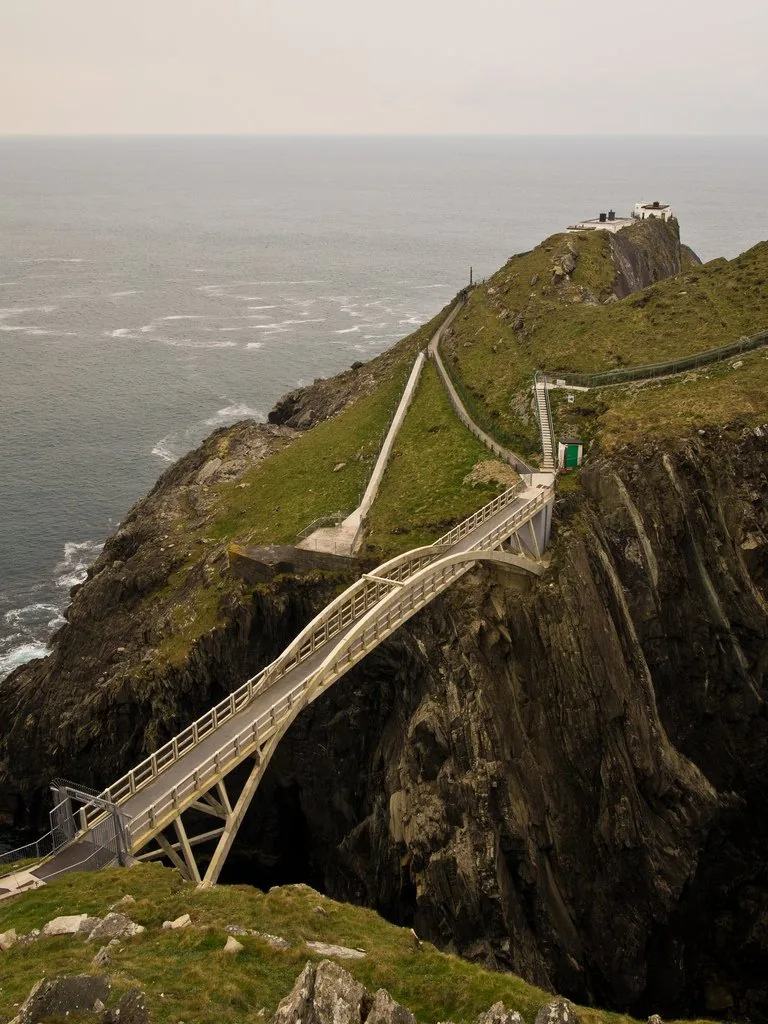
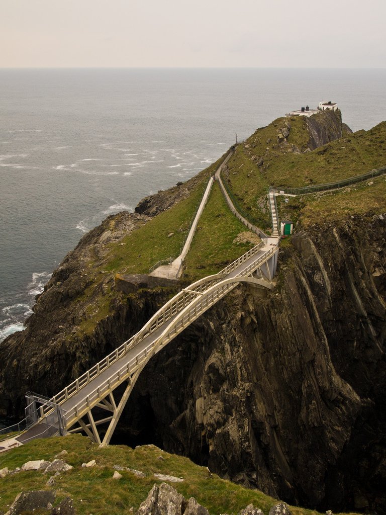
The bridge across the sea channel at Mizen Head. Historical source photograph; conditions and access may have changed. Resized from the credited source. Photo: fubsan ↗ · CC BY-SA 2.0
Give Mizen Head’s bridge and signal station the main part of the outing, then choose a Barleycove beach pause if conditions suit. Crookhaven is optional, with the full return journey kept outside the visit totals.
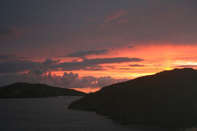
Crookhaven Harbour seen from Rock Island. Historical source photograph; conditions and access may have changed. Resized from the credited source. Photo: Dr Brian Lynch ↗ · CC BY-SA 2.0
Begin with Schull’s town and harbour, consider Brow Head only when the approach and conditions suit, then slow down in Crookhaven. Barleycove stays optional; the full peninsula drive and return are additional.
A researched selection, not a complete county directory. Read each score and its practical limitations. Service points and closed or unresolved visits are separated below.
5 current visitor choices. Select a place to see its details.
The static place guides remain available if the map cannot load.
The bridge across the sea channel at Mizen Head. Historical source photograph; conditions and access may have changed. Resized from the credited source. Photo: fubsan ↗ · CC BY-SA 2.0
Give Mizen Head time for both the approach across the bridge and the signal-station story. The sea is the setting, but the effort to warn shipping and the people who worked here give the visit its purpose.
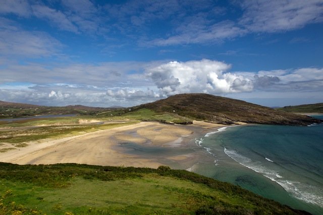
The sand and coastal setting at Barleycove. Historical source photograph; conditions and access may have changed. Resized from the credited source. Photo: EHRENBERG Kommunikation ↗ · CC BY-SA 2.0
Choose Barleycove for an open beach visit after a more structured stop. A walk, a pause on the sand and time looking back at the dunes can give the day a different rhythm without requiring another ticket.
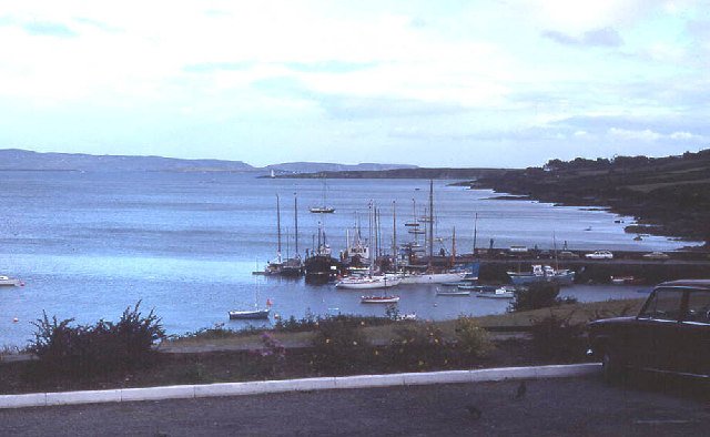
Schull Bay and quay with islands beyond. Historical source photograph; conditions and access may have changed. Resized from the credited source. Photo: Martin Southwood ↗ · CC BY-SA 2.0
Use Schull as a deliberate first part of a peninsula day: a harbour look, a short town browse and a chance to organise the onward journey. It gives the outing a gentler beginning before more exposed coastal stops.
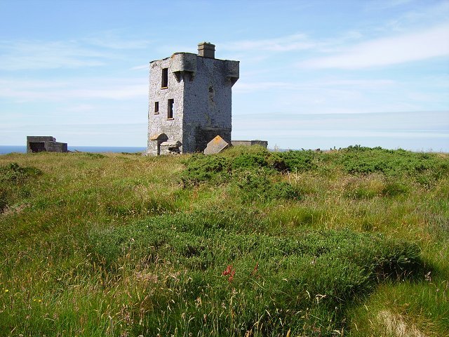
The former signal tower on Brow Head. Historical source photograph; conditions and access may have changed. Resized from the credited source. Photo: Richard Webb ↗ · CC BY-SA 2.0
Choose Brow Head for a more exposed landscape visit, with the former signalling structures providing context. Make the approach and visibility part of the decision; this is not simply another managed viewpoint like Mizen.
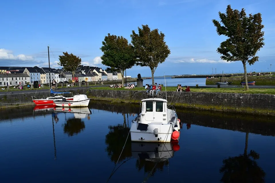
Crookhaven Harbour seen from Rock Island. Historical source photograph; conditions and access may have changed. Resized from the credited source. Photo: Dr Brian Lynch ↗ · CC BY-SA 2.0
Choose Crookhaven for a harbour pause after the exposed parts of the peninsula. Give yourself time to look at boats and the relationship between the water and the village, rather than making it only a place to turn the car.
Brow HeadHeadland landscape and signalling history
8.5
5.5
7.0
No places match. Try another search or include closed places.
Source-based editorial judgements assessed 19 October 2026. Services have no numerical score until evidence supports one. Scale, formula & limits.
When should you go?
May, June and September are our editorial preference for a flexible coastal stay. Seasonal patterns do not promise visibility, safe water conditions or open paths. Confirm Mizen’s live calendar and current local conditions for your date.
Tap a month for the tradeoff. These are editorial seasonal patterns; weather varies.
JanChallenging
Expect shorter daylight and limited seasonal opening; confirm the actual date and keep a town or harbour alternative.
FebChallenging
Expect shorter daylight and limited seasonal opening; confirm the actual date and keep a town or harbour alternative.
MarChallenging
Expect shorter daylight and limited seasonal opening; confirm the actual date and keep a town or harbour alternative.
AprMixed
Keep the route flexible and check Mizen’s date-specific opening; shorten outdoor time when conditions require it.
MayGood
Longer daylight leaves more room for a local coastal day, but check wind, visibility and the operator’s current access notice.
JunGood
Longer daylight leaves more room for a local coastal day, but check wind, visibility and the operator’s current access notice.
JulGood
Longer daylight leaves more room for a local coastal day, but check wind, visibility and the operator’s current access notice.
AugGood
Longer daylight leaves more room for a local coastal day, but check wind, visibility and the operator’s current access notice.
SepGood
Longer daylight leaves more room for a local coastal day, but check wind, visibility and the operator’s current access notice.
OctMixed
Keep the route flexible and check Mizen’s date-specific opening; shorten outdoor time when conditions require it.
NovChallenging
Expect shorter daylight and limited seasonal opening; confirm the actual date and keep a town or harbour alternative.
DecChallenging
Expect shorter daylight and limited seasonal opening; confirm the actual date and keep a town or harbour alternative.
Does it fit your trip?
Five editorial suitability scores, each out of five. Open a category to see the reasoning. These are not visitor averages. How we rate.
Scenery5 / 5
The collection contrasts an exposed headland, a broad beach and harbour landscapes, rewarding a day with time outside the car.
Heritage4 / 5
Signal-station interpretation and the sourced Irada rescue give the main visit a story beyond its coastal views.
Without a car2 / 5
Connections to a base and the last coastal leg must be checked separately; no continuous service to every stop is assumed.
Family suitability3 / 5
The day can be shortened around the group, but exposed headlands, water edges and managed-site access require individual judgement.
Value4 / 5
A deliberate main visit and flexible beach or harbour time can make a satisfying stay; accommodation, transport and meals change the cost.
What is the best way to get around?
The best option depends on the stops you choose. These comparisons explain the tradeoffs; routes, availability and fares need a current check.
A local driving day with a planned return
A car or local driver supports these dispersed coastal stops. Check the full road journey and suitable legal stopping places, preserve daylight and avoid adding every nearby headland. Pins are approximate place references, not parking instructions.
Verify each local connection before choosing stops
Use the national journey planner and the actual operator to check services to your base. Do not assume one scheduled service connects Mizen Head, Brow Head and all harbour stops. A taxi or prearranged transfer needs an agreed return as well as an outward journey.
A booked excursion can simplify transport only when its actual stops, admission inclusions and return suit you. The five places shown here are a planning collection, not a promise that any tour covers them. Confirm directly before paying.
Combine these local day plans or use just one. Stop times are suggested visit allowances, not opening hours or travel times. Leave additional time for meals and transfers.
Give Mizen Head time for both the approach across the bridge and the signal-station story. The sea is the setting, but the effort to warn shipping and the people who worked here give the visit its purpose.
Choose Barleycove for an open beach visit after a more structured stop. A walk, a pause on the sand and time looking back at the dunes can give the day a different rhythm without requiring another ticket.
Use Schull as a deliberate first part of a peninsula day: a harbour look, a short town browse and a chance to organise the onward journey. It gives the outing a gentler beginning before more exposed coastal stops.
Choose Brow Head for a more exposed landscape visit, with the former signalling structures providing context. Make the approach and visibility part of the decision; this is not simply another managed viewpoint like Mizen.
Choose Crookhaven for a harbour pause after the exposed parts of the peninsula. Give yourself time to look at boats and the relationship between the water and the village, rather than making it only a place to turn the car.
Mizen’s live October 2026 notice gives daily opening from 10:30 to 17:00. Its winter calendar is more limited, and paths can start closing before the site closes. Check the current notice rather than planning to arrive at the last minute. Tickets are sold at the desk, not online.
Use the correct Mizen entrance
The signal-station visitor site uses P81 NY52. The information and e-centre in Goleen is a separate destination. The operator states the entire headland site is locked when closed and the bridge cannot be seen from the car park; arrival after closing is not an alternative way to see it.
Choose the complete drive
Allow arrival from your actual accommodation, every connection and the full return. The planner totals only editorial time at stops; it adds no invented road duration. Read current signs, use designated legal parking and skip a stop when the road approach or available space does not suit your vehicle and group.
Keep the coast flexible
A beach pause and an exposed headland demand different decisions. This collection does not include swimming or mine exploration. Check on-site restrictions, flags and current local advice; do not assume seasonal lifeguard information applies today or that a historic access description establishes a current public route.
Make facilities specific
A village can support a food break, but verify the venue’s actual hours, entrance and availability before depending on it. Nearby amenity links help you search; they are not verified recommendations. Add meals and queues separately. Do not assume every beach or headland has staffed facilities.
Know what the map and scores mean
Pins are approximate place references and do not identify a guaranteed accessible entrance or a navigable walking line. Ratings are source-based editorial judgements, not visitor averages or inspections. The forecast is referenced to Goleen and cannot establish conditions on a bridge, cliff path or beach.
Your questions, answered
How long should I stay?
Two local days allow the signal-station visit and a different harbour-and-headland outing. Arrival and departure from farther away are extra, and a shorter stay should use fewer stops.
Can I do these plans without a car?
Only after checking every connection and the return with the actual service or transfer provider. The featured plans use car mode; the public-transport setting is a checking tool, not proof of a continuous route.
Is this a swimming or hiking itinerary?
No. It combines visitor, shore, headland and harbour visits. Water activities and longer walks need separate current advice, access checks and suitable preparation.
Where is the SS Irada story?
Open the dedicated Mizen Head place guide for the sourced rescue account and historical documents. You can also choose to load TheLazyNick’s published Mizen Head travel film there; the history sources remain linked separately.
Your own field notes
Visited? Record your personal category ratings for next time. They stay on this device and are not published or counted as visitor reviews.
Sources & editorial notes
Researched for TheLazyNick using the sources below. This is a source-based planning guide, not a claim of a personal visit. The suggested routes, timings and suitability scores are editorial judgements.
Source check: . Check live notices before setting off.
Distances are straight-line estimates between catalogue pins, within 30 km. Roads, entrances and walking routes may be much longer. Known closed places are excluded; inclusion does not confirm opening today.
Crookhaven Harbour seen from Rock Island. Historical source photograph; conditions and access may have changed. Resized from the credited source. Photo: Dr Brian Lynch ↗ · CC BY-SA 2.0
Choose Crookhaven for a harbour pause after the exposed parts of the peninsula. Give yourself time to look at boats and the relationship between the water and the village, rather than making it only a place to…
Open place page →The former signal tower on Brow Head. Historical source photograph; conditions and access may have changed. Resized from the credited source. Photo: Richard Webb ↗ · CC BY-SA 2.0
Choose Brow Head for a more exposed landscape visit, with the former signalling structures providing context. Make the approach and visibility part of the decision; this is not simply another managed viewpoint…
Choose Barleycove for an open beach visit after a more structured stop. A walk, a pause on the sand and time looking back at the dunes can give the day a different rhythm without requiring another ticket.
Open place page →The bridge across the sea channel at Mizen Head. Historical source photograph; conditions and access may have changed. Resized from the credited source. Photo: fubsan ↗ · CC BY-SA 2.0
Give Mizen Head time for both the approach across the bridge and the signal-station story. The sea is the setting, but the effort to warn shipping and the people who worked here give the visit its purpose.
Open place page →Schull Bay and quay with islands beyond. Historical source photograph; conditions and access may have changed. Resized from the credited source. Photo: Martin Southwood ↗ · CC BY-SA 2.0
Use Schull as a deliberate first part of a peninsula day: a harbour look, a short town browse and a chance to organise the onward journey. It gives the outing a gentler beginning before more exposed coastal…
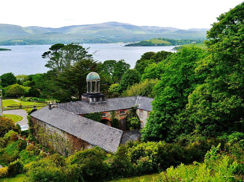
Open place page →Bantry House gardens overlooking Bantry Bay. Source photograph; conditions and access may have changed. Resized from the credited original. Photo: Zairon ↗ · CC BY 4.0
At Bantry House, the best view is also a clue to the estate’s design: house, terraces and bay are arranged to be read together. Look back as you move through the garden. The rising ground changes the…