Promenade outlook
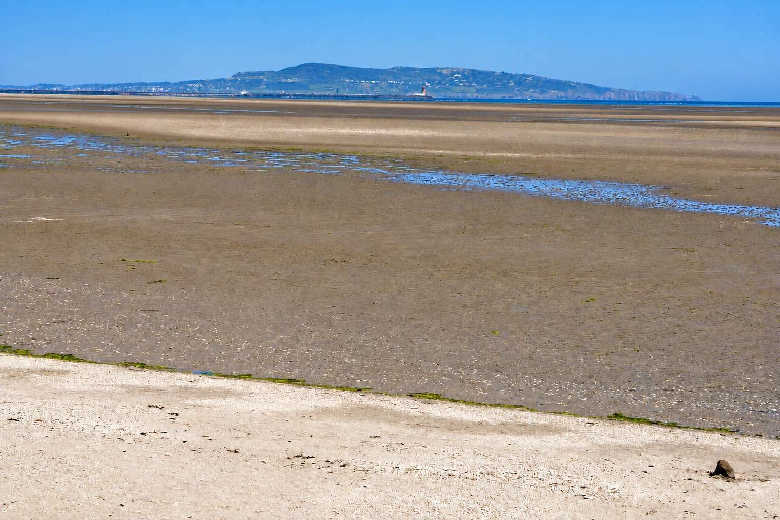
Look towards Poolbeg Lighthouse, Howth and Dún Laoghaire from the coastal path.
coast · Dublin
A broad tidal strand and coastal promenade on the south side of Dublin Bay.
Source-based editorial assessment · out of 10
Broad tidal views towards Dublin Bay landmarks and shorebird interest give this strand a distinctive spaciousness. The promenade offers the simpler way to appreciate its changing landscape.
A short shore-side section can fit a Dublin day, but access planning changes if you leave the promenade. Incoming tides and weather limit flexibility on exposed sands.
Best for: Bay views and shorebird watching
Planning blend: 7.5 / 10 · Sustainability: unrated
Experience considers the reward and depth of this particular stop. Visitor friendliness considers practical ease: arrival, booking, physical demands, cost and flexibility. These are editorial judgements based on linked information, not visitor averages or a claim of a personal visit.
Assessed . Supporting guide source-check date: 15 October 2026. The assessment date does not mean every linked source was newly checked.
The blend uses (40 × Experience + 55 × Visitor friendliness) ÷ 95, rounded to the nearest half point. Missing sustainability does not affect it. A missing current visit score is not zero and has no blend.
A high score is not a safety clearance or a guarantee of step-free access. Food-stop scores concern the planned visit, not an untested meal. Read the scale and scope · Suggest a correction.
From research
Choose Sandymount for open views and birdwatching from the shore. Prefer the promenade if you want a predictable firm route; the exposed sands are tidal terrain.
Before you go: Strong incoming tides are a known hazard. This guide does not establish safe tidal crossing routes or swimming conditions.
Place highlights
Look towards Poolbeg Lighthouse, Howth and Dún Laoghaire from the coastal path.
Notice how the available sand and water change; stay close to a safe shore return.
Watch the bay’s wildlife without approaching feeding or resting birds.
The story behind the visit
Sandymount is part of the Dublin Bay Biosphere, and its changing appearance is tied to the tide. A visitor arriving at low water sees a different place from someone walking the promenade with the sea nearer the shore. That openness can be deceptive: exposed sand should not be treated as a permanent walking route. The tourism authority specifically warns of strong incoming tides. Source ↗
The strand also belongs to a wider system of wetlands that supports migratory birds. Its value is not confined to the skyline view. Watching from the landward edge lets you notice feeding behaviour and the relationship between water and mud without adding disturbance. Bring binoculars if birdwatching is the aim, and do not pursue a bird for a closer picture. For a simple visit, stay on the promenade, choose a view towards the lighthouse or Howth and return the way you came. There is no need to cross the sands to make the stop worthwhile. Source ↗
Dated visitor information
Head to the promenade on Strand Road, Sandymount, and select a shore access point that suits your group. Use current transport directions for the final approach. Official visitor information ↗
Source information checked 15 October 2026; confirm current access and visitor arrangements with the operator.
No safe crossing is established here. Strong incoming tides can cut off exposed sand. Source ↗
Yes. The promenade offers the bay outlook from the shore. Source ↗
No. Swimming suitability, water quality and conditions have not been verified here. Source ↗
Nearby options
Distances are straight-line estimates between catalogue pins, within 30 km. Roads, entrances and walking routes may be much longer. Known closed places are excluded; inclusion does not confirm opening today.
coast · 1.7 km
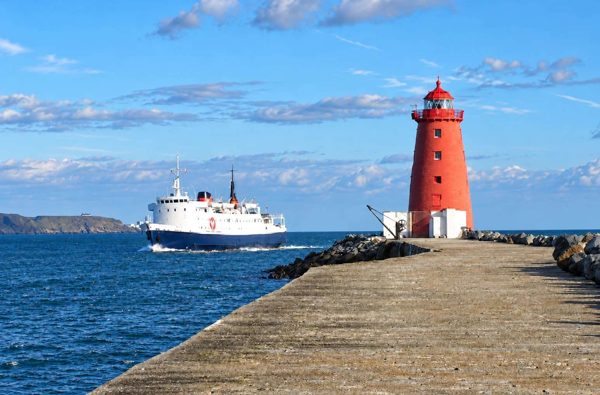
An exposed harbour-wall walk towards the red Poolbeg Lighthouse, with shipping and bay views.
Open place page →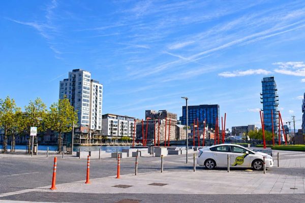
attraction · 3.0 km
A designed waterfront square where bold paving, planting and theatre architecture meet Grand Canal Dock.
Open place page →
attraction · 3.3 km
A modern Liffey crossing whose harp-like form helps explain the changing Docklands skyline.
Open place page →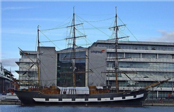
heritage · 3.6 km
Board a replica emigrant ship for a guided account of the people who crossed the Atlantic during the Great Famine. The physical setting makes a useful companion to EPIC’s broader migration story.
Open place page →
heritage · 3.6 km
The National Gallery makes a free art stop in central Dublin, with Irish paintings alongside European works by Caravaggio, Vermeer and others. A small route gives you time to look closely; a ticketed temporary…
Open place page →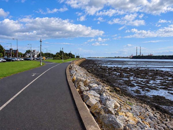
coast · 3.7 km
A linear seafront walk from Fairview towards the Bull Wall, with broad views across Dublin Bay.
Open place page →The tide-out view is the detail singled out in the accessible accounts. It explains the strand’s changing appearance, but should not be mistaken for advice to follow the water or cross the sand. Enjoy the shoreline within the current local guidance, and treat a photograph as a view rather than an access instruction.
Original paraphrases of public visitor accounts. These are limited perspectives, not a representative survey or a claim of our own visit. Use current operator information for access and opening.
Location & access
Strong incoming tides are a known hazard. This guide does not establish safe tidal crossing routes or swimming conditions.
53.32850, -6.20250 · Reference point; confirm the correct entrance and access. Map © OpenStreetMap contributors.
Source-based place brief. A catalogue reference is not a live availability check or a report of a personal visit.
Visitor details checked 15 October 2026. Page content updated 2026-10-15.