Skip to content
THELAZYNICK

Republic of Ireland · 10 researched places

Leitrim: things to do & places to visit

Leitrim changes character sharply between the north’s rock-framed valleys and the south’s broader Shannon water landscape. Glencar, Glenade and the dramatic escarpments suit a scenic day that remains at permitted viewpoints when conditions are poor. Parke’s Castle and Creevelea add a different historical layer around the Lough Gill side. Farther south, Drumshanbo’s boardwalk and Lough Allen invite a slower pace, while Dromod gives transport history an enthusiastic human voice. Keep the itinerary geographically honest. A county-level list should not encourage you to rush from one end to the other, and an attractive mountain photograph should not be mistaken for a simple public trail.

Numbered guide to the places below, with a map for each stop. Numbers help you browse; they are not a visitor ranking. Dated closures are shown on the cards and take priority over sightseeing suggestions.

10 places

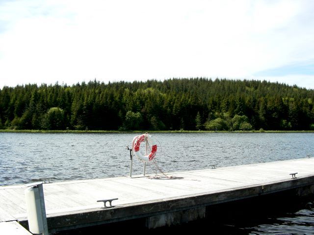
Acres Lough and jetty near Drumshanbo before the floating boardwalk
Historical photograph of Acres Lake near Drumshanbo. Source photograph dated 2004. It shows the lake setting before the floating boardwalk, not the present walkway or its current condition. Resized from the credited source. Suse · CC BY-SA 2.0

nature

1. Acres Lake Floating Boardwalk

Acres Lake gives Drumshanbo a distinctive way to meet the water: a floating boardwalk rather than a road along the shore. The interest is in the low viewpoint across reeds and lake, not in covering a long distance. Treat it as a pause within a wider town and Blueway visit.

Worth your time? A good option for a gentle waterside outing when the route is operating normally. A short boardwalk visit can be enough; longer Blueway sections need separate planning.

Show location map

Reference point; check the guide for the correct visitor entrance. Map © OpenStreetMap contributors.

View location map ↗ · Reference pin; confirm the visitor entrance.

Read the guide →
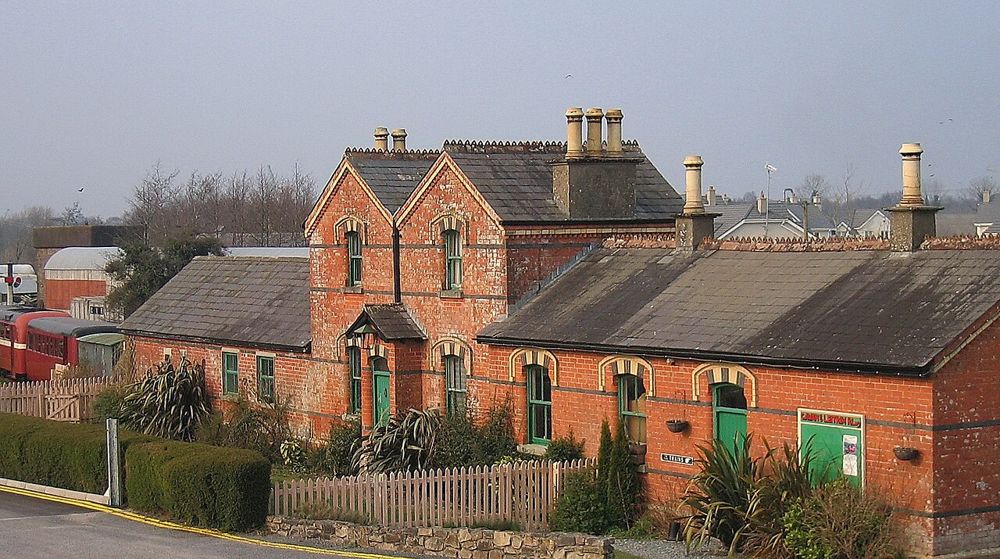
The railway buildings at the Cavan and Leitrim Railway visitor site

attraction

2. Cavan and Leitrim Railway

Dromod’s Cavan and Leitrim Railway is an enthusiast-led collection with the personality of an ongoing restoration project. The attraction is hearing why the machines matter, not finding every object in a polished museum hall. Give the guides room to tell the stories and the apparent clutter becomes much more interesting.

Worth your time? Best for transport enthusiasts and curious families who enjoy volunteer-run places. Choose another museum if you need a predictable, self-directed sequence of finished galleries.

Show location map

Reference point; check the guide for the correct visitor entrance. Map © OpenStreetMap contributors.

View location map ↗ · Reference pin; confirm the visitor entrance.

Read the guide →
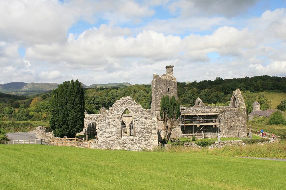
The roofless church walls and tower at Creevelea Abbey
The roofless church walls and tower at Creevelea Abbey. Source photograph; current access and conditions may differ. Resized from the credited source. Andreas F. Borchert · CC BY-SA 4.0

heritage

3. Creevelea Abbey

Creevelea’s roofless walls make a satisfying small heritage stop near Dromahair. The ruined friary has enough surviving structure to follow its spaces, while the River Bonet gives the approach a gentler setting. Come with time to look closely rather than expecting a ticketed attraction to organise the visit for you.

Worth your time? A worthwhile addition to Dromahair or Parke’s Castle. It suits visitors who enjoy a quiet ruin and a little historical reading without needing a formal tour.

Show location map

Reference point; check the guide for the correct visitor entrance. Map © OpenStreetMap contributors.

View location map ↗ · Reference pin; confirm the visitor entrance.

Read the guide →
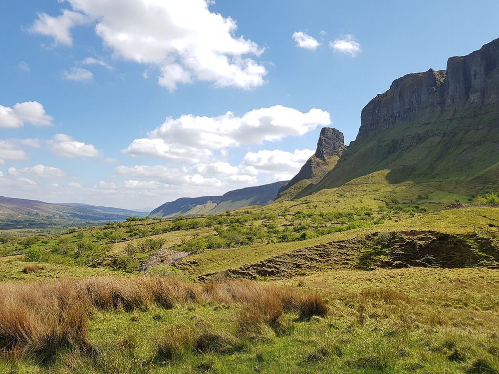
The Glenade Valley and the cliffs around Eagle’s Rock
The Glenade Valley and the cliffs around Eagle’s Rock. Source photograph; current access and conditions may differ. Resized from the credited source. Jacobfrid · CC BY-SA 4.0

nature

4. Eagle’s Rock

The rock formations above Glenade give north Leitrim an unexpectedly theatrical skyline. Eagle’s Rock and neighbouring Hag’s Leap are better approached first as a landscape to look at from an authorised viewpoint than as something to climb. Their scale is clearest when the surrounding cliffs remain in the picture.

Worth your time? Worth including in a Glenade and Glencar landscape day when visibility is good. Do not turn a scenic stop into an unplanned scramble on private or unstable ground.

Show location map

Reference point; check the guide for the correct visitor entrance. Map © OpenStreetMap contributors.

View location map ↗ · Reference pin; confirm the visitor entrance.

Read the guide →
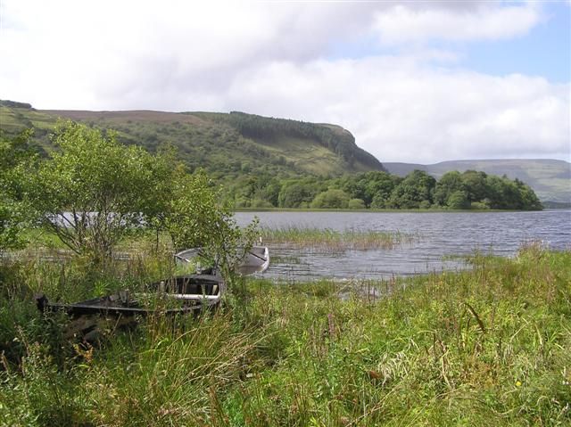
Glenade Lough with reeds, trees and surrounding hills
Glenade Lough with reeds, trees and surrounding hills. Source photograph; current access and conditions may differ. Resized from the credited source. Kenneth Allen · CC BY-SA 2.0

nature

5. Glenade Lough

Glenade Lough sits between steep valley sides, giving a short stop a surprisingly enclosed, almost amphitheatre-like feel. The lake is quiet to look at, but access around it needs care: a beautiful shoreline on a photograph is not automatically a public walking route. Find a permitted viewpoint and let the valley do the work.

Worth your time? Good for a scenic pause during a north Leitrim day. It is not a reliable choice for an improvised full-lake circuit or unrestricted shore access.

Show location map

Reference point; check the guide for the correct visitor entrance. Map © OpenStreetMap contributors.

View location map ↗ · Reference pin; confirm the visitor entrance.

Read the guide →
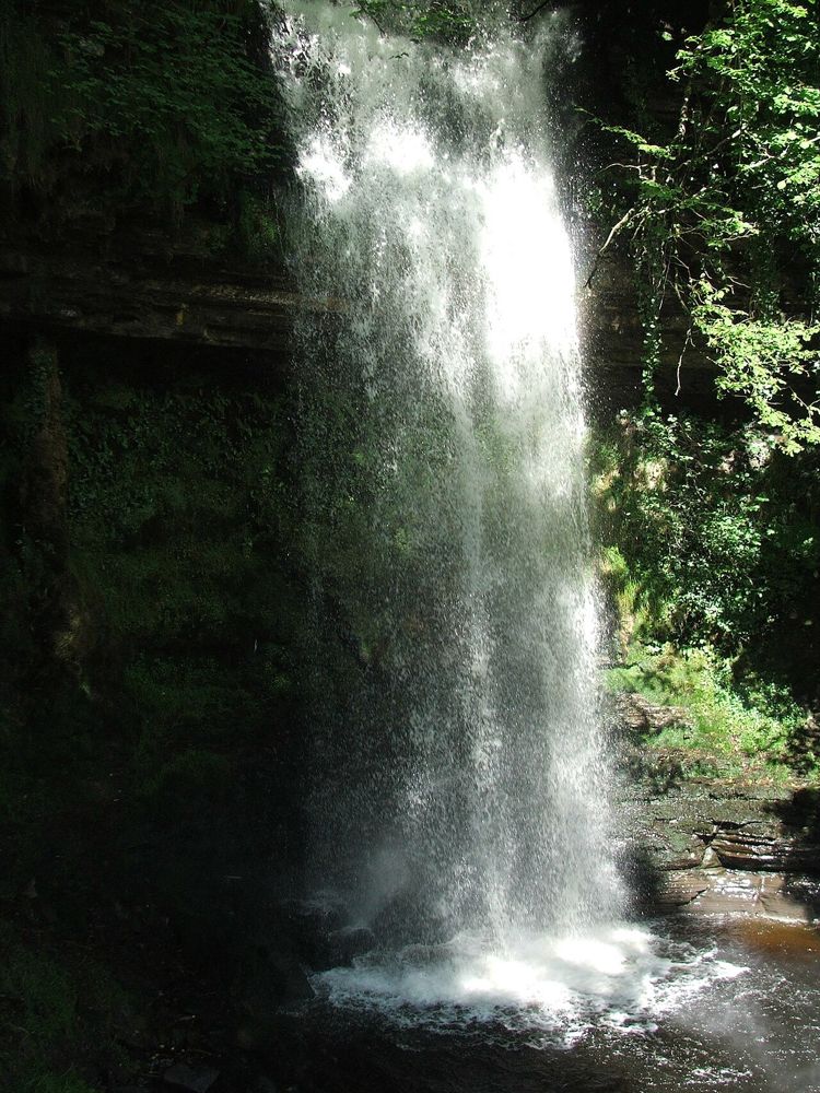
Glencar Waterfall descending between dark rocks and woodland
Glencar Waterfall descending between dark rocks and woodland. Source photograph; current access and conditions may differ. Resized from the credited source. User: (WT-shared) The.Q at wts wikivoyage · CC BY-SA 2.5

nature

6. Glencar Waterfall

Glencar is an accessible introduction to north Leitrim’s dramatic landscape, without committing to a mountain day. The waterfall sits in a wooded fold above the lake, so even the approach has a different mood from the open valley. Give the lake a look as well; it stops the visit becoming only a queue for one photograph.

Worth your time? A good short nature stop in the Glencar area. The appeal is the wooded setting and wider valley as much as the size of the fall.

Show location map

Reference point; check the guide for the correct visitor entrance. Map © OpenStreetMap contributors.

View location map ↗ · Reference pin; confirm the visitor entrance.

Read the guide →
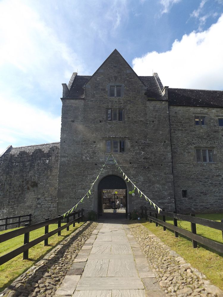
The stone entrance and approach to Parke’s Castle
The stone entrance and approach to Parke’s Castle. Source photograph; current access and conditions may differ. Resized from the credited source. Creevylea · CC BY-SA 4.0

heritage

7. Parke’s Castle

Parke’s Castle is best understood with Lough Gill beside it. The water gives the restored courtyard house its setting, while the building tells a more complicated story than a simple medieval fortress. Inside, look for how traditional materials were used in the restoration as well as what survives from earlier occupation.

Worth your time? A strong choice for a Lough Gill day and for visitors interested in the change from Gaelic lordship to plantation-era ownership. It offers more structure than an unstaffed ruin.

Show location map

Reference point; check the guide for the correct visitor entrance. Map © OpenStreetMap contributors.

View location map ↗ · Reference pin; confirm the visitor entrance.

Read the guide →
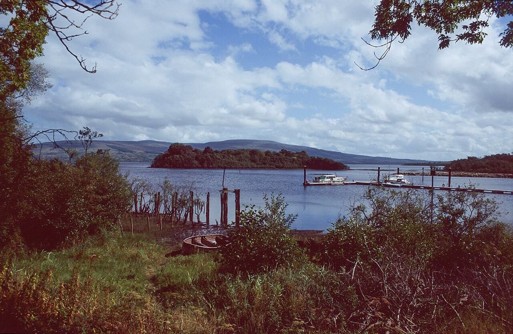
Sliabh an Iarainn viewed across Lough Allen
Sliabh an Iarainn viewed across Lough Allen. This landscape view does not show a summit route or establish access. Resized from the credited source. Pampuco · CC BY-SA 4.0

nature

8. Sliabh an Iarainn

Sliabh an Iarainn rises above Lough Allen with a broad, rugged profile. Its iron-working history gives the scenery another dimension, but the mountain should not be treated as an easy extension of a lakeside stroll. Choose a published lower route or a properly prepared hill day according to your experience.

Worth your time? Best for confident walkers interested in a quieter mountain landscape. If conditions or navigation are doubtful, enjoy the mountain from below and use Drumshanbo’s heritage interpretation instead.

Show location map

Reference point; check the guide for the correct visitor entrance. Map © OpenStreetMap contributors.

View location map ↗ · Reference pin; confirm the visitor entrance.

Read the guide →
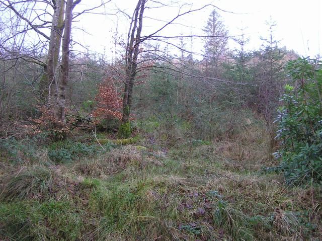
A path through Glenfarne’s trees and undergrowth
A path through Glenfarne’s trees and undergrowth. Source photograph; current access and conditions may differ. Resized from the credited source. Kenneth Allen · CC BY-SA 2.0

nature

9. Glenfarne Wood

Glenfarne Wood offers lake-edge forest walking in a part of Leitrim that many visitors pass through. The water of Lough MacNean gives the trees a changing backdrop, while traces of the former demesne add history. Current development works make checking access particularly important before planning a full walk.

Worth your time? A good quieter woodland option when the relevant paths are available. During works, choose a confirmed open section rather than assuming an older loop description still applies.

Visitor development works began 16 October 2026; check current path access and obey works restrictions.

Show location map

Reference point; check the guide for the correct visitor entrance. Map © OpenStreetMap contributors.

View location map ↗ · Reference pin; confirm the visitor entrance.

Read the guide →
Spencer Harbour and Corry Island on Lough Allen in September 2003
Spencer Harbour and Corry Island in September 2003. This historical photograph shows the specific harbour setting, not the current entrance, facilities or shoreline condition. Resized from the credited source. Andreas F. Borchert · CC BY-SA 4.0

nature

10. Lough Allen at Spencer Harbour

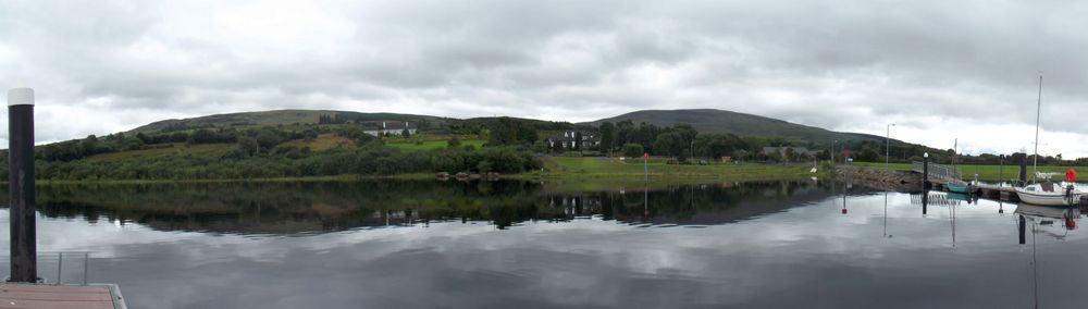
Spencer Harbour gives a Lough Allen visit a real destination: a public waterside amenity reached from the R280, rather than a pin floating in the middle of the lake. The view across the water towards Sliabh an Iarainn is the main reason to come. Keep the outing simple: time by the shore and a picnic can be enough.

Worth your time? A worthwhile scenic pause near Drumkeeran if you want lake views without booking a watersport. It is a short harbour visit, not a promise of a continuous lakeshore walk or a fully serviced visitor centre.

Public amenity named at Spencer Harbour; the historical map point does not verify a current entrance. Use the official named approach. Checked 19 October 2026.

Show location map

Reference point; check the guide for the correct visitor entrance. Map © OpenStreetMap contributors.

View location map ↗ · Reference pin; confirm the visitor entrance.

Read the guide →

Researched guides with original summaries of linked public visitor accounts. These are limited perspectives, not personal visits or visitor-average scores. Opening and access notices take priority over older accounts. How we rate · Suggest a correction.

Explore all 32 counties →

More Ireland tools & field guides

Copper Coast 7-Stop Audio & Driving GuideChoose your stops, hear the English or Hindi audio, and print a coastal day.Dublin Places & Local CollectionsCompare visitor places, local collections and public transport planning notes.Glendalough Field GuidePlan the monastic valley, lakes and a walk that fits your day.Ireland Salary & Budget CalculatorUnderstand take-home pay and plan an Irish monthly budget.