Copper Coast route notes · Route anchor
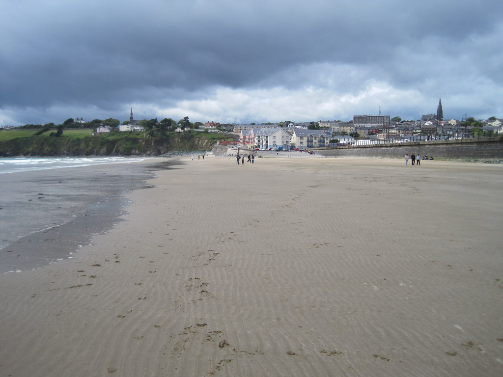
Tramore Strand: the east-end start of a Copper Coast drive
An easy coastal start before the smaller coves.
Position 1 in the expanded eight-stop route · Suggested on-site allowance: 30–45 min. Add travel, meals and breaks.
By Nick · TheLazyNick · Route notes updated . Practical source dates appear below.
Open the interactive Copper Coast planner · Open the standalone place record
Where this stop fits in the drive
Use Tramore to establish the pace of the day before turning the coast into a sequence of smaller coves. A strand visit can be a short opening pause rather than a commitment to a full beach day. Decide whether everyone needs a walk, a food stop or simply a chance to get their bearings before the next leg. Starting with that decision is more useful than trying to leave at an exact minute taken from a generic driving itinerary.
Tramore is the starting point of this selected east-to-west route, not evidence that the whole drive forms one signed walking trail or that every point lies inside the same administrative boundary. The route links places with different purposes: a town beach, geological shores, industrial remains and an eventual castle stop. Read it as an editorial way of organising a Waterford day, with room to omit stops rather than a challenge to complete them all.
Keep the first shore visit proportional to your priority later in the day. If mining history is the main reason for travelling, protect time for Tankardstown and Bunmahon instead of using the whole morning at the beach. If a relaxed coastal break is the aim, Tramore may deserve more of the day and the route can be shortened. Both are valid plans. The durations below are on-site allowances and leave road travel, parking and meals to be added separately.
History and the landscape
The historical thread
Tramore provides the modern seaside-town opening to a route whose central story is the Copper Coast’s geology and nineteenth-century mining. Use the Geopark’s mining account for that historical thread rather than attributing every part of the coast to a single mine or period. Historical source.
Geology and what to notice
Begin with the broad coastal view here, then use the interpreted geosites farther west for specific rock stories. Kilfarrasy is the next route stop for the Geopark’s account of Ordovician volcanic and sedimentary rocks; the beach at Tramore is not substituted for that separate site. Geological source.
Parking, access and conditions
- Access
- Waterford Council lists Tramore strand as suitable for wheelchair access. Practical source Source check: 2026-09-24
- Facilities
- Public toilets are listed for the bathing season; confirm dates and opening locally. Practical source Source check: 2026-09-24
- Parking
- Council pay-and-display parking operates in Tramore during June to September; check the signs for the space used. Practical source Source check: 2026-09-24
Tide and the safe extent of the visit
Choose a beach walk separately from a swim. Follow local signs and current bathing-water or lifeguard information; this route is not a swimming recommendation. Do not use the appearance of a broad strand as proof that conditions are suitable at the water’s edge.
Food and comfort breaks
Choose and check a specific Tramore venue if food is part of the start. This guide does not confirm café opening or a meal included with parking.
Road travel and public transport
Use live directions for each road leg; the route line is an order of places, not a navigable road or verified coastal path. If travelling by bus, check the actual service, return departure and last-mile walk separately. Do not assume a bus reaches every beach entrance.
Check TFI journey planning · Check the Geopark’s official site guidance
Listen to the Copper Coast in English or Hindi
These are the real continuous whole-coast narrations used by the main guide. They are background for the route, not recordings specific to this stop. There are no verified stop chapters or time offsets, so both players begin at the start of the full track.
Hindi · हिन्दी
Load a track while connected and listen when safely stopped. The static stop notes remain available without playing audio.
Choose the next part of the day
If you are starting late, keep Tramore as a short orientation stop and make one cove your main shore visit. Confirm where you will eat and use facilities before leaving town; smaller shore stops should not inherit assumptions about what was available at the starting point.
The original seven-stop plan omits the optional Kilmurrin detour. The expanded route adds it between Annestown and Tankardstown; all eight real place records remain available. Optional labels help shorten the day without losing the route’s main historical and geological threads.
Sources for this stop
- Waterford Council: beaches and seasonal facilities
- Waterford Council: Tramore parking
- Geopark: mining heritage
Standalone place details and image credits · Send a correction