Copper Coast route notes · Route anchor
Kilfarrasy: a geology pause on the Copper Coast route
A striking first encounter with the Geopark’s folded coast.
Position 2 in the expanded eight-stop route · Suggested on-site allowance: 30–60 min. Add travel, meals and breaks.
By Nick · TheLazyNick · Route notes updated . Practical source dates appear below.
Open the interactive Copper Coast planner · Open the standalone place record
Where this stop fits in the drive
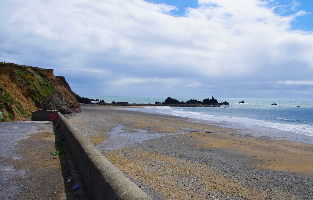
Make Kilfarrasy the shore stop where you slow down enough to look at the rock rather than treating the coastline as a series of interchangeable beach photographs. The Geopark’s interpretation gives the place a geological thread, while the tide and the conditions determine how much of the shore is appropriate to explore. A useful visit can stay close to the signed access and still connect the landscape with the much older processes described in the guide.
On this route, Kilfarrasy follows Tramore and comes before Annestown. That sequence is a road-trip framework, not a verified coastal footpath joining the beaches. Plan the next leg with live directions and legal parking at each end. The suggested stop allowance should not be read as including the drive, a wait for a parking space or a meal. If the shore holds your attention, reduce the number of later coves instead of rushing this visit to protect a checklist.
Look for differences in the rocks and the shape of the coast, using the interpretive panel as a starting point. Do not make reaching an arch, headland or sea stack the condition for a successful day. The Geopark describes farther shore exploration that depends on low tide, and a low-tide time by itself does not settle swell, slippery surfaces, falling-rock risks or the safe return. Stay with a permitted area that fits the actual conditions and your group.
History and the landscape
The historical thread
Kilfarrasy supplies the deep-time opening to the route before the industrial story at Tankardstown. The point of pairing them is to distinguish the rocks that formed the landscape from the much later mining that changed how people worked within it. The Geopark’s historical account provides the second part of that comparison. Historical source.
Geology and what to notice
The Geopark describes Ordovician rocks around 460 million years old, including volcanic and sedimentary types. Folding and cleavage show later deformation. Coastal erosion adds another, younger layer to the story through arches and stacks; those visible forms should not be mistaken for an invitation to climb them. Geological source.
Parking, access and conditions
- Access
- Beach publicly accessible; further exploration towards either headland needs low tide. Practical source Source check: 2026-09-24
- Parking
- Geopark lists parking at the beach. Practical source Source check: 2026-09-24
Tide and the safe extent of the visit
The Geopark says exploration west towards the Kilfarrasy headland and east towards Sheep Island needs low tide. Do not pass a tidal restriction without a safe return plan, and follow signs or closures. A short visit near the access is an alternative to extended foreshore exploration.
Food and comfort breaks
No current café service has been verified for this shore stop. Carry water and arrange a meal separately rather than assuming the beach parking point includes refreshments.
Road travel and public transport
Use live directions for each road leg; the route line is an order of places, not a navigable road or verified coastal path. If travelling by bus, check the actual service, return departure and last-mile walk separately. Do not assume a bus reaches every beach entrance.
Check TFI journey planning · Check the Geopark’s official site guidance
Listen to the Copper Coast in English or Hindi
These are the real continuous whole-coast narrations used by the main guide. They are background for the route, not recordings specific to this stop. There are no verified stop chapters or time offsets, so both players begin at the start of the full track.
Hindi · हिन्दी
Load a track while connected and listen when safely stopped. The static stop notes remain available without playing audio.
Choose the next part of the day
Choose Kilfarrasy as the main geology stop if you want fewer departures and arrivals. Annestown remains an optional change of setting, and the longer route still leaves Tankardstown as a different kind of stop. Build the selection around what you want to understand rather than repeating the same shore visit at every cove.
The original seven-stop plan omits the optional Kilmurrin detour. The expanded route adds it between Annestown and Tankardstown; all eight real place records remain available. Optional labels help shorten the day without losing the route’s main historical and geological threads.
Sources for this stop
Standalone place details and image credits · Send a correction