Stone enclosures
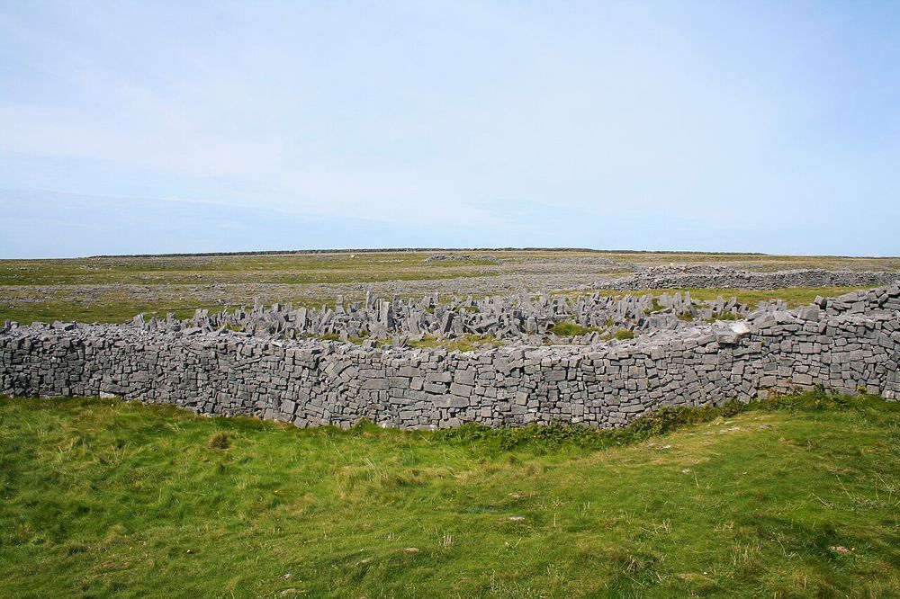
Notice the scale and arrangement of the walls rather than heading straight to the ocean. The structure is evidence of a place built and adapted over time.
heritage · Galway
Dún Aonghasa is an ancient stone fort with an unusually abrupt boundary: one side ends at a sea cliff. The walk up from the visitor centre lets its walls emerge gradually above the limestone. Once there, the enclosure and its exposed position make a stronger impression than any attempt to collect the closest possible cliff photograph.
Source-based editorial assessment · out of 10
Make the fort the main heritage stop on Inis Mór if prehistoric structures and landscape are your interests. It requires an island journey, onward transport and an uphill walk, so it cannot sensibly be treated as a quick Galway city attraction.
The approach is over rising, uneven ground and the cliff edge is unprotected. The fort route is separate from simply reaching the island harbour.
Best for: Stone enclosures
Planning blend: 7.5 / 10 · Sustainability: unrated
Experience considers the reward and depth of this particular stop. Visitor friendliness considers practical ease: arrival, booking, physical demands, cost and flexibility. These are editorial judgements based on linked information, not visitor averages or a claim of a personal visit.
Assessed . Supporting guide source-check date: 2026-10-19. The assessment date does not mean every linked source was newly checked.
The blend uses (40 × Experience + 55 × Visitor friendliness) ÷ 95, rounded to the nearest half point. Missing sustainability does not affect it. A missing current visit score is not zero and has no blend.
A high score is not a safety clearance or a guarantee of step-free access. Food-stop scores concern the planned visit, not an untested meal. Read the scale and scope · Suggest a correction.
From research
Make the fort the main heritage stop on Inis Mór if prehistoric structures and landscape are your interests. It requires an island journey, onward transport and an uphill walk, so it cannot sensibly be treated as a quick Galway city attraction.
Know before you book: The approach is over rising, uneven ground and the cliff edge is unprotected. The fort route is separate from simply reaching the island harbour.
Place highlights
Notice the scale and arrangement of the walls rather than heading straight to the ocean. The structure is evidence of a place built and adapted over time.
OPW reopened a refurbished visitor experience in 2026. Use it to understand the wider Aran landscape before climbing towards the fort.
The story behind the visit
The fort belongs to the prehistoric settlement landscape of the Aran Islands. Its prominent position is part of its meaning, but a dramatic location alone does not explain its construction; the interpretation helps separate archaeological evidence from modern speculation. Source ↗
Dated visitor information
The visitor centre is on Inis Mór, away from Kilronan harbour. Choose a current island transport option and navigate to the authorised entrance; the fort pin itself is not a drop-off point. Official visitor information ↗
Source information checked 19 October 2026; confirm current access and visitor arrangements with the operator.
No. Reaching Inis Mór is only the first stage. You still need onward island travel and the walking approach. Source ↗
The cliff edge is unprotected. Stay well back and do not approach it for photographs. Source ↗
Nearby options
Distances are straight-line estimates between catalogue pins, within 30 km. Roads, entrances and walking routes may be much longer. Known closed places are excluded; inclusion does not confirm opening today.
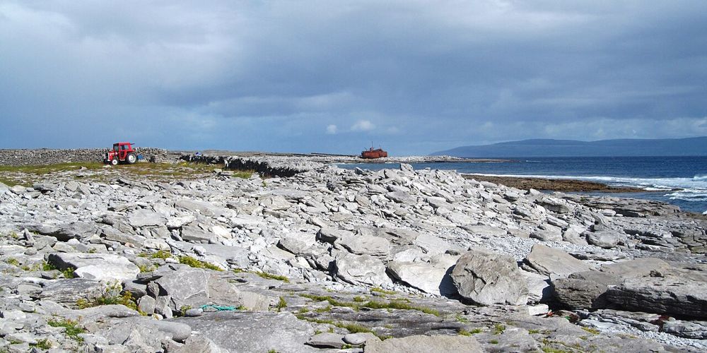
coast · 17.3 km
Inis Oírr is the smallest Aran Island, but a small island is not the same as an effortless checklist. Stone-walled lanes, the harbour-side settlement and the Plassey wreck draw people in different directions.…
Open place page →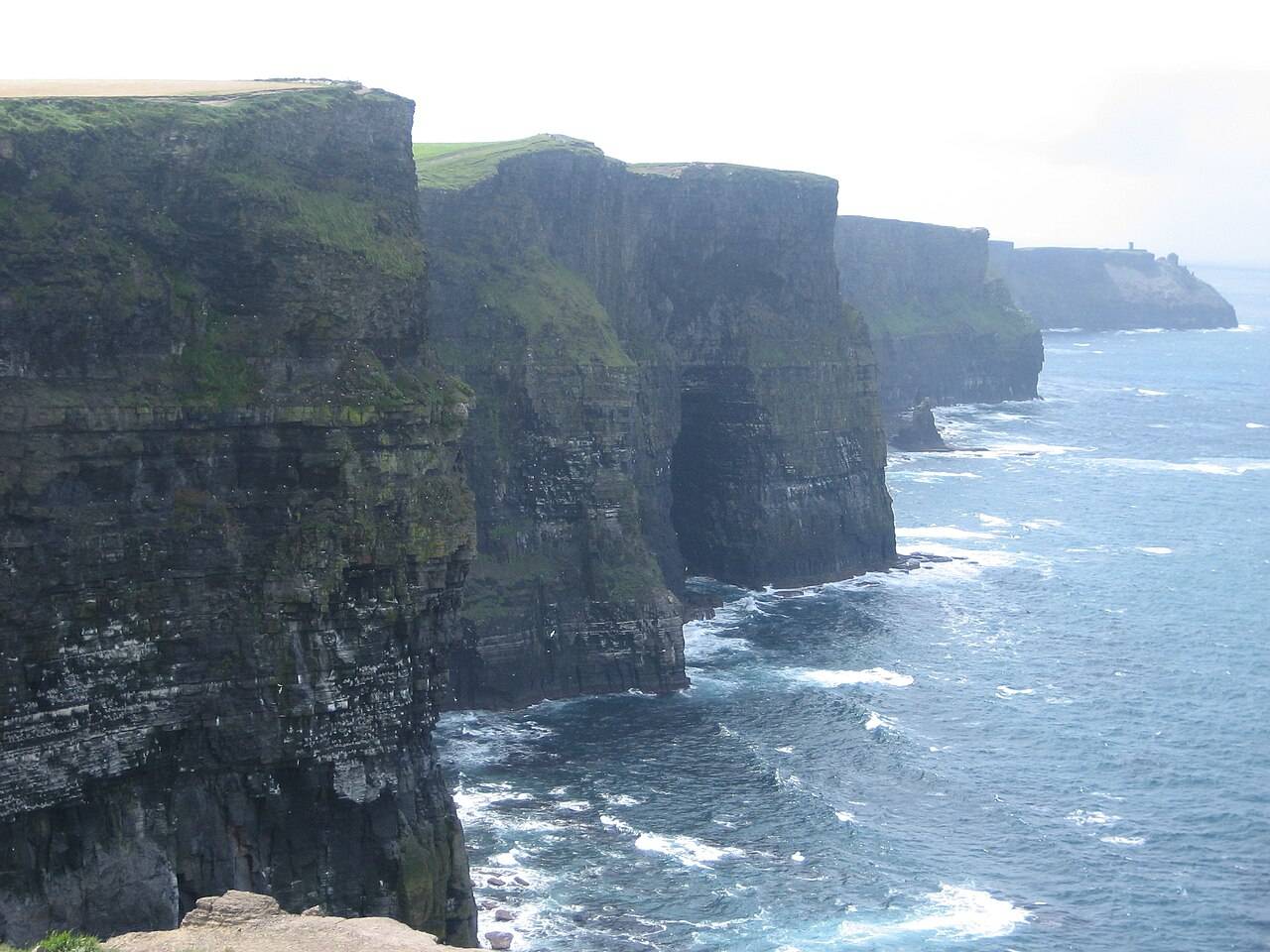
coast · 28.5 km
The Cliffs of Moher are best planned around the managed visitor site and the paths actually open on the day, with time to look rather than a promise of a through-hike.
Open place page →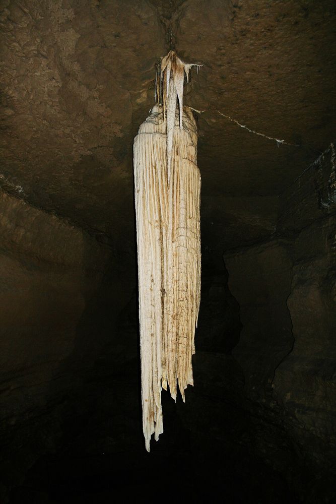
attraction · 29.7 km
Doolin Cave builds its visit around a single geological object: a huge free-hanging stalactite in an underground chamber. The reward comes from seeing its scale after the descent, not from covering miles of…
Open place page →An accessible visitor account describes combining an island drive with a substantial stop at the fort, rather than rushing up between ferry times. The limited material reinforces planning onward transport; it is not evidence that the approach suits every visitor or weather condition.
Original paraphrases of public visitor accounts. These are limited perspectives, not a representative survey or a claim of our own visit. Use current operator information for access and opening.
Location & access
The approach is over rising, uneven ground and the cliff edge is unprotected. The fort route is separate from simply reaching the island harbour.
53.12550, -9.76670 · Reference point; confirm the correct entrance and access. Map © OpenStreetMap contributors.
Source-based place brief. A catalogue reference is not a live availability check or a report of a personal visit.
Visitor details checked 19 October 2026. Page content updated 2026-10-20.