Buried field systems
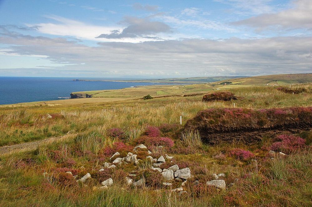
Use the interpretation to understand how walls hidden by bog can reveal the layout of a much older landscape. Seeing a small exposed section is only part of that explanation.
heritage · Mayo
Céide Fields asks you to look for a landscape that is mostly hidden. Beneath the bog are traces of prehistoric fields and settlement, and the visitor interpretation does much of the work of making that invisible pattern understandable. Come prepared for an archaeological idea, not rows of standing monuments spread across a manicured field.
Source-based editorial assessment · out of 10
Choose it if early farming and the relationship between people, land and climate interest you. It pairs naturally with a separate Downpatrick Head visit, but the indoor story deserves attention rather than becoming a short stop before the sea-stack photograph.
The visitor centre and outdoor archaeological experience have managed opening arrangements. Exposed north-coast weather can change how much of the outdoor element feels comfortable.
Best for: Buried field systems
Planning blend: 8.0 / 10 · Sustainability: unrated
Experience considers the reward and depth of this particular stop. Visitor friendliness considers practical ease: arrival, booking, physical demands, cost and flexibility. These are editorial judgements based on linked information, not visitor averages or a claim of a personal visit.
Assessed . Supporting guide source-check date: 2026-10-19. The assessment date does not mean every linked source was newly checked.
The blend uses (40 × Experience + 55 × Visitor friendliness) ÷ 95, rounded to the nearest half point. Missing sustainability does not affect it. A missing current visit score is not zero and has no blend.
A high score is not a safety clearance or a guarantee of step-free access. Food-stop scores concern the planned visit, not an untested meal. Read the scale and scope · Suggest a correction.
From research
Choose it if early farming and the relationship between people, land and climate interest you. It pairs naturally with a separate Downpatrick Head visit, but the indoor story deserves attention rather than becoming a short stop before the sea-stack photograph.
Know before you book: The visitor centre and outdoor archaeological experience have managed opening arrangements. Exposed north-coast weather can change how much of the outdoor element feels comfortable.
Place highlights
Use the interpretation to understand how walls hidden by bog can reveal the layout of a much older landscape. Seeing a small exposed section is only part of that explanation.
The displays connect archaeology with the geology and ecology around it. Start here rather than expecting the significance to be self-evident from the car park.
The story behind the visit
The discovery of ancient walls beneath peat changed how this north Mayo landscape could be read. What looks like open bog preserves evidence of farming communities, making the growth of the landscape itself part of the history. Source ↗
Dated visitor information
8km west of Ballycastle on R314; F26 PF66; car park. Official visitor information ↗
Source information checked 19 October 2026; confirm current access and visitor arrangements with the operator.
No. Much of the evidence is buried beneath bog. The centre and interpretation explain why the exposed remains matter. Source ↗
No. They are separate north Mayo stops, useful to combine only when you leave adequate time for both. Source ↗
Nearby options
Distances are straight-line estimates between catalogue pins, within 30 km. Roads, entrances and walking routes may be much longer. Known closed places are excluded; inclusion does not confirm opening today.
coast · 7.5 km
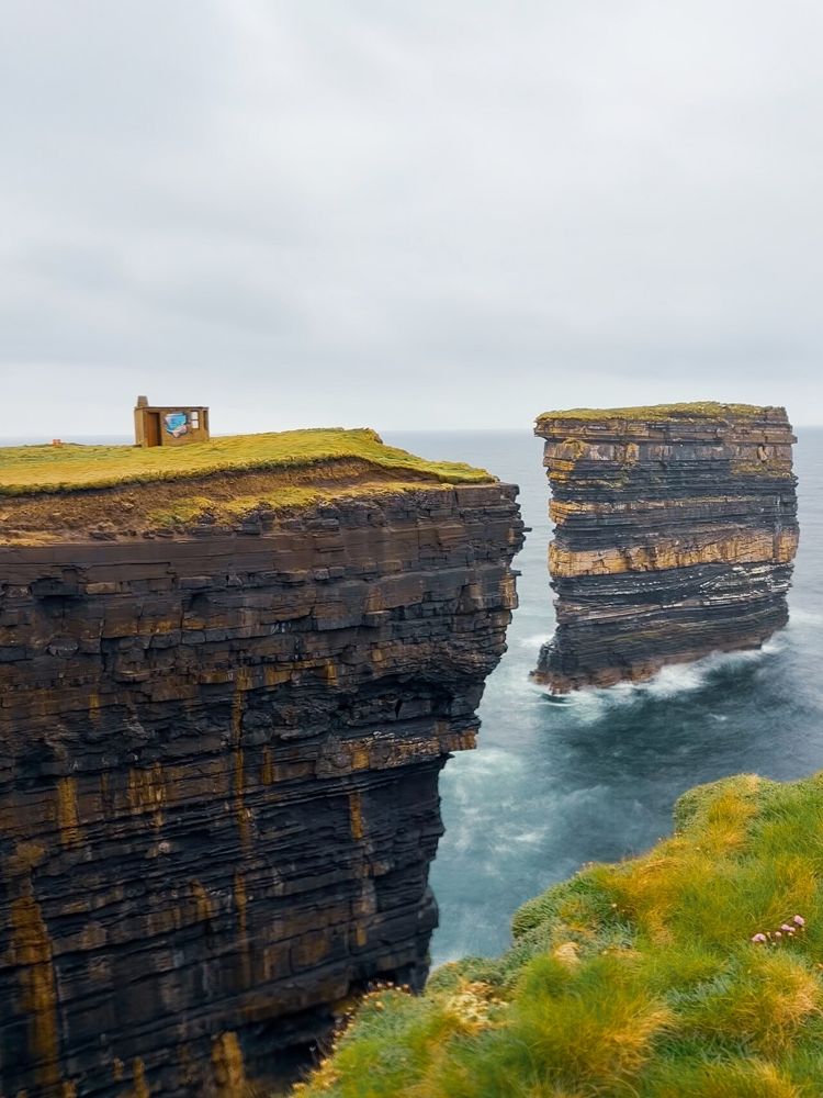
Downpatrick Head’s detached sea stack, Dún Briste, is the obvious draw, but the headland is more than a platform for one photograph. The open turf, layers of cliff and sound of water below make the coastline’s…
Open place page →
coast · 25.5 km
Enniscrone’s long sandy sweep makes a good antidote to a day of tightly timed attractions. The town sits beside the beach, so you can choose a short shore pause or a longer out-and-back without turning the…
Open place page →Accessible reviews praise the interactive rooms and explanations, while one account describes missing a tour after arriving later than expected. The small sample supports making interpretation the priority and checking last entry, rather than expecting the buried landscape to explain itself.
Original paraphrases of public visitor accounts. These are limited perspectives, not a representative survey or a claim of our own visit. Use current operator information for access and opening.
Location & access
The visitor centre and outdoor archaeological experience have managed opening arrangements. Exposed north-coast weather can change how much of the outdoor element feels comfortable.
54.30800, -9.45600 · Reference point; confirm the correct entrance and access. Map © OpenStreetMap contributors.
Source-based place brief. A catalogue reference is not a live availability check or a report of a personal visit.
Visitor details checked 19 October 2026. Page content updated 2026-10-20.