Spiti Valley Bike Trip: 8 Days from Chandigarh to Chandrataal via Kinnaur
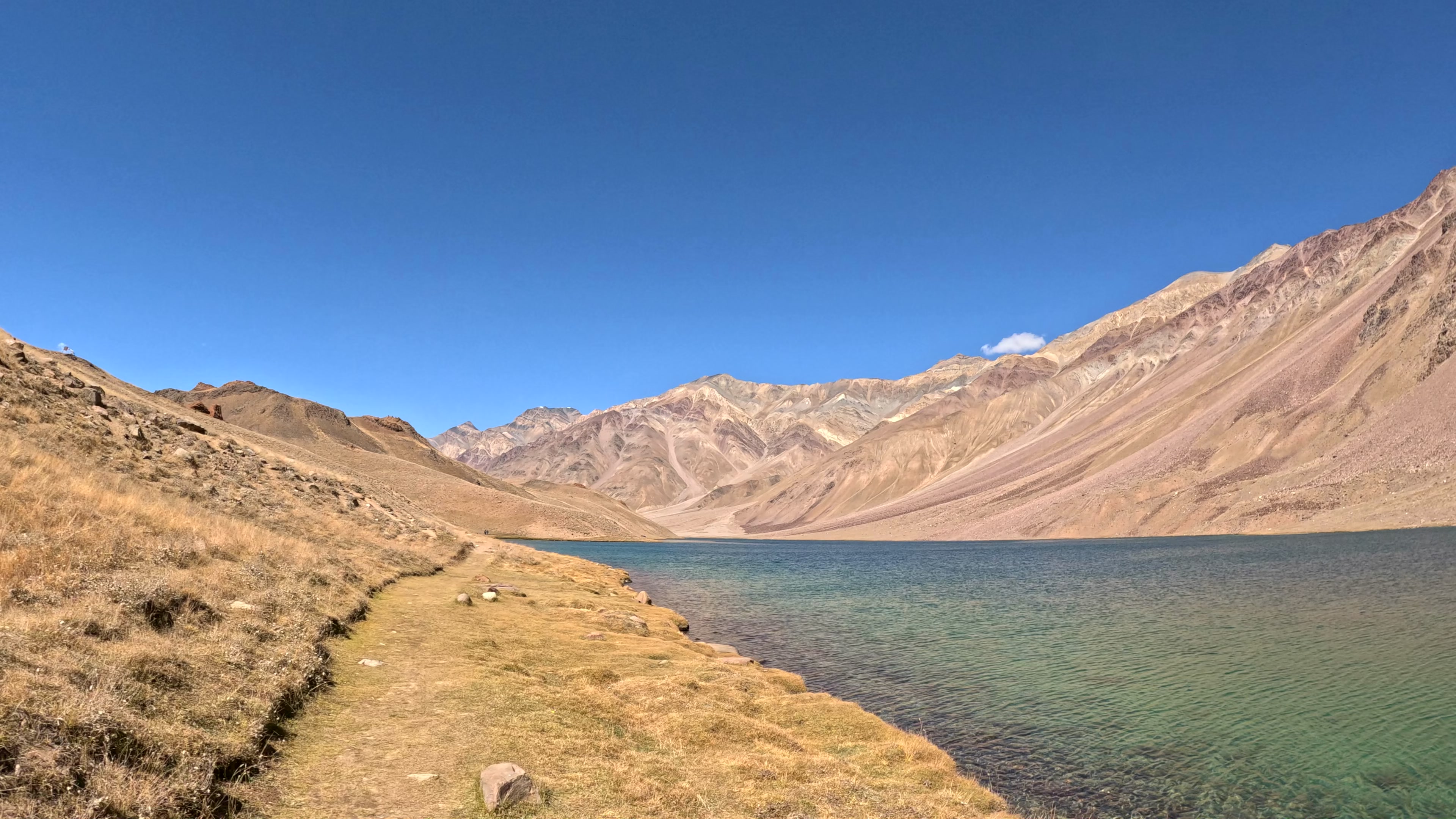
I went to Spiti for Chandrataal. On the fifth day of our ride, in Kaza, the organisers told us we could not go. A motorsport rally would close the road. We pushed back, waited for a narrow opening, crossed Kunzum La and finally reached the lake the following morning.
That is the heart of this film, but it took eight days to get there. We rode from Chandigarh through Kinnaur and the Spiti Valley on Royal Enfield Himalayans, then returned via Manali. I fell three times, and a car knocked me down once on the highway after the lake. I finished with a face full of dust and no injury.
This is the route we rode from 29 September to 6 October 2024. It is a story and a record of that trip, not a promise that the same roads, permits or stays will be available on your dates. The interactive map and all eight day cards are on the Spiti trip page.
Watch the full Spiti motorcycle film
The film follows the roads, conversations, mistakes and eventual arrival at Chandrataal. Watch it here or open it on YouTube.
The route at a glance
We rode clockwise: Chandigarh → Shimla → Narkanda → Rampur → Sangla → Chitkul → Khab → Nako → Tabo → Dhankar → Kaza → Langza, Hikkim and Key → Losar → Kunzum La → Batal → Chandrataal → Atal Tunnel → Manali → Chandigarh.
The map's daily road lines were reconstructed from camera GPS, OpenStreetMap tracks and OSRM routing between our stops. They add up to about 1,173 km, including the return to Chandigarh. That is a route estimate, not a measured odometer total. Some exact hotel names and incident locations are still unconfirmed; I have left those out rather than guess. Open the map and download its GeoJSON.
Day 1 — Chandigarh to the Narkanda area
We had collected the bikes in Chandigarh the evening before. On the first riding day we climbed past Shimla. I was riding at the back, missed a turn in a dusty town and spent my group's rest break catching up. Thick fog came in near Narkanda. We stayed at a resort in that area; I have not confirmed its name. The mapped route for the day is approximately 150 km.
Day 2 — Kinnaur's cliff road to Chitkul
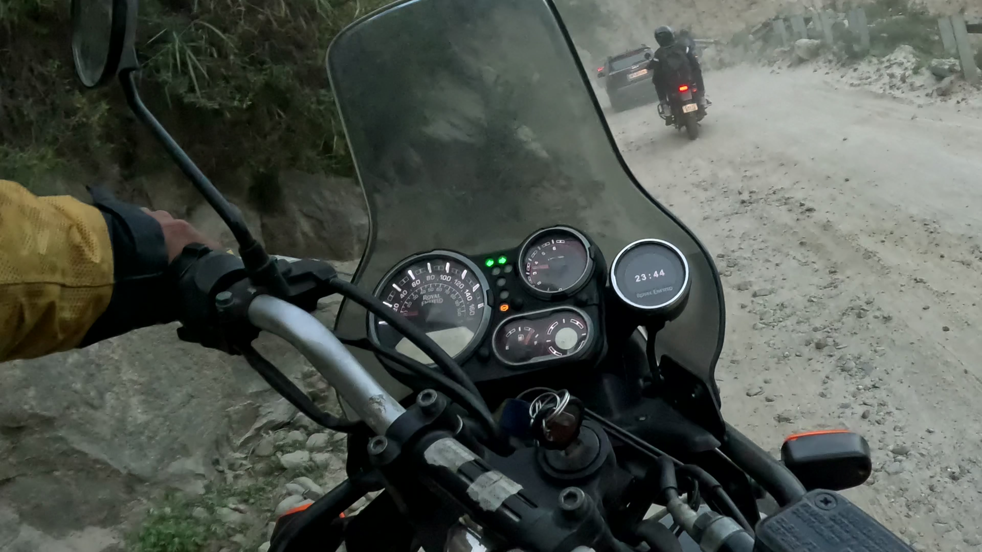
From Narkanda we descended towards the Sutlej at Rampur, then entered the narrow Kinnaur road. Trucks, single-lane stretches, gravel and dust slowed the group. Several bikes, including mine, had brake trouble on the descents. My first fall happened on the gravel on the way to Chitkul.
We passed Sangla as the light faded and finished the Baspa valley approach in darkness. The night ended in Swiss tents near Chitkul, with a bonfire and stars. In daylight the following morning, the exposed road made that night ride feel even less sensible. The routed estimate for day two is about 206 km.
Day 3 — Chitkul, Khab and Nako
We went beyond Chitkul in the morning for photographs, then returned through Kinnaur. At Khab the scenery changed as our route left the Sutlej corridor and followed the Spiti River into a colder, drier landscape. Someone stopped us on the road and offered apples. Later, I managed to get lost again in Nako before finding our stay. The route model puts this day at approximately 151 km. The property name in Nako is still to confirm.
Day 4 — Nako, Tabo, Dhankar and Kaza
A few of us walked above Nako at sunrise. We then rode to Tabo for a long stop and on to Dhankar, where the monastery and settlement sit above the river confluence. By the time we reached Kaza it was dark.
Fall number two was hardly cinematic: the hotel car park sloped, the Himalayan stood very upright on its side stand and tipped onto my boot. I was fine. We slept in Kaza, though I have not verified the hotel's name. The map estimates about 121 km of riding between the day's stops; our visits made it a much longer day than that distance suggests.
Day 5 — The Chandrataal news, then Langza, Hikkim and Key
This was the turn in the story. The organisers said a rally would block the way to Chandrataal. They told us they had received short notice; my own later check suggested the event had been announced much earlier. That timing is my account of the dispute, not an independently established finding about the organisers.
While our plans were uncertain, we rode the high villages around Kaza: Langza, Hikkim and Key. I had my third fall near Hikkim. That night we photographed the stars near Langza and slept in Kaza again. The local loop is approximately 68 km in the route model.
Day 6 — The call to leave, Kunzum La and Batal
The message finally came: if we wanted to see Chandrataal, we had to leave immediately. Bags were already packed. We rode through Losar and over Kunzum La. By the time we reached the Chandrataal turn-off, the rough final track looked like a poor bet late in the day, so we stopped in the Batal area and left the lake for morning. The mapped day is approximately 87 km. I have not confirmed the exact overnight property.
Day 7 — Chandrataal, then the crash towards Manali
We started early but still had to wait for the final rally bike to pass. Then we took the track to Chandrataal. After the uncertainty in Kaza and the cold approach through Batal, standing beside the blue water was the moment I had ridden for.
The day was not over. After returning to the main route and continuing towards Manali, a car overtaking on the left struck my front tyre and knocked me down. I was unhurt, but my face was covered in road dust. We finished in Manali. The route model estimates about 134 km for the day; it cannot express how slow the lake track and the stops felt.
Day 8 — Manali back to Chandigarh
We rode south through Kullu, Mandi and Bilaspur to Chandigarh and returned the bikes. The last day is approximately 256 km by the model. The trip ended, but the story had already changed at Chandrataal.
Where we stayed
Our seven nights were in the Narkanda area, Chitkul, Nako, Kaza, Kaza again, Batal and Manali. We used a resort near Narkanda, Swiss tents near Chitkul, and a mix of guesthouses, hotels or simple accommodation after that. The trip page lists each night. I am withholding exact property names and booking links until I can identify them reliably from the footage and records.
What I would check before riding this route
Daylight matters. We reached Chitkul and Kaza after dark. The Chitkul approach was the stretch I most wished I had seen clearly while riding.
A road plan needs an event plan. The rally nearly removed the one destination I cared about. Before booking, check current road status, local closures and a sensible alternative if the Kunzum or Chandrataal approach is blocked. The Lahaul and Spiti district travel page directs travellers to current road information.
Fuel and permits need a current check. Kaza had a filling station on our route, and Himachal Tourism lists one there. Its guidance also says Indian citizens do not need an entry permit for the valley, while foreign tourists using the Shimla–Kinnaur route need an inner-line permit. Check the current rule for your nationality, route and dates before travelling.
Agree how the group will regroup. We had limited phone coverage around Batal. On this ride, the people in a Tempo Traveller experienced a breakdown and long wait after the motorcycle group moved ahead. A shared meeting and breakdown plan matters more than a neat itinerary on a phone.
Use gear that can take a slow fall. My boots protected my foot when the bike tipped in Kaza. The Himalayan is heavy, especially on loose ground and awkward parking slopes.
Questions about this Spiti bike trip
How long did this Chandigarh to Spiti trip take?
Our filmed circuit took eight days, from 29 September to 6 October 2024. That describes our group ride, not a minimum or recommended pace for everyone.
Did you reach Chandrataal?
Yes. The rally delayed us, but we crossed Kunzum La on day six, stopped around Batal and reached Chandrataal on day seven.
Are the distances exact?
No. The daily numbers and the approximately 1,173 km total are reconstructed road-routing estimates. They are not the bike's odometer reading and do not include stops, traffic or road changes.
Can I use this as a current navigation plan?
Use it to understand our 2024 route. Check current road conditions, permit requirements, weather and local advice before every leg. The district travel page and Himachal Tourism's Spiti guide are starting points.
Sources
- The full Spiti motorcycle documentary: my footage and narration for the sequence and first-person incidents.
- TheLazyNick Spiti trip page and downloadable route file: camera GPS, OpenStreetMap and OSRM reconstruction; daily distances are estimates.
- Himachal Tourism: Spiti Valley: regional access, Kaza services and permit guidance.
- Lahaul and Spiti district: How to reach: official reminder to check current road status and advisories.
The lake and gravel photographs on this page are frames from my own trip. I have not reused the stock aerial that appears in the film.
Comments
No sign-in needed. Comments are reviewed before publication. Your name and comment will be public after approval. Comment rules · Privacy details
Loading comments…