The sandy strand
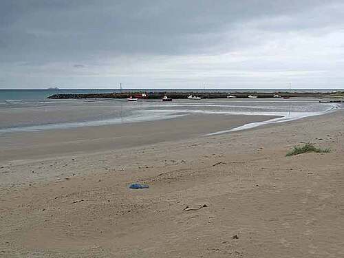
Look along the east-facing shore and compare the different textures left by wind and water. Keep your route short enough to turn back comfortably if conditions change.

nature · Wexford
Carne combines an east-facing sandy beach with the working scale of a small harbour. A visit can be as simple as pausing at the shore, looking along the strand and watching the relationship between beach and pier. Keep the outing flexible enough to respond to wind and tide.
From research
Choose this for a coastal stop in south-east Wexford rather than a long expedition. Begin at the public viewing area and decide whether the sand suits the conditions and your group. The beach and harbour offer different viewpoints without requiring a boat trip or a swim.
Know before you book: Plan a land-based visit. A beach wheelchair or accessible ramp does not remove the effects of soft sand, weather or water levels. Use current local signs, keep away from exposed harbour edges in rough conditions and treat any swimming decision as a separate matter.
Place highlights
Look along the east-facing shore and compare the different textures left by wind and water. Keep your route short enough to turn back comfortably if conditions change.
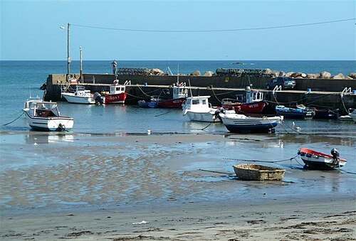
View the pier and boats from the permitted public areas. The harbour gives a useful sense of scale against the open sea, but working spaces and access restrictions take priority over sightseeing.
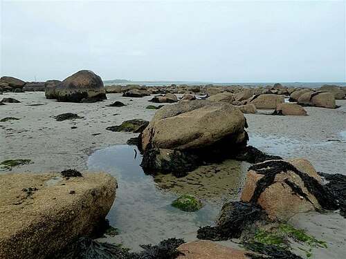
Notice how vegetation and sand form the landward boundary of the beach. Stay on established access paths instead of creating new routes through the planted or naturally vegetated dunes.
The story behind the visit
Carne lies between Carnsore Point and Greenore Point in the south-east corner of County Wexford. Discover Ireland describes an east-facing sandy shore beside Carne Pier, with dunes to the west. That arrangement makes the visit a meeting of open coast, harbour and dune landscape. Source ↗
The harbour is part of the everyday setting rather than a separate excursion included with a beach visit. Looking at the water from a permitted viewing area can be worthwhile in its own right. Do not assume that a pier, vessel or slipway is open for unrestricted visitor use. Source ↗
The council records a flat concrete ramp to the beach and viewing from the car park and pier area. Those facilities create options for a short coastal visit, while the beach surface remains different from a hard path. Choose the viewing position that works for the people with you. Source ↗
Visitor information
Use Carne Beach near Carne Pier, County Wexford, and follow the signed public access. The official tourism coordinate identifies the beach locality for orientation, not a verified accessible doorway or a route along the whole shore. Official visitor information ↗
Confirm current access and visitor arrangements with the operator.
No. This guide is for Carne in County Wexford, Ireland. Check the county when selecting maps or photographs. Source ↗
The tourism page describes seasonal provision. Confirm it through the listed local contact rather than assuming equipment is available on arrival. Source ↗
No. The planned activity is shore viewing and a walk suited to current conditions. Check local water-safety information separately. Source ↗
Nearby options
Explore other places in the area, then use live directions to plan your journey.
heritage
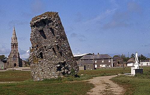
Our Lady’s Island brings a pilgrimage landscape into contact with a coastal lagoon. Ruined buildings, a graveyard and the public pilgrim route give the place several layers of meaning. Begin with the landward…
Open place page →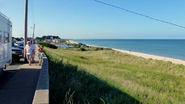
nature
Rosslare Strand is a long coastal landscape that changes with the tide and weather. Choose a short section of beach and give it time: the timber groynes, shifting sand and wide seaward view offer more to…
Open place page →
heritage
Johnstown is easiest to enjoy as an estate day with several choices, rather than simply a castle ticket. The Gothic house provides the image, but lakeside paths and the agricultural museum give the visit a…
Open place page →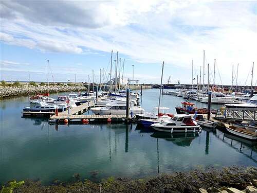
heritage
Kilmore Quay is a village to explore at walking pace, with a working harbour at its centre and a memorial landscape looking out to sea. Give the public waterfront and village streets time together. The…
Open place page →
heritage
Selskar is a rewarding interruption to a Wexford town walk because the ruins sit inside the modern street pattern. It is not a large countryside abbey: the interest is in finding the medieval town beneath…
Open place page →
nature
Wexford Wildfowl Reserve is a place to watch a landscape carefully rather than walk straight through it. Fields, shallow water and harbour margins provide feeding and resting ground for birds. Begin at the…
Open place page →Location & access
Plan a land-based visit. A beach wheelchair or accessible ramp does not remove the effects of soft sand, weather or water levels. Use current local signs, keep away from exposed harbour edges in rough conditions and treat any swimming decision as a separate matter.
52.19874, -6.35036 · Reference point; confirm the correct entrance and access. Map © OpenStreetMap contributors.
Orientation only: a verified public entrance is not established by this pin. Use the operator arrival information before travel.