Skip to content
TheLazyNick

coast · Antrim

Whitepark Bay

White Park Bay is a broad sandy arc between headlands on the north Antrim coast, backed by old dunes. It offers space for a beach walk and close attention to the shoreline rather than a built attraction. The National Trust explicitly warns that dangerous rip currents make this beach unsafe for swimming.

Add to planSaved trips & places

Saved on this browser. No account needed.

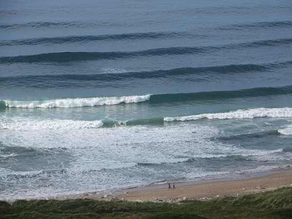
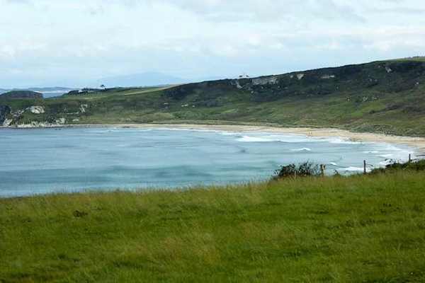
White Park Bay framed by its headlands
White Park Bay framed by its headlands. Resized for display. Photo: David Dixon ↗ · CC BY-SA 2.0

From research

Is this worth your time?

Choose White Park Bay for walking, coastal scenery and dune habitats. It works best when you can descend and climb the steep access without rushing. Bring what you need, because there are no toilets, and leave room in the plan to return another time if the small car park is full.

Know before you book: This is a walking beach, with steep access and unsafe swimming conditions.

Place highlights

What you will actually see

01

The sandy bay

The beach curves between two headlands, creating a strong sense of enclosure despite the open sea. Walk only as far as conditions and the return climb allow; its scale is easier to appreciate from several viewpoints than from one quick photograph.

02

Dune landscape

Ancient sand dunes back the shore and support a variety of habitats. Keep to the established access and avoid damaging vegetation. The dunes are part of the attraction in their own right, rather than spare ground behind the sand.

03

Shoreline details

Look closely at the changing textures of sand, stones and rock, and watch for coastal birds. The Trust includes fossil spotting among the activities here. Leave natural features in place and keep dogs on leads where livestock graze.

The story behind the visit

The story behind the place

The bay’s apparent simplicity rewards a slower visit. Two headlands frame the sand, while the dunes make a softer boundary inland. Weather and light can change the relationship between these elements within a single walk. Start by taking in the whole curve, then turn towards the smaller details along the beach. A coastal landscape does not need a long checklist: noticing a shifting line of washed-up material or a bird feeding at the edge can be as worthwhile as reaching the far end. Source ↗

The dunes are long-established habitat, and grazing animals can be part of the scene. Their presence is a reason to keep a respectful distance and control dogs, not an invitation to approach for photographs. Access also deserves attention: slopes, steep steps, kissing gates and a rough car-park surface mean that an easy-looking stretch of sand is not an easy-access promise. The most important distinction is between enjoying the shore and entering the water. Dangerous currents remain a serious limitation even when the beach looks calm. Source ↗

Visitor information

Tickets, timing and access

Opening
Beach dawn–dusk; car park open all day.Confirm with the operator ↗
Admission
Free parking; no beach ticket.Confirm with the operator ↗
Booking
No timed admission; return later if parking is full.Confirm with the operator ↗
Access
Steep steps and slopes, kissing gates and uneven surfaces; no toilets.Confirm with the operator ↗
Duration
Allow about an hour for a short walk and the return climb.Confirm with the operator ↗
Seasonal
Avoid swimming; assess weather and sea conditions from the shore.Confirm with the operator ↗

Getting to the entrance

Use the National Trust parking off the coastal B146 between Bushmills and Ballycastle. Official visitor information ↗

Your questions, answered

Confirm current access and visitor arrangements with the operator.

Is White Park Bay suitable for swimming?

No. The National Trust warns of dangerous rip currents. Source ↗

Are dogs allowed?

Dogs must remain on leads because livestock graze here. Source ↗

Nearby options

Nearby places to explore

Explore other places in the area, then use live directions to plan your journey.

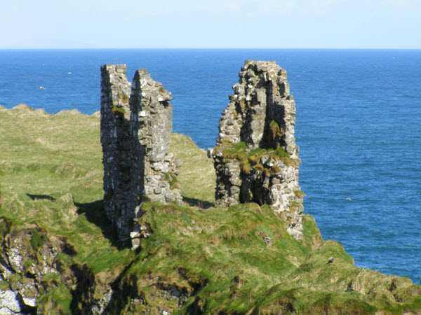
Surviving tower walls at Dunseverick Castle
Surviving tower walls at Dunseverick Castle. Resized for display. Photo: mauldy ↗ · CC BY-SA 2.0

heritage

Dunseverick Castle

Dunseverick Castle occupies a steep basalt promontory on the Causeway coast. A small surviving masonry tower stands within a much older fortified landscape, where earthworks matter as much as the conspicuous…

Open place page →
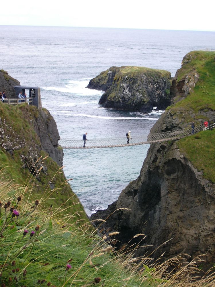
The Carrick-a-Rede rope bridge
The Carrick-a-Rede rope bridge. Source photograph dated 2005. Credited source photograph; appearance and access may have changed. Resized from the original. Photo: Stuart Yeates from Oxford, UK ↗ · CC BY-SA 2.0

coast

Carrick-a-Rede

At Carrick-a-Rede, the coastal approach is a substantial part of the experience. The bridge is the brief, memorable crossing within a longer outing above the sea, not something beside the car door.

Open place page →
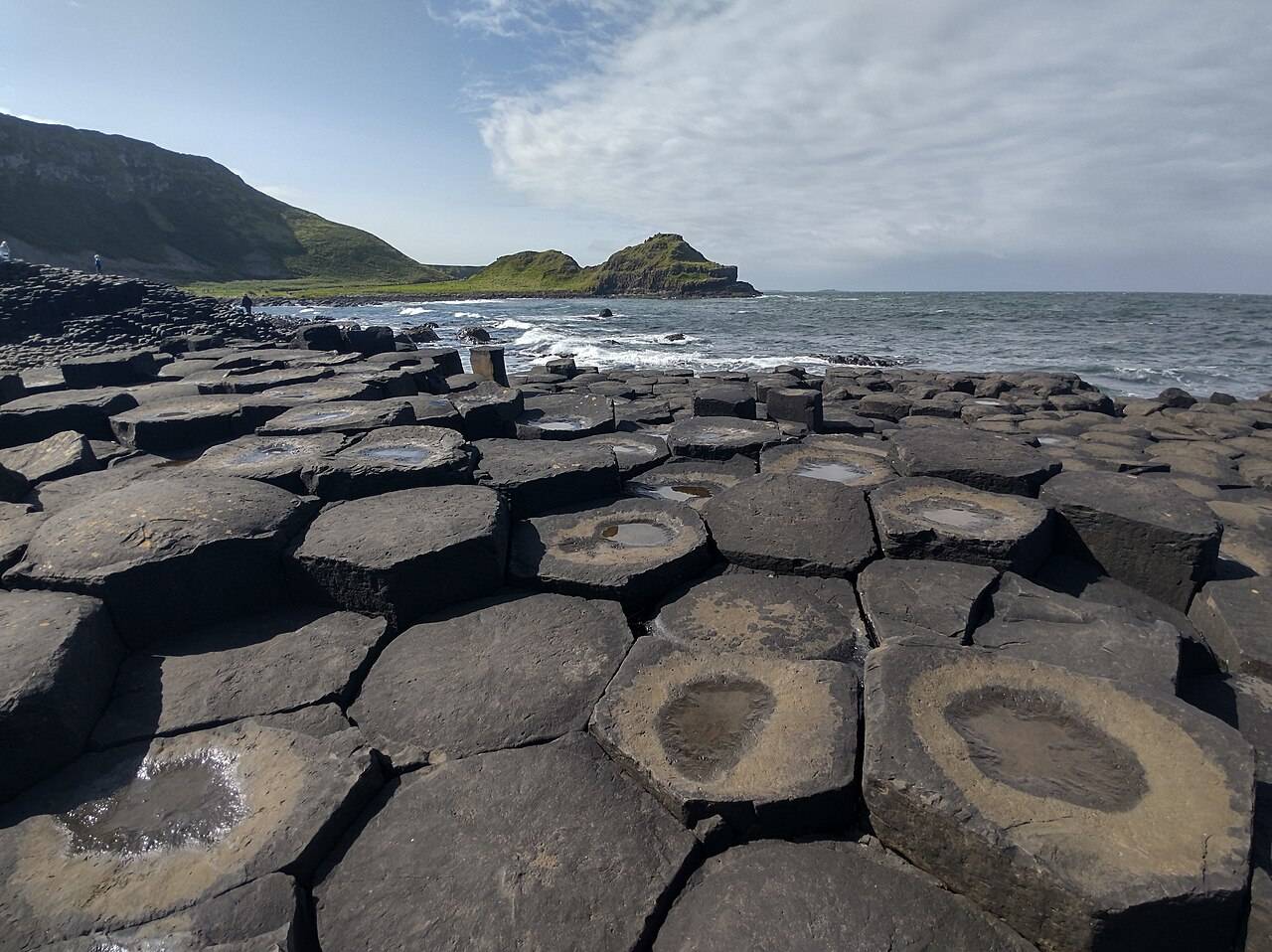
Basalt columns and sea at the Giant's Causeway
Basalt columns and sea at the Giant's Causeway. Source photograph; current access and conditions may differ. Photo: Yujin ↗ · CC0

coast

Giant’s Causeway

The Giant’s Causeway combines an extraordinary basalt shoreline with a managed visitor experience. Decide how you will arrive and which services you want before travelling.

Open place page →
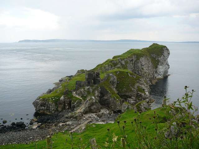
Kinbane’s chalk headland and castle beside the sea
Kinbane’s chalk headland and castle beside the sea. Resized for display. Photo: Colin Park ↗ · CC BY-SA 2.0

heritage

Kinbane Castle

Kinbane Castle occupies a chalk headland below the Causeway Coast near Ballycastle. Its ruined tower and enclosure are interesting in their own right, but the relationship between masonry, cliffs and sea gives…

Open place page →
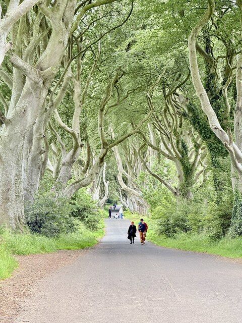
Beech trees along the Dark Hedges road
Beech trees along the Dark Hedges road. Credited source photograph; appearance and access may have changed. Resized from the original. Photo: Paul Buckingham ↗ · CC BY-SA 2.0

nature

The Dark Hedges

The Dark Hedges is a short avenue, not a forest hike. Its attraction is the way mature beech limbs lean across the road, producing a tunnel whose appearance changes with light, weather and the remaining trees.

Open place page →
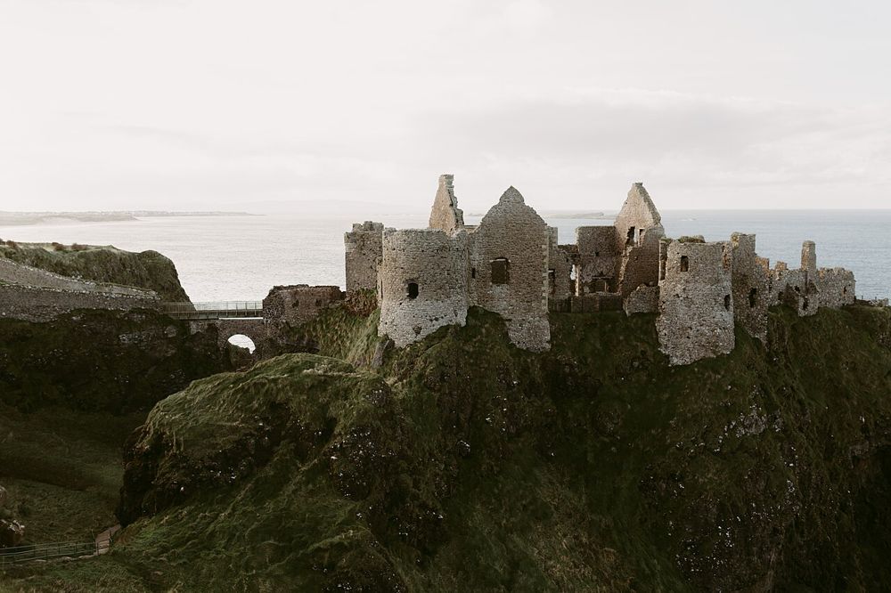
Dunluce Castle above the rocky coast
Dunluce Castle above the rocky coast. Credited source photograph; appearance and access may have changed. Resized from the original. Photo: Iain Irwin ↗ · CC BY-SA 4.0

heritage

Dunluce Castle

Dunluce is a ruin with a very legible geography: a castle gripping a rocky coastal outcrop, separated from the mainland by a narrow approach. The setting is compelling before you know the family names.

Open place page →

External visitor reviews

Find the matching listing and reviews on Google Maps ↗

Part of a bigger journey

Location & access

Getting your bearings

This is a walking beach, with steep access and unsafe swimming conditions.

55.22890, -6.40669 · Reference point; confirm the correct entrance and access. Map © OpenStreetMap contributors.

Orientation only: a verified public entrance is not established by this pin. Use the operator arrival information before travel.

Sources & place context

Browse more Ireland places →