Skip to content
TheLazyNick

heritage · Antrim

Dunseverick Castle

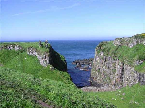
Dunseverick Castle occupies a steep basalt promontory on the Causeway coast. A small surviving masonry tower stands within a much older fortified landscape, where earthworks matter as much as the conspicuous ruin. The National Trust describes it as an ancient royal site associated with the Dál Riada kingdom and later medieval strongholds.

Add to planSaved trips & places

Saved on this browser. No account needed.

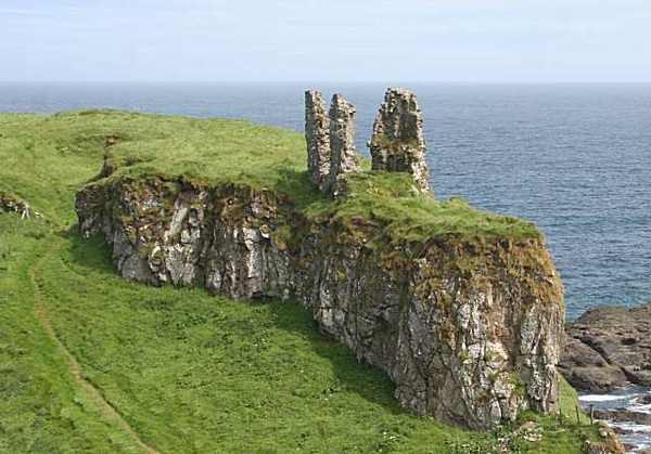
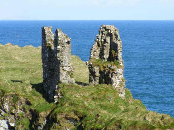
Surviving tower walls at Dunseverick Castle
Surviving tower walls at Dunseverick Castle. Resized for display. Photo: mauldy ↗ · CC BY-SA 2.0

From research

Is this worth your time?

Choose Dunseverick for its coastal position and layered history, rather than expecting a furnished castle or extensive standing rooms. A short visit from the coast offers the essential view. The setting is exposed and steep-sided, so stay well back from edges and let conditions determine how closely you approach.

Know before you book: An exposed ruined promontory, with no castle-interior visitor experience promised.

Place highlights

What you will actually see

01

Basalt headland

First look at the relationship between the rock stack and the inlets around it. The steep sides explain the defensive value of this position more clearly than the amount of masonry now standing. A view from a safe distance is enough to appreciate that setting.

02

Surviving tower

The small residential masonry tower on the southern edge is the most obvious ruin. Part collapsed with the rock face in 1978 and was subsequently stabilised. Observe its silhouette without climbing the masonry or treating the surrounding slopes as a maintained castle staircase.

03

Banks and ditches

Low earthworks survive around and on the promontory. These quieter features help show that the site extended beyond one tower. Look for changes in ground level from established approaches, keeping away from unstable edges and respecting any signs or barriers.

The story behind the visit

The story behind the place

Dunseverick’s history reaches beyond the visible stone fragment. The National Trust connects the site with early fortification and the maritime world of Dál Riada, linking north-east Ireland and western Scotland. Later occupants included the Earls of Ulster, the O’Cahans and the MacDonnells. That sequence makes it a useful place to think about changing power along a coast whose sea routes could connect communities as readily as they exposed them to attack. Source ↗

Traditions involving Saint Patrick belong alongside, rather than in place of, the archaeological evidence. The low banks, ditches and possible building divisions show how much of a stronghold can survive as shape in the ground. The headland was never refortified after its seventeenth-century destruction, and the remaining tower is only part of the story. Spend a little time comparing the defensive landscape with the open sea. A brief coastal stop becomes more meaningful when the absence of grand walls is understood as evidence of loss, rather than a reason to overlook the site. Source ↗

Visitor information

Tickets, timing and access

Opening
Outdoor ruin; visit in daylight and obey any local restrictions.Confirm with the operator ↗
Admission
No castle-interior admission offer is advertised.Confirm with the operator ↗
Booking
No timed interior visit is offered.Confirm with the operator ↗
Access
Exposed steep-sided coastal terrain; keep away from cliff edges and unstable masonry.Confirm with the operator ↗
Duration
Allow about 30 minutes for the main view.Confirm with the operator ↗
Seasonal
Strong wind, rain and short daylight can limit a visit.Confirm with the operator ↗

Getting to the entrance

Use the signed coastal location near Dunseverick; remain on the established approach rather than crossing private land. Official visitor information ↗

Your questions, answered

Confirm current access and visitor arrangements with the operator.

Is this a complete castle?

No. A small tower and earthworks survive on the fortified headland. Source ↗

Must I climb onto the headland?

No. The coastal setting can be appreciated from a safe distance. Source ↗

Nearby options

Nearby places to explore

Explore other places in the area, then use live directions to plan your journey.

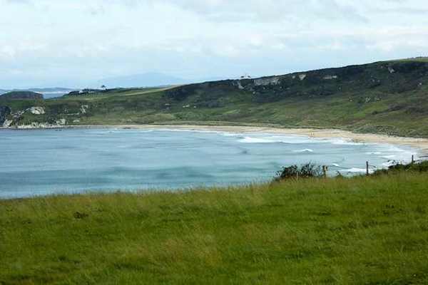
White Park Bay framed by its headlands
White Park Bay framed by its headlands. Resized for display. Photo: David Dixon ↗ · CC BY-SA 2.0

coast

Whitepark Bay

White Park Bay is a broad sandy arc between headlands on the north Antrim coast, backed by old dunes. It offers space for a beach walk and close attention to the shoreline rather than a built attraction. The…

Open place page →
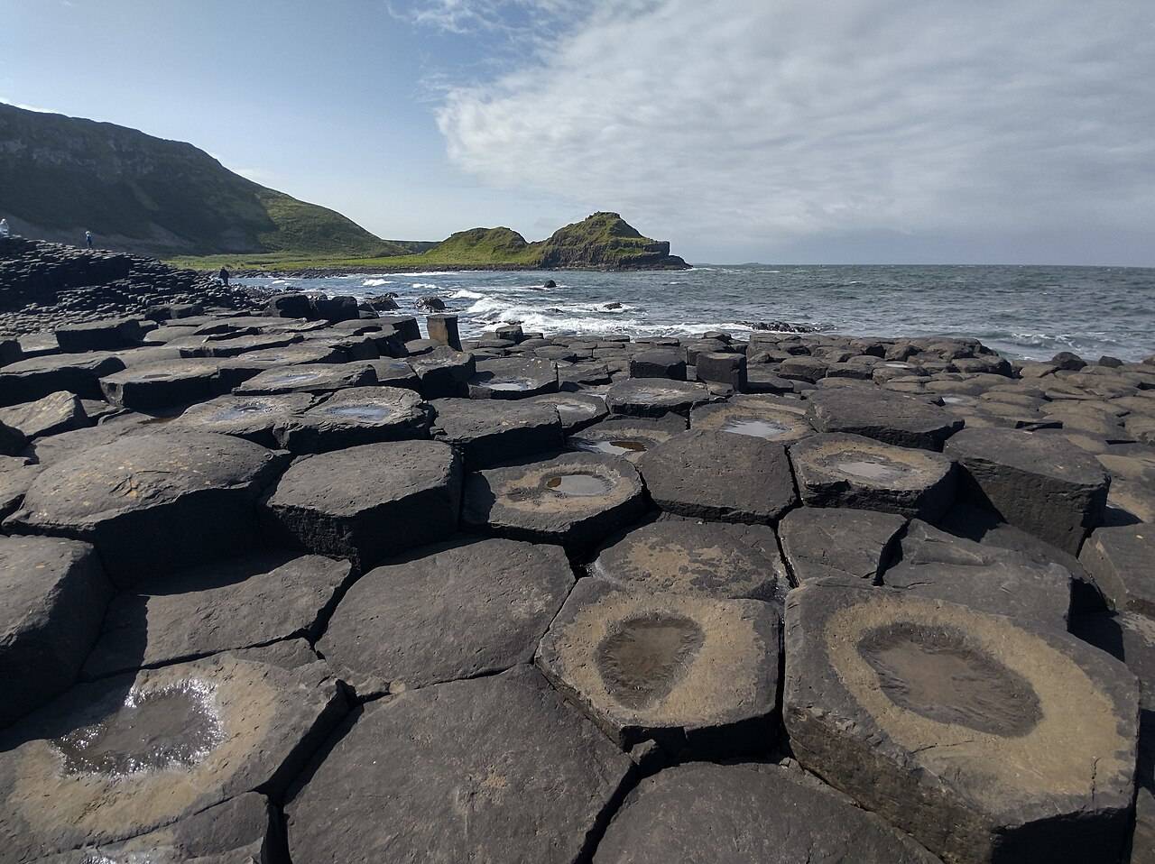
Basalt columns and sea at the Giant's Causeway
Basalt columns and sea at the Giant's Causeway. Source photograph; current access and conditions may differ. Photo: Yujin ↗ · CC0

coast

Giant’s Causeway

The Giant’s Causeway combines an extraordinary basalt shoreline with a managed visitor experience. Decide how you will arrive and which services you want before travelling.

Open place page →
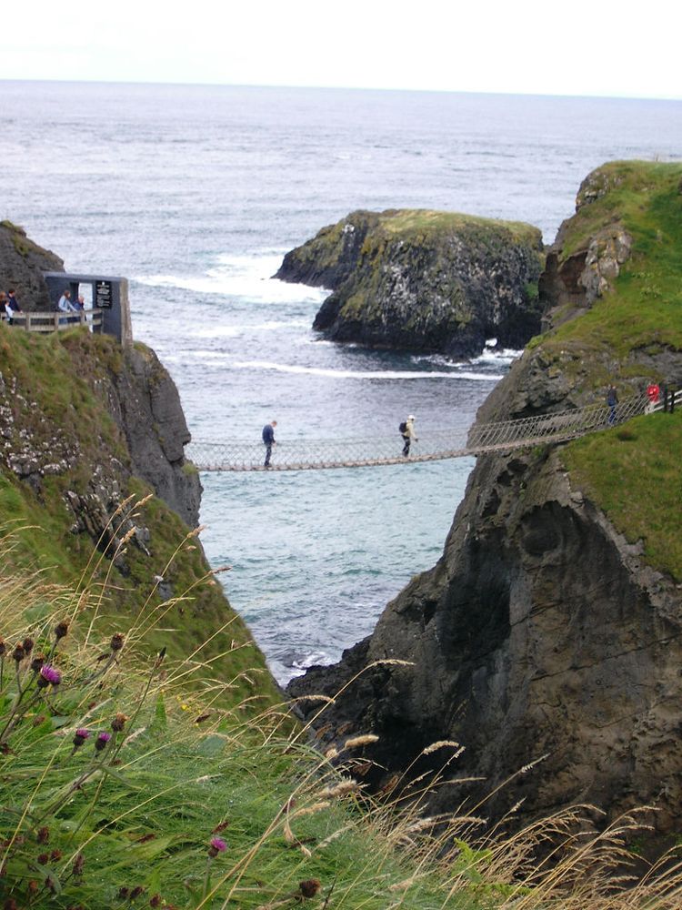
The Carrick-a-Rede rope bridge
The Carrick-a-Rede rope bridge. Source photograph dated 2005. Credited source photograph; appearance and access may have changed. Resized from the original. Photo: Stuart Yeates from Oxford, UK ↗ · CC BY-SA 2.0

coast

Carrick-a-Rede

At Carrick-a-Rede, the coastal approach is a substantial part of the experience. The bridge is the brief, memorable crossing within a longer outing above the sea, not something beside the car door.

Open place page →
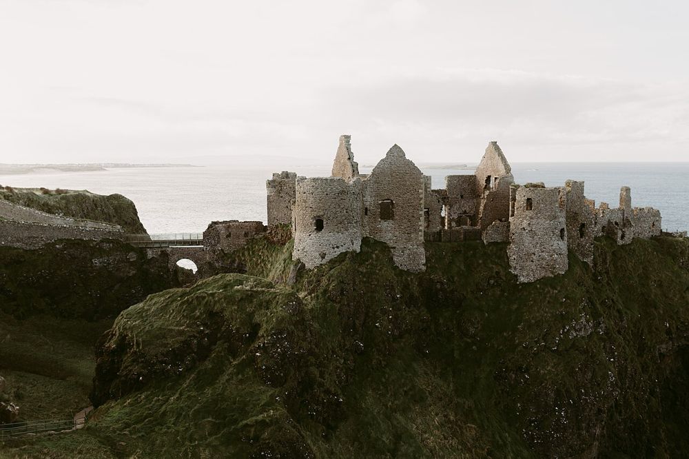
Dunluce Castle above the rocky coast
Dunluce Castle above the rocky coast. Credited source photograph; appearance and access may have changed. Resized from the original. Photo: Iain Irwin ↗ · CC BY-SA 4.0

heritage

Dunluce Castle

Dunluce is a ruin with a very legible geography: a castle gripping a rocky coastal outcrop, separated from the mainland by a narrow approach. The setting is compelling before you know the family names.

Open place page →
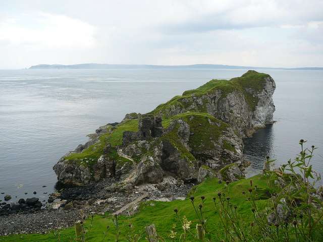
Kinbane’s chalk headland and castle beside the sea
Kinbane’s chalk headland and castle beside the sea. Resized for display. Photo: Colin Park ↗ · CC BY-SA 2.0

heritage

Kinbane Castle

Kinbane Castle occupies a chalk headland below the Causeway Coast near Ballycastle. Its ruined tower and enclosure are interesting in their own right, but the relationship between masonry, cliffs and sea gives…

Open place page →
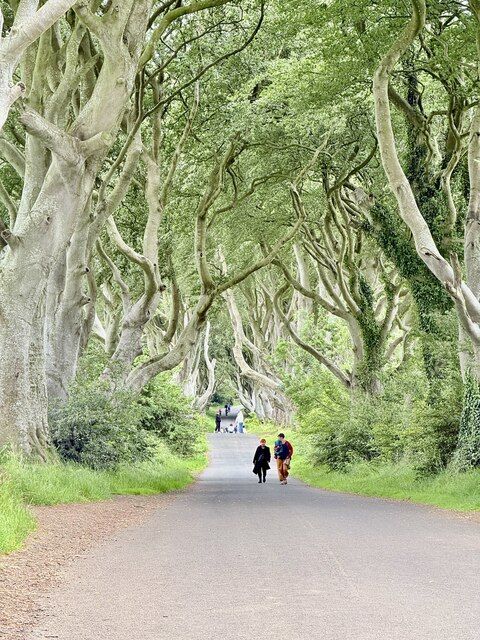
Beech trees along the Dark Hedges road
Beech trees along the Dark Hedges road. Credited source photograph; appearance and access may have changed. Resized from the original. Photo: Paul Buckingham ↗ · CC BY-SA 2.0

nature

The Dark Hedges

The Dark Hedges is a short avenue, not a forest hike. Its attraction is the way mature beech limbs lean across the road, producing a tunnel whose appearance changes with light, weather and the remaining trees.

Open place page →

External visitor reviews

Find the matching listing and reviews on Google Maps ↗

Part of a bigger journey

Location & access

Getting your bearings

An exposed ruined promontory, with no castle-interior visitor experience promised.

55.23837, -6.44820 · Reference point; confirm the correct entrance and access. Map © OpenStreetMap contributors.

Orientation only: a verified public entrance is not established by this pin. Use the operator arrival information before travel.

Sources & place context

Browse more Ireland places →