Skip to content
TheLazyNick

nature · Sligo

Gleniff Horseshoe

The Gleniff Horseshoe is a scenic road circuit beneath the Dartry Mountains in north Sligo. Steep mountain faces enclose the valley, while views open towards Donegal Bay. Keep the visit on the public road and established stopping places: the dramatic cave above the valley is not an invitation to leave the route.

Add to planSaved trips & places

Saved on this browser. No account needed.

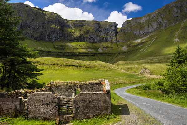
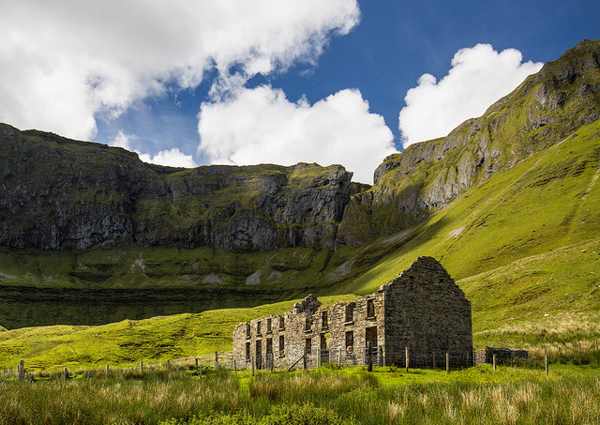
An old building beneath the mountain walls of Gleniff Horseshoe.
An old building beneath the mountain walls of Gleniff Horseshoe. Photo: Mike Searle ↗ · CC BY-SA 2.0

From research

Is this worth your time?

Choose Gleniff for a landscape outing that can be scaled to a short drive, cycle or carefully planned road walk. The road is narrow and shared with traffic, so choose the form of visit that suits your group. A view from below is the intended reward; climbing to Diarmuid and Gráinne’s Cave is specifically discouraged.

Know before you book: Use the public road. Do not climb to Diarmuid and Gráinne’s Cave: official route guidance warns of private land and dangerous terrain.

Place highlights

What you will actually see

01

Mountain walls

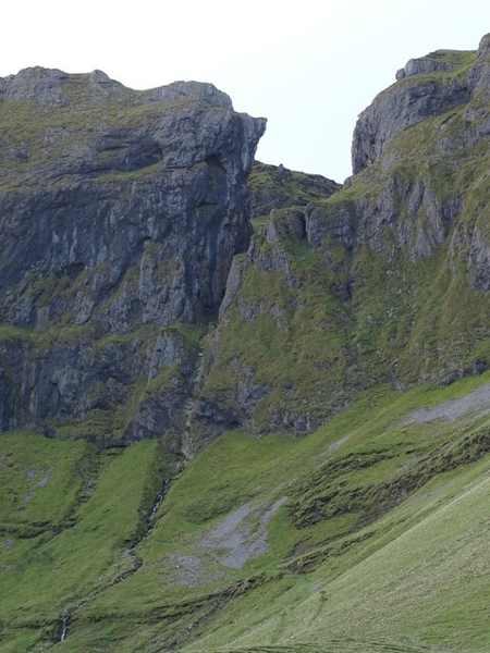
Look up towards the Dartry slopes and the Cliffs of Annacoona from public roadside ground. Pause on the established public route and look carefully. Watch your footing as well as the view; keep well away from exposed edges for photographs.

02

The valley road

Notice how the route follows the enclosed landscape before returning towards lower ground. Compare this feature with the wider surroundings. Use permitted approaches, leave plants and wildlife undisturbed and avoid shortcuts across adjoining land or fragile vegetation.

03

Mill and folklore

The official walking account connects the valley with a nineteenth-century mill and a legendary cave. Choose a comfortable turning point before conditions limit the return. A shorter visit still reveals the place’s character; you need not reach every visible landmark.

The story behind the visit

The story behind the place

Sligo Walks describes the horseshoe as a roughly ten-kilometre road loop beneath several Dartry peaks, with a longer approach from the Benwiskin Centre. It identifies the nineteenth-century Barytes Mill site near the entrance to the valley. This combination of industrial traces and dramatic natural walls gives the route more depth than a single viewpoint. Decide whether you are making a drive or a full road walk before setting off, because those are different commitments. Source ↗

The cave associated with Diarmuid and Gráinne belongs to Irish legend, but access is a practical matter. Sligo Walks warns that reaching it crosses private land and involves dangerous terrain, with a particularly difficult descent. Its advice is not to climb there. Keep the story as something to consider from the road rather than a destination to reach. The valley’s scale remains impressive from below, and a public-road visit does not establish permission to explore the surrounding mountainsides. Source ↗

Visitor information

Tickets, timing and access

Opening
Visit in daylight and follow current local restrictions.Confirm with the operator ↗
Admission
No organised admission applies to viewing from the public road; local arrangements may differ.Confirm with the operator ↗
Booking
A drive has no departure time; book any guided mountain activity separately.Confirm with the operator ↗
Access
Narrow roads carry traffic. The cave climb is not recommended and crosses private land.Confirm with the operator ↗
Duration
Allow about 90 minutes for a scenic drive with pauses; a full road walk needs longer.Confirm with the operator ↗
Seasonal
Avoid the exposed setting in poor visibility or severe weather.Confirm with the operator ↗

Getting to the entrance

Approach the signed Gleniff Horseshoe near Ballintrillick. Keep narrow passing places clear and plan any longer walk from the official route information. Official visitor information ↗

Your questions, answered

Confirm current access and visitor arrangements with the operator.

Must I complete a long walk?

No. Choose a shorter permitted outing that fits conditions and leaves a straightforward return. Source ↗

Can I climb to the cave?

No. Official guidance warns of private land and dangerous terrain; stay on the public road. Source ↗

Nearby options

Nearby places to explore

Explore other places in the area, then use live directions to plan your journey.

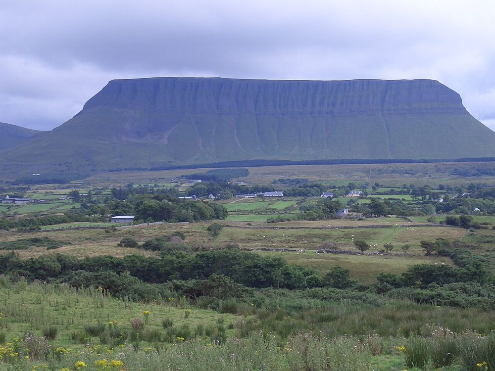
Benbulben’s limestone mountain profile in County Sligo
Benbulben landscape context for the forest walk. Source photograph dated 2005. This is not a photograph of the complete trail or its current surface. Photo: Joebater at English Wikipedia ↗ · CC BY-SA 3.0

nature

Benbulben Forest Walk

Benbulben Forest Walk gives you the mountain’s shape without turning the visit into a summit climb. Woodland and open sections frame the flat-topped limestone skyline, while wider views reach towards the coast…

Open place page →
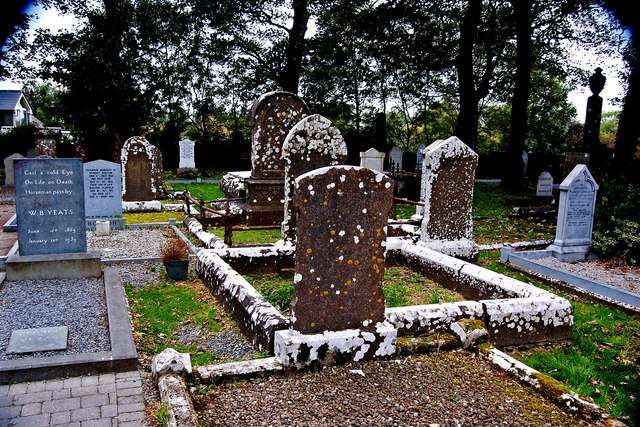
Graves near St Columba’s Church, including the Yeats grave
Graves near St Columba’s Church, including the Yeats grave. Source photograph: 2013-09-25. Appearance, displays and access may have changed. Photo: Joseph Mischyshyn ↗ · CC BY-SA 2.0

heritage

Drumcliffe Church and Yeats’ Grave

Drumcliffe combines the grave of W.B. Yeats with a working church and the remains of an earlier monastic site beneath Benbulben. The high cross and surviving round-tower stump make the visit more than a…

Open place page →
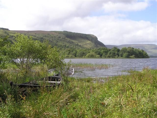
Glenade Lough with reeds, trees and surrounding hills
Glenade Lough with reeds, trees and surrounding hills. Resized from the credited source. Photo: Kenneth Allen ↗ · CC BY-SA 2.0

nature

Glenade Lough

Glenade Lough sits between steep valley sides, giving a short stop a surprisingly enclosed, almost amphitheatre-like feel. The lake is quiet to look at, but access around it needs care: a beautiful shoreline…

Open place page →
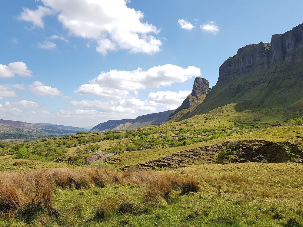
The Glenade Valley and the cliffs around Eagle’s Rock
The Glenade Valley and the cliffs around Eagle’s Rock. Source photograph; current access and conditions may differ. Resized from the credited source. Photo: Jacobfrid ↗ · CC BY-SA 4.0

nature

Eagle’s Rock

The rock formations above Glenade give north Leitrim an unexpectedly theatrical skyline. Eagle’s Rock and neighbouring Hag’s Leap are better approached first as a landscape to look at from an authorised…

Open place page →
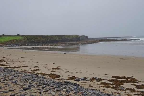
Sand and rocky shoreline at Streedagh Beach.
Sand and rocky shoreline at Streedagh Beach. Photo: Ian Rob ↗ · CC BY-SA 2.0

coast

Streedagh Beach

Streedagh Beach is a long sandy shore near Grange, with Atlantic water on one side and an estuary behind its dune-backed sandbar. The contrast between those two edges gives a walk its interest. Keep this as a…

Open place page →

External visitor reviews

Find the matching listing and reviews on Google Maps ↗

Part of a bigger journey

Location & access

Getting your bearings

Use the public road. Do not climb to Diarmuid and Gráinne’s Cave: official route guidance warns of private land and dangerous terrain.

54.37087, -8.41512 · Reference point; confirm the correct entrance and access. Map © OpenStreetMap contributors.

Orientation only: a verified public entrance is not established by this pin. Use the operator arrival information before travel.

Sources & place context

Browse more Ireland places →