Skip to content
TheLazyNick

nature · Donegal

Glenevin Waterfall

Glenevin Waterfall is reached by a short valley walk near Clonmany on Inishowen. The approach is as much a part of the visit as the cascade: follow the established path beside the stream and let the enclosed landscape replace the wider coastal views. This is a modest outing with a clear natural destination.

Add to planSaved trips & places

Saved on this browser. No account needed.

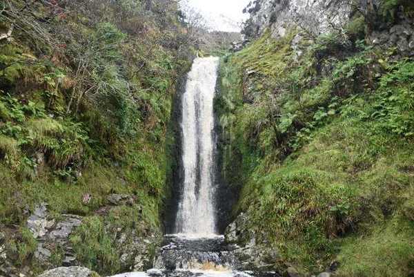
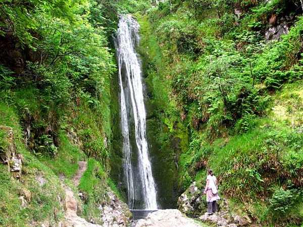
Glenevin Waterfall in its wooded glen
Glenevin Waterfall in its wooded glen. Resized for display. Photo: David Ayrton ↗ · CC BY-SA 2.0

From research

Is this worth your time?

Choose Glenevin when you want a shorter walk rather than a strenuous mountain route. Sport Ireland grades the trail easy, but that does not remove the need for suitable shoes and care on wet ground. Leave enough time to walk back comfortably instead of treating the published distance as a race.

Know before you book: Water and spray can make surfaces slippery. Stay on the visitor path, keep children close and leave dogs behind under the published trail rules.

Place highlights

What you will actually see

01

The valley approach

Follow the designated walkway and notice the stream before concentrating on the final waterfall. The confined valley gives the walk its atmosphere. Keep to the path and avoid turning a short nature walk into an unscheduled scramble over wet rocks.

02

The cascade

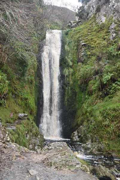
Pause at the permitted viewing area to watch the falling water against the dark rock. Flow varies with weather, so no single photograph defines the experience. Leave space for other visitors and do not enter the water for a closer view.

03

The return walk

Use the return to look back along the valley rather than hurrying immediately to the entrance. Familiar ground can look different in the opposite direction, and an out-and-back route makes it easy to maintain a comfortable pace.

The story behind the visit

The story behind the place

The local visitor organisation describes Glenevin as a wedge-shaped waterfall, with mountain water descending over dark rock. The setting is a valley rather than an isolated roadside cascade, so the walk gives the natural feature its context. Looking at the channel above and below the fall helps explain how the water shapes the outing. Its appeal does not depend on climbing beside it or reaching the top of the rock face. Source ↗

Sport Ireland records the route as a 0.7-kilometre linear trail with an ascent of about fifty metres and an estimated duration of forty-five minutes. Those figures describe the published walk rather than a guarantee of conditions. Easy is a relative trail grade, and wet paths still require attention. Keeping the visit on the established walkway protects both the visitor and the narrow valley environment, while allowing time to appreciate a place whose interest is concentrated rather than extensive. Look carefully. Source ↗

Visitor information

Tickets, timing and access

Opening
Plan a daylight visit and follow any current entrance or trail notices.Confirm with the operator ↗
Admission
Check the current entrance arrangements locally; do not assume a published parking listing sets a tariff.Confirm with the operator ↗
Booking
Independent walkers follow the trail; organised groups should contact the trail manager.Confirm with the operator ↗
Access
The published trail is easy and linear; dogs are not allowed.Confirm with the operator ↗
Duration
Sport Ireland estimates 45 minutes; allow about an hour with pauses.Confirm with the operator ↗
Seasonal
Rain changes flow and footing. Do not continue across barriers or flooded paths.Confirm with the operator ↗

Getting to the entrance

The official trail starts at Straid near Clonmany. Follow the signed waterfall approach beside Glen House and the established walkway. Official visitor information ↗

Your questions, answered

Confirm current access and visitor arrangements with the operator.

Is it a loop?

No. Sport Ireland records a linear trail, so keep time for the return. Source ↗

Is easy the same as step-free?

No. Check current access with the manager if gradients or uneven surfaces affect your visit. Source ↗

Nearby options

Nearby places to explore

Explore other places in the area, then use live directions to plan your journey.

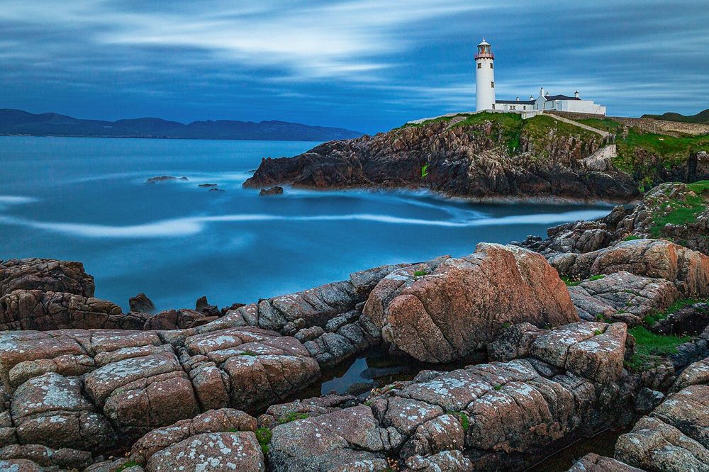
White lighthouse tower on Fanad Head’s rocky coast
White lighthouse tower on Fanad Head’s rocky coast. Source photograph; conditions and access may have changed. Photo: Cesare Barillà ↗ · CC BY-SA 4.0

heritage

Fanad Head Lighthouse

Fanad is immediately recognisable from its white lighthouse above dark rock and open water. A tour adds a reason to look beyond the façade: the purpose of the light, the keepers’ work and the coast’s maritime…

Open place page →
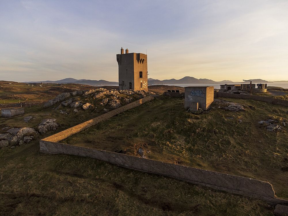
Exposed Atlantic headland at Malin Head
Exposed Atlantic headland at Malin Head. Source photograph; conditions and access may have changed. Photo: Greg Clarke ↗ · CC BY 2.0

coast

Malin Head

Malin Head is a place to understand distance: the Atlantic fills the outlook, while low headland features and scattered buildings give scale to the exposure. The geographical label draws people here, but the…

Open place page →
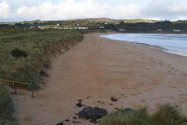
Culdaff Beach from the dunes
Culdaff Beach from the dunes. Resized for display. Photo: N Chadwick ↗ · CC BY-SA 2.0

coast

Culdaff Beach

Culdaff Beach brings sand, dunes, rock outcrops and a river mouth together on the Inishowen coast. Its interest lies in the different edges of the bay, not just the space for a beach walk. Start from the…

Open place page →
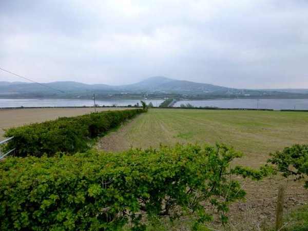
Fields and water beside Inch Island
Fields and water beside Inch Island. Resized for display. Photo: Kenneth Allen ↗ · CC BY-SA 2.0

coast

Inch Island

Inch Island sits within Lough Swilly and is connected to the mainland by a bridge. For a clear visitor plan, focus on the public Inch Wildfowl Reserve trail and its wetland views rather than assuming the whole…

Open place page →

External visitor reviews

Find the matching listing and reviews on Google Maps ↗

Part of a bigger journey

Location & access

Getting your bearings

Water and spray can make surfaces slippery. Stay on the visitor path, keep children close and leave dogs behind under the published trail rules.

55.26782, -7.43668 · Reference point; confirm the correct entrance and access. Map © OpenStreetMap contributors.

Orientation only: a verified public entrance is not established by this pin. Use the operator arrival information before travel.

Sources & place context

Browse more Ireland places →