Skip to content
TheLazyNick

coast · Donegal

Inch Island

Inch Island sits within Lough Swilly and is connected to the mainland by a bridge. For a clear visitor plan, focus on the public Inch Wildfowl Reserve trail and its wetland views rather than assuming the whole island is open for exploration. It is a landscape best appreciated quietly, with time to watch rather than chase wildlife.

Add to planSaved trips & places

Saved on this browser. No account needed.

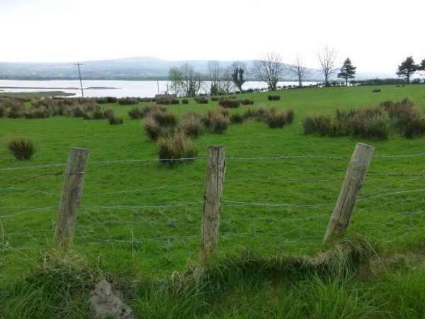
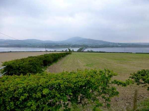
Fields and water beside Inch Island
Fields and water beside Inch Island. Resized for display. Photo: Kenneth Allen ↗ · CC BY-SA 2.0

From research

Is this worth your time?

Choose this outing for birdwatching and an easy-paced wetland walk. The published reserve circuit is substantial enough for a morning or afternoon, but you can choose a shorter return walk. Bring binoculars if you have them, keep dogs on a lead, and let the birds remain the reason to pause at a distance.

Know before you book: This guide covers the public reserve walk and island context. It does not establish access across private fields or to the castle ruins.

Place highlights

What you will actually see

01

Wetland views

Pause at established viewpoints and look across the water and adjoining fields. Different birds use different parts of the reserve, so watch patiently rather than moving close. A quiet position often reveals more than a hurried attempt to cover every section.

02

The trail landscape

Notice how the walking surface changes between gravel, tarmac and concrete. The route partly follows an old railway embankment, adding a human-made line to the wetland setting. Follow the published route rather than cutting across surrounding farmland.

03

Seasonal birdlife

Autumn and winter bring migratory birds, while warmer months have their own activity. Treat every sighting as a possibility rather than a guarantee. Keep enough distance that birds can continue feeding or resting without responding to your presence.

The story behind the visit

The story behind the place

The reserve is a designated Special Protection Area and one of the region’s important birdwatching landscapes. Its interest comes from the relationship between open water, wetland margins and surrounding fields. Birds move between these habitats rather than remaining beside one viewing point. A visit therefore rewards patience and a willingness to watch the broader scene, with the shoreline and agricultural setting forming part of the experience rather than a backdrop to a single species. Source ↗

The purpose-built trail partly uses an old railway embankment. This surviving transport feature now offers a way to experience the protected landscape on foot, but the published circuit also includes different surfaces and sections beside local roads. Visit Inishowen describes an eight-kilometre route taking roughly two to three hours. That is a useful allowance for the full walk, not a requirement for every visitor. A shorter out-and-back visit can give ample time for watching birds while keeping the day comfortable. Source ↗

Visitor information

Tickets, timing and access

Opening
Visit in daylight and follow current reserve signs or temporary restrictions.Confirm with the operator ↗
Admission
The county visitor organisation lists reserve admission as free.Confirm with the operator ↗
Booking
Independent walking has no advertised departure; arrange specialist guiding separately.Confirm with the operator ↗
Access
The route is graded easy with mixed surfaces. Keep dogs on a lead.Confirm with the operator ↗
Duration
Allow 2–3 hours for the published 8 km circuit; shorter returns are possible.Confirm with the operator ↗
Seasonal
Migratory birds are seasonal. Wind, rain and flooding can affect comfort and access.Confirm with the operator ↗

Getting to the entrance

The island is bridge-connected, so no ferry is required. Use the reserve’s signed Pump House, Farland or McGrath’s access rather than the island pin as a trailhead. Official visitor information ↗

Your questions, answered

Confirm current access and visitor arrangements with the operator.

Does the pin mark the walk entrance?

No. It locates the island; choose a signed reserve trailhead from the published route. Source ↗

Can I enter the castle grounds?

This guide does not establish castle or private-land access. Stay on the public reserve route. Source ↗

Nearby options

Nearby places to explore

Explore other places in the area, then use live directions to plan your journey.

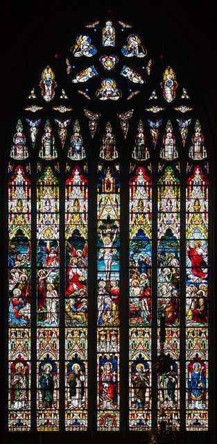
Chancel east window in St Eugene’s Cathedral
Chancel east window in St Eugene’s Cathedral. Source photograph: 2013-09-17. Appearance, displays and access may have changed. Photo: Andreas F. Borchert ↗ · CC BY-SA 4.0

heritage

St Eugene’s Cathedral

St Eugene’s Cathedral is the Catholic mother church of the Diocese of Derry and a significant part of the city’s nineteenth-century religious history. Its long building campaign and continuing parish life…

Open place page →
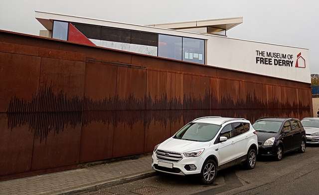
Museum of Free Derry building in the Bogside
Museum of Free Derry building in the Bogside. Source photograph: 2025-10-04. Appearance, displays and access may have changed. Photo: FDW777 ↗ · CC BY 4.0

heritage

Museum of Free Derry

The Museum of Free Derry tells the history of the Bogside community through the civil-rights era and the events of 1968–1972. Its Glenfada Park location is integral to the subject, particularly Bloody Sunday.…

Open place page →
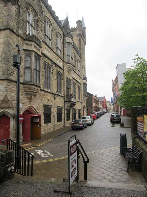
Society Street with the Siege Museum building in Derry
Society Street with the Siege Museum building in Derry. Historical source photograph; wider setting rather than the museum interior. Appearance, displays and access may have changed. Photo: Eric Jones ↗ · CC BY-SA 2.0

heritage

The Siege Museum

The Siege Museum provides an indoor introduction to the 1689 siege and the traditions of the Apprentice Boys in Derry’s walled centre. Artefacts, film and interpretation bring together military events and…

Open place page →
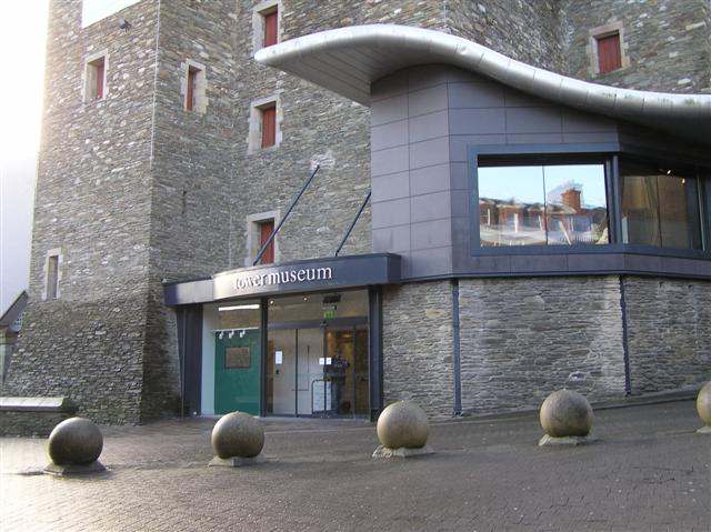
The Tower Museum entrance in Derry.
The Tower Museum entrance in Derry. Photo: Kenneth Allen ↗ · CC BY-SA 2.0

heritage

Tower Museum

The Tower Museum remains a visitor stop inside Derry’s walls, but its offer is changing. The Derry Girls Experience continues while the long-running Story of Derry exhibition has closed ahead of the planned…

Open place page →
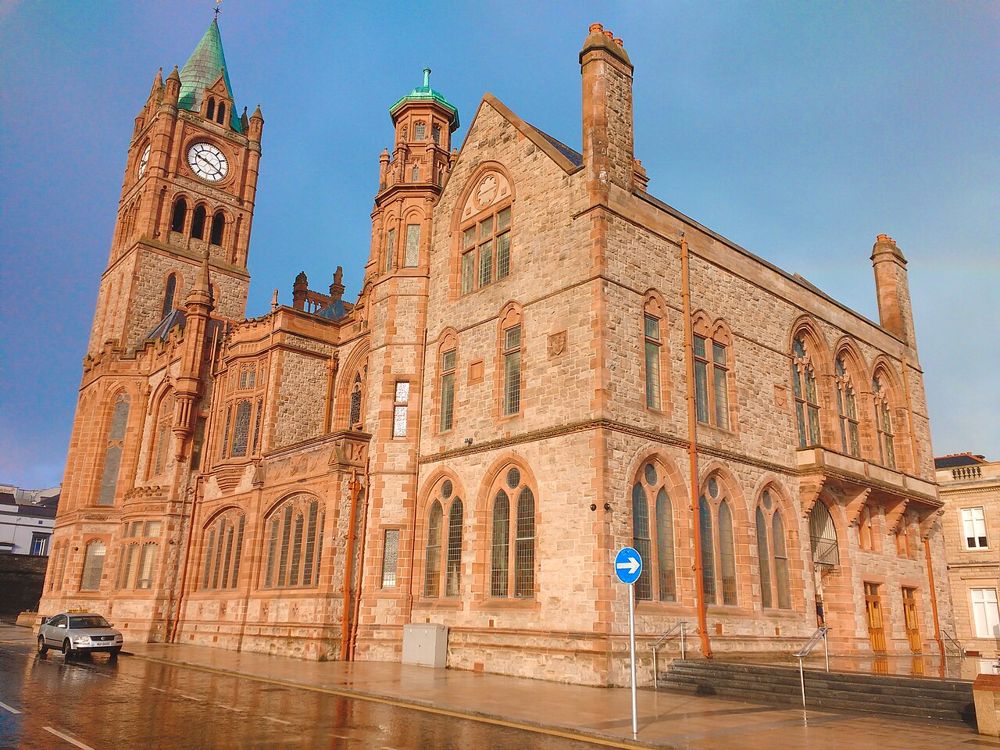
The Guildhall in Derry
The Guildhall in Derry. Credited source photograph; appearance and access may have changed. Resized from the original. Photo: Udit Kapoor ↗ · CC BY-SA 4.0

heritage

Derry Guildhall

The Guildhall is an easy building to admire from the square and a more rewarding one to enter. Its stained glass, organ and civic rooms add texture to a Derry day dominated by the walls and river.

Open place page →

External visitor reviews

Find the matching listing and reviews on Google Maps ↗

Part of a bigger journey

Location & access

Getting your bearings

This guide covers the public reserve walk and island context. It does not establish access across private fields or to the castle ruins.

55.06688, -7.48693 · Reference point; confirm the correct entrance and access. Map © OpenStreetMap contributors.

Orientation only: a verified public entrance is not established by this pin. Use the operator arrival information before travel.

Sources & place context

Browse more Ireland places →