Skip to content
TheLazyNick

coast · Galway

Dog’s Bay and Gurteen Beaches

Dog’s Bay and Gurteen are back-to-back beaches near Roundstone, joined by a narrow coastal landform that makes them best understood together. Pale sand, grassland and contrasting views give a short visit plenty of variety. Explore from the established public approaches, keeping off fragile vegetation and letting conditions determine the extent of your walk.

Add to planSaved trips & places

Saved on this browser. No account needed.

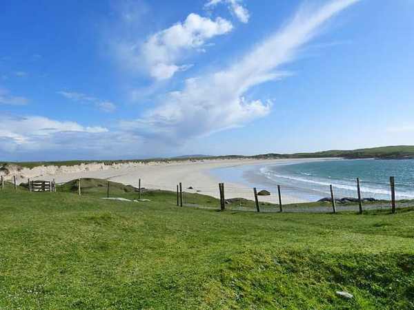
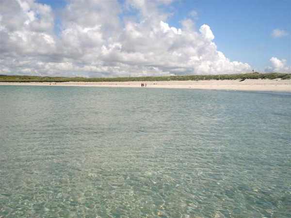
Clear water and sand at Dog’s Bay
Clear water and sand at Dog’s Bay. Resized for display. Photo: Raúl Corral ↗ · CC BY-SA 3.0

From research

Is this worth your time?

Choose these beaches if you enjoy seeing how a coast is put together as well as walking beside the sea. You need not cover both shores end to end to appreciate their relationship. Start with one accessible stretch, then decide whether the second beach fits the weather, tide and time available.

Know before you book: The dunes and machair are fragile. This beach guide does not certify safe swimming or permit shortcuts through vegetated ground.

Place highlights

What you will actually see

01

Dog’s Bay

Look along the curved shore from the established access and notice the pale sand against the water. Keep the walk on clearly accessible sand. The view can be enjoyed without entering the sea or crossing the headland to find a different angle.

02

Gurteen

The larger adjoining beach gives a different view of the same coastal formation. Use the proper approach rather than cutting directly through grassland. Comparing the two shores is more informative than treating either one as a place to tick off quickly.

03

The joining landform

Observe the narrow ground between the beaches from permitted routes. The back-to-back arrangement is what makes this coast distinctive. Vegetation is part of that structure, so avoid trampling it while looking for an unobstructed photograph of both bays.

The story behind the visit

The story behind the place

Fáilte Ireland describes Dog’s Bay and Gurteen as two sides of a tombolo projecting into the Atlantic. Gurteen is the larger beach and lies closer to Roundstone. Understanding that shared landform gives the outing a clear theme: the beaches are connected parts of one coastal system rather than unrelated stops. Their appearance changes with light and tide, while the narrow strip between them makes the relationship visible even during a modest visit. Source ↗

The sand is notable because much of it comes from the shells of tiny marine organisms rather than ordinary fragments of rock. The associated grassland includes machair, an uncommon coastal habitat. These details explain both the beaches’ distinctive colour and the care needed on the ground behind them. Stay on established access, give grazing land and wildlife space, and leave shells and living organisms where they are. The place rewards observation without collecting material or extending the walk across fragile vegetation. Source ↗

Visitor information

Tickets, timing and access

Opening
Visit in daylight and follow current access or closure notices.Confirm with the operator ↗
Admission
Check local signs for parking arrangements; no organised beach ticket is required.Confirm with the operator ↗
Booking
An independent shore walk has no departure time; book water activities separately.Confirm with the operator ↗
Access
Use established public approaches and open sand; protect dune and machair vegetation.Confirm with the operator ↗
Duration
Allow 60–90 minutes to appreciate both beaches without covering every stretch.Confirm with the operator ↗
Seasonal
Check tide, wind and current water notices. Do not infer swimming safety from calm-looking water.Confirm with the operator ↗

Getting to the entrance

Approach the signed beaches near Roundstone. The mapped point is an orientation reference for the shared coastal setting, not permission to cross the grassland. Official visitor information ↗

Your questions, answered

Confirm current access and visitor arrangements with the operator.

Are these separate outings?

They can be visited together as one coastal landscape, using the established approaches. Source ↗

Can I cross the dunes directly?

Use the designated routes and keep off fragile vegetation, even if a shortcut looks convenient. Source ↗

Nearby options

Nearby places to explore

Explore other places in the area, then use live directions to plan your journey.

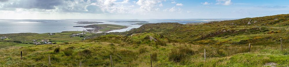
Coastal panorama from the Sky Road near Clifden
Coastal panorama from the Sky Road near Clifden. Source photograph; conditions and access may have changed. Photo: Superbass ↗ · CC BY-SA 4.0

coast

Sky Road, Clifden

The Sky Road climbs away from Clifden into a view of bays, small islands and the Connemara coastline. Its reward is the widening perspective, not a single building at the end. It suits a clear-weather pause…

Open place page →
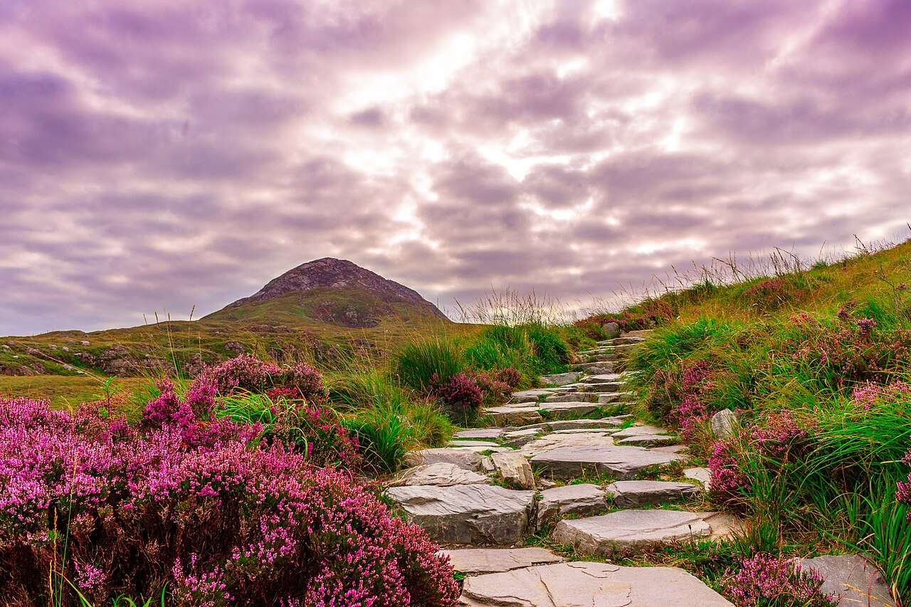
Stone path climbing Diamond Hill in Connemara
Stone path on Diamond Hill in Connemara. Historical source photograph; current trail access and conditions may differ. Photo: Jonas_Fehre ↗ · CC0

nature

Diamond Hill

Diamond Hill offers a clearly defined way into Connemara’s upland landscape, with lower and upper walking options that should be chosen for the day’s conditions.

Open place page →
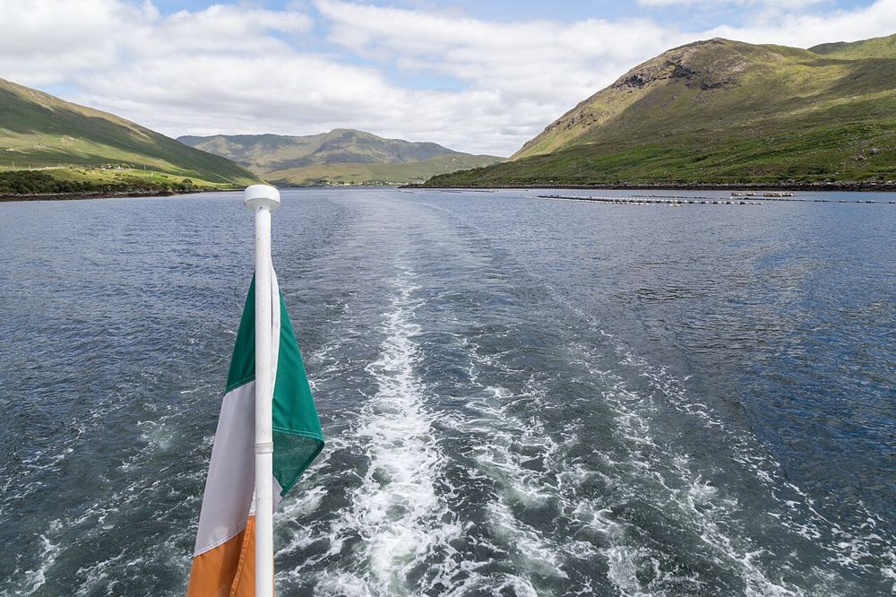
Killary Harbour framed by Connemara mountain slopes
Killary Harbour framed by Connemara mountain slopes. Source photograph; conditions and access may have changed. Photo: JoachimKohler-HB ↗ · CC BY-SA 4.0

nature

Killary Harbour

Killary’s long inlet gives north Connemara a different kind of coastline: mountain slopes frame a narrow strip of water, and the view changes as you move along its southern shore. You can appreciate the…

Open place page →

External visitor reviews

Find the matching listing and reviews on Google Maps ↗

Part of a bigger journey

Location & access

Getting your bearings

The dunes and machair are fragile. This beach guide does not certify safe swimming or permit shortcuts through vegetated ground.

53.37969, -9.96144 · Reference point; confirm the correct entrance and access. Map © OpenStreetMap contributors.

Orientation only: a verified public entrance is not established by this pin. Use the operator arrival information before travel.

Sources & place context

Browse more Ireland places →