Skip to content
TheLazyNick

nature · Kerry

Bray Head

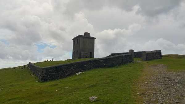
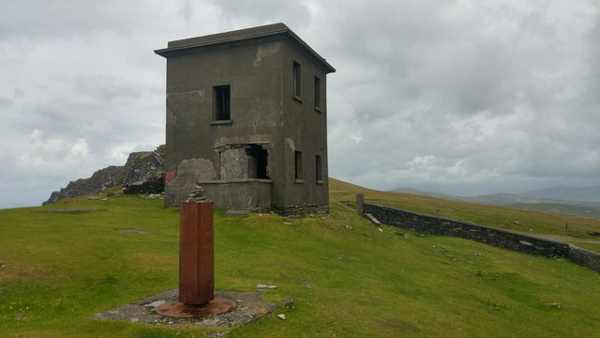
Bray Head on Valentia Island is a coastal upland walk towards an abandoned signal tower, with views towards the Skelligs and neighbouring islands in suitable weather. It is distinct from Bray Head in County Wicklow. Use the current Valentia route as an out-and-back outing and keep well away from the exposed cliff edges.

Add to planSaved trips & places

Saved on this browser. No account needed.

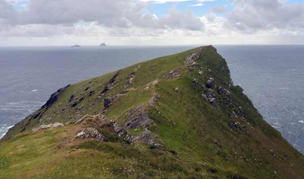
The coastal promontory at Bray Head on Valentia Island.
The coastal promontory at Bray Head on Valentia Island. Photo: Phil Champion ↗ · CC BY-SA 2.0

From research

Is this worth your time?

Choose Bray Head if you are comfortable with a climbing coastal path and can allow time to return by the same permitted route. The tower is a landmark to view, not a promised interior attraction. Published descriptions differ in distance, so plan from current local trail information rather than extending the outing into an assumed loop.

Know before you book: This exposed headland walk follows a published linear route. Wind, rain and poor visibility affect the outing; keep back from cliff edges.

Place highlights

What you will actually see

01

The old access road

Follow the current established route as it gains height towards the signal-tower area. Pause on the established public route and look carefully. Watch your footing as well as the view; keep well away from exposed edges for photographs.

02

The signal tower

Observe the abandoned structure from permitted ground and respect any barriers or masonry restrictions. Compare this feature with the wider surroundings. Use permitted approaches, leave plants and wildlife undisturbed and avoid shortcuts across adjoining land or fragile vegetation.

03

Island views

Look towards Horse Island, Long Island and the Skelligs only from a secure position. Choose a comfortable turning point before conditions limit the return. A shorter visit still reveals the place’s character; you need not reach every visible landmark.

The story behind the visit

The story behind the place

Sport Ireland identifies the Valentia walk as a moderate linear route following an old access road towards a signal tower and coastal viewpoint. That is a different identity from the similarly named Wicklow trails. The tower gives the outing a clear landmark, while the surrounding sea and islands explain its position within the landscape. Keep the visit focused on the current permitted approach rather than assuming that an old loop map establishes present access around every side of the headland. Source ↗

Valentia’s accessibility guidance describes uneven, stony paths, climbs and exposed sections, and suggests a shorter return for visitors who do not want the more exposed ground. This is useful practical context even for confident walkers. A shorter visit is not a lesser version of the place: the approach reveals the changing island view as height is gained. The road bridge from Portmagee also means the outing can be planned without relying on the separately seasonal ferry service to Knightstown. Source ↗

Visitor information

Tickets, timing and access

Opening
Walk in daylight with enough time for the return and suitable coastal weather.Confirm with the operator ↗
Admission
Check current local trailhead access and parking arrangements.Confirm with the operator ↗
Booking
Independent walking has no advertised departure; arrange guiding separately if needed.Confirm with the operator ↗
Access
Follow the current out-and-back route; uneven climbing ground and exposed sections require care.Confirm with the operator ↗
Duration
Allow about 2 hours, adjusting the turning point to conditions and ability.Confirm with the operator ↗
Seasonal
Avoid strong wind, poor visibility and severe weather; do not assume an old loop remains open.Confirm with the operator ↗

Getting to the entrance

Use the signed Bray Head approach on Valentia Island. Arrive via the Portmagee road bridge if travelling outside the ferry season. Official visitor information ↗

Your questions, answered

Confirm current access and visitor arrangements with the operator.

Must I complete a long walk?

No. Choose a shorter permitted outing that fits conditions and leaves a straightforward return. Source ↗

Is the old loop included?

No. Use the published linear route and return the same way. Source ↗

Nearby options

Nearby places to explore

Explore other places in the area, then use live directions to plan your journey.

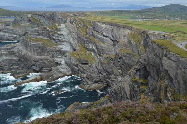
The Atlantic cliffs at the managed Kerry Cliffs viewpoint near Portmagee.
The Atlantic cliffs at the managed Kerry Cliffs viewpoint near Portmagee. Photo: N Chadwick ↗ · CC BY-SA 2.0

coast

Kerry Cliffs

Kerry Cliffs is a managed coastal viewpoint near Portmagee, with a walking approach to high Atlantic cliffs and views towards the Skelligs and Puffin Island. It is a paid attraction with weather-dependent…

Open place page →
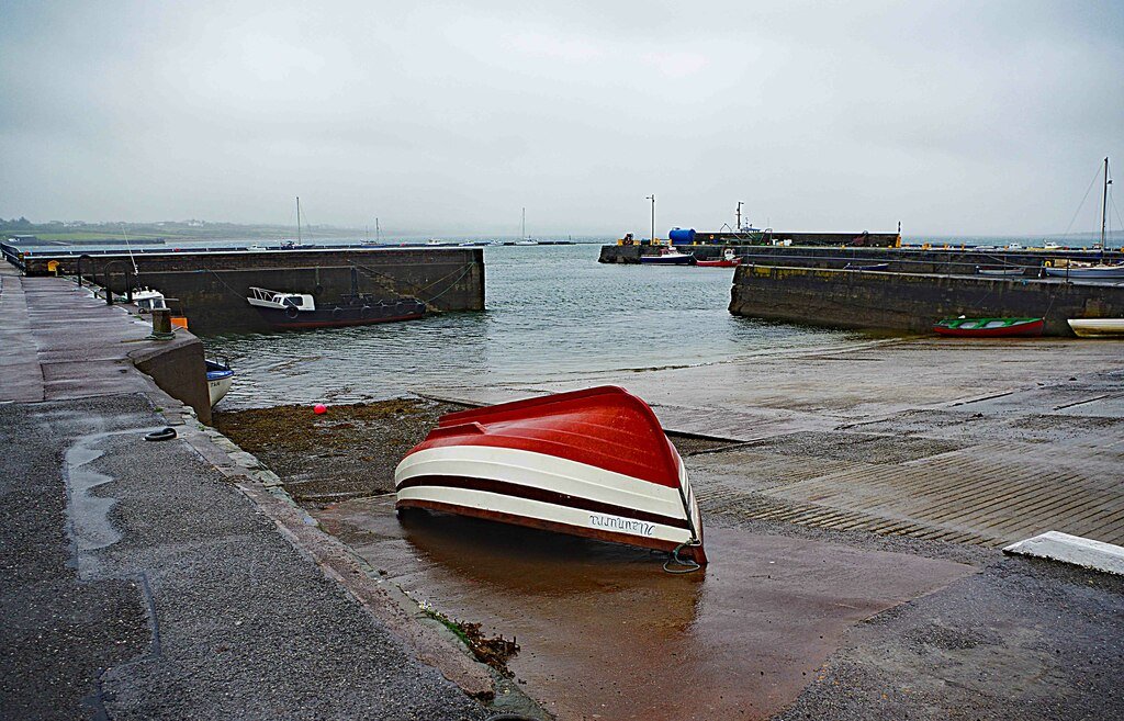
Knightstown harbour on Valentia Island, photographed in September 2018
Knightstown harbour on Valentia Island, photographed in September 2018 Source photograph; conditions and access may have changed. Photo: P L Chadwick ↗ · CC BY-SA 2.0

coast

Valentia Island

Valentia works best as an island day with a theme, rather than a detour where every viewpoint has to be collected. Knightstown offers a harbour-side starting point; the cable story and the lighthouse give two…

Open place page →
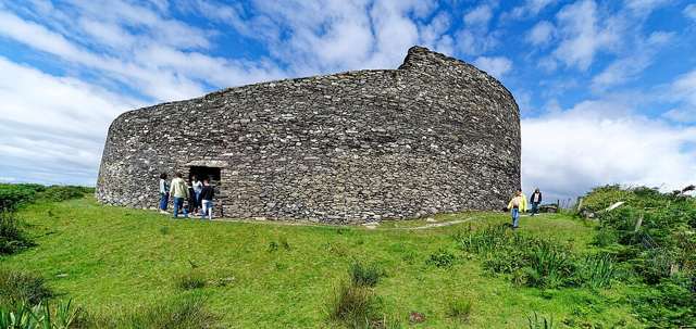
The outer wall and entrance of Cahergall Stone Fort, viewed from ground level
The outer wall and entrance of Cahergall Stone Fort, viewed from ground level. Resized for display. Photo: Holger Uwe Schmitt ↗ · CC BY-SA 4.0

heritage

Cahergal Stone Fort

Cahergal, also called Cahergall Cashel, is a substantial stone-built ringfort near Cahersiveen. Its restored-looking enclosure is best appreciated by following the permitted ground-level route and studying the…

Open place page →
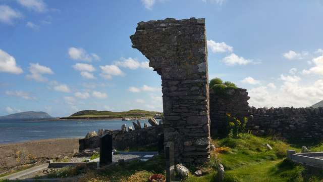
Ballinskelligs Abbey beside the shore
Ballinskelligs Abbey beside the shore. Resized for display. Photo: Phil Champion ↗ · CC BY-SA 2.0

heritage

Ballinskelligs Abbey

Ballinskelligs Abbey, also known as the Augustinian Priory, stands beside the bay in a setting closely connected with the Skelligs. The surviving church, cloister fragments and domestic remains make a…

Open place page →
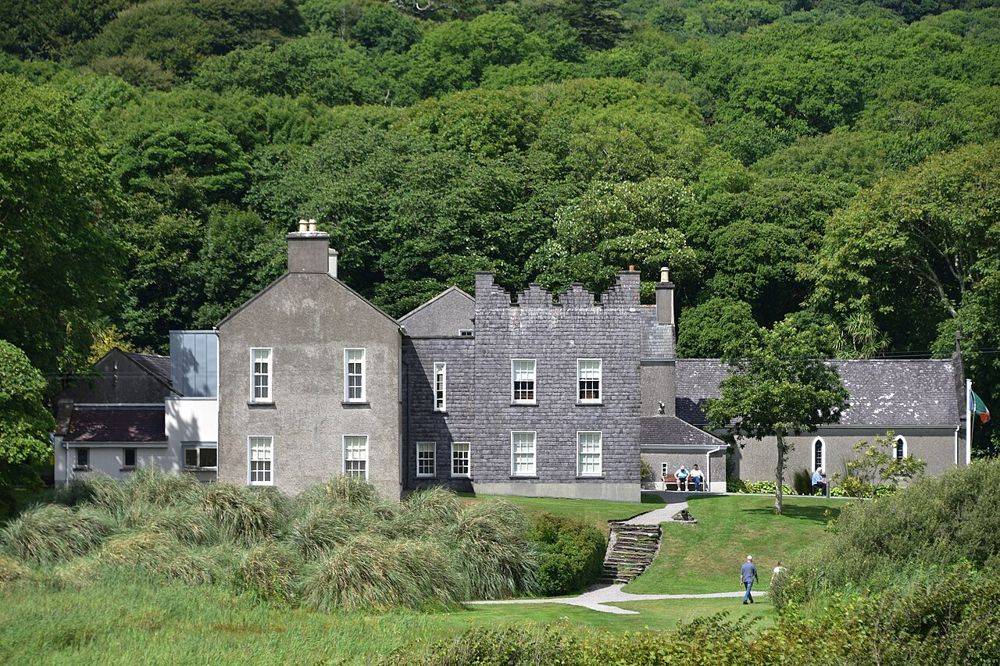
Derrynane House, Daniel O’Connell’s ancestral home
Derrynane House, Daniel O’Connell’s ancestral home. Source photograph; conditions and access may have changed. Resized from the credited original. Photo: August Schwerdfeger ↗ · CC BY 4.0

heritage

Derrynane House

Derrynane gives Daniel O’Connell a domestic setting. After the scale of the Ring of Kerry coast, the house’s rooms and personal objects bring the story back to one family and one political life. Leave some…

Open place page →

External visitor reviews

Find the matching listing and reviews on Google Maps ↗

Part of a bigger journey

Location & access

Getting your bearings

This exposed headland walk follows a published linear route. Wind, rain and poor visibility affect the outing; keep back from cliff edges.

51.89168, -10.39649 · Reference point; confirm the correct entrance and access. Map © OpenStreetMap contributors.

Orientation only: a verified public entrance is not established by this pin. Use the operator arrival information before travel.

Sources & place context

Browse more Ireland places →