Skip to content
TheLazyNick

heritage · Kerry

Ballinskelligs Abbey

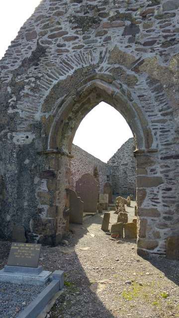
Ballinskelligs Abbey, also known as the Augustinian Priory, stands beside the bay in a setting closely connected with the Skelligs. The surviving church, cloister fragments and domestic remains make a rewarding coastal heritage stop. Its interest lies in the mainland monastic story as much as the surrounding water and mountains.

Add to planSaved trips & places

Saved on this browser. No account needed.

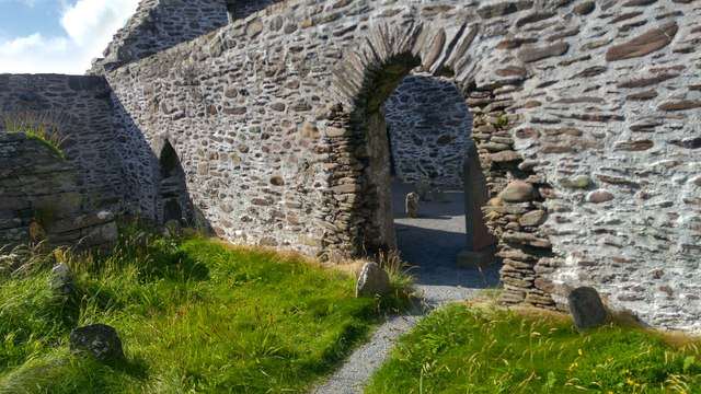
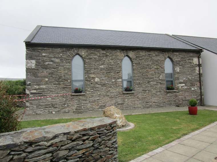
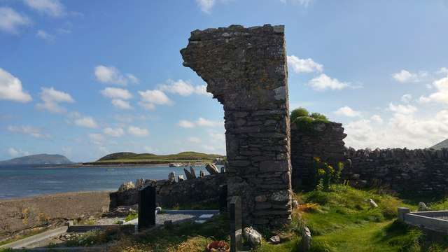
Ballinskelligs Abbey beside the shore
Ballinskelligs Abbey beside the shore. Resized for display. Photo: Phil Champion ↗ · CC BY-SA 2.0

From research

Is this worth your time?

Choose it if you want to connect the Skellig story with a mainland place that can be explored without an offshore crossing. The ruins need time and attention rather than a fixed tour. Combine the visit with the village or coast only where current routes and conditions support it.

Know before you book: Coastal weather, uneven historic ground and burial areas shape the visit. Stay within permitted access and treat tombs and the surviving masonry respectfully.

Place highlights

What you will actually see

01

Church remains

Begin with the surviving rectangular church and look at how its walls define the former religious space. A roofless building can still reveal proportions and movement, especially when you resist treating every opening as a shortcut through the monument.

02

Cloister and domestic life

Fragments of the cloister and a large domestic hall survive. These help move the story beyond worship alone, suggesting the routines of a community that needed sheltered working space, accommodation and places to gather as well as a church.

03

Mainland and islands

Look out towards the bay and consider the relationship with Skellig Michael. The mainland setting is central to the abbey’s history, but the ruins are a distinct attraction with their own route; an abbey visit does not include an island landing.

The story behind the visit

The story behind the place

The local visitor organisation connects Ballinskelligs with monks who moved from Skellig Michael to the mainland during the medieval period and adopted the Augustinian rule. The priory was dedicated to St Michael. Much of the surviving fabric is later medieval, so the standing ruins should not be imagined as a single untouched foundation from the moment of the community’s arrival. Source ↗

Buildings were arranged around a cloister, with church and domestic spaces serving different parts of religious life. Their coastal position continues to make the relationship with the Skelligs visible, even when the islands are not part of a visitor’s itinerary. Read the remains as evidence of a changing mainland community, and distinguish the site’s own history from the broader legends and dramatic images associated with the offshore monastery. The contrast between exposed coast and sheltered communal space offers another way to imagine daily life, while keeping the surviving evidence separate from a complete reconstruction. Source ↗

Visitor information

Tickets, timing and access

Opening
Unguided outdoor monument: visit in daylight and follow current local notices.Confirm with the operator ↗
Admission
Check current site arrangements; no staffed visitor-centre experience is included in this plan.Confirm with the operator ↗
Booking
No regular guided departure is advertised. Arrange organised group or specialist visits separately.Confirm with the operator ↗
Access
Historic outdoor ruins and burial ground. Use the published approach, follow signs and avoid unstable or closed areas.Confirm with the operator ↗
Duration
Allow 30–45 minutes, depending on conditions and interest.Confirm with the operator ↗
Seasonal
Exposed outdoor remains can be wet or slippery. Short winter daylight calls for a flexible plan.Confirm with the operator ↗

Getting to the entrance

The local visitor organisation gives directions off the R566 Skellig Ring road, continuing beyond the beach crossroads when approaching from Cahersiveen. Official visitor information ↗

Your questions, answered

Confirm current access and visitor arrangements with the operator.

Can I explore independently?

This is an unguided visit. Stay within the access permitted by current signs and barriers. Source ↗

Can I enter every structure?

Closed areas and upper levels may be restricted. Follow current signs and do not enter private land beyond the published approach. Source ↗

Nearby options

Nearby places to explore

Explore other places in the area, then use live directions to plan your journey.

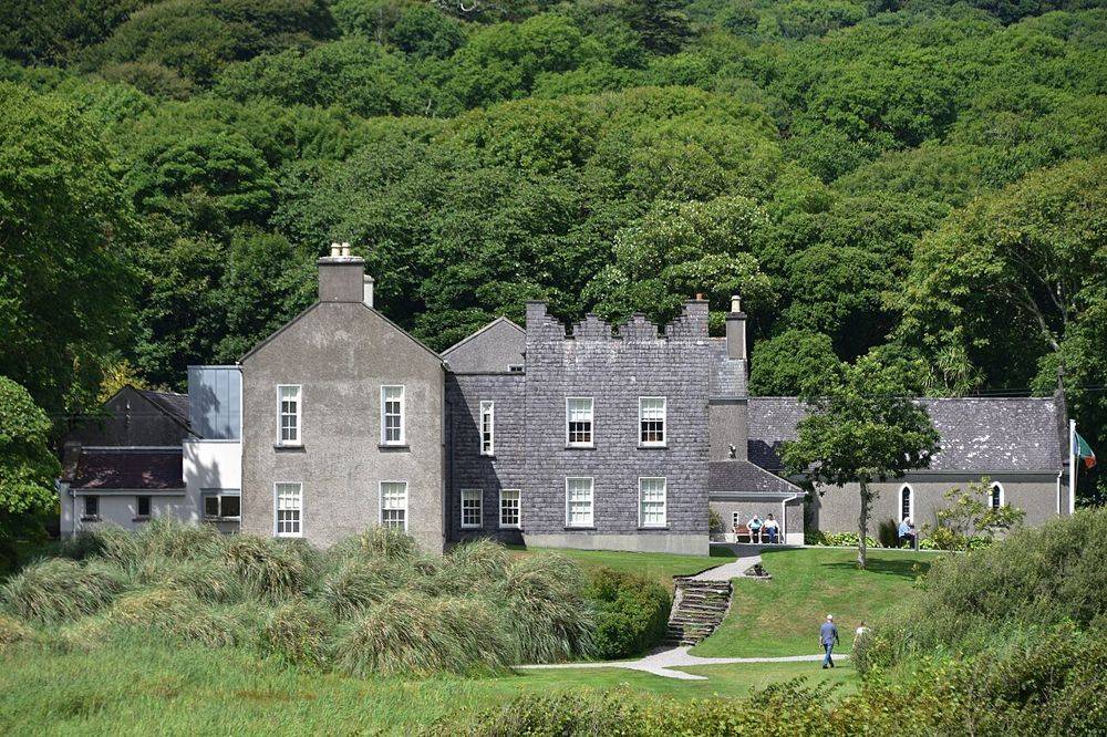
Derrynane House, Daniel O’Connell’s ancestral home
Derrynane House, Daniel O’Connell’s ancestral home. Source photograph; conditions and access may have changed. Resized from the credited original. Photo: August Schwerdfeger ↗ · CC BY 4.0

heritage

Derrynane House

Derrynane gives Daniel O’Connell a domestic setting. After the scale of the Ring of Kerry coast, the house’s rooms and personal objects bring the story back to one family and one political life. Leave some…

Open place page →
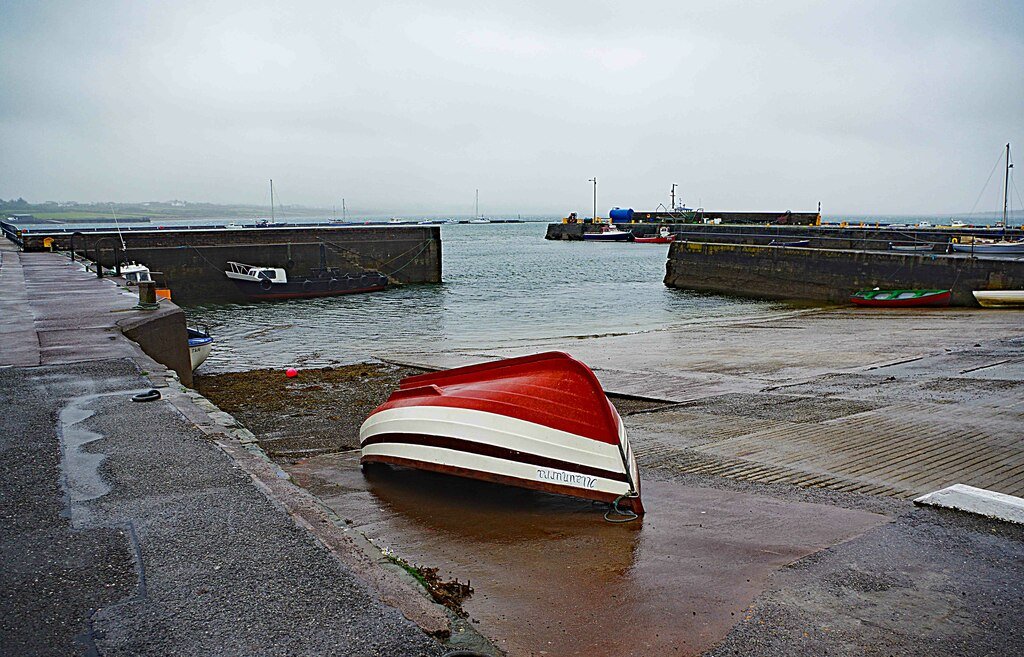
Knightstown harbour on Valentia Island, photographed in September 2018
Knightstown harbour on Valentia Island, photographed in September 2018 Source photograph; conditions and access may have changed. Photo: P L Chadwick ↗ · CC BY-SA 2.0

coast

Valentia Island

Valentia works best as an island day with a theme, rather than a detour where every viewpoint has to be collected. Knightstown offers a harbour-side starting point; the cable story and the lighthouse give two…

Open place page →
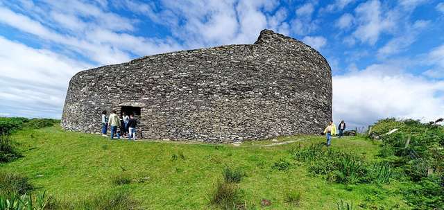
The outer wall and entrance of Cahergall Stone Fort, viewed from ground level
The outer wall and entrance of Cahergall Stone Fort, viewed from ground level. Resized for display. Photo: Holger Uwe Schmitt ↗ · CC BY-SA 4.0

heritage

Cahergal Stone Fort

Cahergal, also called Cahergall Cashel, is a substantial stone-built ringfort near Cahersiveen. Its restored-looking enclosure is best appreciated by following the permitted ground-level route and studying the…

Open place page →
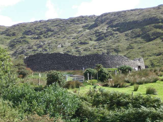
Staigue Fort among the surrounding hills
Staigue Fort among the surrounding hills. Resized for display. Photo: Dafydd Humphreys ↗ · CC BY-SA 2.0

heritage

Staigue Fort

Staigue Fort is a massive dry-stone enclosure above a valley near Castlecove on the Iveragh Peninsula. Thick walls, a narrow entrance and the surrounding hills give the visit its force. Approach it as a…

Open place page →
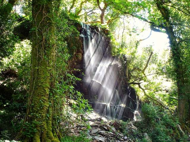
Waterfall at Kells Bay in County Kerry
Waterfall at Kells Bay in County Kerry. Source photograph: 2017-07-24 13:58:43. Appearance, displays and access may have changed. Photo: Hauke Musicaloris ↗ · CC BY 2.0

nature

Kells Bay House And Gardens

Kells Bay House and Gardens combines a coastal Kerry setting with a collection of tree ferns, palms and other unusual plants. The visitor route includes a walled garden, riverside paths and woodland planting.…

Open place page →

External visitor reviews

Find the matching listing and reviews on Google Maps ↗

Part of a bigger journey

Location & access

Getting your bearings

Coastal weather, uneven historic ground and burial areas shape the visit. Stay within permitted access and treat tombs and the surviving masonry respectfully.

51.81564, -10.27145 · Reference point; confirm the correct entrance and access. Map © OpenStreetMap contributors.

Orientation only: a verified public entrance is not established by this pin. Use the operator arrival information before travel.

Sources & place context

Browse more Ireland places →