Skip to content
TheLazyNick

heritage · Cork

Allihies Copper Mine Museum

An indoor introduction to Allihies’ copper-mining past on the Beara Peninsula, exploring the machinery, work and social conditions behind the engine-house remains visible in the surrounding landscape.

Add to planSaved trips & places

Saved on this browser. No account needed.

The Allihies Copper Mine Museum building.
The Allihies Copper Mine Museum building. Photo: Jonathan Thacker ↗ · CC BY-SA 2.0

From research

Is this worth your time?

Choose the museum to understand the technology and social conditions behind Allihies' mining landscape. The museum and surviving engine houses offer related perspectives, but winter staffed admission needs confirmation before a long journey.

Know before you book: For a November–March visit, telephone ahead to confirm museum admission, as the operator advises.

Place highlights

What you will actually see

01

Mining machinery explained

Use the interpretation to distinguish pumping water, lifting material and crushing ore. Those were different tasks, and understanding them gives a practical meaning to the engine-house remains visible around the Allihies landscape.

02

Workers and households

Give the social history as much attention as the engineering. The museum’s account of crowded living conditions and demanding labour connects the impressive machinery with the people whose work made the enterprise possible.

03

Landscape connections

After the exhibition, identify which visible remains belong to the processes described inside. The museum provides context for the wider landscape; any walk among the separate mine sites needs its own route and access planning.

The story behind the visit

Steam power on the Beara coast

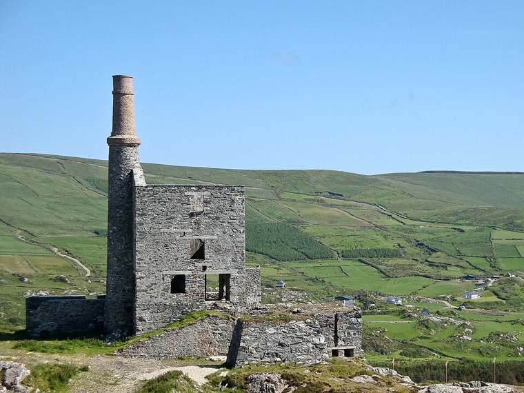
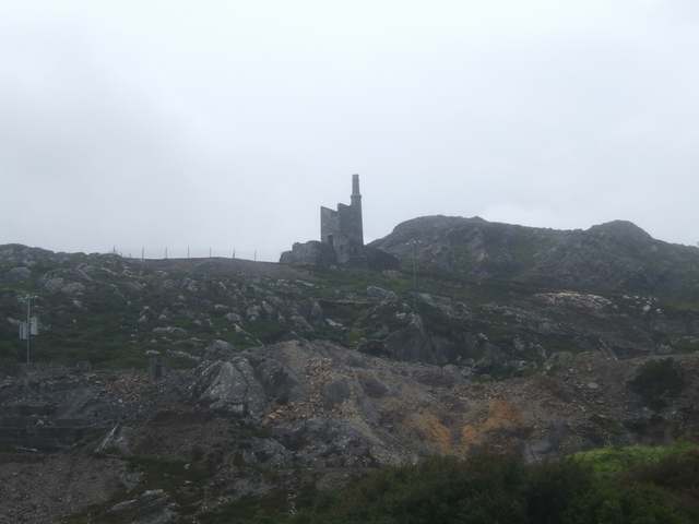
Copper mining transformed Allihies after the Puxley family established the enterprise in 1812. Steam engines allowed mining to push deeper by pumping out water and powering winding machinery. The surviving Cornish engine houses are therefore evidence of a working industrial system, rather than isolated scenic ruins. The museum also addresses the social conditions of that industry, setting engineering achievement alongside the difficult lives of labourers and their families. Source ↗

The wider mines account explains how water, rock and machinery were linked. At Dooneen, an early tunnel was followed by shafts, and a steam engine brought from Cornwall tackled persistent flooding. Reservoirs, dressing floors and discarded quartz belonged to the same process of extracting and separating ore. Understanding those relationships indoors makes the surrounding mining landscape more legible, even if your visit stops at the museum rather than continuing onto a separate outdoor trail. Source ↗

Visitor information

Tickets, timing and access

Opening and seasonal access
Published main-season hours are 10:30–17:00 from Easter to mid-October. November–March visitors should phone 02773218 to confirm the office is staffed for museum admission.Confirm with the operator ↗
Admission
Published prices: adult €7; student €4; child €3; family of 2 adults+2 children €15.Confirm with the operator ↗
Booking
Contact the museum for a winter visit or guided group arrangements.Confirm with the operator ↗
Physical access
Wheelchair-accessible museum, accessible toilets and sensory garden. Multilingual audio guides include Irish Sign Language provision.Confirm with the operator ↗
Time to allow
Allow 45–60 minutes for the museum; planning estimate. Walking outside is additional.Confirm with the operator ↗
Seasonal notes
For a November–March visit, telephone ahead to confirm museum admission, as the operator advises.Confirm with the operator ↗

Getting to the entrance

Allihies village, Beara, County Cork. This is the museum, not an underground mine tour. Official visitor information ↗

Your questions, answered

Confirm current access and visitor arrangements with the operator.

Do I need to book this visit?

Contact the museum for a winter visit or guided group arrangements. Source ↗

What should I know about physical access?

Wheelchair-accessible museum, accessible toilets and sensory garden. Multilingual audio guides include Irish Sign Language provision. Source ↗

Nearby options

Nearby places to explore

Explore other places in the area, then use live directions to plan your journey.

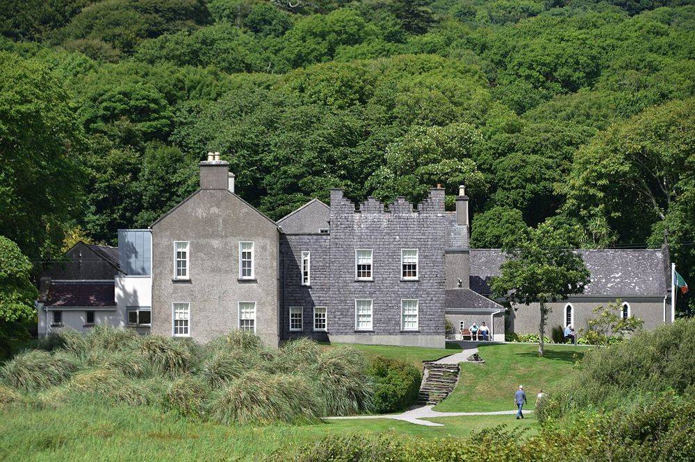
Derrynane House, Daniel O’Connell’s ancestral home
Derrynane House, Daniel O’Connell’s ancestral home. Source photograph; conditions and access may have changed. Resized from the credited original. Photo: August Schwerdfeger ↗ · CC BY 4.0

heritage

Derrynane House

Derrynane gives Daniel O’Connell a domestic setting. After the scale of the Ring of Kerry coast, the house’s rooms and personal objects bring the story back to one family and one political life. Leave some…

Open place page →
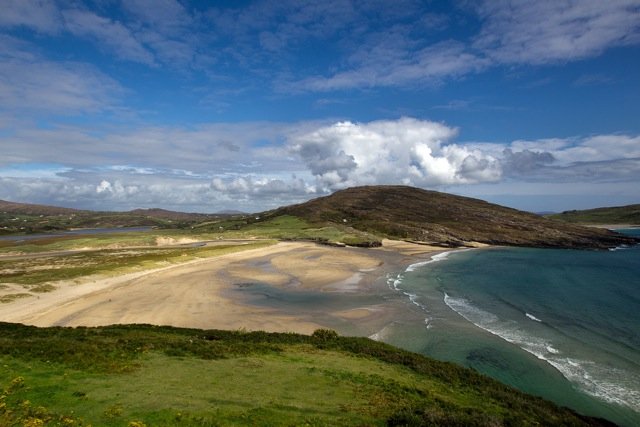
The sand and coastal setting at Barleycove
The sand and coastal setting at Barleycove. Historical source photograph; conditions and access may have changed. Resized from the credited source. Photo: EHRENBERG Kommunikation ↗ · CC BY-SA 2.0

attraction

Barleycove Beach

Choose Barleycove for an open beach visit after a more structured stop. A walk, a pause on the sand and time looking back at the dunes can give the day a different rhythm without requiring another ticket.

Open place page →
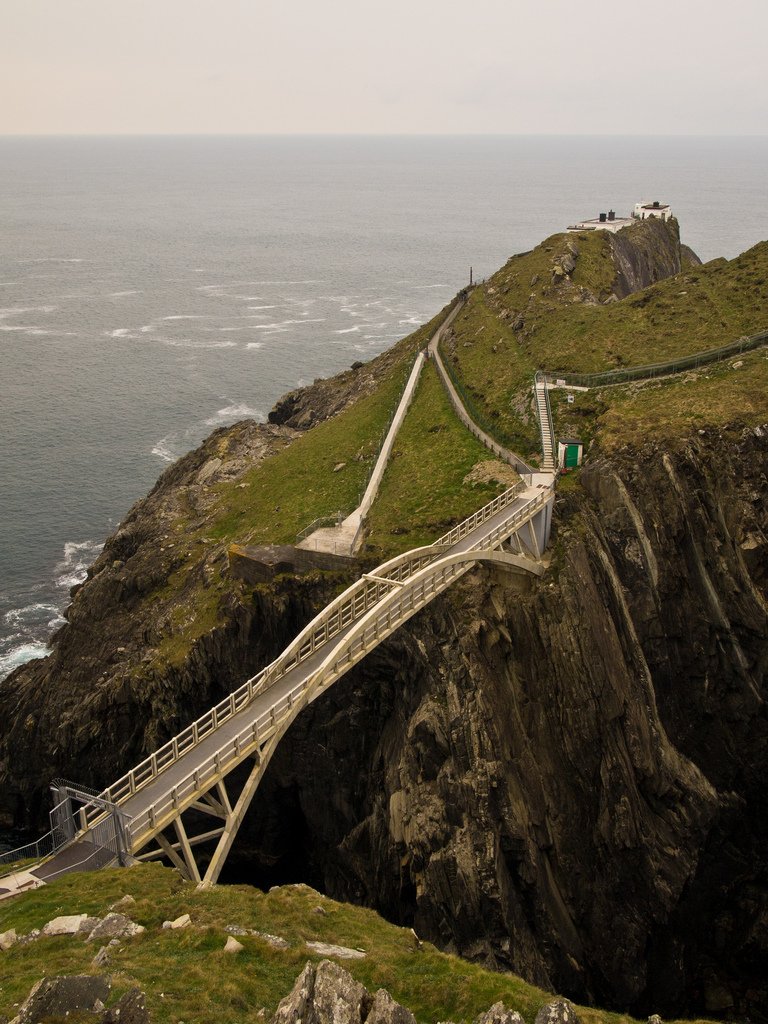
The bridge across the sea channel at Mizen Head
The bridge across the sea channel at Mizen Head. Historical source photograph; conditions and access may have changed. Resized from the credited source. Photo: fubsan ↗ · CC BY-SA 2.0

attraction

Mizen Head Signal Station

Give Mizen Head time for both the approach across the bridge and the signal-station story. The sea is the setting, but the effort to warn shipping and the people who worked here give the visit its purpose.

Open place page →
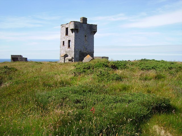
The former signal tower on Brow Head
The former signal tower on Brow Head. Historical source photograph; conditions and access may have changed. Resized from the credited source. Photo: Richard Webb ↗ · CC BY-SA 2.0

attraction

Brow Head

Choose Brow Head for a more exposed landscape visit, with the former signalling structures providing context. Make the approach and visibility part of the decision; this is not simply another managed viewpoint…

Open place page →
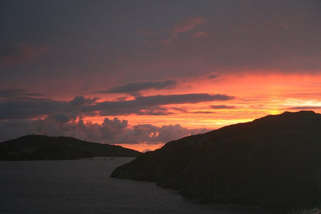
Crookhaven Harbour seen from Rock Island
Crookhaven Harbour seen from Rock Island. Historical source photograph; conditions and access may have changed. Resized from the credited source. Photo: Dr Brian Lynch ↗ · CC BY-SA 2.0

attraction

Crookhaven harbour

Choose Crookhaven for a harbour pause after the exposed parts of the peninsula. Give yourself time to look at boats and the relationship between the water and the village, rather than making it only a place to…

Open place page →

External visitor reviews

Find the matching listing and reviews on Google Maps ↗

Part of a bigger journey

Location & access

Getting your bearings

For a November–March visit, telephone ahead to confirm museum admission, as the operator advises.

51.64126, -10.04416 · Reference point; confirm the correct entrance and access. Map © OpenStreetMap contributors.

Orientation only: a verified public entrance is not established by this pin. Use the operator arrival information before travel.

Sources & place context

Browse more Ireland places →