Skip to content
TheLazyNick

coast · Kerry

Ceann Sléibhe (Slea Head)

Slea Head is a promontory on the western Dingle Peninsula, where the coastal road connects views of beaches, villages, islands and older buildings. It can be appreciated as a particular headland stop or within a longer drive. Keep those two scales distinct so that the broader route does not turn every visible sight into an assumed public attraction.

Add to planSaved trips & places

Saved on this browser. No account needed.

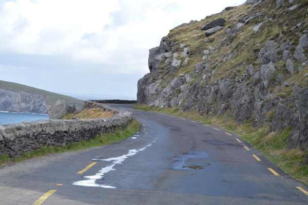
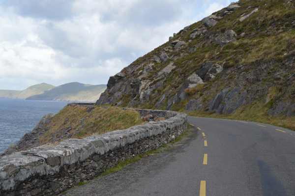
The coastal road below the cliffs at Slea Head.
The coastal road below the cliffs at Slea Head. Photo: N Chadwick ↗ · CC BY-SA 2.0

From research

Is this worth your time?

Choose Slea Head if you want to understand the relationship between Dingle’s coastal scenery and its settled landscape. Allow time for a few permitted stops rather than rushing the road. The headland view can stand alone; visits to churches, forts, beaches or island facilities need their own access decisions and current information.

Know before you book: This is an exposed outdoor visit. Tide, weather and local restrictions can change access; keep well back from cliffs and moving water.

Place highlights

What you will actually see

01

The promontory

Look at the projecting coastline from the established viewpoint without moving towards exposed edges. Pause on the established public route and look carefully. Watch your footing as well as the view; keep well away from exposed edges for photographs.

02

Sea and islands

Watch the changing Atlantic scene and distant landforms when visibility permits, without expecting a guaranteed panorama. Compare this feature with the wider surroundings. Use permitted approaches, leave plants and wildlife undisturbed and avoid shortcuts across adjoining land or fragile coastal vegetation.

03

The settled coast

Notice the villages and traces of older buildings that accompany the road around the peninsula. Choose a comfortable turning point before conditions limit the return. A shorter visit still reveals the place’s character; you need not reach every visible landmark.

The story behind the visit

The story behind the place

Fáilte Ireland identifies Slea Head as a promontory in the western part of the Dingle Peninsula, linked by road with the small settlements around Coumeenoole and Ballyickeen. The broader drive brings together beaches, historic structures and coastal views. That mixture is its central character: this is not an empty scenic edge, but a landscape where communities and older routes share space with visitors moving through the peninsula. Source ↗

A general description of the Slea Head drive gives a length of roughly forty-eight kilometres, but that should not be read as a single walking route or a fixed-duration attraction. The road journey and each stop require separate time. Choose a small number of accessible places, respect current traffic signs and avoid blocking narrow sections. The most rewarding visit may be a careful headland pause, while a longer circuit belongs in the day’s transport plan rather than being hidden inside a short sightseeing allowance. Source ↗

Visitor information

Tickets, timing and access

Opening
Use daylight and follow current road, traffic and viewpoint notices.Confirm with the operator ↗
Admission
The public headland view is separate from any paid attraction along the wider drive.Confirm with the operator ↗
Booking
No organised departure applies; book guided driving or individual attractions separately.Confirm with the operator ↗
Access
Use designated stopping places and respect private fields, entrances and exposed edges.Confirm with the operator ↗
Duration
Allow 60–90 minutes for selected headland stops; a full circuit needs separate travel time.Confirm with the operator ↗
Seasonal
Wind, rain or cloud can limit the view; reduce stops when conditions deteriorate.Confirm with the operator ↗

Getting to the entrance

Follow the signed Slea Head route from Dingle and current local traffic guidance. Use established public viewpoints; avoid stopping on narrow bends. Official visitor information ↗

Your questions, answered

Confirm current access and visitor arrangements with the operator.

Must I complete a long walk?

No. Choose a shorter permitted outing that fits conditions and leaves a straightforward return. Source ↗

Does this include access to adjoining land?

No. Use established public viewpoints and respect private boundaries and current local signs. Source ↗

Nearby options

Nearby places to explore

Explore other places in the area, then use live directions to plan your journey.

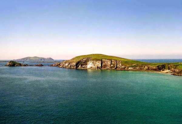
Dunmore Head viewed across the coastal bay.
Dunmore Head viewed across the coastal bay. Photo: Jeff Buck ↗ · CC BY-SA 2.0

coast

Dunmore Head

Dunmore Head is an exposed promontory near Dunquin on the western Dingle Peninsula, with Atlantic views and an ogham stone in the upland landscape. Its appeal comes from the meeting of headland, sea and the…

Open place page →
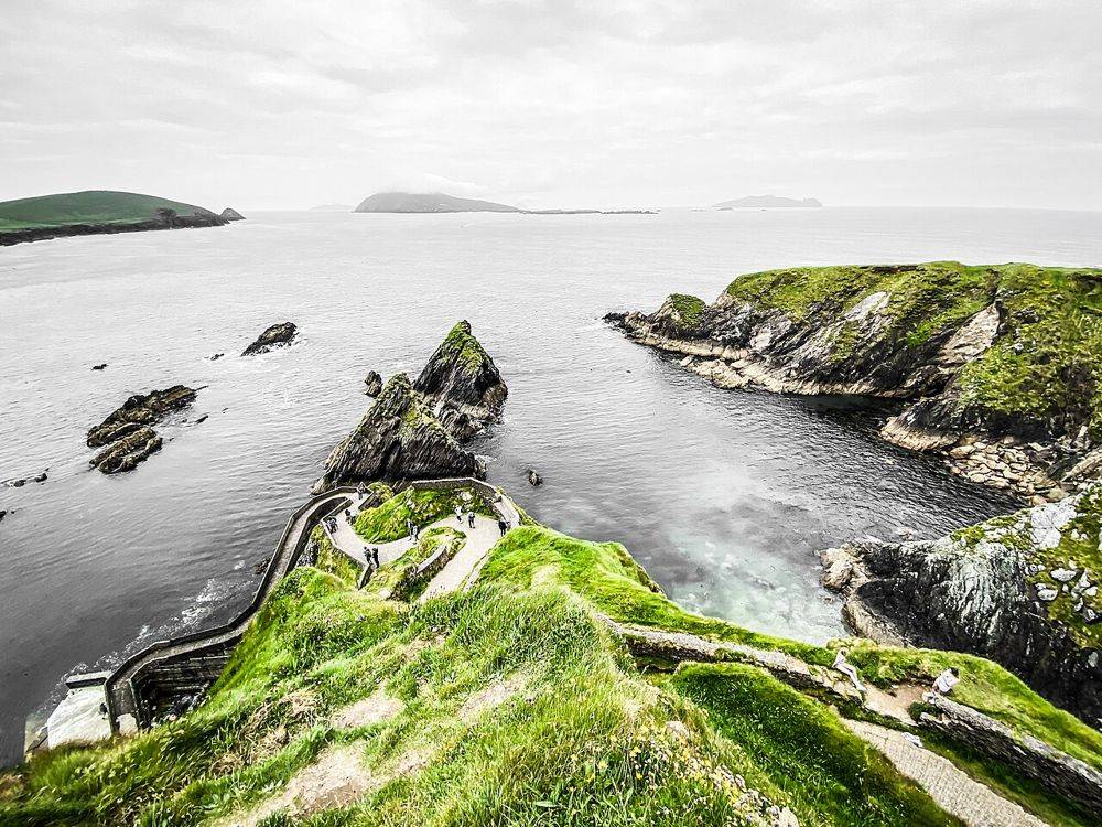
The winding descent to Dunquin Pier beneath the cliffs
The winding descent to Dunquin Pier beneath the cliffs. Source photograph; conditions and access may have changed. Resized from the credited original. Photo: Dieglop ↗ · CC BY-SA 4.0

coast

Cé Dhún Chaoin — Dunquin Pier

Dunquin’s zigzag path is easy to recognise from photographs, but the practical detail gets lost in the image: the pier is far below you. Look first from a permitted place above. Walking down is an optional…

Open place page →
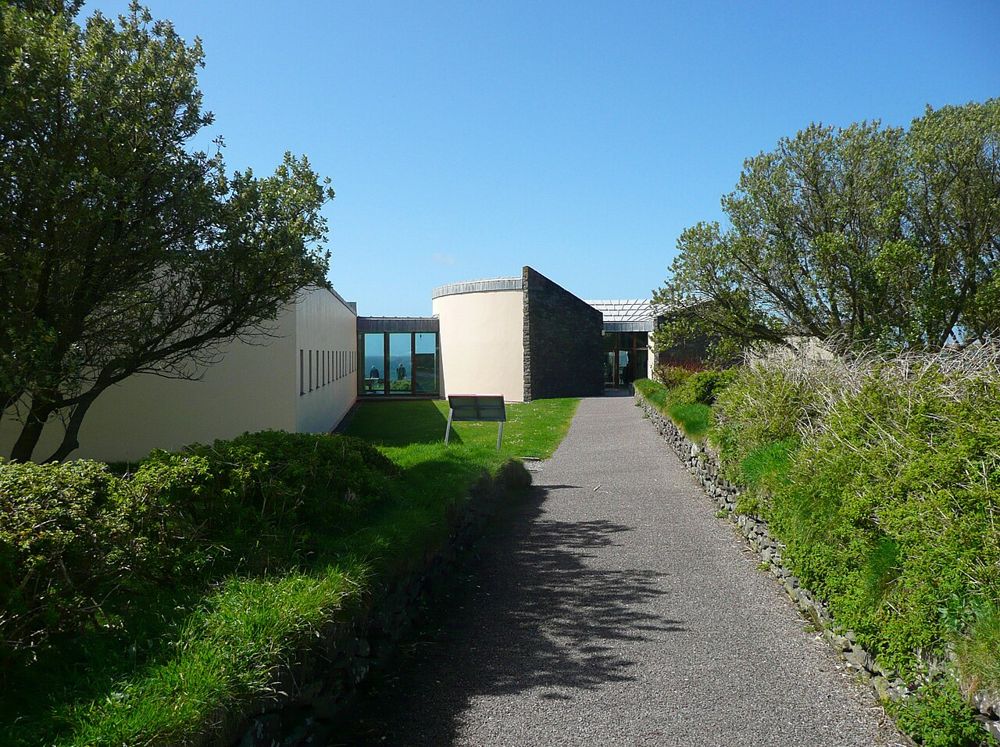
The approach to the Blasket Centre on the Dingle Peninsula
The approach to the Blasket Centre on the Dingle Peninsula. Source photograph; conditions and access may have changed. Resized from the credited original. Photo: Humphrey Bolton ↗ · CC BY-SA 2.0

heritage

Ionad an Bhlascaoid — The Blasket Centre

The Blasket Centre gives the islands people, language and ordinary days. Across the water, Great Blasket can look like an empty scenic shape; inside, recordings, writing and interpretation return the community…

Open place page →
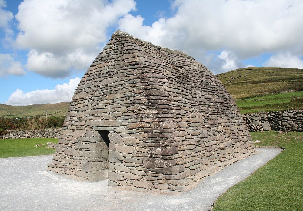
The curved stone roof and walls of Gallarus Oratory
The curved stone roof and walls of Gallarus Oratory. Source photograph; conditions and access may have changed. Resized from the credited original. Photo: Ingo Mehling ↗ · CC BY-SA 3.0

heritage

Gallarus Oratory

Gallarus asks you to look closely. The little stone building has none of a cathedral’s theatrical scale; its appeal is the precision of the walls curving into a roof. Step back to see the shape, then let your…

Open place page →
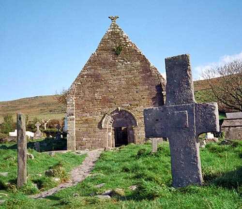
Kilmalkedar’s church ruins and burial ground.
Kilmalkedar’s church ruins and burial ground. Photo: Benson Wills ↗ · CC BY-SA 2.0

heritage

Kilmalkedar Church

Kilmalkedar Church is part of an early Christian and medieval religious complex on the Dingle Peninsula, overlooking the Smerwick area. A Romanesque church and several carved or inscribed stones give the visit…

Open place page →
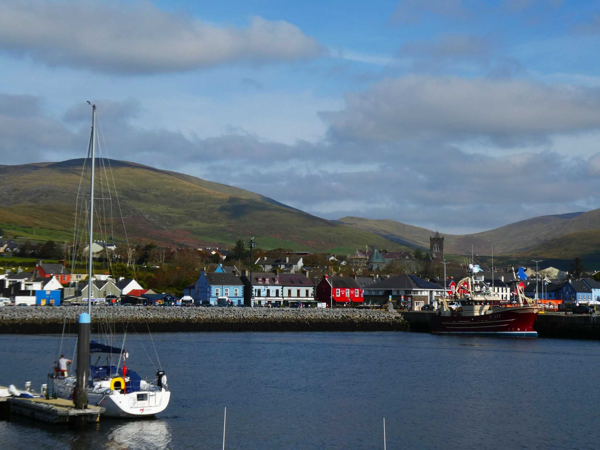
Dingle harbour and town with St Mary’s Church and hills behind
Dingle harbour and town, photographed on 12 October 2025. Source photograph; current conditions may differ. Photo: Maoileann ↗ · CC BY-SA 4.0

coast

Dingle

Dingle town is a harbour and streets visit that can anchor a peninsula stay. It is not a shorthand for driving every part of the Dingle Peninsula in one stop.

Open place page →

External visitor reviews

Find the matching listing and reviews on Google Maps ↗

Part of a bigger journey

Location & access

Getting your bearings

This is an exposed outdoor visit. Tide, weather and local restrictions can change access; keep well back from cliffs and moving water.

52.10502, -10.45534 · Reference point; confirm the correct entrance and access. Map © OpenStreetMap contributors.

Orientation only: a verified public entrance is not established by this pin. Use the operator arrival information before travel.

Sources & place context

Browse more Ireland places →