Skip to content
TheLazyNick

heritage · Antrim

Bonamargy Friary

Bonamargy Friary is a roofless religious ruin near Ballycastle, with surviving church and cloister features beside a burial ground. Founded around 1500, it became closely associated with the MacDonnell family. The Department for Communities lists free public entry, with possible temporary restrictions for works, so keep the visit to the areas actually open.

Add to planSaved trips & places

Saved on this browser. No account needed.

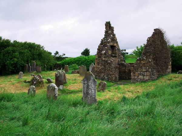
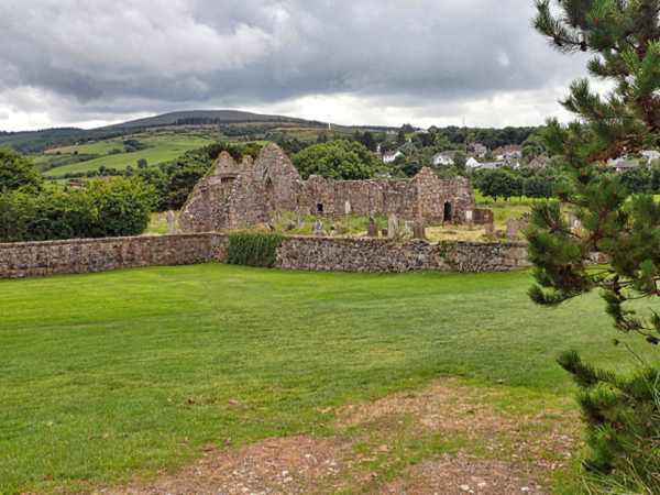
The roofless church and burial ground at Bonamargy Friary.
The roofless church and burial ground at Bonamargy Friary. Photo: Mick Garratt ↗ · CC BY-SA 2.0

From research

Is this worth your time?

Choose Bonamargy for a short historical stop where the surviving walls and windows can be studied without an indoor museum route. It pairs naturally with time in Ballycastle, but deserves a quiet pause of its own. Respect graves, avoid climbing the masonry and do not expect access to the sealed burial vault.

Know before you book: The burial vault is sealed; the visit is to the accessible ruined friary and grounds.

Place highlights

What you will actually see

01

Church and window

The surviving church walls and east window give the friary its strongest architectural focus. Look at the openings from ground level and compare the scale of the church with the adjoining spaces. An attractive window is not a safe place to climb for a photograph.

02

Cloister and gatehouse

Remains of the cloister and gatehouse help explain how the friary was organised beyond its church. Follow the permitted route and pause where the relationship between spaces is easiest to see. Missing roofs and floors mean that the present outline is only part of the former complex.

03

Burial associations

The site is connected with the MacDonnells, including Sorley Boy MacDonnell, whose coffin lies in the sealed vault. Appreciate that association without expecting to enter the vault. The surrounding burial ground should be treated as a place of remembrance as well as a historic setting.

The story behind the visit

The story behind the place

Rory MacQuillan established the friary near the mouths of the Carey and Shesk rivers around 1500. In 1588 the rival MacDonnells claimed it, adding a political and family history to the religious foundation. The surviving buildings therefore belong to a local story of competing power as well as monastic life. Their position close to Ballycastle makes it easy to connect the ruin with the wider north Antrim landscape. Source ↗

A roofless friary can be read through the spaces between its walls. The church, cloister and entrance served different purposes, and walking slowly helps keep those functions distinct. The sealed burial vault adds another kind of survival: an important part of the history remains physically present but outside the ordinary visitor route. Do not treat every feature mentioned in a historical description as an accessible room. A respectful circuit, with attention to masonry and graves, gives a fuller visit than a quick search for the most dramatic fragment. Source ↗

Visitor information

Tickets, timing and access

Opening
DfC lists public entry, subject to temporary works restrictions.Confirm with the operator ↗
Admission
Entry is free.Confirm with the operator ↗
Booking
No ordinary timed admission is listed.Confirm with the operator ↗
Access
Historic ruin and burial ground; do not climb or enter sealed areas.Confirm with the operator ↗
Duration
Allow 30–45 minutes for a careful circuit.Confirm with the operator ↗
Seasonal
Wet grass and uneven masonry can affect footing.Confirm with the operator ↗

Getting to the entrance

The official location is on the Ballycastle–Cushendall coast road; use the recognised approach and keep local access clear. Official visitor information ↗

Your questions, answered

Confirm current access and visitor arrangements with the operator.

Can I enter the MacDonnell vault?

No. The official account describes it as sealed. Source ↗

Is this an indoor attraction?

No. Expect roofless ruins and a burial-ground setting. Source ↗

Nearby options

Nearby places to explore

Explore other places in the area, then use live directions to plan your journey.

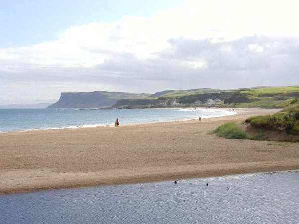
Ballycastle Beach with Fair Head beyond
Ballycastle Beach with Fair Head beyond. Resized for display. Photo: Kenneth Allen ↗ · CC BY-SA 2.0

coast

Ballycastle Beach

Ballycastle Beach runs from the marina pier towards Pans Rock, with sand, some shingle and views towards Rathlin Island and Fair Head. Its western promenade places the shore close to town facilities. A visit…

Open place page →
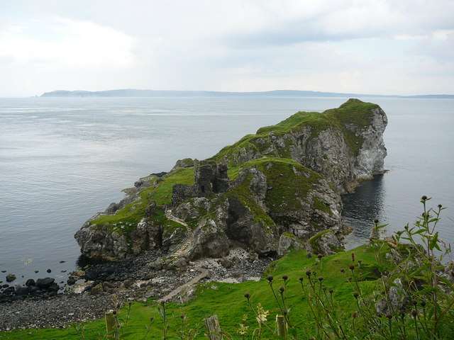
Kinbane’s chalk headland and castle beside the sea
Kinbane’s chalk headland and castle beside the sea. Resized for display. Photo: Colin Park ↗ · CC BY-SA 2.0

heritage

Kinbane Castle

Kinbane Castle occupies a chalk headland below the Causeway Coast near Ballycastle. Its ruined tower and enclosure are interesting in their own right, but the relationship between masonry, cliffs and sea gives…

Open place page →
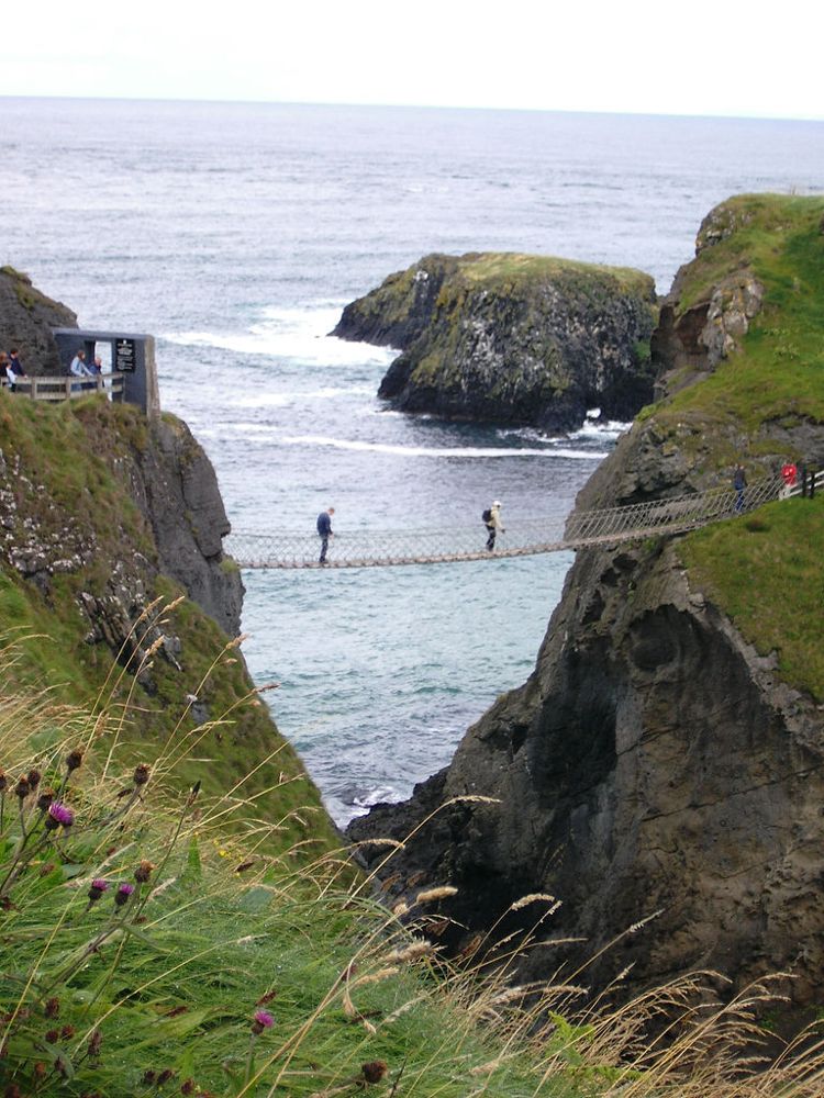
The Carrick-a-Rede rope bridge
The Carrick-a-Rede rope bridge. Source photograph dated 2005. Credited source photograph; appearance and access may have changed. Resized from the original. Photo: Stuart Yeates from Oxford, UK ↗ · CC BY-SA 2.0

coast

Carrick-a-Rede

At Carrick-a-Rede, the coastal approach is a substantial part of the experience. The bridge is the brief, memorable crossing within a longer outing above the sea, not something beside the car door.

Open place page →
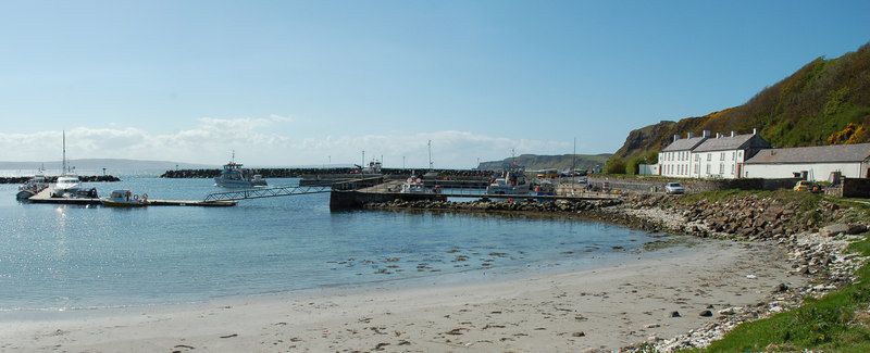
Church Bay harbour on Rathlin Island
Church Bay harbour on Rathlin Island. Credited source photograph; appearance and access may have changed. Resized from the original. Photo: Donald MacDonald ↗ · CC BY-SA 2.0

nature

Rathlin Island

Rathlin needs its own day-shaped space in a trip. Once the ferry reaches Church Bay, distances across the island and the timetable become more important than the mainland temptation to collect another stop.

Open place page →
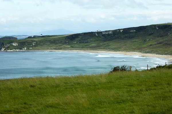
White Park Bay framed by its headlands
White Park Bay framed by its headlands. Resized for display. Photo: David Dixon ↗ · CC BY-SA 2.0

coast

Whitepark Bay

White Park Bay is a broad sandy arc between headlands on the north Antrim coast, backed by old dunes. It offers space for a beach walk and close attention to the shoreline rather than a built attraction. The…

Open place page →
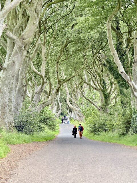
Beech trees along the Dark Hedges road
Beech trees along the Dark Hedges road. Credited source photograph; appearance and access may have changed. Resized from the original. Photo: Paul Buckingham ↗ · CC BY-SA 2.0

nature

The Dark Hedges

The Dark Hedges is a short avenue, not a forest hike. Its attraction is the way mature beech limbs lean across the road, producing a tunnel whose appearance changes with light, weather and the remaining trees.

Open place page →

External visitor reviews

Find the matching listing and reviews on Google Maps ↗

Part of a bigger journey

Location & access

Getting your bearings

The burial vault is sealed; the visit is to the accessible ruined friary and grounds.

55.20203, -6.23095 · Reference point; confirm the correct entrance and access. Map © OpenStreetMap contributors.

Orientation only: a verified public entrance is not established by this pin. Use the operator arrival information before travel.

Sources & place context

Browse more Ireland places →