Skip to content
TheLazyNick

coast · Antrim

Ballycastle Beach

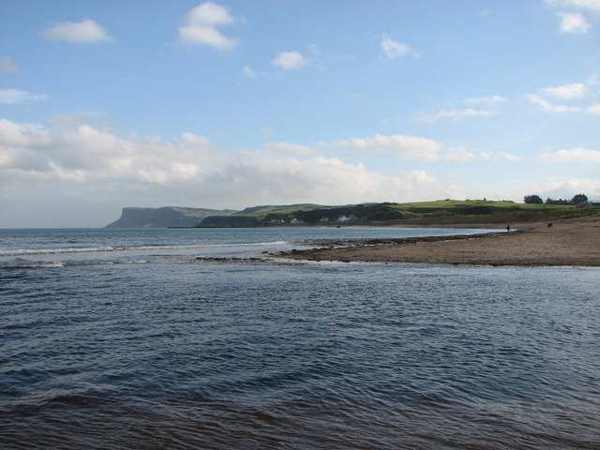
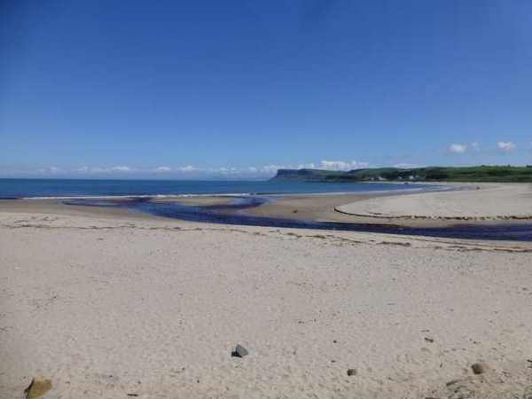
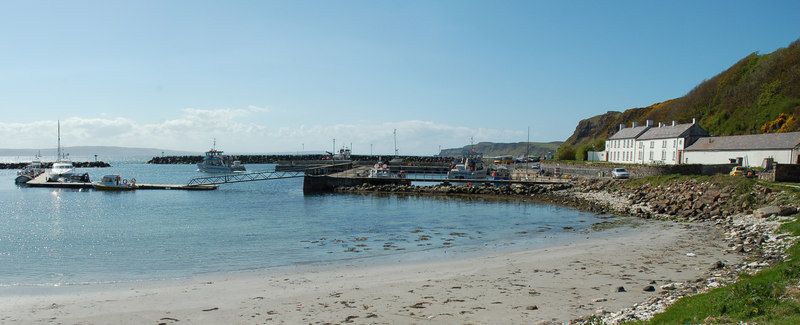
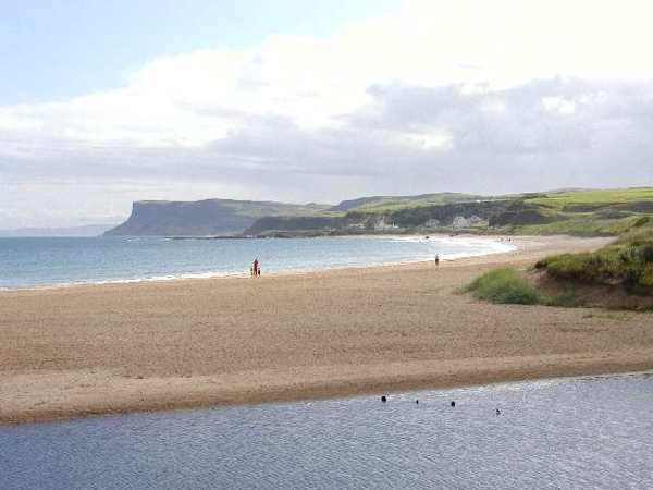
Ballycastle Beach runs from the marina pier towards Pans Rock, with sand, some shingle and views towards Rathlin Island and Fair Head. Its western promenade places the shore close to town facilities. A visit can be a short waterfront pause or a longer walk along the approximately 1.2-kilometre beach.

Add to planSaved trips & places

Saved on this browser. No account needed.

Ballycastle Beach with Fair Head beyond
Ballycastle Beach with Fair Head beyond. Resized for display. Photo: Kenneth Allen ↗ · CC BY-SA 2.0

From research

Is this worth your time?

Choose this beach when you want a coastal walk without leaving Ballycastle’s town setting. Start near the marina if a promenade suits the group, then decide whether to continue onto sand and shingle. Seasonal lifeguarding is not a year-round service, so a beach visit should not depend on supervised swimming outside the advertised season.

Know before you book: The promenade and beach have different surfaces; lifeguard cover is seasonal.

Place highlights

What you will actually see

01

Western promenade

Begin at the marina end for an easy introduction to the shape of the bay and the sea-facing town. This is a useful place to pause before committing to the beach itself, particularly when wind or mobility makes a longer walk less appealing.

02

Towards Pans Rock

The beach extends east towards Pans Rock, with sand giving way in places to shingle. Follow the shore at a distance appropriate to the sea conditions, and do not assume that reaching the rock is essential to enjoying the bay.

03

Sea horizons

Rathlin Island and Fair Head give the coastline its wider setting. On a clear day they help place Ballycastle within the north-coast landscape; when visibility is poor, concentrate on the near shoreline rather than expecting the distant views.

The story behind the visit

The story behind the place

The beach sits beside a working seaside town rather than apart from it. The marina pier anchors the western end, while the golf course backs much of the strand. That arrangement gives a walk a clear direction: town and harbour behind, a longer ribbon of coast ahead. Look back occasionally to see how the promenade and buildings change with distance. The views across the water also explain why this is a useful place to understand the geography of the north Antrim coast. Source ↗

Its practical convenience should not obscure the difference between a town promenade and an open beach. Sand, shingle, wind and waves still determine how comfortable a visit will be. Facilities nearby make a short outing possible, but they do not guarantee conditions in the water. The council advertises RNLI lifeguards during July and August, not through the colder months. Treat the beach primarily as a place for walking and looking, and follow the notices, flags and advice in force when you arrive rather than a remembered summer arrangement. Source ↗

Visitor information

Tickets, timing and access

Opening
Outdoor beach; plan a walk in daylight.Confirm with the operator ↗
Admission
Beach access is free; parking charges can be seasonal.Confirm with the operator ↗
Booking
No beach admission booking.Confirm with the operator ↗
Access
Western promenade and beach boardwalk available; sand and shingle remain uneven.Confirm with the operator ↗
Duration
Allow 45–60 minutes for a beach and promenade walk.Confirm with the operator ↗
Seasonal
Lifeguards are advertised for July–August only; follow current flags and notices.Confirm with the operator ↗

Getting to the entrance

Approach via the marina and Carrickmore Road, a short distance from Ballycastle town centre. Official visitor information ↗

Your questions, answered

Confirm current access and visitor arrangements with the operator.

Is there a promenade?

Yes, at the western end near the marina. Source ↗

Are dogs unrestricted all year?

No. Seasonal dog restrictions apply; follow the beach signs. Source ↗

Nearby options

Nearby places to explore

Explore other places in the area, then use live directions to plan your journey.

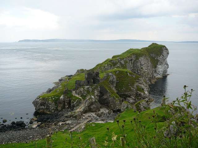
Kinbane’s chalk headland and castle beside the sea
Kinbane’s chalk headland and castle beside the sea. Resized for display. Photo: Colin Park ↗ · CC BY-SA 2.0

heritage

Kinbane Castle

Kinbane Castle occupies a chalk headland below the Causeway Coast near Ballycastle. Its ruined tower and enclosure are interesting in their own right, but the relationship between masonry, cliffs and sea gives…

Open place page →
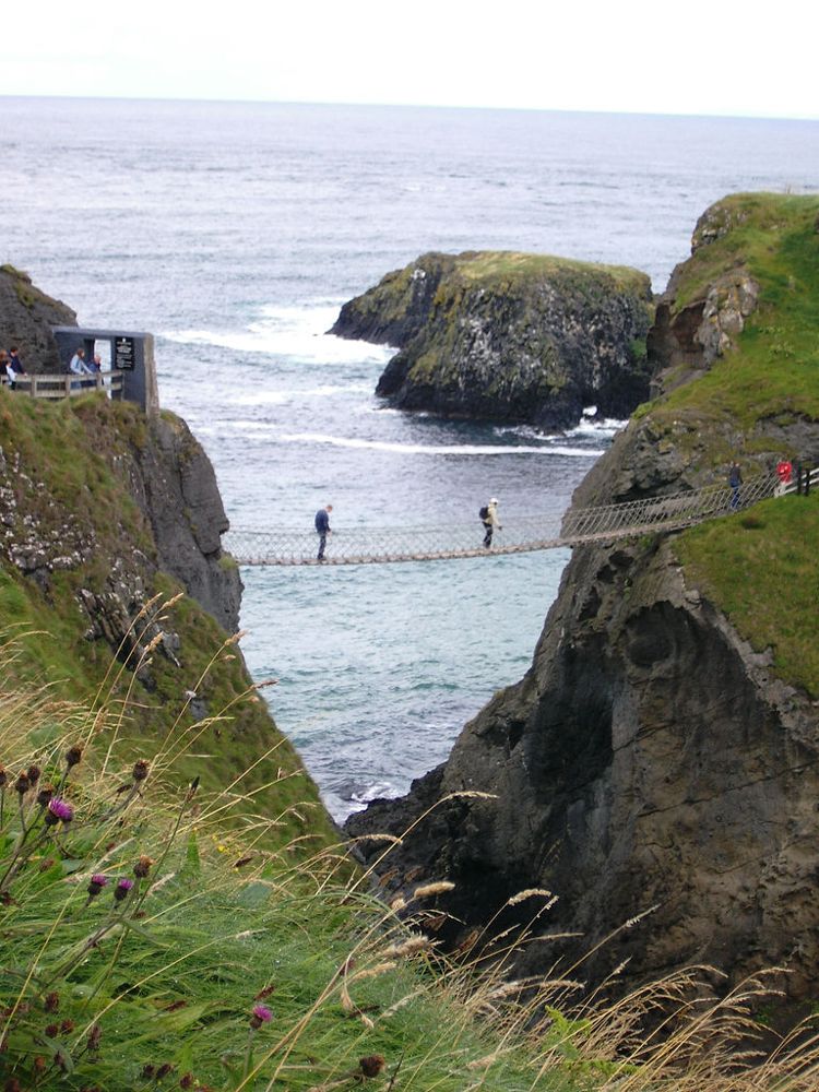
The Carrick-a-Rede rope bridge
The Carrick-a-Rede rope bridge. Source photograph dated 2005. Credited source photograph; appearance and access may have changed. Resized from the original. Photo: Stuart Yeates from Oxford, UK ↗ · CC BY-SA 2.0

coast

Carrick-a-Rede

At Carrick-a-Rede, the coastal approach is a substantial part of the experience. The bridge is the brief, memorable crossing within a longer outing above the sea, not something beside the car door.

Open place page →
Church Bay harbour on Rathlin Island
Church Bay harbour on Rathlin Island. Credited source photograph; appearance and access may have changed. Resized from the original. Photo: Donald MacDonald ↗ · CC BY-SA 2.0

nature

Rathlin Island

Rathlin needs its own day-shaped space in a trip. Once the ferry reaches Church Bay, distances across the island and the timetable become more important than the mainland temptation to collect another stop.

Open place page →
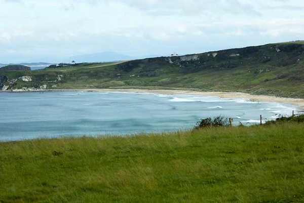
White Park Bay framed by its headlands
White Park Bay framed by its headlands. Resized for display. Photo: David Dixon ↗ · CC BY-SA 2.0

coast

Whitepark Bay

White Park Bay is a broad sandy arc between headlands on the north Antrim coast, backed by old dunes. It offers space for a beach walk and close attention to the shoreline rather than a built attraction. The…

Open place page →
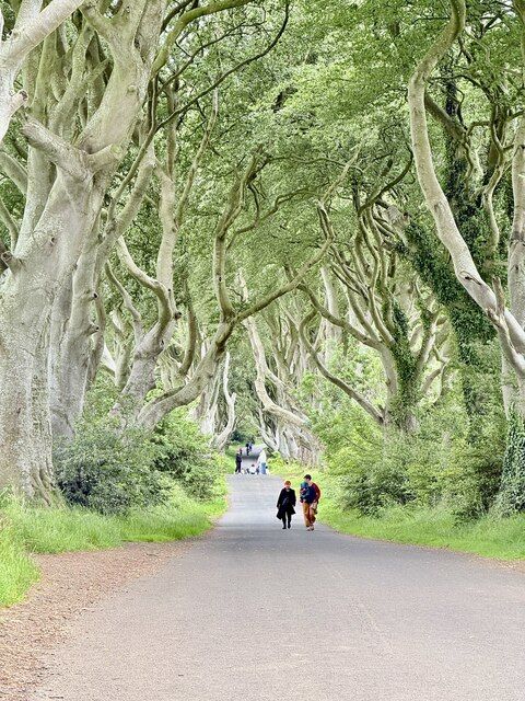
Beech trees along the Dark Hedges road
Beech trees along the Dark Hedges road. Credited source photograph; appearance and access may have changed. Resized from the original. Photo: Paul Buckingham ↗ · CC BY-SA 2.0

nature

The Dark Hedges

The Dark Hedges is a short avenue, not a forest hike. Its attraction is the way mature beech limbs lean across the road, producing a tunnel whose appearance changes with light, weather and the remaining trees.

Open place page →
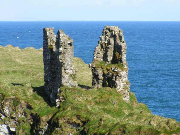
Surviving tower walls at Dunseverick Castle
Surviving tower walls at Dunseverick Castle. Resized for display. Photo: mauldy ↗ · CC BY-SA 2.0

heritage

Dunseverick Castle

Dunseverick Castle occupies a steep basalt promontory on the Causeway coast. A small surviving masonry tower stands within a much older fortified landscape, where earthworks matter as much as the conspicuous…

Open place page →

External visitor reviews

Find the matching listing and reviews on Google Maps ↗

Part of a bigger journey

Location & access

Getting your bearings

The promenade and beach have different surfaces; lifeguard cover is seasonal.

55.20716, -6.21991 · Reference point; confirm the correct entrance and access. Map © OpenStreetMap contributors.

Orientation only: a verified public entrance is not established by this pin. Use the operator arrival information before travel.

Sources & place context

Browse more Ireland places →