Skip to content
TheLazyNick

heritage · Antrim

Antrim Round Tower

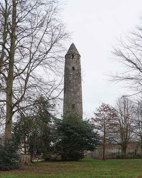
Antrim Round Tower, known locally as the Steeple, survives from the town’s early monastic settlement. The approximately 28-metre tower is a striking vertical landmark within a much quieter historic site. The Department for Communities lists free public entry, but that should be understood as access to the monument’s setting rather than a promise of a climb inside.

Add to planSaved trips & places

Saved on this browser. No account needed.

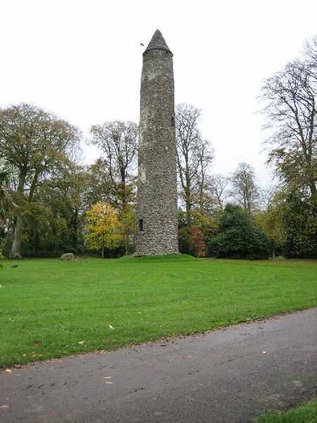
Antrim Round Tower standing within its public grounds.
Antrim Round Tower standing within its public grounds. Photo: Brian Shaw ↗ · CC BY-SA 2.0

From research

Is this worth your time?

Choose the tower for a compact heritage stop focused on its form and monastic connection. It works well when you have time for a short pause rather than a lengthy tour. Look at it from the surrounding permitted ground, and keep expectations to the exterior unless an operator specifically confirms another access arrangement.

Know before you book: An exterior monument visit; public entry does not imply that the tower can be climbed.

Place highlights

What you will actually see

01

Tower silhouette

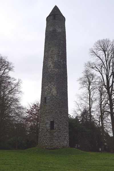
Stand back to appreciate the height and narrow proportions of the round tower. The outline makes more sense when seen as a whole than through a close photograph of one detail. Keep to the visitor ground rather than approaching walls through closed or planted areas.

02

Monastic setting

The tower recalls an early Christian settlement whose buildings have not survived as a complete complex. Look at the space around it as well as the masonry. The visible landmark is a surviving part of a wider place, not evidence that an intact monastery remains beneath every surface.

03

Stonework and scale

From a safe ground-level position, compare the tower’s masonry and openings with its overall height. These details can hold attention during a short visit without needing interior access. Avoid touching fragile areas or using adjacent structures as platforms for a higher viewpoint.

The story behind the visit

The story behind the place

The official account dates the tower to around the tenth century and identifies it as a bell-tower within the early Christian monastery. Its local name, the Steeple, preserves the impression made by a tall surviving structure after much of the surrounding settlement disappeared. The monastic site was burned in 1147, but the tower remains a clear reminder of that earlier religious landscape. Source ↗

A visit is most rewarding when the surviving landmark is allowed to stand for a larger, partly lost setting. Rather than imagining a complete monastery from one tower, notice what the structure itself can show: height, shape, openings and the relationship with the surrounding ground. The small scale of the visitor site also encourages a slower kind of looking. There is no need to make an ambitious itinerary around it, but a few attentive minutes can turn an easily passed landmark into a memorable introduction to Antrim’s earlier history. Respect any conservation barriers as part of caring for that survival. Source ↗

Visitor information

Tickets, timing and access

Opening
DfC lists public entry, with possible restrictions during works.Confirm with the operator ↗
Admission
Entry is free.Confirm with the operator ↗
Booking
No ordinary timed admission is listed.Confirm with the operator ↗
Access
View from permitted ground; no tower climb is promised.Confirm with the operator ↗
Duration
Allow 20–30 minutes for the exterior and setting.Confirm with the operator ↗
Seasonal
Choose daylight and follow any local conservation notices.Confirm with the operator ↗

Getting to the entrance

The official address is Steeple Road, Antrim; follow the recognised entrance rather than the map point across surrounding land. Official visitor information ↗

Your questions, answered

Confirm current access and visitor arrangements with the operator.

How tall is the tower?

The official account gives a height of 28 metres. Source ↗

Can I climb it?

Do not assume so. The visitor information establishes public site access, not an interior climb. Source ↗

Nearby options

Nearby places to explore

Explore other places in the area, then use live directions to plan your journey.

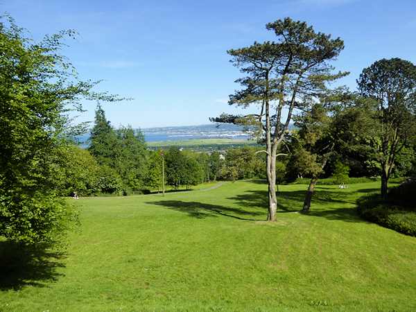
Open parkland and trees within Cave Hill Country Park.
Open parkland and trees within Cave Hill Country Park. Photo: David Dixon ↗ · CC BY-SA 2.0

nature

Cave Hill Country Park

A partial closure caused by erosion affects the Cavehill Trail; follow the signed quarry alternative. Above north Belfast, Cave Hill Country Park combines woodland, open hillside and archaeological earthworks…

Open place page →
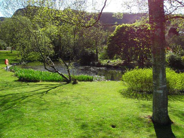
A leafy garden and pond view within Belfast Zoo.
A leafy garden and pond view within Belfast Zoo. Photo: Kenneth Allen ↗ · CC BY-SA 2.0

nature

Belfast Zoo

Belfast Zoo spreads its animal habitats over the slopes of Cave Hill. That hillside setting creates views over the lough, but it also means the day involves more climbing than a flat urban attraction. Check…

Open place page →
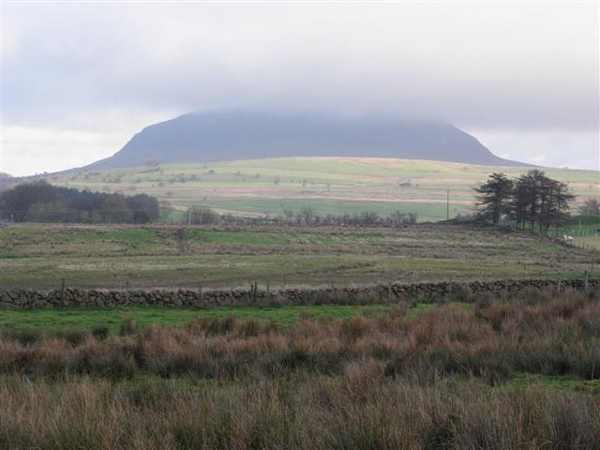
Slemish rising above the surrounding County Antrim countryside.
Slemish rising above the surrounding County Antrim countryside. Photo: Kenneth Allen ↗ · CC BY-SA 2.0

nature

Slemish Mountain

Slemish is a distinctive volcanic hill near Broughshane, closely associated in tradition with Saint Patrick’s years as a shepherd. The short route from the parking area reaches open, rocky ground with broad…

Open place page →

External visitor reviews

Find the matching listing and reviews on Google Maps ↗

Part of a bigger journey

Location & access

Getting your bearings

An exterior monument visit; public entry does not imply that the tower can be climbed.

54.72405, -6.20908 · Reference point; confirm the correct entrance and access. Map © OpenStreetMap contributors.

Orientation only: a verified public entrance is not established by this pin. Use the operator arrival information before travel.

Sources & place context

Browse more Ireland places →