Skip to content
TheLazyNick

nature · Antrim

Cave Hill Country Park

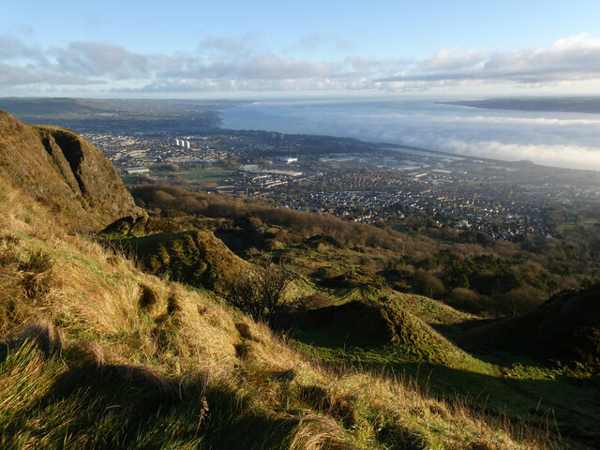
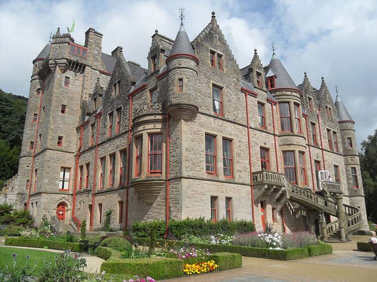
A partial closure caused by erosion affects the Cavehill Trail; follow the signed quarry alternative. Above north Belfast, Cave Hill Country Park combines woodland, open hillside and archaeological earthworks with wide city views. Its higher routes are a different outing from the gardens around Belfast Castle below.

Add to planSaved trips & places

Saved on this browser. No account needed.

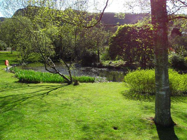
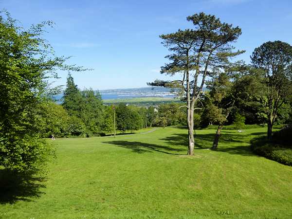
Open parkland and trees within Cave Hill Country Park.
Open parkland and trees within Cave Hill Country Park. Photo: David Dixon ↗ · CC BY-SA 2.0

From research

Is this worth your time?

Choose Cave Hill for a proper hill walk close to the city, rather than assuming the castle’s easy garden circuit reaches the summit. The longer route needs fitness, suitable footwear and enough daylight. Follow the current quarry diversion and be prepared to shorten the walk if weather, visibility or the ground makes the climb unsuitable.

Know before you book: The section between Devil’s Punchbowl and McArt’s Fort is partially closed; follow the council’s quarry alternative.

Place highlights

What you will actually see

01

McArt’s Fort

The hilltop earthwork is the main high-level destination, with views across Belfast when conditions allow. Keep well away from exposed edges and respect the current approach restrictions. Its height and setting are part of the experience; reaching it is not essential when conditions deteriorate.

02

Woodland to open hill

The country park includes lower woodland and higher heath and moorland, giving a walk changing texture as well as elevation. Choose a waymarked route suited to the group. The shorter estate option is different from the full hill circuit and can be a sensible alternative.

03

Caves and archaeology

Five caves give the hill its name, while cairn and other archaeological remains add depth to the landscape. Observe from established paths; the name does not imply a visitor cave tour or permission to scramble into openings and onto fragile earthworks.

The story behind the visit

The story behind the place

Cave Hill is both Belfast’s backdrop and a landscape with its own history. The caves may be associated with early mining, while McArt’s Fort and other remains show how the hill was used before the modern country park. Look at the relationship between the summit, the lower slopes and the city rather than treating the viewpoint as the only thing worth seeing. Different routes reveal different parts of that setting. Source ↗

The council manages habitats as well as recreation, including grazing cattle. Keep to pathways, give animals space and follow the specific livestock guidance on site. A public country park is not a guarantee that every path remains available: erosion has closed part of the hill route, and the current alternative passes through the limestone quarry. Use that information to choose a realistic walk, with time for the descent. The castle and gardens below can be visited separately, but their presence should not make the exposed upper slopes seem like an easy extension. Source ↗

Visitor information

Tickets, timing and access

Opening
Council park gates open 7.30 am with seasonal closing times.Confirm with the operator ↗
Admission
General park entry is free.Confirm with the operator ↗
Booking
Ordinary walks need no timed admission.Confirm with the operator ↗
Access
Partial hill-trail closure; use the quarry diversion and keep dogs controlled around cattle.Confirm with the operator ↗
Duration
Allow 2–3 hours for the longer hill outing, excluding travel.Confirm with the operator ↗
Seasonal
Check weather and daylight; use shorter routes when conditions require.Confirm with the operator ↗

Getting to the entrance

The council lists several entrances; the main trailhead is at the second car park on the Belfast Castle drive from Innisfayle Park. Official visitor information ↗

Your questions, answered

Confirm current access and visitor arrangements with the operator.

Does the castle garden route reach the summit?

No. The short Castle Trail and longer Cavehill Trail are different walks. Source ↗

Can I ignore the closed section?

No. Follow the council’s quarry alternative and local signs. Source ↗

Nearby options

Nearby places to explore

Explore other places in the area, then use live directions to plan your journey.

A leafy garden and pond view within Belfast Zoo.
A leafy garden and pond view within Belfast Zoo. Photo: Kenneth Allen ↗ · CC BY-SA 2.0

nature

Belfast Zoo

Belfast Zoo spreads its animal habitats over the slopes of Cave Hill. That hillside setting creates views over the lough, but it also means the day involves more climbing than a flat urban attraction. Check…

Open place page →
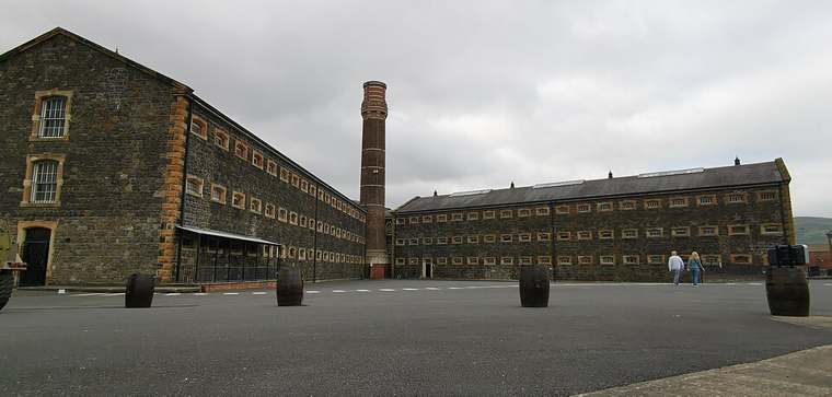
The prison courtyard and buildings at Crumlin Road Gaol.
The prison courtyard and buildings at Crumlin Road Gaol. Photo: Z thomas ↗ · CC BY-SA 4.0

heritage

Crumlin Road Gaol

Crumlin Road Gaol interprets imprisonment inside the former Belfast prison, using original spaces alongside audiovisual displays. The current standard experience is self-guided, so visitors can pause at the…

Open place page →
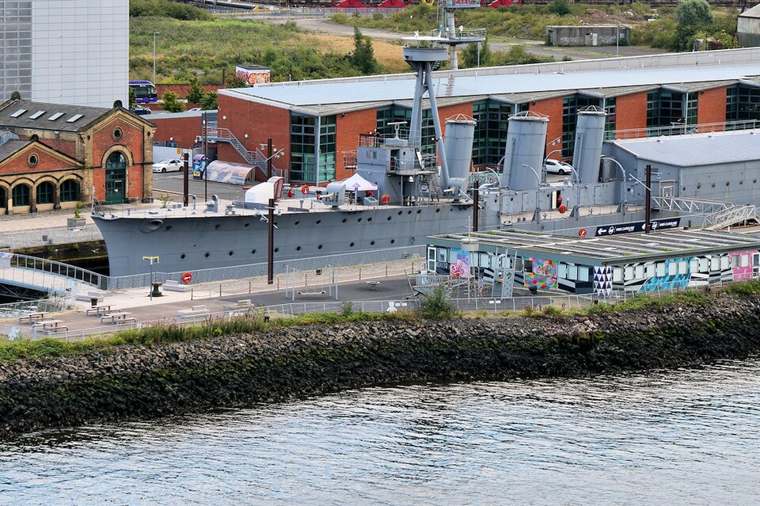
HMS Caroline at her Belfast berth.
HMS Caroline at her Belfast berth. Photo: David Dixon ↗ · CC BY-SA 2.0

heritage

HMS Caroline

HMS Caroline brings a First World War cruiser into Belfast’s maritime story. The floating museum preserves the character of a working ship while interpreting the people who served aboard and the Battle of…

Open place page →
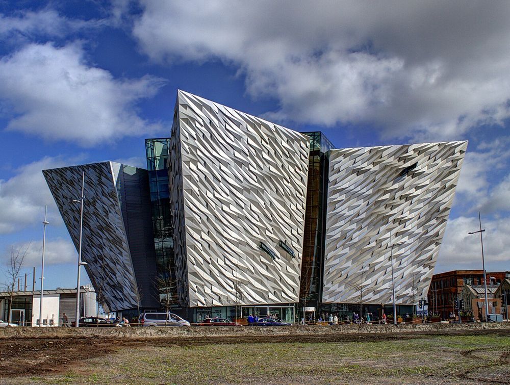
The angular Titanic Belfast building from the front
The angular Titanic Belfast building from the front. Credited source photograph; appearance and access may have changed. Resized from the original. Photo: Soerfm ↗ · CC BY-SA 4.0

attraction

Titanic Belfast

Titanic Belfast makes most sense when the ship is put back into the city that built it. The angular galleries stand beside the original slipways, so the industrial landscape continues beyond the ticket…

Open place page →

External visitor reviews

Find the matching listing and reviews on Google Maps ↗

Part of a bigger journey

Location & access

Getting your bearings

The section between Devil’s Punchbowl and McArt’s Fort is partially closed; follow the council’s quarry alternative.

54.64715, -5.95198 · Reference point; confirm the correct entrance and access. Map © OpenStreetMap contributors.

Orientation only: a verified public entrance is not established by this pin. Use the operator arrival information before travel.

Sources & place context

Browse more Ireland places →