Skip to content
TheLazyNick

coast · Cork

Sheep's Head

Sheep’s Head is the narrow peninsula between Bantry Bay and Dunmanus Bay. This guide focuses on its published Lighthouse Loop at the far tip, where rocky paths, coastal exposure and views make a compact but demanding walk. The short distance should not obscure the strenuous grade or the care required beside high cliffs.

Add to planSaved trips & places

Saved on this browser. No account needed.

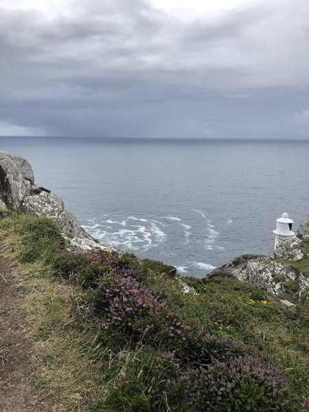
Sheep’s Head Lighthouse below the coastal cliffs
Sheep’s Head Lighthouse below the coastal cliffs. Resized for display. Photo: Karie Kuiper ↗ · CC BY-SA 4.0

From research

Is this worth your time?

Choose the Lighthouse Loop if you are comfortable with steep, rocky walking and an exposed coastal setting. It is not a casual promenade or an easy route justified by its length. Read trail information, prepare and choose another outing if wind, footing or confidence makes the circuit unsuitable.

Know before you book: The official trail is strenuous and passes high cliffs. No dogs are allowed. Stay well away from edges and follow current waymarks or diversions.

Place highlights

What you will actually see

01

The headland paths

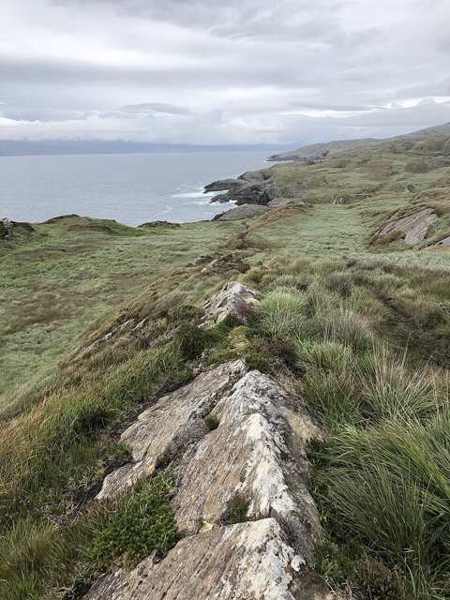
Follow the blue arrows on their yellow background and give the ground your attention. The route includes tracks and paths that can be steep and rocky. Keep the group together and stop somewhere secure before looking out across the sea.

02

Lough Akeen

The published loop passes the small lake, adding an inland feature to the coastal outing. Notice the contrast between this water and the surrounding Atlantic views, while remaining on the route rather than searching for an unsignposted shortcut.

03

Coastal views

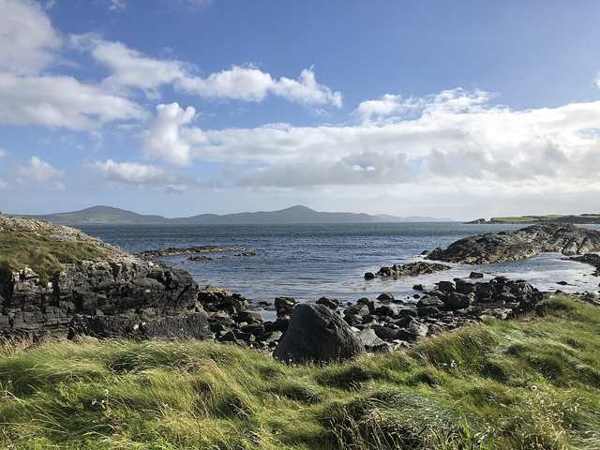
In suitable visibility, look towards the neighbouring peninsulas from a safe position on the trail. The scenery is a reason to pause, not to move closer to the cliff edge. Wind can change the judgement required even on a familiar-looking section.

The story behind the visit

The story behind the place

Sheep’s Head lies between two long bays, giving the far end of the peninsula a strongly maritime setting. Sport Ireland’s published loop circles its tip and includes views towards Mizen Head and the Beara Peninsula. This geography explains the appeal of a relatively short route: the surrounding sea opens several directions at once. It also explains why the outing needs a weather decision rather than being treated as a guaranteed addition to any drive. Source ↗

The Lighthouse Loop is recorded as 3.7 kilometres with about 190 metres of ascent and an estimated two-hour duration. Its strenuous grade reflects the character of the paths, including steep and rocky sections near high cliffs. The much longer Sheep’s Head Way is a different undertaking, with its own route notices and diversions. Keeping these routes distinct helps avoid a common planning mistake: a short loop at the tip does not make the entire peninsula trail a short walk, nor remove the need for preparation. Source ↗

Visitor information

Tickets, timing and access

Opening
Walk only with sufficient daylight and suitable conditions; follow current trail notices.Confirm with the operator ↗
Admission
Check local arrangements at the trailhead; no organised walking ticket is advertised.Confirm with the operator ↗
Booking
Independent walkers use the waymarked route; arrange specialist guiding separately if needed.Confirm with the operator ↗
Access
Strenuous 3.7 km loop with steep rocky paths and high cliffs; no dogs.Confirm with the operator ↗
Duration
Sport Ireland estimates 2 hours. Allow extra time for safe pauses and changing conditions.Confirm with the operator ↗
Seasonal
Avoid the exposed route in strong wind or severe weather; check route diversions before travelling.Confirm with the operator ↗

Getting to the entrance

The published start is Tooreen Point car park at the peninsula tip, beyond Kilcrohane. Allow separate time for the narrow-road approach. Official visitor information ↗

Your questions, answered

Confirm current access and visitor arrangements with the operator.

Is it an easy short walk?

No. The published grade is strenuous despite the modest distance. Source ↗

Does this cover the whole Sheep’s Head Way?

No. This visit focuses on the Lighthouse Loop; the long-distance route needs separate planning. Source ↗

Nearby options

Nearby places to explore

Explore other places in the area, then use live directions to plan your journey.

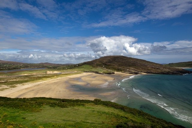
The sand and coastal setting at Barleycove
The sand and coastal setting at Barleycove. Historical source photograph; conditions and access may have changed. Resized from the credited source. Photo: EHRENBERG Kommunikation ↗ · CC BY-SA 2.0

attraction

Barleycove Beach

Choose Barleycove for an open beach visit after a more structured stop. A walk, a pause on the sand and time looking back at the dunes can give the day a different rhythm without requiring another ticket.

Open place page →
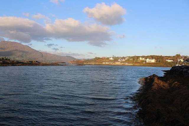
Harbour on Bere Island
Harbour on Bere Island. Source photograph: 2016-10-23 17:39:45. Appearance, displays and access may have changed. Photo: Towel401 ↗ · CC BY-SA 4.0

nature

Bere Island

Bere Island lies at the entrance to Bantry Bay, with a living community, coastal roads, walking routes and a substantial military-heritage landscape. Two year-round car-ferry services connect it with the Beara…

Open place page →
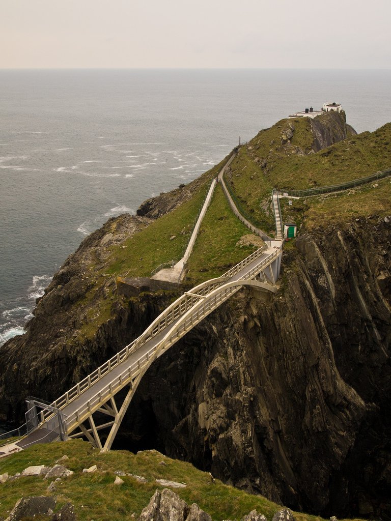
The bridge across the sea channel at Mizen Head
The bridge across the sea channel at Mizen Head. Historical source photograph; conditions and access may have changed. Resized from the credited source. Photo: fubsan ↗ · CC BY-SA 2.0

attraction

Mizen Head Signal Station

Give Mizen Head time for both the approach across the bridge and the signal-station story. The sea is the setting, but the effort to warn shipping and the people who worked here give the visit its purpose.

Open place page →
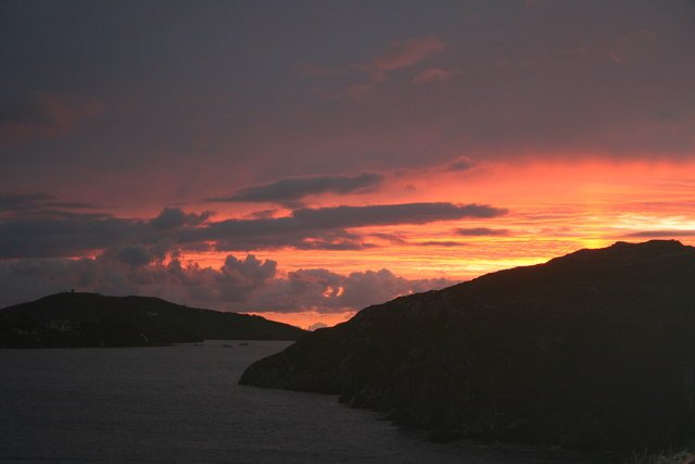
Crookhaven Harbour seen from Rock Island
Crookhaven Harbour seen from Rock Island. Historical source photograph; conditions and access may have changed. Resized from the credited source. Photo: Dr Brian Lynch ↗ · CC BY-SA 2.0

attraction

Crookhaven harbour

Choose Crookhaven for a harbour pause after the exposed parts of the peninsula. Give yourself time to look at boats and the relationship between the water and the village, rather than making it only a place to…

Open place page →
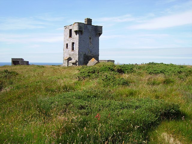
The former signal tower on Brow Head
The former signal tower on Brow Head. Historical source photograph; conditions and access may have changed. Resized from the credited source. Photo: Richard Webb ↗ · CC BY-SA 2.0

attraction

Brow Head

Choose Brow Head for a more exposed landscape visit, with the former signalling structures providing context. Make the approach and visibility part of the decision; this is not simply another managed viewpoint…

Open place page →

External visitor reviews

Find the matching listing and reviews on Google Maps ↗

Part of a bigger journey

Location & access

Getting your bearings

The official trail is strenuous and passes high cliffs. No dogs are allowed. Stay well away from edges and follow current waymarks or diversions.

51.54599, -9.82644 · Reference point; confirm the correct entrance and access. Map © OpenStreetMap contributors.

Orientation only: a verified public entrance is not established by this pin. Use the operator arrival information before travel.

Sources & place context

Browse more Ireland places →