Skip to content
TheLazyNick

nature · Clare

Dromore Wood Nature Reserve

Dromore Wood Nature Reserve lies north of Ennis, with woodland, lakes and wetland habitats alongside traces of older buildings. The attraction is the variety within one landscape rather than a guaranteed visitor-centre session. Choose an established public walking route and confirm current gate and centre arrangements before making a special journey.

Add to planSaved trips & places

Saved on this browser. No account needed.

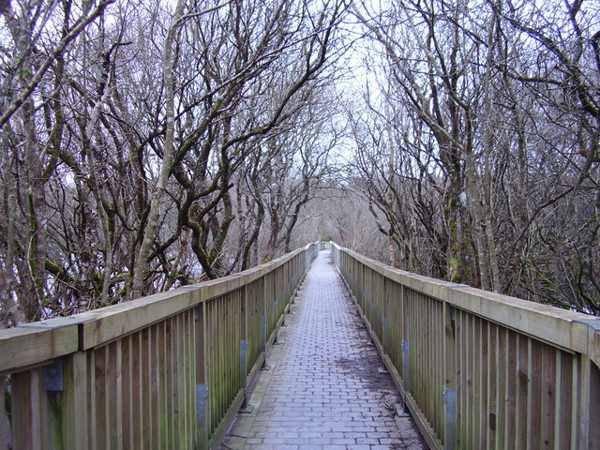
A boardwalk through Dromore Woods in County Clare.
A boardwalk through Dromore Woods in County Clare. Photo: Geno ↗ · CC BY-SA 2.0

From research

Is this worth your time?

Choose Dromore for a slower nature outing with historical features in the wider setting. You can enjoy a woodland route without expecting to enter a castle or attend a guided tour. Check the current local information, especially in winter, and keep the visitor centre separate from the outdoor reserve when planning your day.

Know before you book: Reserve paths and the visitor centre have separate access arrangements. Do not assume winter centre opening, guided tours or castle-interior access.

Place highlights

What you will actually see

01

Woodland and water

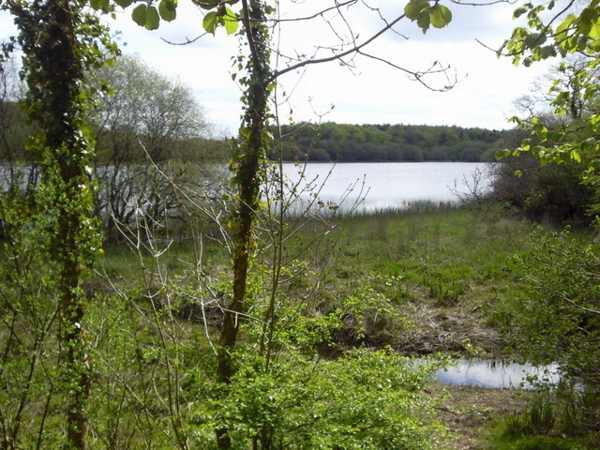
Follow the established public route and notice where woodland meets lake, wetland or seasonally flooded ground. Pause on the established public route and look carefully. Watch your footing as well as the view; keep well away from exposed edges for photographs.

02

Habitat variety

Observe the changing vegetation from the path without entering reed beds, wet meadows or other sensitive ground. Compare this feature with the wider surroundings. Use permitted approaches, leave plants and wildlife undisturbed and avoid shortcuts across adjoining land or fragile vegetation.

03

Historic remains

Look at the older structures only from permitted routes; their presence does not establish safe interior access. Choose a comfortable turning point before conditions limit the return. A shorter visit still reveals the place’s character; you need not reach every visible landmark.

The story behind the visit

The story behind the place

NPWS records Dromore as a state-owned nature reserve established in 1985. Its conservation value comes from a combination of habitats rather than one uniform wood. Official visitor information identifies lakes, river, turloughs, flooded meadows, limestone pavement, fen and reed beds alongside woodland. These transitions explain why a short walk can feel varied. Stay on the established routes and allow water levels and local notices to determine which sections are suitable on the day. Source ↗

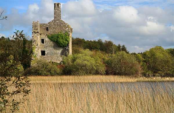
The wider reserve also contains historical remains, including the seventeenth-century O’Brien castle beside the lake and other earlier sites. Those features add context to the landscape but should not be treated as separate open interiors without confirmation. Fáilte Ireland describes guided tours by advance arrangement during summer and a booklet available when the centre is open. That seasonal description is not a promise of a winter departure or staffed building. An outdoor visit should therefore stand on its own, with centre access confirmed separately. Source ↗

Visitor information

Tickets, timing and access

Opening
Check current reserve gate times and local notices; confirm centre opening separately.Confirm with the operator ↗
Admission
Official visitor information lists the reserve visit as free.Confirm with the operator ↗
Booking
Summer guided tours are described by advance arrangement; no winter departure is promised.Confirm with the operator ↗
Access
Use established routes and respect closures around wet ground, habitat and historic structures.Confirm with the operator ↗
Duration
Allow about 2 hours for a selected woodland and lakeside walk.Confirm with the operator ↗
Seasonal
Flooding, wet paths and shorter daylight can affect routes; check the current entrance information.Confirm with the operator ↗

Getting to the entrance

Use the signed Dromore reserve approach near Ruan, north of Ennis. The NPWS point locates the reserve; follow current public entrance signs. Official visitor information ↗

Your questions, answered

Confirm current access and visitor arrangements with the operator.

Must I complete a long walk?

No. Choose a shorter permitted outing that fits conditions and leaves a straightforward return. Source ↗

Are the buildings part of the visit?

Outdoor reserve access is separate. Check NPWS information for visitor-centre hours and historic-building access. Source ↗

Nearby options

Nearby places to explore

Explore other places in the area, then use live directions to plan your journey.

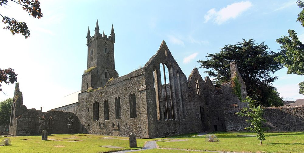
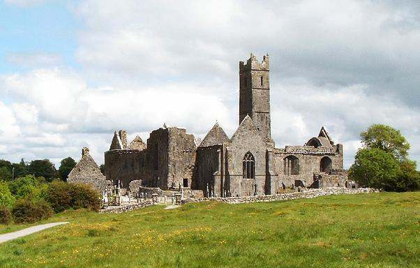
Stone walls and church windows at Ennis Friary
Stone walls and church windows at Ennis Friary. Photo: Ruhrfisch ↗ · CC BY-SA 4.0

heritage

Ennis Friary

Ennis Friary is a good reminder that the most interesting part of a ruin can be small. Its limestone carvings, tombs and windows reward looking closely rather than chasing a grand view. Because it sits in…

Open place page →
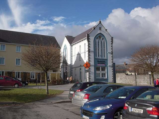
Clare Museum and visitor-service building in Ennis
Clare Museum and visitor-service building in Ennis. Source photograph: 2010-02-17. Appearance, displays and access may have changed. Photo: C O'Flanagan ↗ · CC BY-SA 2.0

heritage

Clare Museum

Clare Museum in Ennis introduces the county through original objects and the stories attached to them. Its collection ranges across archaeology, political history and everyday life, making it a useful indoor…

Open place page →
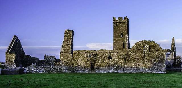
The church, belfry and surrounding ruins at Clare Abbey
The church, belfry and surrounding ruins at Clare Abbey. Resized for display. Photo: Francisjosephchandler ↗ · CC BY-SA 4.0

heritage

Clare Abbey

Clare Abbey is a ruined Augustinian monastery beside the River Fergus near Ennis. Its church, square belfry and domestic ranges form a substantial complex, with late-medieval window detail worth a close look.…

Open place page →
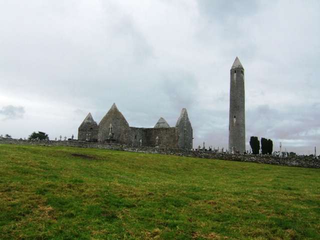
Kilmacduagh monastic ruins and round tower
Kilmacduagh monastic ruins and round tower. Source photograph: 2011-07-06. Appearance, displays and access may have changed. Photo: John M ↗ · CC BY-SA 2.0

heritage

Kilmacduagh Monastic Site

Kilmacduagh brings a tall leaning round tower, a ruined cathedral and several other medieval buildings together near the edge of the Burren. The interest lies in the whole ecclesiastical landscape rather than…

Open place page →

External visitor reviews

Find the matching listing and reviews on Google Maps ↗

Part of a bigger journey

Location & access

Getting your bearings

Reserve paths and the visitor centre have separate access arrangements. Do not assume winter centre opening, guided tours or castle-interior access.

52.92300, -8.96700 · Reference point; confirm the correct entrance and access. Map © OpenStreetMap contributors.

Orientation only: a verified public entrance is not established by this pin. Use the operator arrival information before travel.

Sources & place context

Browse more Ireland places →