Skip to content
TheLazyNick

nature · Derry/Londonderry

Binevenagh Mountain and Nature Reserve

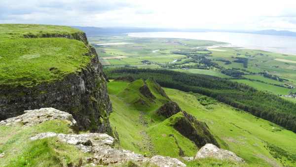
Binevenagh combines a steep basalt escarpment, upland nature reserve and small artificial lake above the north-west coast. In clear weather the outlook takes in Benone, Lough Foyle and Donegal. The mountain, lake and reserve belong to one landscape visit, with exposed ground and route choices that require more preparation than a roadside photograph.

Add to planSaved trips & places

Saved on this browser. No account needed.

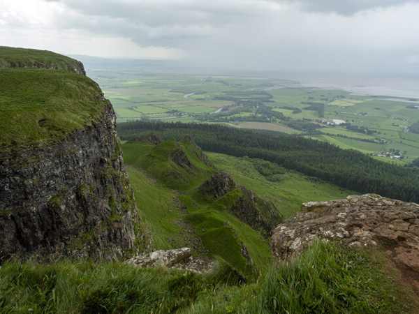
The upland landscape at Binevenagh.
The upland landscape at Binevenagh. Photo: Rossographer ↗ · CC BY-SA 2.0

From research

Is this worth your time?

Choose Binevenagh for a hill-and-nature outing when weather and visibility suit the group. Decide whether you want a short lake-side look or a longer forest approach before setting out. A public nature reserve does not make cliff edges safe, and the stocked lake is not an invitation to swim or fish without checking the relevant rules.

Know before you book: Exposed cliffs and upland ground; lake, mountain and reserve access are one landscape, not three separate attractions.

Place highlights

What you will actually see

01

Basalt escarpment

The cliffs reveal the mountain’s volcanic character and create its dramatic outlook. Appreciate them from established safe ground, well back from edges. Wind and poor visibility can make an apparently simple viewpoint stop unsuitable, so let conditions determine how far you go.

02

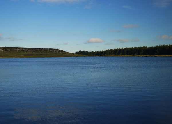
Upland lake

The artificial lake adds a quieter focus on the mountain top. Look at its relationship with the open slopes rather than assuming it is a natural swimming place. The official account notes stocked trout, but angling is a separate activity whose permissions must be checked.

03

Reserve habitats

The nature reserve combines upland ground with managed grazing. Keep dogs on leads around livestock and ponies, and stay on appropriate paths. A slow look at vegetation and landform can make a visit worthwhile even when distant views are limited.

The story behind the visit

The story behind the place

The official nature-reserve account connects Binevenagh’s cliffs with lava formed around 60 million years ago. That geological origin helps explain the contrast between the abrupt escarpment and the lower landscape beyond it. The view is not simply a distant panorama: it is a way of seeing how the mountain, coast and low ground fit together. The lake introduces a later, human-made feature into that older landform. Source ↗

The landscape is also actively managed, including grazing by livestock and ponies. Keep that working reality in mind when walking through what may look like open, empty hill country. The lake, reserve and mountain-walk names describe overlapping parts of the same place, so a good plan chooses an appropriate route instead of trying to collect them as separate stops. Carry the route information, allow for the return and avoid pressure to reach an edge for a better photograph. Clear weather may reveal Donegal and the lough; cloud can shift attention towards the nearby ground instead. Source ↗

Visitor information

Tickets, timing and access

Opening
Official reserve information says open every day; follow local access notices.Confirm with the operator ↗
Admission
Reserve entry is free.Confirm with the operator ↗
Booking
No ordinary walking ticket; check angling permissions separately.Confirm with the operator ↗
Access
Upland paths and exposed cliffs; dogs on leads around grazing animals.Confirm with the operator ↗
Duration
Allow 90–120 minutes for a chosen short hill-and-lake outing.Confirm with the operator ↗
Seasonal
Wind, cloud and wet ground can limit views and routes.Confirm with the operator ↗

Getting to the entrance

The official walking approach begins from Leighry Road; use the land manager’s route information and designated parking. Official visitor information ↗

Your questions, answered

Confirm current access and visitor arrangements with the operator.

Are the lake and reserve separate destinations?

They are overlapping parts of the same Binevenagh landscape. Source ↗

Can I fish simply because trout are stocked?

No. Check current angling rules and permissions separately. Source ↗

Nearby options

Nearby places to explore

Explore other places in the area, then use live directions to plan your journey.

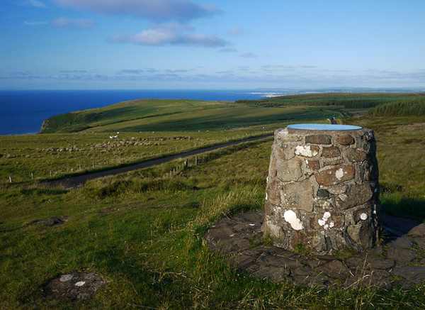
The outlook across the coastal plain from Gortmore Viewpoint.
The outlook across the coastal plain from Gortmore Viewpoint. Photo: Rossographer ↗ · CC BY-SA 2.0

nature

Gortmore View Point

Gortmore View Point is an elevated stop on Bishop’s Road, with a broad outlook over the Magilligan area and the north-west coast. A sculpture of Manannán Mac Lir adds a distinctive foreground to the landscape.…

Open place page →
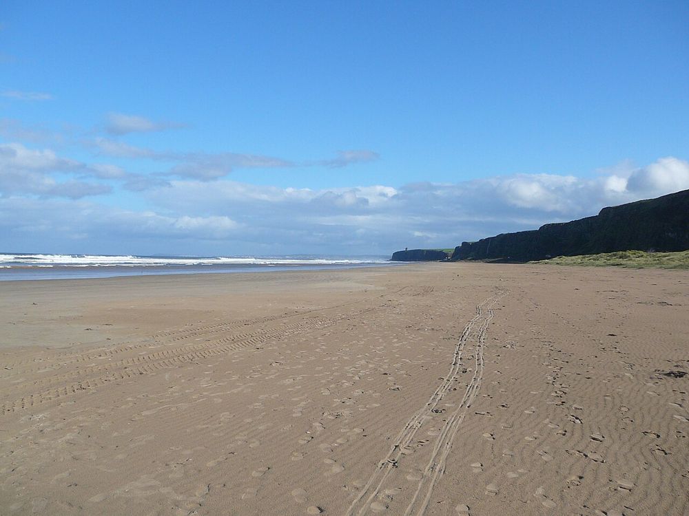
The open coastal setting at Benone Strand
The open coastal setting at Benone Strand. Resized from the credited source; appearance and access may have changed. Photo: Bjmullan (talk) ↗ · CC BY-SA 3.0

coast

Benone Strand

Benone is a beach for breathing space: broad sand, an open horizon and the coastline continuing towards Downhill. Its scale is the attraction, so a simple shore walk often makes more sense than a crowded…

Open place page →
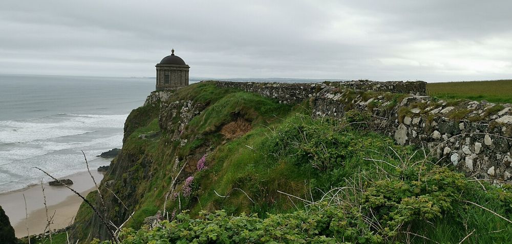
Mussenden Temple above the County Derry coast
Mussenden Temple above the County Derry coast. Resized from the credited source; appearance and access may have changed. Photo: Z thomas ↗ · CC BY-SA 4.0

heritage

Mussenden Temple and Downhill Demesne

Mussenden Temple is striking because of its position, but Downhill Demesne supplies the larger story. The small circular building, ruined house and open coast form one landscape that deserves more than a…

Open place page →
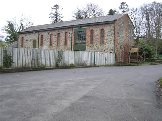
A museum building in Roe Valley Country Park
A museum building in Roe Valley Country Park. Resized from the credited source; appearance and access may have changed. Photo: Kenneth Allen ↗ · CC BY-SA 2.0

nature

Roe Valley Country Park

Roe Valley gives the river the leading role. Woodland paths, moving water and traces of former industry make a quieter alternative to the north-coast beach circuit, particularly when you want a walk with…

Open place page →
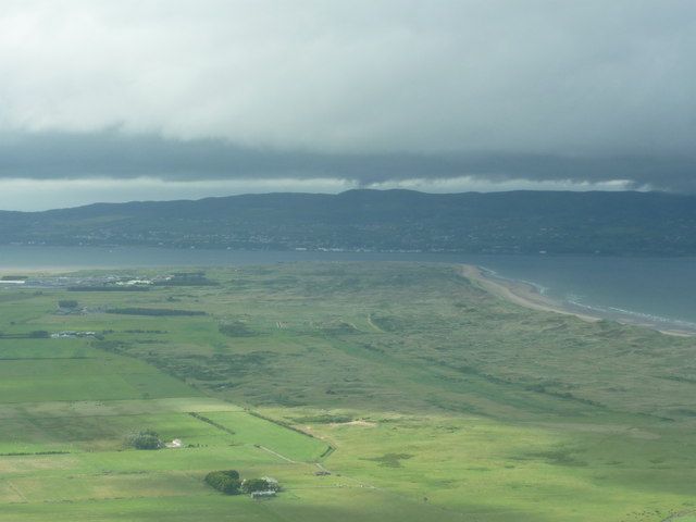
Magilligan Point viewed from Gortmore
Magilligan Point viewed from Gortmore. Credited source photograph; appearance and access may have changed. Resized from the original. Photo: Carroll Pierce ↗ · CC BY-SA 2.0

coast

Magilligan Point

Magilligan Point is an edge-of-the-map kind of stop: flat open shore, Lough Foyle ahead and the Donegal side clearly part of the view. It rewards a pause more than a long list of activities.

Open place page →
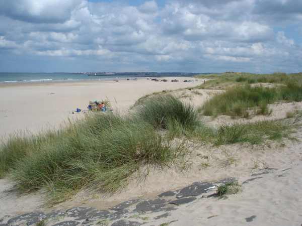
Castlerock Beach looking towards Portstewart.
Castlerock Beach looking towards Portstewart. Photo: Kay Atherton ↗ · CC BY-SA 2.0

coast

Castlerock Beach

Castlerock Beach runs between the Downhill cliffs and the River Bann estuary, with sand, dunes and a village setting close behind. Boardwalks provide access through the dunes, while the promenade offers…

Open place page →

External visitor reviews

Find the matching listing and reviews on Google Maps ↗

Part of a bigger journey

Location & access

Getting your bearings

Exposed cliffs and upland ground; lake, mountain and reserve access are one landscape, not three separate attractions.

55.11417, -6.91556 · Reference point; confirm the correct entrance and access. Map © OpenStreetMap contributors.

Orientation only: a verified public entrance is not established by this pin. Use the operator arrival information before travel.

Sources & place context

Browse more Ireland places →