Skip to content
TheLazyNick

nature · Kerry

An Chonair (Conor Pass)

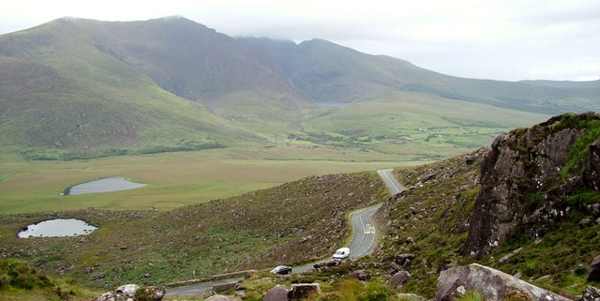
Conor Pass crosses the mountains of the Dingle Peninsula, connecting the Dingle side with settlements along the northern coast. The attraction is the changing glaciated landscape: steep slopes, corrie lakes and views that open from the high road. Stop only at established places and treat visibility as part of the decision to travel.

Add to planSaved trips & places

Saved on this browser. No account needed.

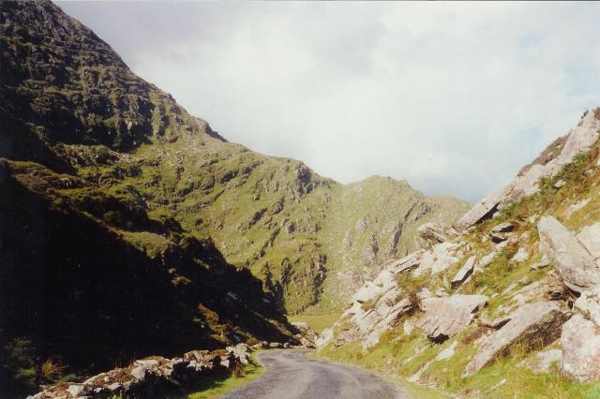
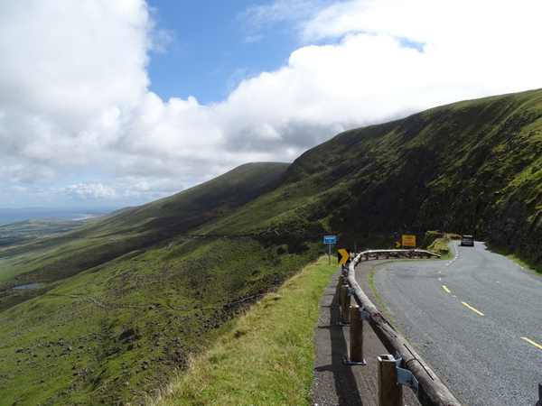
The mountain road at Conor Pass.
The mountain road at Conor Pass. Photo: Matthew Chadwick ↗ · CC BY-SA 2.0

From research

Is this worth your time?

Choose the pass for a scenic mountain-road outing rather than a summit walk. A clear day can reveal distant coast, while cloud may conceal the view completely. Check current road restrictions and your vehicle’s suitability before the approach; a narrow road through dramatic scenery still needs ordinary traffic judgement and full attention.

Know before you book: This is a narrow mountain road. Check current road restrictions, weather and visibility before setting out, and use established stopping places rather than walking along exposed road edges.

Place highlights

What you will actually see

01

The high viewpoint

Look across the peninsula only from the established stopping area, keeping road and turning space clear. Pause on the established public route and look carefully. Watch your footing as well as the view; keep well away from exposed edges for photographs.

02

Corrie lakes

Observe the lakes and steep mountain forms from permitted ground without scrambling towards a closer view. Compare this feature with the wider surroundings. Use permitted approaches, leave plants and wildlife undisturbed and avoid shortcuts across adjoining land or fragile vegetation.

03

The pass road

Notice how the route links the peninsula’s two coasts through the mountain landscape. Choose a comfortable turning point before conditions limit the return. A shorter visit still reveals the place’s character; you need not reach every visible landmark.

The story behind the visit

The story behind the place

Fáilte Ireland describes the pass as a connection between Dingle town on the south side and settlements along the northern coast. Its scenery includes mountains shaped by glaciation and corrie lakes within the steep ground. This gives the outing a useful focus beyond the road itself: look at how enclosed hollows, water and slopes fit together. A viewpoint can make that pattern legible without needing to leave the established visitor area. Source ↗

The possibility of a long view is part of the attraction, but it depends on visibility rather than a timetable. Mountain cloud can remove the distant scene while leaving the road exposed to wind and rain. Keep the visit flexible and avoid treating a scenic route as a promise that conditions will suit every vehicle or group. The current road signs and restrictions take precedence over a general destination description, and stopping safely matters more than completing a planned photograph. Source ↗

Visitor information

Tickets, timing and access

Opening
Visit in daylight and follow current access notices or barriers.Confirm with the operator ↗
Admission
Check local signs for parking or managed-access arrangements; no organised attraction ticket is advertised.Confirm with the operator ↗
Booking
Independent viewing has no scheduled departure; arrange specialist activities separately.Confirm with the operator ↗
Access
Use established public approaches; do not infer access across private land or beyond barriers.Confirm with the operator ↗
Duration
Allow about 60 minutes for a cautious visit with pauses, excluding travel.Confirm with the operator ↗
Seasonal
Wind, rain and short daylight can make a shorter outing preferable.Confirm with the operator ↗

Getting to the entrance

Use the signed Conor Pass road on the Dingle Peninsula. Check current vehicle restrictions and road conditions before committing to the narrow approach. Official visitor information ↗

Your questions, answered

Confirm current access and visitor arrangements with the operator.

Is this a mountain-walking route?

This guide covers road viewpoints. Plan mountain walks separately with suitable route information, equipment and conditions. Source ↗

Does this include access to adjoining land?

No. Use established public viewpoints and respect private boundaries and current local signs. Source ↗

Nearby options

Nearby places to explore

Explore other places in the area, then use live directions to plan your journey.

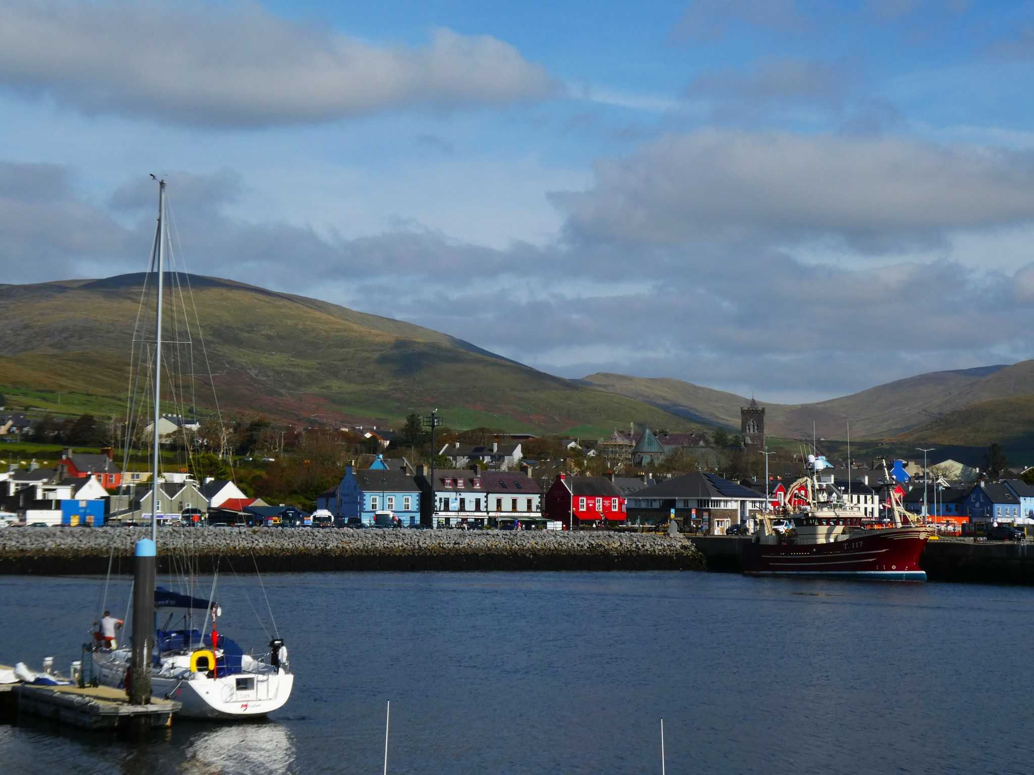
Dingle harbour and town with St Mary’s Church and hills behind
Dingle harbour and town, photographed on 12 October 2025. Source photograph; current conditions may differ. Photo: Maoileann ↗ · CC BY-SA 4.0

coast

Dingle

Dingle town is a harbour and streets visit that can anchor a peninsula stay. It is not a shorthand for driving every part of the Dingle Peninsula in one stop.

Open place page →
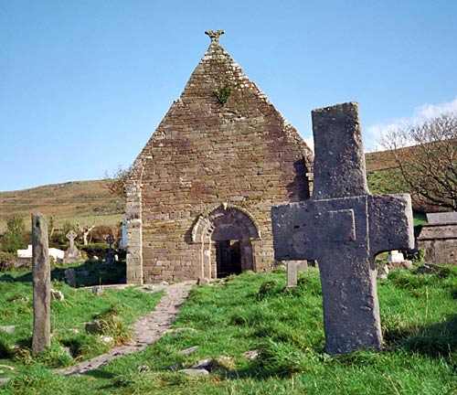
Kilmalkedar’s church ruins and burial ground.
Kilmalkedar’s church ruins and burial ground. Photo: Benson Wills ↗ · CC BY-SA 2.0

heritage

Kilmalkedar Church

Kilmalkedar Church is part of an early Christian and medieval religious complex on the Dingle Peninsula, overlooking the Smerwick area. A Romanesque church and several carved or inscribed stones give the visit…

Open place page →
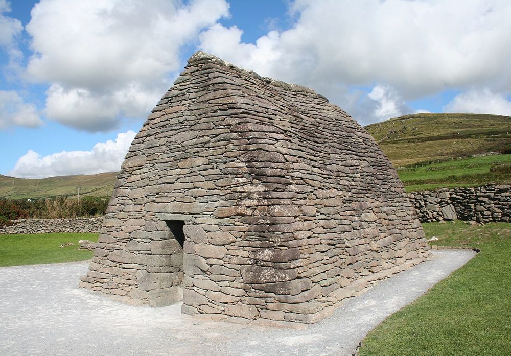
The curved stone roof and walls of Gallarus Oratory
The curved stone roof and walls of Gallarus Oratory. Source photograph; conditions and access may have changed. Resized from the credited original. Photo: Ingo Mehling ↗ · CC BY-SA 3.0

heritage

Gallarus Oratory

Gallarus asks you to look closely. The little stone building has none of a cathedral’s theatrical scale; its appeal is the precision of the walls curving into a roof. Step back to see the shape, then let your…

Open place page →
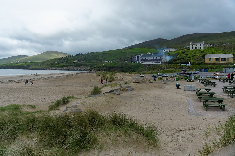
Inch Strand opening across Dingle Bay
Inch Strand opening across Dingle Bay. Source photograph; conditions and access may have changed. Resized from the credited original. Photo: Pedelecs ↗ · CC BY-SA 3.0

coast

Inch Strand

Inch is a beach for looking into distance. The long sand spit reaches into Dingle Bay, opening views across water that can make a hurried roadside stop feel oddly small. Walk only as far as suits the tide and…

Open place page →
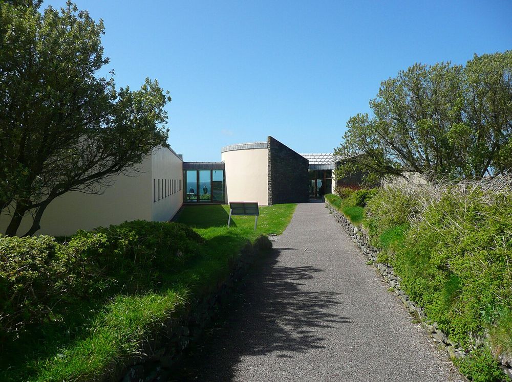
The approach to the Blasket Centre on the Dingle Peninsula
The approach to the Blasket Centre on the Dingle Peninsula. Source photograph; conditions and access may have changed. Resized from the credited original. Photo: Humphrey Bolton ↗ · CC BY-SA 2.0

heritage

Ionad an Bhlascaoid — The Blasket Centre

The Blasket Centre gives the islands people, language and ordinary days. Across the water, Great Blasket can look like an empty scenic shape; inside, recordings, writing and interpretation return the community…

Open place page →
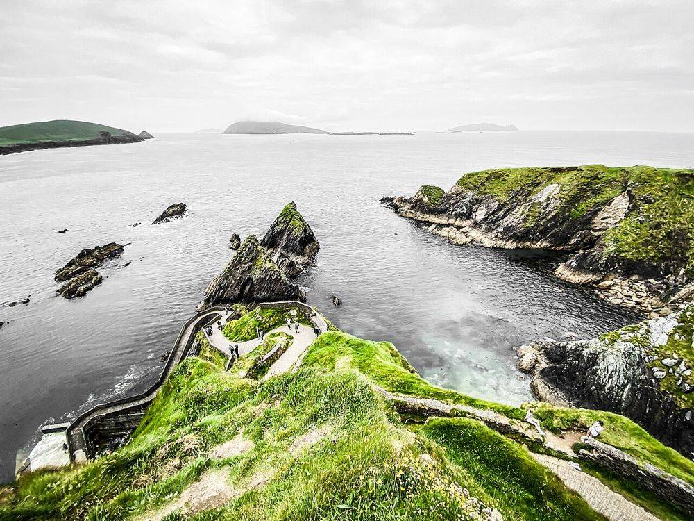
The winding descent to Dunquin Pier beneath the cliffs
The winding descent to Dunquin Pier beneath the cliffs. Source photograph; conditions and access may have changed. Resized from the credited original. Photo: Dieglop ↗ · CC BY-SA 4.0

coast

Cé Dhún Chaoin — Dunquin Pier

Dunquin’s zigzag path is easy to recognise from photographs, but the practical detail gets lost in the image: the pier is far below you. Look first from a permitted place above. Walking down is an optional…

Open place page →

External visitor reviews

Find the matching listing and reviews on Google Maps ↗

Part of a bigger journey

Location & access

Getting your bearings

This is a narrow mountain road. Check current road restrictions, weather and visibility before setting out, and use established stopping places rather than walking along exposed road edges.

52.18187, -10.20728 · Reference point; confirm the correct entrance and access. Map © OpenStreetMap contributors.

Orientation only: a verified public entrance is not established by this pin. Use the operator arrival information before travel.

Sources & place context

Browse more Ireland places →