Skip to content
TheLazyNick

nature · Fermanagh

Topped Mountain

Dogs are not permitted on the working-farm route to Topped Mountain. This small hill near Lisbellaw has a short, sharp path to a summit viewpoint. Its height is modest, but the open top can provide a wide Fermanagh outlook in clear weather; a trig point and protected cairn add interest.

Add to planSaved trips & places

Saved on this browser. No account needed.

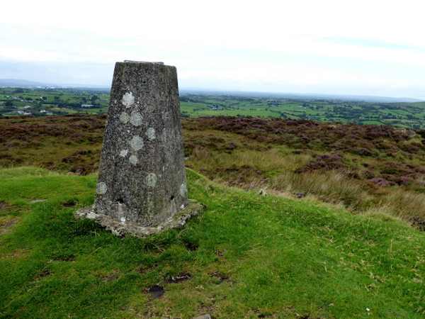
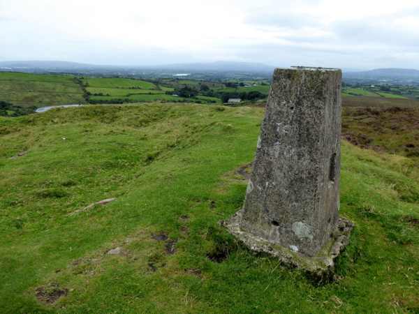
The summit marker and outlook on Topped Mountain.
The summit marker and outlook on Topped Mountain. Photo: Kenneth Allen ↗ · CC BY-SA 2.0

From research

Is this worth your time?

Choose Topped Mountain for a brief climb when you want a broad view without a long mountain circuit. The short distance still includes a steep gradient, and there are no toilets at the trailhead. Keep to the listed path, leave the cairn undisturbed and plan the visit without a dog, in line with the published route rules.

Know before you book: Dogs are not permitted on this working-farm route; the short climb is steep.

Place highlights

What you will actually see

01

Summit approach

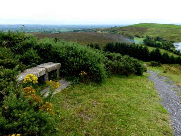
The gravel path rises directly from the small parking area towards the top. Take a measured pace and leave time for the descent. Its brevity does not make the gradient disappear, so decide whether the ground and weather suit the group before committing to the climb.

02

Wide outlook

The summit can reveal Upper and Lower Lough Erne and the surrounding county when visibility is good. Enjoy the view from suitable ground rather than moving towards an edge or crossing beyond the route. A clear panorama is a possibility, not a reason to disregard conditions.

03

Trig point and cairn

The survey pillar and older cairn represent different uses of the high ground. Look at both without climbing or moving cairn stones. The cairn is a protected monument, so a photograph or a wish to improve the view does not justify disturbing its fabric.

The story behind the visit

The story behind the place

Although called a mountain, the 277-metre summit is a hill in scale. Its prominence comes from the surrounding landscape and the extensive outlook rather than a long ascent. The published route also identifies a cairn and a survey trig point, giving the top an archaeological and mapping history alongside the view. Those features should be appreciated as they stand, without inventing a precise story for the cairn beyond the evidence provided. Source ↗

The route’s working-farm setting is equally important to an ordinary visit. Publicly described walking access applies to the listed path, not to every field or track around it, and the no-dogs rule should shape the plan before travelling. Use the small parking area considerately and avoid blocking the road on its sharp bend. A short visit can still be rewarding: climb in suitable conditions, pause to understand the landscape and return the same way. There is no need to add unsignposted wandering or alter the protected stones to make the stop feel more substantial. Source ↗

Visitor information

Tickets, timing and access

Opening
Use the published route and follow local access notices.Confirm with the operator ↗
Admission
No walking admission ticket is listed.Confirm with the operator ↗
Booking
No ordinary timed booking is listed.Confirm with the operator ↗
Access
Steep gravel path on a working farm; dogs prohibited.Confirm with the operator ↗
Duration
Allow 30–45 minutes for the climb, viewpoint and return.Confirm with the operator ↗
Seasonal
Wind, wet ground and visibility affect the summit experience.Confirm with the operator ↗

Getting to the entrance

The hill is signposted from the Enniskillen–Tempo road; the small gravel car park is beside a lough on a sharp bend. Official visitor information ↗

Your questions, answered

Confirm current access and visitor arrangements with the operator.

Can I bring my dog on a lead?

The published route says dogs are not permitted. Source ↗

Can I rearrange cairn stones?

No. The cairn is a protected monument and should remain undisturbed. Source ↗

Nearby options

Nearby places to explore

Explore other places in the area, then use live directions to plan your journey.

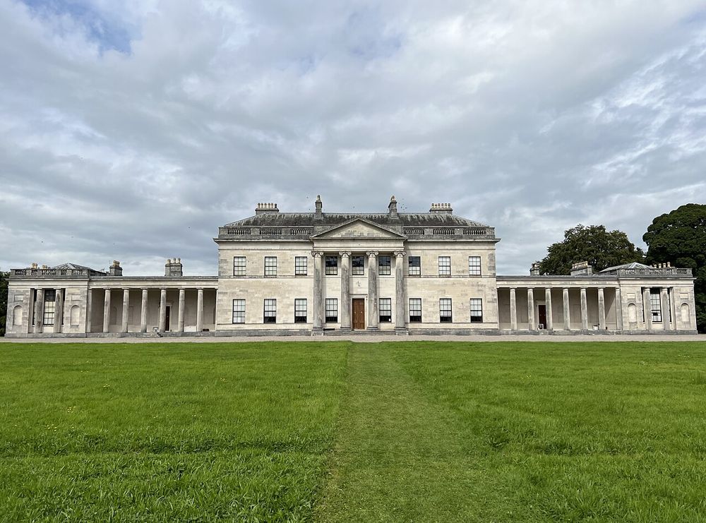
The neoclassical exterior of Castle Coole
The neoclassical exterior of Castle Coole. Credited source photograph; appearance and access may have changed. Resized from the original. Photo: Lucius Winslow ↗ · CC BY-SA 4.0

heritage

Castle Coole

Castle Coole is a country house rather than a defensive castle, and its formal architecture sets expectations for the rooms inside. The parkland adds space afterwards without needing to be the principal reason…

Open place page →
The monastic landscape on Devenish Island
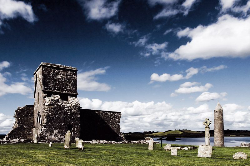
The monastic landscape on Devenish Island. Credited source photograph; appearance and access may have changed. Resized from the original. Photo: Mole2k at English Wikipedia ↗ · CC BY-SA 3.0

heritage

Devenish Island

Devenish’s round tower becomes more memorable when you arrive across the lough. The water journey separates the monastic ruins from an ordinary roadside stop and gives the island’s setting a clear role in the…

Open place page →
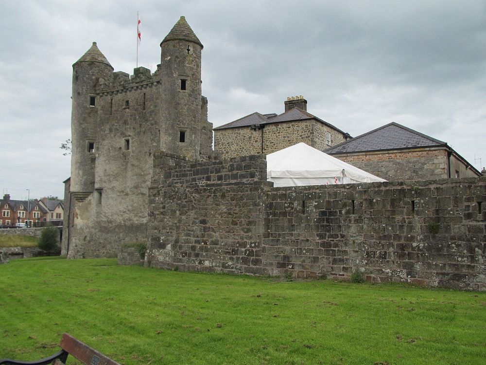
Stone walls and towers at Enniskillen Castle
Stone walls and towers at Enniskillen Castle. Resized from the credited source; appearance and access may have changed. Photo: Romeparis ↗ · CC BY-SA 3.0

attraction

Enniskillen Castle

Enniskillen Castle gives the island town a substantial historical anchor. The waterfront buildings contain more than a picturesque exterior: county history and military collections can occupy a much fuller…

Open place page →
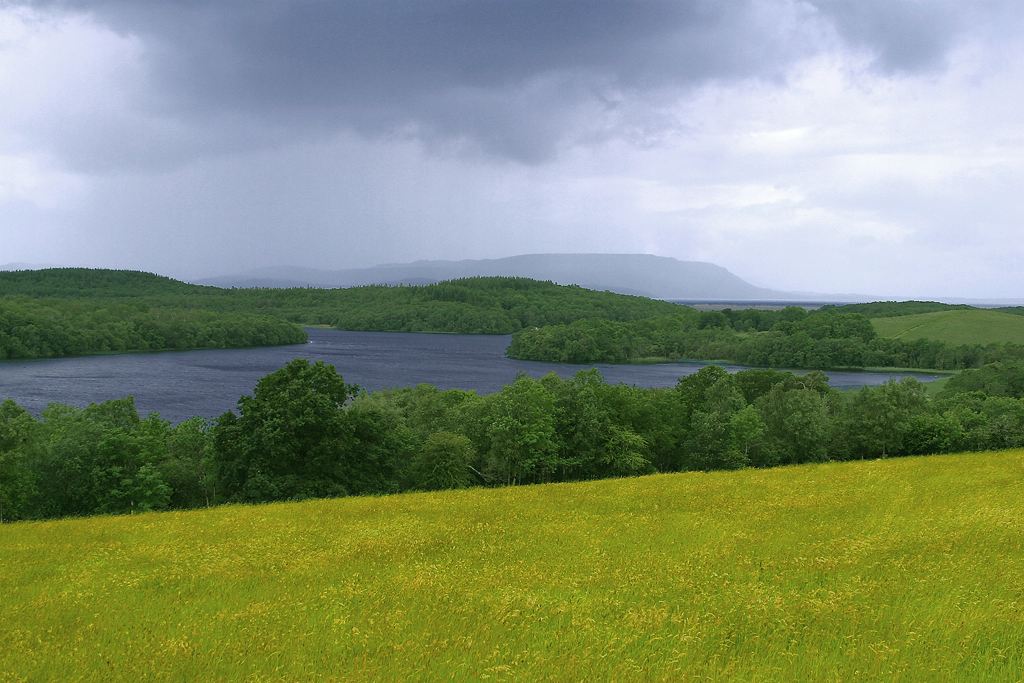
Lough Erne waters near Enniskillen
Lough Erne landscape in County Fermanagh, providing regional context for Enniskillen. This is not a photograph of the town centre or an identified visitor entrance. Photo: Jon Sullivan / PD Photo.org ↗ · Public domain

heritage

Enniskillen

Enniskillen is a town-and-waterfront visit with the castle museums as a useful heritage anchor. Wider lakeland outings and boat trips are separate plans.

Open place page →
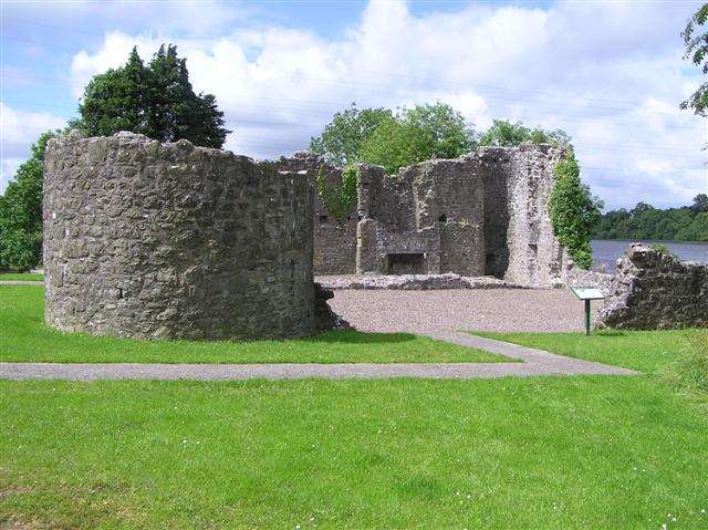
The surviving towers and walls at Portora Castle
The surviving towers and walls at Portora Castle. Resized for display. Photo: Kenneth Allen ↗ · CC BY-SA 2.0

heritage

Portora Castle

Portora Castle is a ruined plantation-era residence and defensive enclosure near Enniskillen, positioned where the river joins Lough Erne. Surviving round towers and wall fragments make the plan worth…

Open place page →
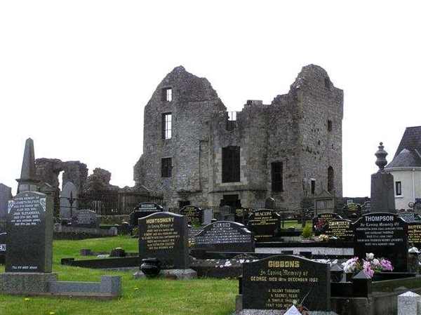
Castle Balfour beyond the churchyard in Lisnaskea
Castle Balfour beyond the churchyard in Lisnaskea. Resized for display. Photo: Kenneth Allen ↗ · CC BY-SA 2.0

heritage

Castle Balfour

Castle Balfour is a substantial ruined plantation-era house in Lisnaskea, built for Sir James Balfour from about 1618. Scottish influence is visible in its surviving plan and details. The Department for…

Open place page →

External visitor reviews

Find the matching listing and reviews on Google Maps ↗

Part of a bigger journey

Location & access

Getting your bearings

Dogs are not permitted on this working-farm route; the short climb is steep.

54.35636, -7.52394 · Reference point; confirm the correct entrance and access. Map © OpenStreetMap contributors.

Orientation only: a verified public entrance is not established by this pin. Use the operator arrival information before travel.

Sources & place context

Browse more Ireland places →