Skip to content
TheLazyNick

nature · Armagh

Slieve Gullion Mountain Walk

The South Cairn passage tomb is closed. Slieve Gullion Mountain Walk explores the high ground at the centre of the Ring of Gullion, using mountain paths, forest tracks and minor roads. The summit landscape also includes a lough and prehistoric cairns; this is an upland walking guide, distinct from a drive around the forest road.

Add to planSaved trips & places

Saved on this browser. No account needed.

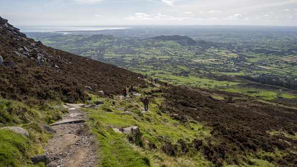
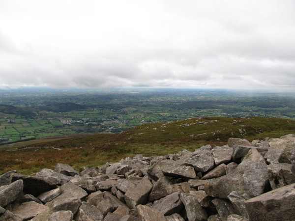
The outlook west from Slieve Gullion’s summit cairn.
The outlook west from Slieve Gullion’s summit cairn. Photo: Eric Jones ↗ · CC BY-SA 2.0

From research

Is this worth your time?

Choose this route for a substantial mountain outing with navigation, fitness and enough daylight, rather than a short family forest stroll. The official circular walk is 9.5 miles and includes steep, rocky and peaty ground. Follow forestry notices and keep the plan flexible; a vehicle-drive closure does not by itself tell you which walking routes are available.

Know before you book: The South Cairn passage tomb is closed; working-forest diversions and mountain conditions can affect the walk.

Place highlights

What you will actually see

01

Mountain ascent

The path towards the summit becomes steep and rocky, with peat underfoot in places. Use the official route description and carry proper navigation equipment. Views across the Ring of Gullion are a reward in clear weather, not a guarantee that makes poor conditions safe.

02

Summit landscape

The South Cairn and Calliagh Beara’s Lough give the high ground archaeological and legendary associations. Observe the cairn from permitted outside areas and respect its closure. The lough is part of an exposed mountain landscape, not a promised bathing or sheltered picnic site.

03

Longer circuit

The published circuit continues across the plateau and down towards minor roads, linking mountain and countryside. Those road sections are part of the full distance. Plan the whole return before leaving, rather than improvising a descent when tired or short of daylight.

The story behind the visit

The story behind the place

Slieve Gullion is central to the volcanic landscape of the Ring of Gullion, now part of the Mourne Gullion Strangford Geopark. Its cairns and lough add cultural stories to the geological setting. The official walking route moves through both upland ground and the surrounding countryside, so the mountain is best understood in relation to the ring of hills and settlements around it. Source ↗

The forest below is also an actively managed place. Tree disease work can cause access changes, and the Forest Service asks visitors to follow advance notices and biosecurity instructions. These practical limits are separate from the closed passage tomb and from winter restrictions on the scenic drive. Read each notice for the activity it actually concerns. A long circular walk needs more preparation than a viewpoint stop: choose suitable weather, carry a map and compass, and allow for the road return as well as the summit ascent. Shortening or postponing the plan is appropriate when the route or conditions do not fit the group. Source ↗

Visitor information

Tickets, timing and access

Opening
Check official walking and forestry notices; park gates have seasonal hours.Confirm with the operator ↗
Admission
Walking is free; parking charges may apply.Confirm with the operator ↗
Booking
No ordinary mountain-walk ticket; organised activities can differ.Confirm with the operator ↗
Access
Steep upland terrain and minor roads; South Cairn passage tomb closed.Confirm with the operator ↗
Duration
Allow roughly 4–5 hours for the full 9.5-mile circuit, according to ability and conditions.Confirm with the operator ↗
Seasonal
Snow, ice, forestry work and poor visibility can change access.Confirm with the operator ↗

Getting to the entrance

The official circular route starts at Slieve Gullion Courtyard Centre; confirm current parking and gates before setting out. Official visitor information ↗

Your questions, answered

Confirm current access and visitor arrangements with the operator.

Can I enter the South Cairn passage tomb?

No. The official route currently states it is closed. Source ↗

Is the whole route waymarked like a park path?

No. The operator advises an OSNI map, compass and mountain preparation. Source ↗

Nearby options

Nearby places to explore

Explore other places in the area, then use live directions to plan your journey.

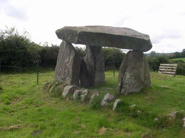
Capstone and portal stones at Ballykeel Dolmen
Capstone and portal stones at Ballykeel Dolmen. Resized for display. Photo: Ron Murray ↗ · CC BY-SA 2.0

heritage

Ballykeel Portal Tomb (Dolmen)

Ballykeel Dolmen and Cairn is a Neolithic burial monument near Mullaghbawn, known locally as the Hag’s Chair. A large capstone rests above an octagonal chamber at the southern end of a much reduced cairn. The…

Open place page →
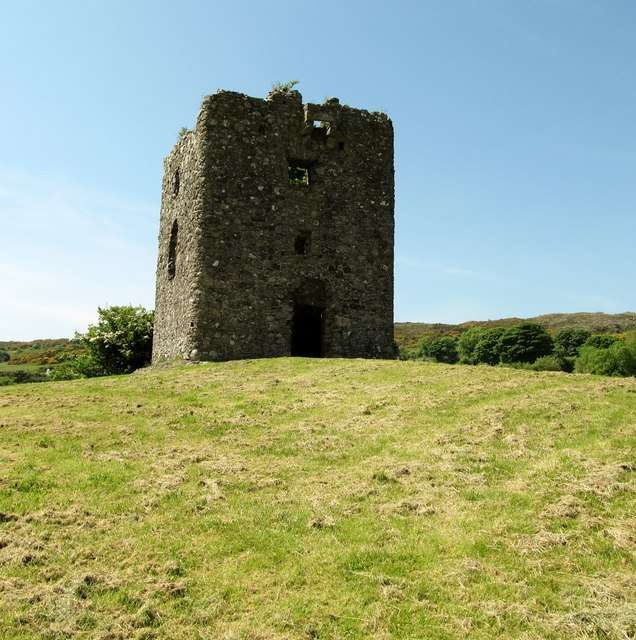
The surviving tower at Moyry Castle
The surviving tower at Moyry Castle. Resized for display. Photo: Eric Jones ↗ · CC BY-SA 2.0

heritage

Moyry Castle

Moyry Castle is a small ruined tower on a rocky height overlooking the Gap of the North near Jonesborough. Its size makes more sense when viewed in relation to the pass it was built to control. This is an…

Open place page →
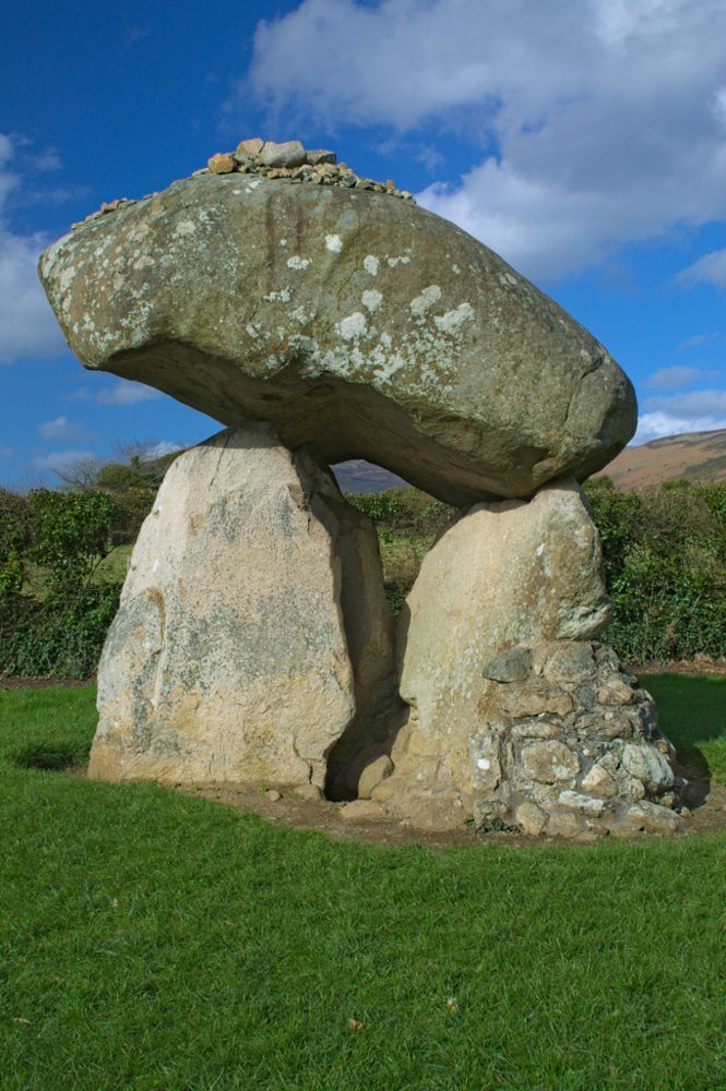
The capstone and upright stones of Proleek Dolmen
The capstone and upright stones of Proleek Dolmen. Source photograph; current access and conditions may differ. Resized from the credited source. Photo: Gia.S.Cen ↗ · CC BY-SA 4.0

heritage

Proleek Dolmen

Proleek’s enormous capstone is the detail that stays with you. The portal tomb sits in maintained grounds near Ballymascanlon, a prehistoric structure encountered on a walk rather than through a major visitor…

Open place page →
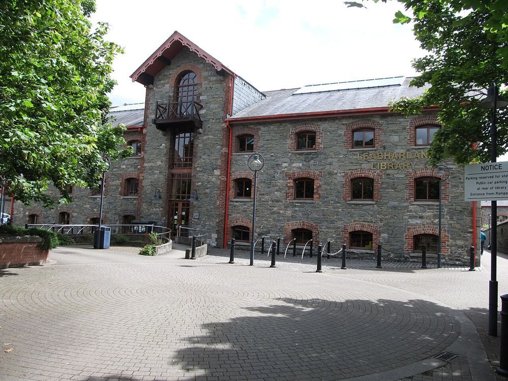
The stone frontage of the County Museum building in Dundalk
The stone frontage of the County Museum building in Dundalk. Source photograph; current access and conditions may differ. Resized from the credited source. Photo: Eric Jones ↗ · CC BY-SA 2.0

attraction

Louth County Museum

Dundalk’s county museum gives Louth a useful indoor chapter. In a restored warehouse, archaeological objects sit alongside the county’s industrial and social history. It is the place to connect the crosses,…

Open place page →
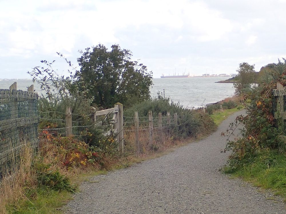
A waterside path on the Carlingford Lough Greenway
A waterside path on the Carlingford Lough Greenway. Source photograph; current access and conditions may differ. Resized from the credited source. Photo: Eric Jones ↗ · CC BY-SA 2.0

nature

Carlingford Lough Greenway

The Carlingford Lough Greenway lets you spend time with the water at walking or cycling pace. The attraction is the changing relationship between shoreline and mountains, not reaching a finish line. Choose a…

Open place page →

External visitor reviews

Find the matching listing and reviews on Google Maps ↗

Part of a bigger journey

Location & access

Getting your bearings

The South Cairn passage tomb is closed; working-forest diversions and mountain conditions can affect the walk.

54.11498, -6.40734 · Reference point; confirm the correct entrance and access. Map © OpenStreetMap contributors.

Orientation only: a verified public entrance is not established by this pin. Use the operator arrival information before travel.

Sources & place context

Browse more Ireland places →