Skip to content
TheLazyNick

heritage · Kerry

Kenmare Stone Circle

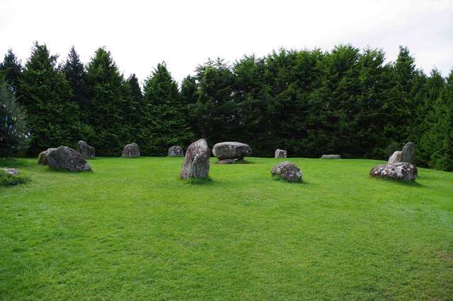
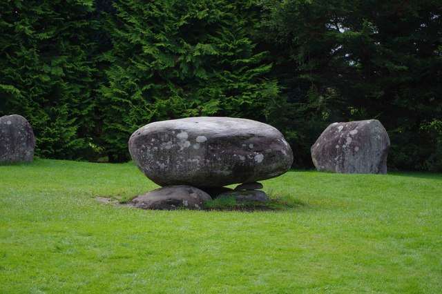
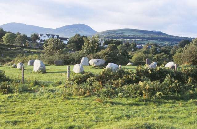
Kenmare Stone Circle sits close to the town centre, bringing a prehistoric monument into an easy walking itinerary. Fifteen large stones form an oval enclosure around a central boulder monument. Its compact scale rewards a slow circuit and close looking, rather than a long visit or an elaborate reconstructed narrative.

Add to planSaved trips & places

Saved on this browser. No account needed.

Kenmare Stone Circle in its town-edge landscape
Kenmare Stone Circle in its town-edge landscape. Resized for display. Photo: Nigel Cox ↗ · CC BY-SA 2.0

From research

Is this worth your time?

Choose it for a brief archaeological stop while exploring Kenmare on foot. It is particularly useful when a wider Kerry drive leaves little time for a remote monument. Come for the arrangement of the stones and the questions they raise, allowing the site’s uncertainties to remain visible.

Know before you book: The central monument’s precise meaning is uncertain. Folklore and suggestions about ceremony should be distinguished from established archaeological evidence; the seasonal coffee dock is not a year-round facility.

Place highlights

What you will actually see

01

Oval stone setting

Walk slowly around the permitted path and observe how the stones form an oval rather than a perfect circle. Differences in size and placement make the arrangement worth studying from more than one position, without touching or moving any material.

02

Central boulder monument

The large central feature provides the strongest contrast with the surrounding ring. Look at its relationship with the other stones while keeping interpretation cautious: an impressive surviving structure does not by itself reveal exactly what happened here.

03

Town and monument

The short distance from Kenmare’s streets makes the change of setting part of the attraction. Leave time to approach on foot and settle into the enclosure, rather than reducing the stop to a photograph taken immediately inside the entrance.

The story behind the visit

The story behind the place

The operator describes a Bronze Age stone setting made up of fifteen heavy boulders, measuring roughly seventeen by sixteen metres. A central boulder monument distinguishes the interior. The site is often called the Druid’s Circle locally, but that traditional name should not be treated as proof of who built it or how it was used. The monument belongs to a much longer prehistoric landscape than the modern town around it. Source ↗

Stone circles invite confident-sounding explanations about ceremony, astronomy and burial, yet surviving stones rarely supply a complete account of their purpose. At Kenmare, the operator itself acknowledges uncertainty about the central monument. That uncertainty need not diminish the visit. Comparing the oval ring, central feature and surrounding space can be rewarding without converting a possibility into a fact or expecting an interpretive museum on site. Let the arrangement itself lead the visit, with traditional names treated as part of later local memory. Source ↗

Visitor information

Tickets, timing and access

Opening
Unguided outdoor monument: visit in daylight and follow current local notices.Confirm with the operator ↗
Admission
The operator lists a €2.50 admission contribution through an on-site honesty box; donations support maintenance.Confirm with the operator ↗
Booking
No regular guided departure is advertised. Arrange organised group or specialist visits separately.Confirm with the operator ↗
Access
Follow the maintained approach and current site notices. Confirm individual mobility requirements before relying on the whole route.Confirm with the operator ↗
Duration
Allow 30–45 minutes, depending on conditions and interest.Confirm with the operator ↗
Seasonal
The outdoor monument is exposed to weather. The operator’s coffee dock is described as a summer facility.Confirm with the operator ↗

Getting to the entrance

The circle is close to Kenmare town centre, near Cromwell’s Bridge. Use the operator’s current entrance directions. Official visitor information ↗

Your questions, answered

Confirm current access and visitor arrangements with the operator.

Is the central monument fully understood?

No. Its exact meaning remains uncertain; distinguish interpretation from evidence. Source ↗

Is the coffee dock always open?

No. The operator describes it as a summer facility. Source ↗

Nearby options

Nearby places to explore

Explore other places in the area, then use live directions to plan your journey.

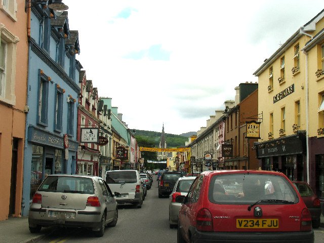
A street in Kenmare town centre
A street in Kenmare town centre. Historical source photograph; conditions and access may have changed. Resized from the credited source. Photo: Pam Brophy ↗ · CC BY-SA 2.0

attraction

Kenmare town

Choose Kenmare as the unhurried town portion of a scenic drive: park legally, have time to explore and decide whether a meal fits before the return. It is a destination in its own right, not merely a turning…

Open place page →
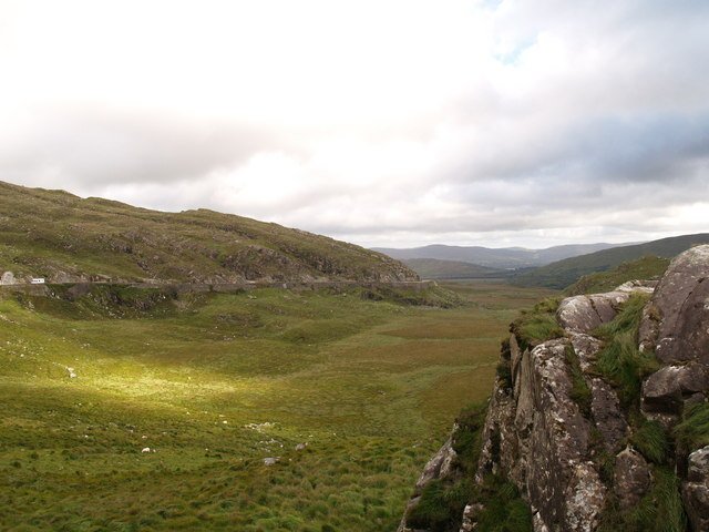
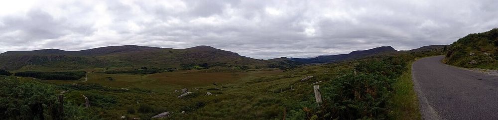
The mountain-road landscape at Moll’s Gap
The mountain-road landscape at Moll’s Gap. Historical source photograph; conditions and access may have changed. Resized from the credited source. Photo: Adrian King ↗ · CC BY-SA 2.0

attraction

Moll’s Gap

Choose Moll’s Gap when you want the scenic drive to include the shape of a mountain pass as well as lake views. Keep it a considered pause with a safe arrival, rather than an obligatory photograph beside a…

Open place page →
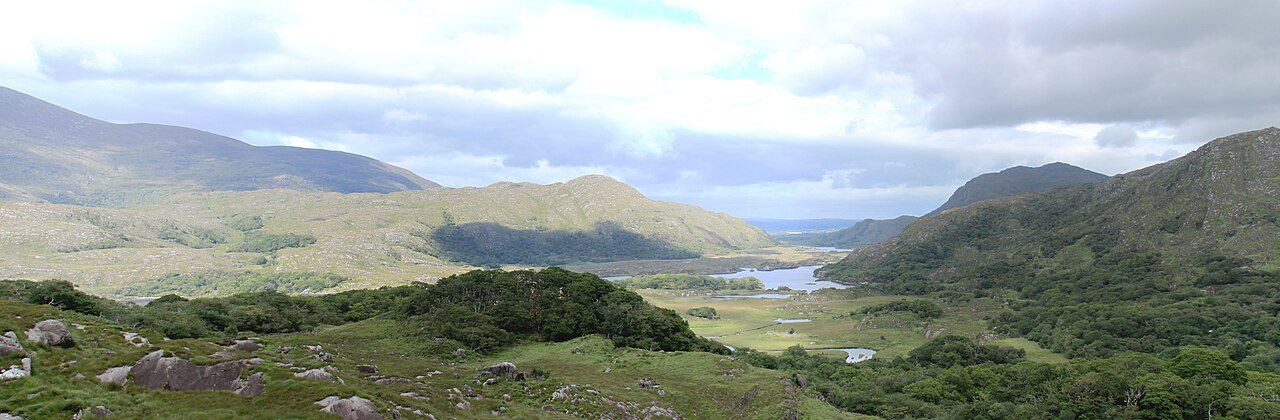
The lake landscape from Ladies View
The lake landscape from Ladies View. Historical source photograph; conditions and access may have changed. Resized from the credited source. Photo: Cédric Bonhomme ↗ · CC BY-SA 4.0

attraction

Ladies View

Choose this viewpoint for the broader relationship between water, wooded slopes and mountains. It is a scenic pause on a driving day, not a substitute for walking inside the park.

Open place page →
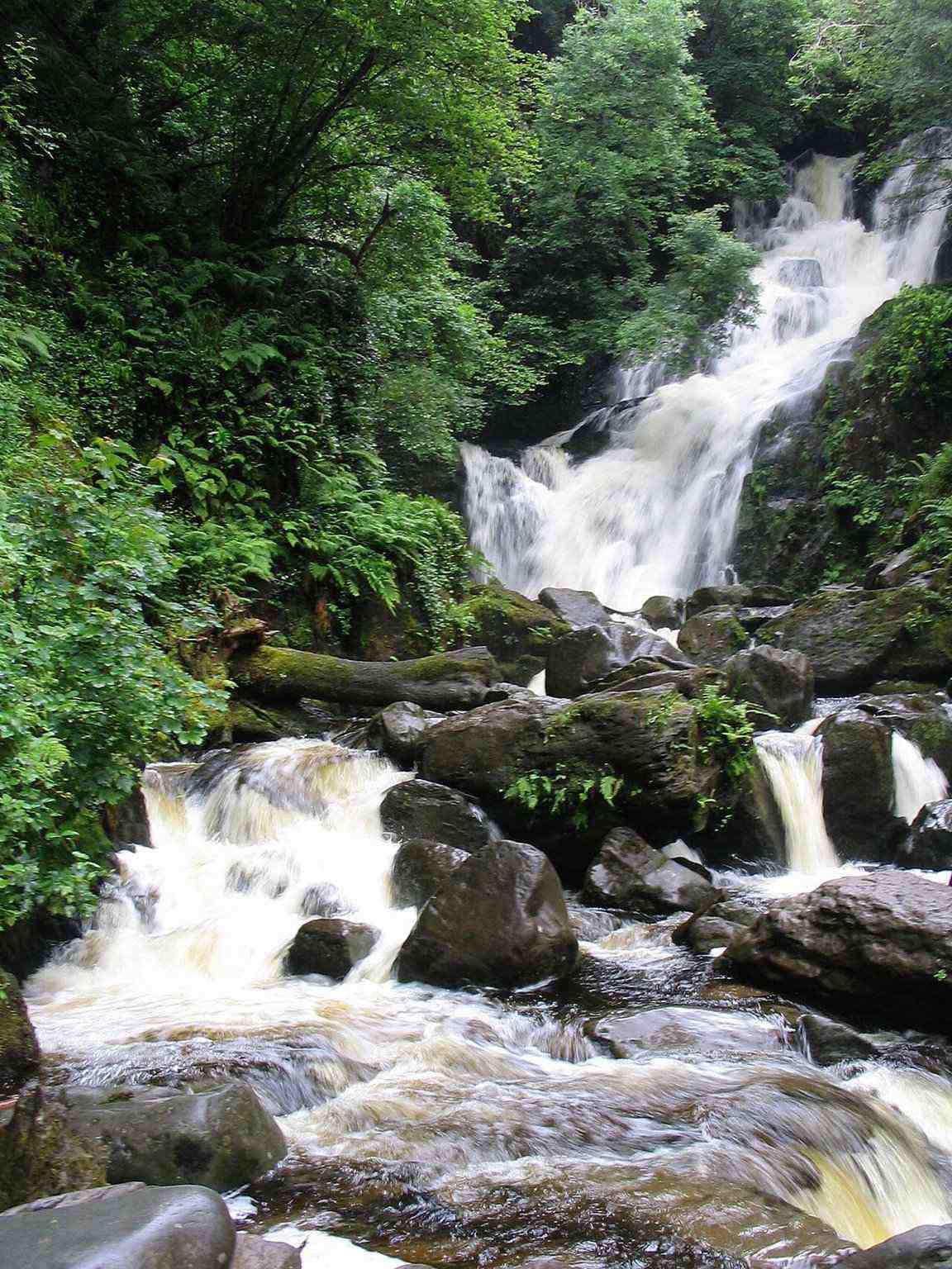
Torc Waterfall among woodland
Torc Waterfall among woodland. Historical source photograph; conditions and access may have changed. Resized from the credited source. Photo: Borvan53 ↗ · CC BY-SA 3.0

attraction

Torc Waterfall

Choose Torc for falling water and woodland atmosphere, with the option to keep the outing modest. A waterfall stop, a longer woodland circuit and a Torc Mountain summit walk are three different decisions.

Open place page →
Lakes and steep mountain sides along the Gap of Dunloe
Lakes and steep mountain sides along the Gap of Dunloe. Source photograph; conditions and access may have changed. Resized from the credited original. Photo: Mith ↗ · CC BY-SA 4.0

nature

Gap of Dunloe

The Gap of Dunloe is most convincing at walking pace. Lakes keep appearing between the mountains, and small bridges make the changing scale easier to notice than from behind a windscreen. Decide how far you…

Open place page →
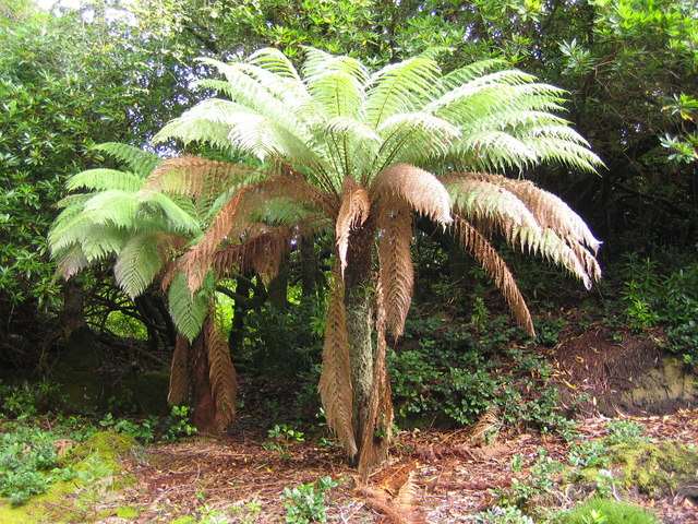
A third garden view at Derreen
A third garden view at Derreen. Source photograph: 2006-09-28. Appearance, displays and access may have changed. Photo: Nigel Cox ↗ · CC BY-SA 2.0

nature

Derreen Gardens

Derreen is a woodland garden at Lauragh on the Beara Peninsula, where winding paths pass through tree ferns, bamboo, rhododendrons and mature trees. Its sheltered, damp coastal setting is part of the…

Open place page →

External visitor reviews

Find the matching listing and reviews on Google Maps ↗

Part of a bigger journey

Location & access

Getting your bearings

The central monument’s precise meaning is uncertain. Folklore and suggestions about ceremony should be distinguished from established archaeological evidence; the seasonal coffee dock is not a year-round facility.

51.87847, -9.58813 · Reference point; confirm the correct entrance and access. Map © OpenStreetMap contributors.

Orientation only: a verified public entrance is not established by this pin. Use the operator arrival information before travel.

Sources & place context

Browse more Ireland places →