Skip to content
TheLazyNick

heritage · Mayo

Deserted Village Achill Island

The Deserted Village at Slievemore is a line of roofless stone cottages beneath the mountain on Achill Island. The remains connect domestic buildings, old cultivation and a long history of seasonal land use. Walk carefully through the permitted visitor area and resist reducing every house to one simple story of sudden abandonment.

Add to planSaved trips & places

Saved on this browser. No account needed.

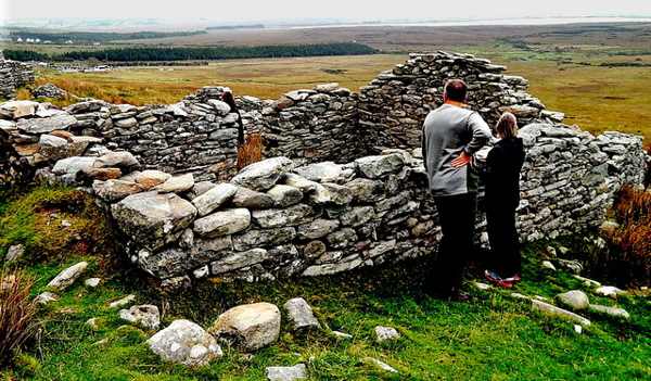
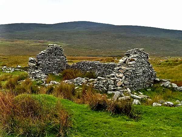
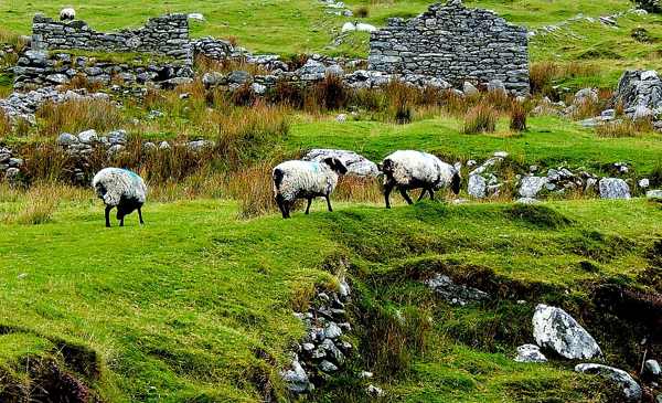
Sheep grazing among roofless cottages at Slievemore’s Deserted Village.
Sheep grazing among roofless cottages at Slievemore’s Deserted Village. Photo: Suzanne Mischyshyn ↗ · CC BY-SA 2.0

From research

Is this worth your time?

Choose the village if you want to look closely at everyday buildings and the landscape around them. An hour can reveal more than a hurried photograph of the ruins. Keep to the established route, avoid climbing walls and distinguish a self-guided visit from the separately seasonal guided tours advertised by local tourism.

Know before you book: An unguided outdoor monument has uneven ground and fragile fabric. Stay on permitted approaches, keep off masonry and respect local restrictions.

Place highlights

What you will actually see

01

The cottage line

Look along the surviving row and compare the size and arrangement of neighbouring buildings. The repetition is part of the site’s effect. Stay outside unstable walls and avoid entering spaces where current signs or conditions restrict access.

02

Fields and cultivation

Notice the relationship between houses and the ground around them from the permitted route. Traces of cultivation help connect the buildings with daily work. Do not cross fences or walk into adjoining fields to follow every visible line.

03

Slievemore setting

Look back at the mountain slope and the broader island landscape. The village is a settlement site, not a mountain trailhead for an unplanned climb. Let its position help explain the visit without extending into rougher ground.

The story behind the visit

The story behind the place

Achill Tourism describes roughly eighty to one hundred stone cottages along the southern slopes of Slievemore. Some continued as summer dwellings within living memory, while the surrounding area contains evidence of much earlier settlement and archaeological activity. These different timescales matter: the age of human presence on the mountain is not the age of every cottage visible today. Looking at the buildings alongside fields and older features gives a richer picture than attaching one date to the whole place. Source ↗

The seasonal use is associated with booleying, or transhumance, when families moved cattle to summer grazing and used different dwellings through the year. Achill Tourism notes that the larger story of the village is more complex than the end of that practice alone. Keep that caution in mind when considering abandonment and hardship. The remains invite reflection, but individual houses should not be assigned precise personal stories without evidence. A careful self-guided walk can acknowledge both the known pattern of use and what remains uncertain. Source ↗

Visitor information

Tickets, timing and access

Opening
Visit in daylight and obey current access signs or temporary restrictions.Confirm with the operator ↗
Admission
Check current local arrangements; do not infer a staffed museum or included guided tour.Confirm with the operator ↗
Booking
Independent viewing has no advertised departure; arrange specialist or group guiding separately.Confirm with the operator ↗
Access
Use the permitted visitor approach; do not climb walls, stones or roofless structures.Confirm with the operator ↗
Duration
Allow about 90 minutes for a careful look at the monument and setting.Confirm with the operator ↗
Seasonal
Wet grass, wind and short daylight can affect the visit; wear suitable footwear.Confirm with the operator ↗

Getting to the entrance

Use the signed Slievemore Deserted Village approach on Achill. Follow the established route and respect neighbouring land and burial-ground activity. Official visitor information ↗

Your questions, answered

Confirm current access and visitor arrangements with the operator.

Can I climb the remains?

No. Observe from permitted ground and leave historic masonry and stones undisturbed. Source ↗

Is there a staffed indoor attraction?

Do not assume one. This guide covers the outdoor monument and its currently permitted approach. Source ↗

Nearby options

Nearby places to explore

Explore other places in the area, then use live directions to plan your journey.

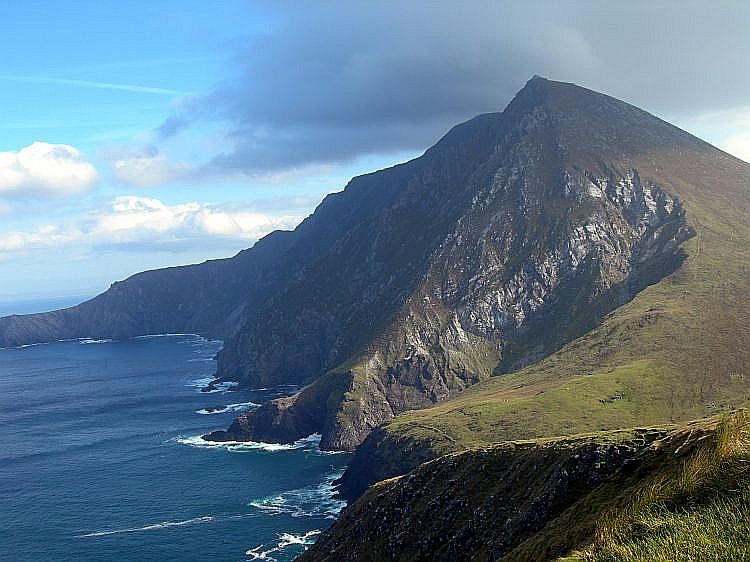
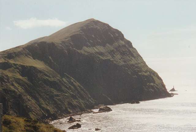
Croaghaun cliffs on Achill Island
Croaghaun cliffs on Achill Island. This landscape photograph does not identify Keem Beach or a verified walking approach. Photo: Boholaman ↗ · Public domain

coast

Achill Island

Achill is an island landscape with several possible days, not a single beach stop. Choose one area and a realistic route before adding viewpoints across the island.

Open place page →
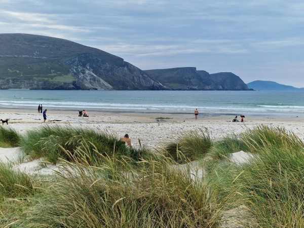
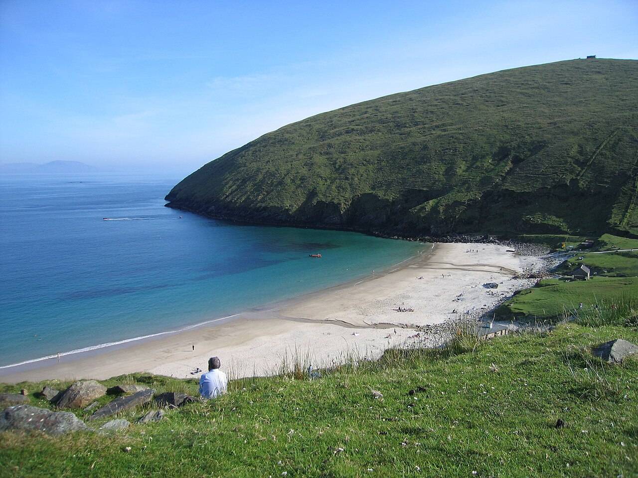
Keem Bay beach and headland on Achill Island
Keem Bay beach and headland on Achill Island. Historical source photograph; current beach access and conditions may differ. Photo: Eoghan888 ↗ · CC0

coast

Keem Bay

Keem Bay is a distinct outing at Achill’s western end: a steeply framed cove whose approach and weather deserve as much thought as the beach photograph.

Open place page →
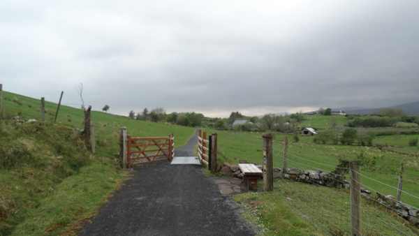
The wider Great Western Greenway west of Nixon’s Lough, away from the example Achill Sound–Cashel section.
The wider Great Western Greenway west of Nixon’s Lough, away from the example Achill Sound–Cashel section. Photo: Colin Park ↗ · CC BY-SA 2.0

nature

Great Western Greenway

The Great Western Greenway is Mayo’s walking and cycling corridor linking the Westport area with Newport, Mulranny and Achill. Its railway alignment links coast, farmland and mountain views. Plan a specific…

Open place page →
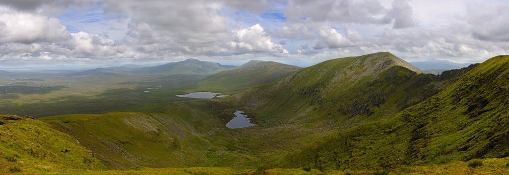
Open bog and hills in Wild Nephin National Park
Open bog and hills in Wild Nephin National Park. Source photograph; conditions and access may have changed. Photo: Youngbillyhappy ↗ · CC BY-SA 3.0

nature

Wild Nephin National Park

Wild Nephin’s open bog and mountain country can feel far removed from a busy coast road. Ballycroy Visitor Centre is the sensible starting point for understanding it: exhibitions and a short nature trail give…

Open place page →
Clare Island’s high coastal cliffs above the Atlantic
Clare Island’s high coastal cliffs above the Atlantic. Resized for display. Photo: Ridiculopathy ↗ · CC0

nature

Clare Island

Clare Island lies at the entrance to Clew Bay, combining a working island community, coastal scenery and a long history. Begin with the ferry from Roonagh and a confirmed return. Harbour views and quiet roads…

Open place page →

External visitor reviews

Find the matching listing and reviews on Google Maps ↗

Part of a bigger journey

Location & access

Getting your bearings

An unguided outdoor monument has uneven ground and fragile fabric. Stay on permitted approaches, keep off masonry and respect local restrictions.

53.99643, -10.07671 · Reference point; confirm the correct entrance and access. Map © OpenStreetMap contributors.

Orientation only: a verified public entrance is not established by this pin. Use the operator arrival information before travel.

Sources & place context

Browse more Ireland places →