Skip to content
TheLazyNick

coast · Donegal

Rossnowlagh Beach

Rossnowlagh is a long, west-facing sandy beach on Donegal Bay, framed by the Coolmore cliffs to the south and the coast towards Durnesh to the north. Its broad scale is best appreciated slowly, from the public shoreline. Treat the Atlantic exposure as part of the experience and keep your route flexible.

Add to planSaved trips & places

Saved on this browser. No account needed.

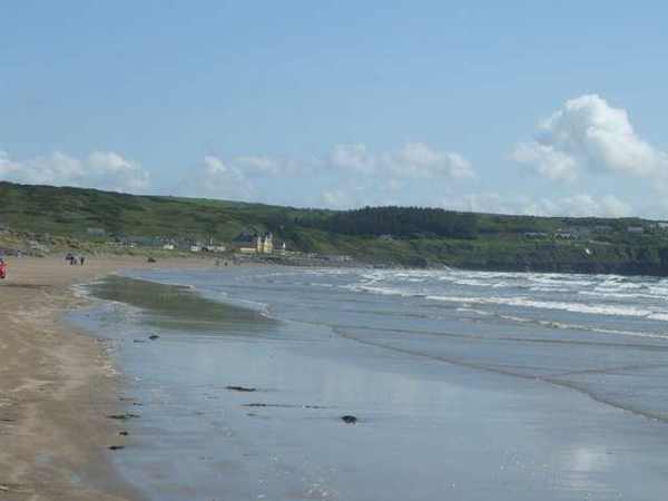
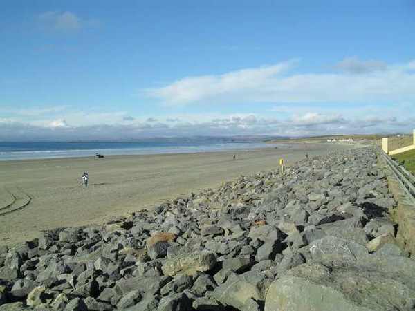
Rossnowlagh Beach viewed north along the shore
Rossnowlagh Beach viewed north along the shore. Resized for display. Photo: Dean Molyneaux ↗ · CC BY-SA 2.0

From research

Is this worth your time?

Choose Rossnowlagh when you want an open coastal landscape rather than a compact cove. It offers room for a short shoreline stroll or a longer out-and-back walk, depending on the conditions. Looking at waves from the sand is a different decision from entering them; no water activity is required to enjoy the beach.

Know before you book: This is a coastal land visit. Tide, waves and weather can change access; a beach designation does not guarantee safe swimming.

Place highlights

What you will actually see

01

The open shore

Pause at the established approach before beginning your walk. Look along the sand and towards Donegal Bay, noticing which sections remain comfortably accessible. An out-and-back route makes it easier to shorten the visit when the weather or available shore changes.

02

The coastal edges

Look at the contrast between the main beach and the land at its margins. Keep to established access and open sand, leaving vegetation and wildlife undisturbed. Avoid using rocks, dunes or river mouths as shortcuts to extend your route.

03

A changing seascape

Take time to watch how water, cloud and light alter the view. A beach can be rewarding without entering the sea. Keep enough space from breaking waves and leave yourself a straightforward return to the public access point.

The story behind the visit

The story behind the place

Rossnowlagh forms part of the wider Donegal Bay coastal environment. The EPA describes a long sandy beach bounded by cliffs at one end and extending towards the Durnesh area at the other. This setting explains the sweep of the view: the strand reads as one long line within a much larger bay. Begin by looking along it rather than immediately aiming for a distant landmark. Source ↗

The bay supports diverse wildlife, including birds and seals, but a beach visit should never depend on a particular sighting. Keep distance from resting animals and feeding birds. The strand also accommodates several recreational uses, so watch the space around you and follow current local separation rules. Its open aspect can make weather feel stronger than it did inland; a modest route with an easy return is often the most enjoyable choice. A measured visit gives room to notice these changes without leaving the established public shore. Source ↗

Visitor information

Tickets, timing and access

Opening
Plan a daylight visit and obey current closures or local beach signs.Confirm with the operator ↗
Admission
Use current local notices for any parking charges or managed-access arrangements.Confirm with the operator ↗
Booking
An independent beach walk needs no organised departure; book any water activity separately.Confirm with the operator ↗
Access
Use the established public approach; avoid dunes, unstable rocks and river mouths.Confirm with the operator ↗
Duration
Allow about an hour for a relaxed out-and-back walk, adjusted to conditions.Confirm with the operator ↗
Seasonal
Check current EPA notices and weather. Never assume lifeguards operate outside posted hours.Confirm with the operator ↗

Getting to the entrance

Use the signed public approach to Rossnowlagh Beach. Follow current parking and beach-management signs rather than assuming vehicles may enter the sand. Official visitor information ↗

Your questions, answered

Confirm current access and visitor arrangements with the operator.

Is swimming included in this visit?

No. Check current water quality, flags, conditions and local safety advice before considering the water. Source ↗

Must I walk the whole beach?

No. Choose a comfortable turning point and return before tide or weather reduces your options. Source ↗

Nearby options

Nearby places to explore

Explore other places in the area, then use live directions to plan your journey.

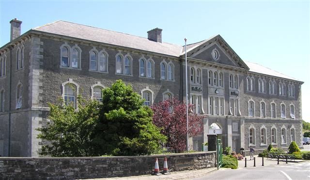
The Belleek Pottery building in County Fermanagh
The Belleek Pottery building in County Fermanagh. Credited source photograph; appearance and access may have changed. Resized from the original. Photo: Kenneth Allen ↗ · CC BY-SA 2.0

attraction

Belleek Pottery

Belleek is most interesting when you see the work behind the delicate finished pieces. A pottery tour can turn an ornamental object in a shop into a sequence of skilled tasks and decisions.

Open place page →
Donegal Castle in the centre of Donegal town
Donegal Castle in the centre of Donegal town. Source photograph; conditions and access may have changed. Photo: Djngsf ↗ · CC0

heritage

Donegal Castle

Donegal Castle is useful precisely because two different kinds of building stand together. A Gaelic tower house and a later manor wing make changes of power and domestic ambition visible within one compact…

Open place page →
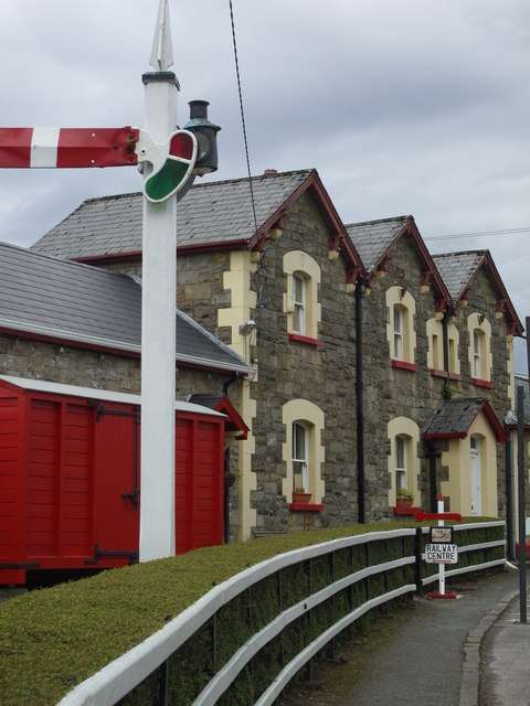
Former railway station building in Donegal Town
Former railway station building in Donegal Town. Source photograph: 2008-08-06. Appearance, displays and access may have changed. Photo: louise price ↗ · CC BY-SA 2.0

heritage

Donegal Railway Heritage Centre

Donegal Railway Heritage Museum occupies an original station building close to the Diamond in Donegal Town. Preserved rolling stock, models, recordings and an interactive cab introduce the railways that once…

Open place page →
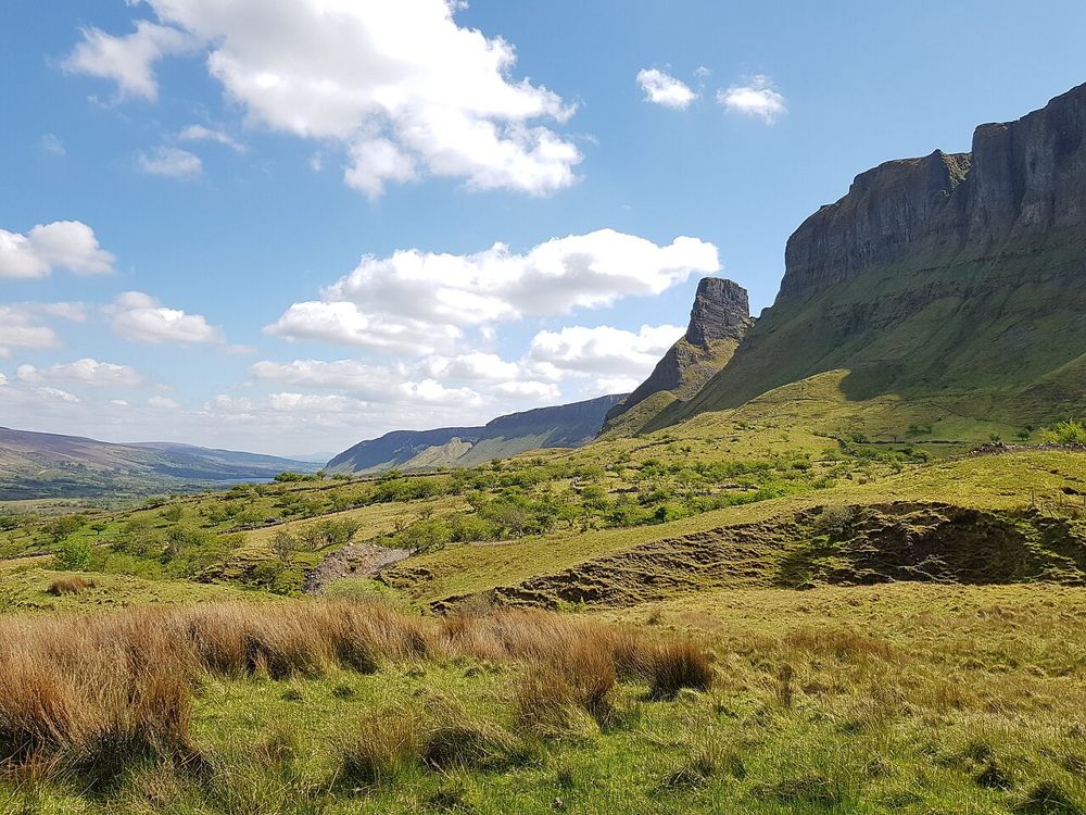
The Glenade Valley and the cliffs around Eagle’s Rock
The Glenade Valley and the cliffs around Eagle’s Rock. Source photograph; current access and conditions may differ. Resized from the credited source. Photo: Jacobfrid ↗ · CC BY-SA 4.0

nature

Eagle’s Rock

The rock formations above Glenade give north Leitrim an unexpectedly theatrical skyline. Eagle’s Rock and neighbouring Hag’s Leap are better approached first as a landscape to look at from an authorised…

Open place page →
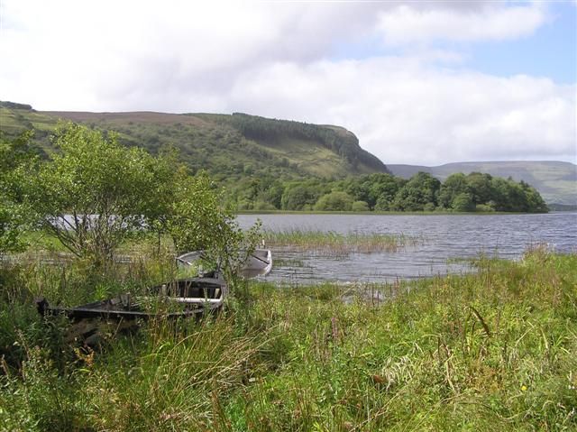
Glenade Lough with reeds, trees and surrounding hills
Glenade Lough with reeds, trees and surrounding hills. Resized from the credited source. Photo: Kenneth Allen ↗ · CC BY-SA 2.0

nature

Glenade Lough

Glenade Lough sits between steep valley sides, giving a short stop a surprisingly enclosed, almost amphitheatre-like feel. The lake is quiet to look at, but access around it needs care: a beautiful shoreline…

Open place page →
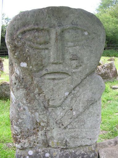
One face of the carved Boa Island figure
One face of the carved Boa Island figure. Credited source photograph; appearance and access may have changed. Resized from the original. Photo: Kenneth Allen ↗ · CC BY-SA 2.0

heritage

Boa Island figures at Caldragh

Caldragh is a small cemetery stop with unusually absorbing carved figures. The famous two-faced stone is not large, and that intimate scale is part of the encounter: close looking matters more than a long…

Open place page →

External visitor reviews

Find the matching listing and reviews on Google Maps ↗

Part of a bigger journey

Location & access

Getting your bearings

This is a coastal land visit. Tide, waves and weather can change access; a beach designation does not guarantee safe swimming.

54.55360, -8.21526 · Reference point; confirm the correct entrance and access. Map © OpenStreetMap contributors.

Orientation only: a verified public entrance is not established by this pin. Use the operator arrival information before travel.

Sources & place context

Browse more Ireland places →