Skip to content
TheLazyNick

coast · Clare

Flaggy Shore

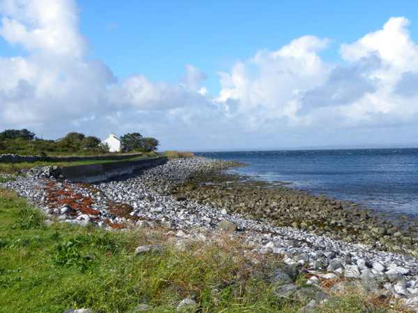
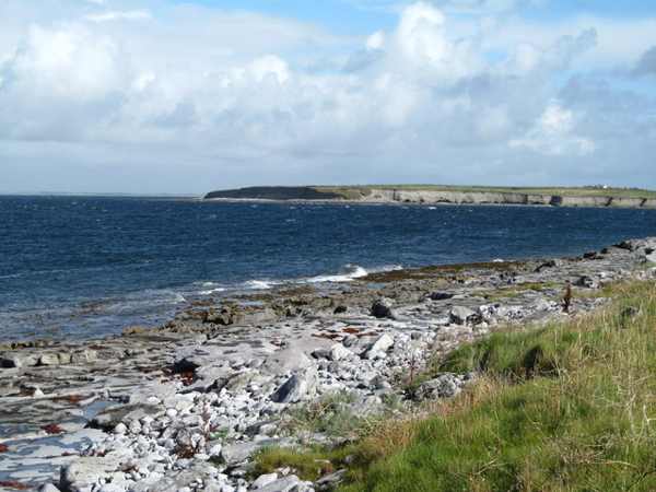
Flaggy Shore follows the north Clare coast between New Quay and Finvarra Point, with limestone, fossils and views across Galway Bay. Its interest is close to the ground as well as on the horizon. Walk on the established public approach and look without collecting or breaking the rock that gives the shoreline its character.

Add to planSaved trips & places

Saved on this browser. No account needed.

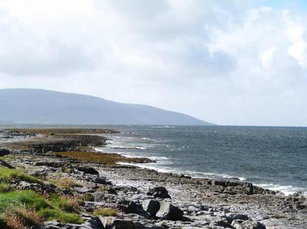
Limestone shoreline and Galway Bay at Flaggy Shore.
Limestone shoreline and Galway Bay at Flaggy Shore. Photo: Gordon Hatton ↗ · CC BY-SA 2.0

From research

Is this worth your time?

Choose Flaggy Shore for a slower outing where small geological details can be as rewarding as a broad sea view. A short accessible section may be enough, especially in poor weather. The limestone can be uneven or slippery, so do not assume the entire shore is a smooth promenade or move close to water for a fossil photograph.

Know before you book: This is an exposed outdoor visit. Tide, weather and local restrictions can change access; keep well back from cliffs and moving water.

Place highlights

What you will actually see

01

Limestone surfaces

Look at the exposed limestone and its varied textures from secure accessible ground. Pause on the established public route and look carefully. Watch your footing as well as the view; keep well away from exposed edges for photographs.

02

Fossils and weathering

Observe fossils and sculptured rock without removing material, hammering or leaving the established approach. Compare this feature with the wider surroundings. Use permitted approaches, leave plants and wildlife undisturbed and avoid shortcuts across adjoining land or fragile coastal vegetation.

03

Galway Bay

Pause to compare the detailed foreground with the wider bay and distant mountains in clear conditions. Choose a comfortable turning point before conditions limit the return. A shorter visit still reveals the place’s character; you need not reach every visible landmark.

The story behind the visit

The story behind the place

The official visitor account identifies fossils within the limestone and sculptured forms described as biokarst. These details make the shore worth a slower look: the interest is not limited to a distant landmark. Rock surfaces record processes and former life, but they are also fragile parts of a shared landscape. Leave material in place and use observation or photography rather than collecting, so later visitors can encounter the same features. Source ↗

Flaggy Shore occupies the northern edge of County Clare, extending between New Quay and Finvarra Point with views towards Aughinish and the wider Galway Bay setting. This location gives a useful contrast between the intimate scale of the rock underfoot and the broad water beyond it. The route need not be treated as a challenge to cover every part of the shoreline. Choose a permitted section that fits the conditions, remain aware of traffic where the approach meets the road and keep a clear return. Source ↗

Visitor information

Tickets, timing and access

Opening
Visit in daylight and follow current access notices or barriers.Confirm with the operator ↗
Admission
Check local signs for parking or managed-access arrangements; no organised attraction ticket is advertised.Confirm with the operator ↗
Booking
Independent viewing has no scheduled departure; arrange specialist activities separately.Confirm with the operator ↗
Access
Use established public approaches; do not infer access across private land or beyond barriers.Confirm with the operator ↗
Duration
Allow about 75 minutes for a cautious visit with pauses, excluding travel.Confirm with the operator ↗
Seasonal
Wind, rain and short daylight can make a shorter outing preferable.Confirm with the operator ↗

Getting to the entrance

Approach from New Quay and follow the established public coastal route towards Finvarra. Keep roadside access clear and avoid private shore approaches. Official visitor information ↗

Your questions, answered

Confirm current access and visitor arrangements with the operator.

Must I complete a long walk?

No. Choose a shorter permitted outing that fits conditions and leaves a straightforward return. Source ↗

Is entering the water part of this visit?

No. This is a land-based visit; water activities need separate current safety advice. Source ↗

Nearby options

Nearby places to explore

Explore other places in the area, then use live directions to plan your journey.

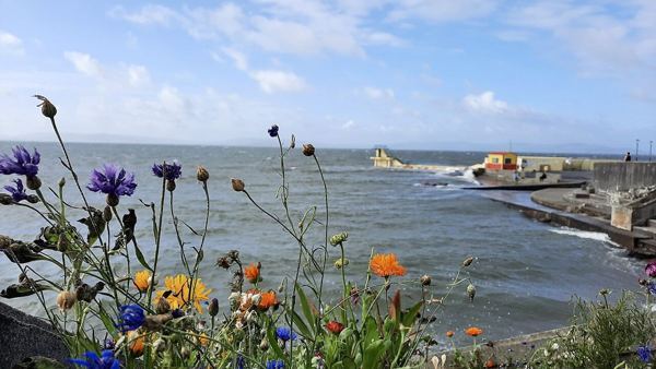
Wildflowers, the sea wall and Blackrock Diving Tower in August 2021
Wildflowers, the sea wall and Blackrock Diving Tower in August 2021. Resized from the credited photograph; this dated view does not establish current conditions. Photo: Ciara Ní Riain ↗ · CC BY-SA 4.0

attraction

Blackrock area viewpoint

Finish a Salthill outing with a land-based view towards Blackrock’s familiar diving structure, without turning the stop into a swim.

Open place page →
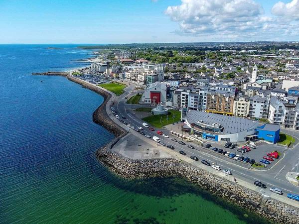
An aerial view along Salthill’s promenade and waterfront in May 2023
An aerial view along Salthill’s promenade and waterfront in May 2023. Resized from the credited photograph; this dated view does not establish current conditions. Photo: GalwayAquarium ↗ · CC BY-SA 4.0

attraction

Salthill Promenade

Choose your own section of Galway Bay’s seafront, with a flexible turnaround rather than an obligation to walk its whole length.

Open place page →
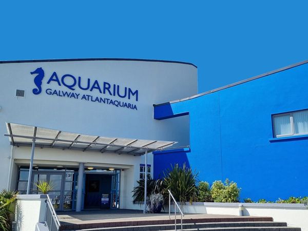
The signed Galway Atlantaquaria entrance in May 2023
The signed Galway Atlantaquaria entrance in May 2023. Resized from the credited photograph; this dated view does not establish current conditions. Photo: GalwayAquarium ↗ · CC BY-SA 4.0

attraction

Galway Atlantaquaria

Explore marine life at Salthill’s indoor aquarium and give a coastal day an anchor that does not depend on completing the promenade.

Open place page →
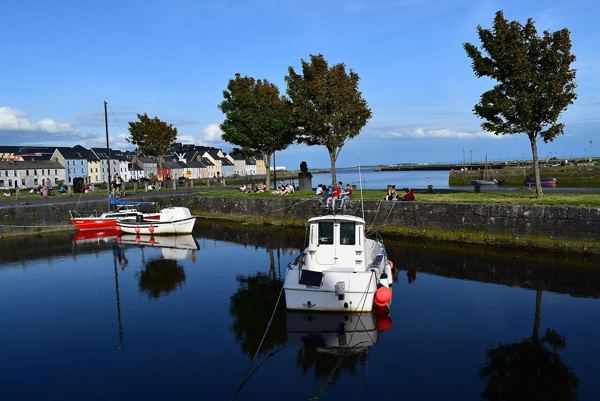
Small boats in Claddagh Basin with the Long Walk beyond in May 2020
Small boats in Claddagh Basin with the Long Walk beyond in May 2020. Resized from the credited photograph; this dated view does not establish current conditions. Photo: Mlhynes ↗ · CC BY-SA 4.0

attraction

The Claddagh waterfront

Read the Claddagh as a living waterfront neighbourhood with a fishing-community history, not a preserved village set.

Open place page →

External visitor reviews

Find the matching listing and reviews on Google Maps ↗

Part of a bigger journey

Location & access

Getting your bearings

This is an exposed outdoor visit. Tide, weather and local restrictions can change access; keep well back from cliffs and moving water.

53.15826, -9.09094 · Reference point; confirm the correct entrance and access. Map © OpenStreetMap contributors.

Orientation only: a verified public entrance is not established by this pin. Use the operator arrival information before travel.

Sources & place context

Browse more Ireland places →