Skip to content
TheLazyNick

coast · Clare

Fanore Beach

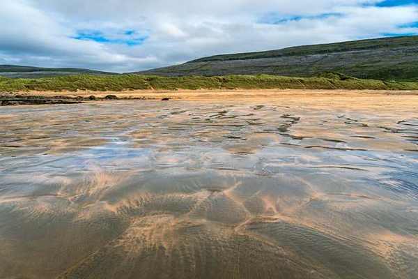
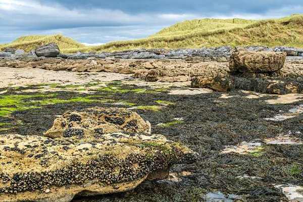
Fanore Beach places pale sand and dunes beside the limestone landscape of the Burren. At lower water, stepped limestone can become visible beneath parts of the shore, giving the beach a character different from a purely sandy strand. Visit for the relationship between rock, sand and Atlantic weather, staying on the established approach.

Add to planSaved trips & places

Saved on this browser. No account needed.

Rocks and dunes at Fanore Beach
Rocks and dunes at Fanore Beach. Resized for display. Photo: dconvertini ↗ · CC BY-SA 4.0

From research

Is this worth your time?

Choose Fanore if you want a coastal stop that connects visibly with the Burren’s geology. A short walk and time to study the changing shore can be enough. The beach is exposed, and rock revealed by a falling tide can be slippery; there is no need to venture across it to appreciate the setting.

Know before you book: This is a coastal land visit. Tide, waves and weather can change access; a beach designation does not guarantee safe swimming.

Place highlights

What you will actually see

01

The open shore

Pause at the established approach before beginning your walk. Look along the sand and towards the Burren, noticing which sections remain comfortably accessible. An out-and-back route makes it easier to shorten the visit when the weather or available shore changes.

02

The coastal edges

Look at the contrast between the main beach and the land at its margins. Keep to established access and open sand, leaving vegetation and wildlife undisturbed. Avoid using rocks, dunes or river mouths as shortcuts to extend your route.

03

A changing seascape

Take time to watch how water, cloud and light alter the view. A beach can be rewarding without entering the sea. Keep enough space from breaking waves and leave yourself a straightforward return to the public access point.

The story behind the visit

The story behind the place

Clare County Council describes the sandy beach as underlain by gently sloping, stepped limestone. Parts of that rock are exposed at low tide, so the appearance of the shore changes through the day. This gives a useful way to look at Fanore: notice where sand conceals the underlying structure and where the rock emerges, while remaining on secure ground away from the moving water. Source ↗

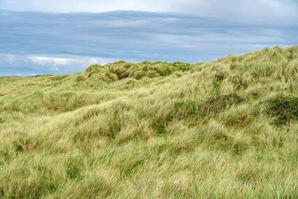
A vegetated dune area lies to the north-east. Together, the dunes and limestone show two different coastal processes in one place: loose sand gathers and supports plants, while a harder foundation shapes the shore below. Protecting the dune vegetation matters to the character of the beach. Use established paths rather than shortcuts, and allow the visit to remain a land-based look at the coast when surf or weather makes the water unsuitable. A measured visit gives room to notice these changes without leaving the established public shore. Source ↗

Visitor information

Tickets, timing and access

Opening
Plan a daylight visit and obey current closures or local beach signs.Confirm with the operator ↗
Admission
Use current local notices for any parking charges or managed-access arrangements.Confirm with the operator ↗
Booking
An independent beach walk needs no organised departure; book any water activity separately.Confirm with the operator ↗
Access
Use the established public approach; avoid dunes, unstable rocks and river mouths.Confirm with the operator ↗
Duration
Allow about an hour for a relaxed out-and-back walk, adjusted to conditions.Confirm with the operator ↗
Seasonal
Check current EPA notices and weather. Never assume lifeguards operate outside posted hours.Confirm with the operator ↗

Getting to the entrance

Follow the signed Fanore Beach approach on the north Clare coast. Keep the dune access clear and use the permitted public route. Official visitor information ↗

Your questions, answered

Confirm current access and visitor arrangements with the operator.

Is swimming included in this visit?

No. Check current water quality, flags, conditions and local safety advice before considering the water. Source ↗

Must I walk the whole beach?

No. Choose a comfortable turning point and return before tide or weather reduces your options. Source ↗

Nearby options

Nearby places to explore

Explore other places in the area, then use live directions to plan your journey.

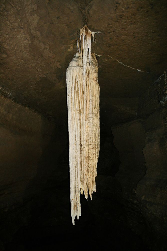
The hanging stalactite inside Doolin Cave
The hanging stalactite inside Doolin Cave. Photo: Ingo Mehling ↗ · CC BY-SA 3.0

attraction

Doolin Cave

Doolin Cave builds its visit around a single geological object: a huge free-hanging stalactite in an underground chamber. The reward comes from seeing its scale after the descent, not from covering miles of…

Open place page →
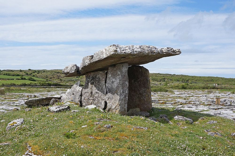
Poulnabrone portal tomb on the Burren limestone plateau
Poulnabrone portal tomb on the Burren limestone plateau. Photo: Bernard Gagnon ↗ · CC BY-SA 4.0

heritage

Poulnabrone Dolmen

Poulnabrone is small enough to be rushed and old enough to deserve better. The tilted capstone stands above a rough limestone plateau, with very little competing for your attention. After the familiar…

Open place page →

External visitor reviews

Find the matching listing and reviews on Google Maps ↗

Part of a bigger journey

Location & access

Getting your bearings

This is a coastal land visit. Tide, waves and weather can change access; a beach designation does not guarantee safe swimming.

53.11971, -9.28982 · Reference point; confirm the correct entrance and access. Map © OpenStreetMap contributors.

Orientation only: a verified public entrance is not established by this pin. Use the operator arrival information before travel.

Sources & place context

Browse more Ireland places →