Skip to content
TheLazyNick

heritage · Mayo

Burrishoole Abbey

Burrishoole Abbey stands beside an inlet of Clew Bay near Newport, where a surviving church and cloister fragments sit within a quiet burial landscape. The Dominican foundation combines local family history with an unusually strong relationship to the water. It is best approached as a reflective unguided heritage stop, with care around graves and shore edges.

Add to planSaved trips & places

Saved on this browser. No account needed.

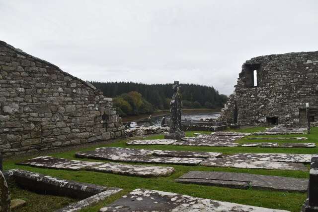
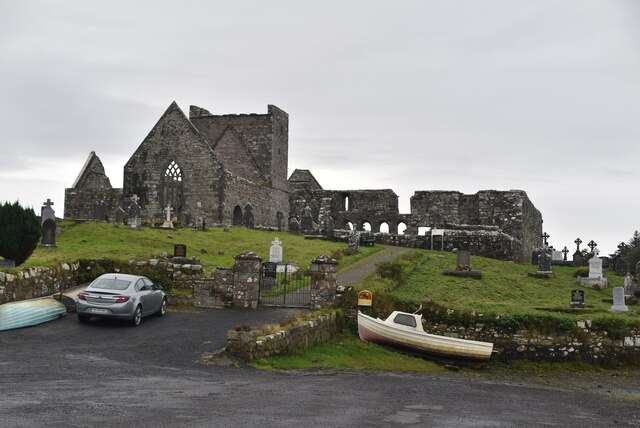
Burrishoole Friary beside the water
Burrishoole Friary beside the water. Resized for display. Photo: N Chadwick ↗ · CC BY-SA 2.0

From research

Is this worth your time?

Choose it if you enjoy smaller monastic ruins whose setting matters as much as their scale. The church, belfry and remaining communal spaces reward a measured circuit rather than a quick photograph. Keep the visit within permitted ground and allow weather or a ceremony to change the plan.

Know before you book: This is an unguided ruin and burial ground beside water. Respect graves and any funerals or local use, follow signs and stay away from unstable masonry and unsafe shore edges.

Place highlights

What you will actually see

01

Church and belfry

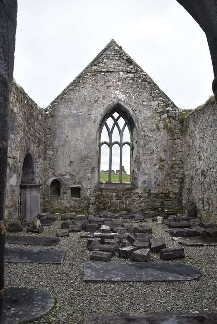
Identify nave and chancel, then look at how the belfry and adjoining remains relate to them. The surviving arrangement helps recover the religious building’s former organisation without imagining that every visible wall belongs to the same phase.

02

Cloister traces

A few remains of the cloister and domestic ranges survive alongside the church. Give these lower or less dramatic traces attention: they connect worship with the everyday communal life that a friary also had to accommodate.

03

Estuary setting

Step back from the architecture to see its relationship with the inlet. Water and low-lying ground shape the atmosphere, but the shoreline is not automatically part of a safe walking route. Keep to permitted, stable ground around the monument.

The story behind the visit

The story behind the place

OPW dates the Dominican foundation to 1469 and associates it with Richard Bourke, a member of the influential Mayo Bourke family. Its dedication to St Mary and later family connections place the priory within the religious and political landscape around Clew Bay. The founder’s decision to enter the community himself adds a personal dimension to the relationship between patronage and monastic life. Source ↗

The remains include a nave-and-chancel church, belfry, chapel and fragments of communal buildings. Their survival beside an active burial ground connects medieval use with later remembrance rather than leaving the site as an abandoned architectural object. Look at both the larger church form and the less conspicuous traces, allowing the estuary setting to explain part of the place while keeping any shore exploration outside the plan unless current access and conditions support it. That combination of architecture, remembrance and water is enough to reward an attentive visit without adding an unverified shoreline walk. Source ↗

Visitor information

Tickets, timing and access

Opening
Unguided outdoor monument: visit in daylight and follow current local notices.Confirm with the operator ↗
Admission
Check current site arrangements; no staffed visitor-centre experience is included in this plan.Confirm with the operator ↗
Booking
No regular guided departure is advertised. Arrange organised group or specialist visits separately.Confirm with the operator ↗
Access
Unguided historic ruin and burial ground. Follow permitted routes, respect ceremonies and avoid unsafe masonry or water edges.Confirm with the operator ↗
Duration
Allow 30–45 minutes, depending on conditions and interest.Confirm with the operator ↗
Seasonal
Exposed outdoor remains can be wet or slippery. Short winter daylight calls for a flexible plan.Confirm with the operator ↗

Getting to the entrance

Burrishoole Abbey is near Newport in County Mayo, beside an inlet of Clew Bay. Use local signs and leave cemetery and property access unobstructed. Official visitor information ↗

Your questions, answered

Confirm current access and visitor arrangements with the operator.

Can I explore independently?

This is an unguided visit. Stay within the access permitted by current signs and barriers. Source ↗

Can I enter every structure?

Closed areas and upper levels may be restricted. Follow current signs and do not enter private land beyond the published approach. Source ↗

Nearby options

Nearby places to explore

Explore other places in the area, then use live directions to plan your journey.

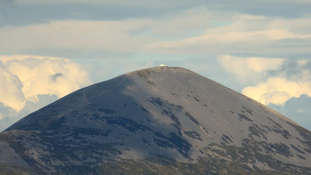
Croagh Patrick rising above the Mayo landscape
Croagh Patrick rising above the Mayo landscape. Source photograph; conditions and access may have changed. Photo: Vicuna R ↗ · CC BY-SA 2.0

nature

Croagh Patrick

Croagh Patrick rises above Clew Bay with a history that matters to many people before they take a step uphill. Some come as pilgrims, others for the mountain and the view. Either way, a climb is a substantial…

Open place page →
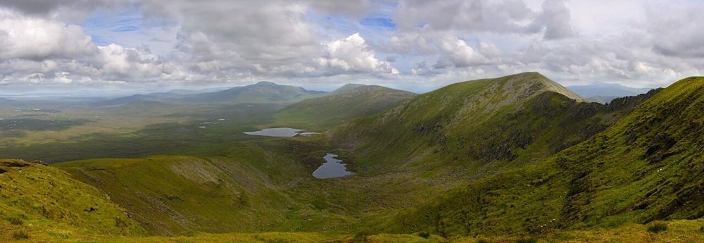
Open bog and hills in Wild Nephin National Park
Open bog and hills in Wild Nephin National Park. Source photograph; conditions and access may have changed. Photo: Youngbillyhappy ↗ · CC BY-SA 3.0

nature

Wild Nephin National Park

Wild Nephin’s open bog and mountain country can feel far removed from a busy coast road. Ballycroy Visitor Centre is the sensible starting point for understanding it: exhibitions and a short nature trail give…

Open place page →
Turlough Park House at the National Museum of Ireland’s Country Life site
Turlough Park House in the grounds of the National Museum of Ireland’s Country Life site. This is the historic house, rather than the modern exhibition galleries. Resized from the credited source. Photo: Shanehahaha ↗ · CC BY-SA 3.0

attraction

National Museum of Ireland, Turlough Park

Turlough Park gives time to the tools, clothing and household objects that grand houses often leave in the background. The National Folklife Collection explores rural life through things people made and used.…

Open place page →
Eastern elevation of Ballintubber Abbey
Eastern elevation of Ballintubber Abbey. Source photograph; conditions and access may have changed. Photo: Laurel Lodged ↗ · CC0

heritage

Ballintubber Abbey

Ballintubber is a living church as well as an old abbey, and that changes the way to visit. The building, cloister remains and grounds reward quiet attention, while worship and local use continue around them.…

Open place page →
Clare Island’s high coastal cliffs above the Atlantic
Clare Island’s high coastal cliffs above the Atlantic. Resized for display. Photo: Ridiculopathy ↗ · CC0

nature

Clare Island

Clare Island lies at the entrance to Clew Bay, combining a working island community, coastal scenery and a long history. Begin with the ferry from Roonagh and a confirmed return. Harbour views and quiet roads…

Open place page →

External visitor reviews

Find the matching listing and reviews on Google Maps ↗

Part of a bigger journey

Location & access

Getting your bearings

This is an unguided ruin and burial ground beside water. Respect graves and any funerals or local use, follow signs and stay away from unstable masonry and unsafe shore edges.

53.89962, -9.56876 · Reference point; confirm the correct entrance and access. Map © OpenStreetMap contributors.

Orientation only: a verified public entrance is not established by this pin. Use the operator arrival information before travel.

Sources & place context

Browse more Ireland places →