Skip to content
TheLazyNick

coast · Clare

Bridges of Ross

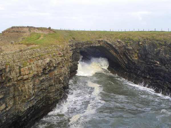
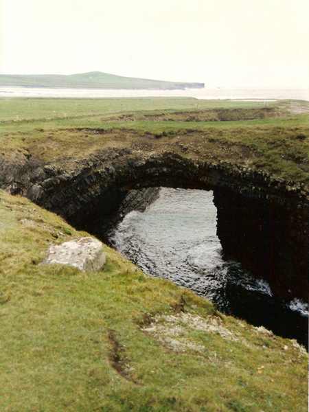
The Bridges of Ross are a group of coastal formations near Kilbaha whose plural name survives although only one natural arch remains. A footpath leads towards the viewing area. Visit to look at the ocean-shaped rock and the wider Atlantic setting, staying well clear of the exposed edge.

Add to planSaved trips & places

Saved on this browser. No account needed.

The surviving natural sea arch at the Bridges of Ross.
The surviving natural sea arch at the Bridges of Ross. Photo: Neil Theasby ↗ · CC BY-SA 2.0

From research

Is this worth your time?

Choose this stop for a short geological landscape visit rather than a long cliff expedition. The arch is most rewarding when you take time to understand its relationship to the surrounding rock and sea. Strong wind or spray can change the outing, so keep it flexible and do not attempt to cross the bridge itself.

Know before you book: This is an exposed outdoor visit. Tide, weather and local restrictions can change access; keep well back from cliffs and moving water.

Place highlights

What you will actually see

01

The surviving arch

Look at the remaining natural bridge from a secure position on the permitted visitor route. Pause on the established public route and look carefully. Watch your footing as well as the view; keep well away from exposed edges for photographs.

02

The wider rock coast

Compare the arch with the broken coastline around it, noticing how openings and headlands relate. Compare this feature with the wider surroundings. Use permitted approaches, leave plants and wildlife undisturbed and avoid shortcuts across adjoining land or fragile coastal vegetation.

03

Sea and bird movement

Watch the Atlantic and any passing birds quietly; no particular wildlife display can be promised. Choose a comfortable turning point before conditions limit the return. A shorter visit still reveals the place’s character; you need not reach every visible landmark.

The story behind the visit

The story behind the place

Fáilte Ireland explains that the name once referred to three ocean-carved arches, while only one survives today. The plural therefore records an earlier coastline rather than the number of bridges a visitor should expect to find. That makes the site a useful place to think about change: the rock appears solid at a brief glance, but the coastal forms have been altered by the same marine forces that make the scene so compelling. Source ↗

The remaining arch stands on the western side of Ross Bay, within the wider Loop Head coastal landscape. The official visitor description identifies a connecting footpath, so a short outing can remain on the established approach. Birdwatching is also associated with the area, particularly during migration, but it should stay an open possibility rather than the condition for a successful visit. Give the scene time, keep wildlife undisturbed and remember that a natural bridge is a feature to observe, not a structure certified for crossing. Source ↗

Visitor information

Tickets, timing and access

Opening
Visit in daylight and follow current access notices or barriers.Confirm with the operator ↗
Admission
Check local signs for parking or managed-access arrangements; no organised attraction ticket is advertised.Confirm with the operator ↗
Booking
Independent viewing has no scheduled departure; arrange specialist activities separately.Confirm with the operator ↗
Access
Use established public approaches; do not infer access across private land or beyond barriers.Confirm with the operator ↗
Duration
Allow about 45 minutes for a cautious visit with pauses, excluding travel.Confirm with the operator ↗
Seasonal
Wind, rain and short daylight can make a shorter outing preferable.Confirm with the operator ↗

Getting to the entrance

Use the signed Bridges of Ross approach near Kilbaha. Follow the established footpath and any current barriers; do not cross the natural arch. Official visitor information ↗

Your questions, answered

Confirm current access and visitor arrangements with the operator.

Must I complete a long walk?

No. Choose a shorter permitted outing that fits conditions and leaves a straightforward return. Source ↗

Is entering the water part of this visit?

No. This is a land-based visit; water activities need separate current safety advice. Source ↗

Nearby options

Nearby places to explore

Explore other places in the area, then use live directions to plan your journey.

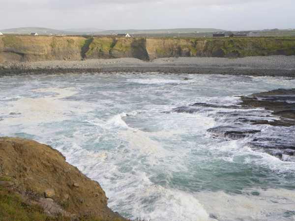
An inlet cut into the Atlantic cliffs near Kilkee.
An inlet cut into the Atlantic cliffs near Kilkee. Photo: James Emmans ↗ · CC BY-SA 2.0

coast

Kilkee Cliffs

Kilkee Cliffs form a coastal walking landscape beyond the town’s beach, with exposed Atlantic edges, bays and views towards higher ground. They are a separate outing from a stroll on Kilkee’s sand. Plan a…

Open place page →
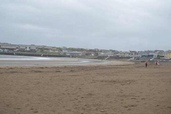
Kilkee Beach with the town beyond
Kilkee Beach with the town beyond. Resized for display. Photo: N Chadwick ↗ · CC BY-SA 2.0

coast

Kilkee Beach

Kilkee Beach curves around a crescent-shaped bay beside the town, combining an accessible coastal setting with rocky edges that frame the sand. The sweep of the beach is the main attraction for a simple visit.…

Open place page →
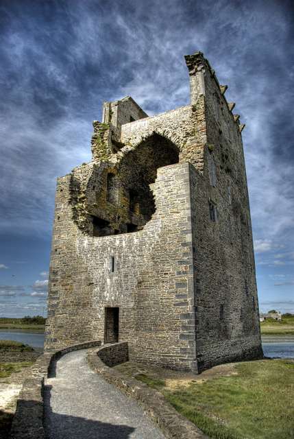
Carrigafoyle Castle tower-house beside the Shannon Estuary
Carrigafoyle Castle tower-house beside the Shannon Estuary. Source photograph: 2009-06-14. Appearance, displays and access may have changed. Photo: Arcaist ↗ · CC BY-SA 3.0

heritage

Carrigafoyle Castle

Carrigafoyle Castle rises beside the Shannon Estuary near Ballylongford, an imposing late-medieval tower-house in a setting that explains its strategic purpose. Treat this as an exterior-focused heritage stop…

Open place page →
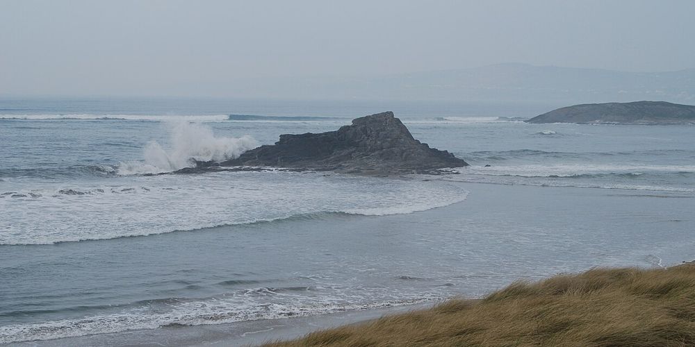
Black Rock and the open sands of Banna Strand
Black Rock and the open sands of Banna Strand. Source photograph; conditions and access may have changed. Resized from the credited original. Photo: Kglavin ↗ · CC BY 2.5

coast

Banna Strand

Banna gives north Kerry a long, open Atlantic edge within reach of Tralee. The most satisfying visit is often simple: a shoreline walk, a look back at the dunes and no attempt to turn the whole afternoon into…

Open place page →

External visitor reviews

Find the matching listing and reviews on Google Maps ↗

Part of a bigger journey

Location & access

Getting your bearings

This is an exposed outdoor visit. Tide, weather and local restrictions can change access; keep well back from cliffs and moving water.

52.59126, -9.87307 · Reference point; confirm the correct entrance and access. Map © OpenStreetMap contributors.

Orientation only: a verified public entrance is not established by this pin. Use the operator arrival information before travel.

Sources & place context

Browse more Ireland places →