Skip to content
TheLazyNick

coast · Antrim

Blackhead Coastal Path Walk

Blackhead Coastal Path follows the shore from Whitehead towards the lighthouse above the entrance to Belfast Lough. The walk combines sea-level views, rocky shoreline and a climb near the headland. The council describes a circuit continuing by country road and the B150, so it is worth distinguishing that longer route from a simple return along the coast.

Add to planSaved trips & places

Saved on this browser. No account needed.

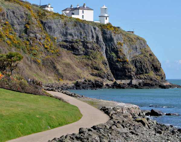
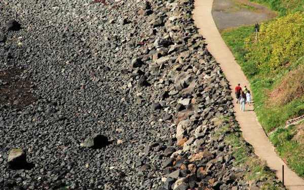
Blackhead coastal path below the lighthouse
Blackhead coastal path below the lighthouse. Resized for display. Photo: Albert Bridge ↗ · CC BY-SA 2.0

From research

Is this worth your time?

Choose Blackhead when you want a bracing coastal walk close to Whitehead rather than a booked cliff-path tour. The lighthouse is a landmark on the route, not a promise of interior access. Decide whether to return the same way or follow the council’s mixed coastal-and-road circuit, taking account of steps, wind and daylight.

Know before you book: The complete circuit includes roads; lighthouse accommodation is separate from public path access.

Place highlights

What you will actually see

01

Whitehead shoreline

Set out along the coast from Whitehead, looking back towards the town as the view opens. The path keeps the sea close, with shipping moving through the mouth of Belfast Lough. Stay on the route and avoid turning a coastal walk into an unsignposted shore scramble.

02

Blackhead landmark

The lighthouse stands above the headland and gives the walk a clear visual destination. Enjoy it from the public route without assuming that the tower or the keeper’s houses are open. The houses operate as accommodation and should be respected as occupied private space.

03

Coast and wildlife

Seabirds and marine wildlife are among the reasons the council recommends the path. Sightings are possibilities, never a timetable. Stop where there is room, keep the path clear and use binoculars rather than moving towards cliff edges for a closer look.

The story behind the visit

The story behind the place

The headland is an ancient volcanic plug, and its shape has made it both a natural landmark and a useful place for a lighthouse. From the coast, the relationship between rock, sea and navigation is immediate: vessels passing through Belfast Lough share the view with walkers on shore. A route like this works at two scales, from the close texture of the rocks to the much wider movement of traffic across the water. Source ↗

Whitehead’s coastal path has been restored and is again promoted by the council as a visitor walk. That public route should be distinguished from the accommodation at the lighthouse and from the separate booked experience at the Gobbins. You can enjoy the shoreline without adding either. The council’s full circuit also returns through a country road and a footpath beside the B150; choosing a shorter out-and-back walk may suit a different group. Make that decision before tiring on the outward section, and keep enough time and daylight for the route you actually intend to follow. Source ↗

Visitor information

Tickets, timing and access

Opening
Public outdoor path; use daylight and follow any closure notices.Confirm with the operator ↗
Admission
No walking admission ticket is advertised.Confirm with the operator ↗
Booking
No path tour booking is required; lighthouse stays are separate.Confirm with the operator ↗
Access
Coastal exposure, steps and road sections on the full circuit.Confirm with the operator ↗
Duration
Allow around 90 minutes for a coastal walk with stops.Confirm with the operator ↗
Seasonal
Avoid exposed sections in severe wind or rough conditions.Confirm with the operator ↗

Getting to the entrance

Begin at the coastal parking area in Whitehead; the council circuit returns by country road, golf club and the B150. Official visitor information ↗

Your questions, answered

Confirm current access and visitor arrangements with the operator.

Is this the Gobbins?

No. Blackhead is a separate public coastal walk from Whitehead. Source ↗

Can I enter the lighthouse houses?

They are accommodation, not open-access visitor rooms. Source ↗

Nearby options

Nearby places to explore

Explore other places in the area, then use live directions to plan your journey.

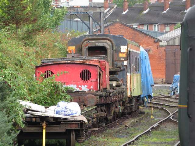
Whitehead Railway Museum site
Whitehead Railway Museum site. Source photograph: 2019-10-04. Appearance, displays and access may have changed. Photo: Gareth James ↗ · CC BY-SA 2.0

heritage

Whitehead Railway Museum

Whitehead Railway Museum offers a close view of preserved steam-era railway vehicles and the work involved in maintaining them. Five galleries introduce locomotives, carriages and restoration at the Railway…

Open place page →
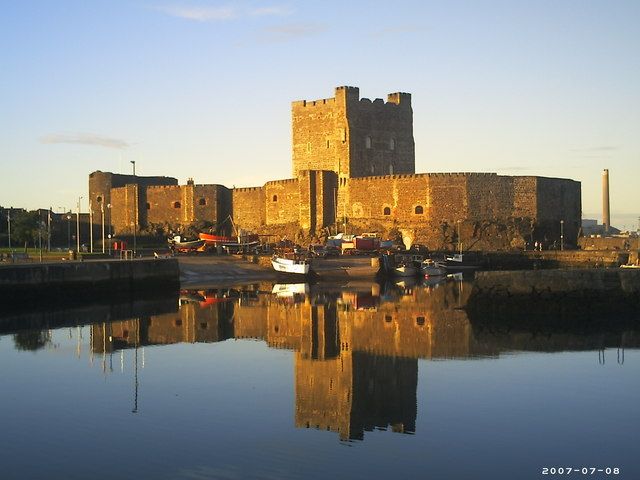
Carrickfergus Castle reflected in the harbour at sunset
Carrickfergus Castle reflected in the harbour at sunset. Credited source photograph; appearance and access may have changed. Resized from the original. Photo: Stewart ↗ · CC BY-SA 2.0

heritage

Carrickfergus Castle

Carrickfergus Castle has the advantage of a setting that still explains its purpose. The bulky stone walls sit against Belfast Lough, with the town immediately behind rather than a remote countryside approach.

Open place page →
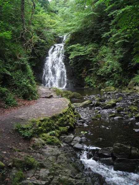
Gleno Waterfall above its rocky stream
Gleno Waterfall above its rocky stream. Resized for display. Photo: Puffer ↗ · CC BY-SA 2.0

nature

Gleno Waterfall

Gleno Waterfall lies in a small wooded glen close to Gleno village, reached by paths and steps from Waterfall Road. The enclosed setting makes this a compact landscape visit rather than a long mountain walk.…

Open place page →
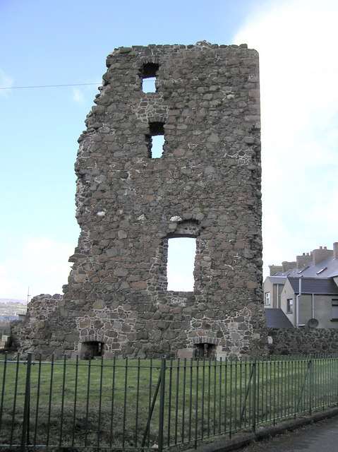
The surviving tower wall at Olderfleet Castle in Larne
The surviving tower wall at Olderfleet Castle in Larne. Resized for display. Photo: Kenneth Allen ↗ · CC BY-SA 2.0

heritage

Olderfleet Castle

Olderfleet Castle is a ruined harbour-side tower on Larne’s Curran peninsula. Today its built-up surroundings make it easy to miss the maritime logic of the position, but the structure once stood in a more…

Open place page →
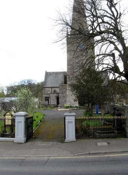
Entrance and tower at Bangor Abbey
Entrance and tower at Bangor Abbey. Resized for display. Photo: Eric Jones ↗ · CC BY-SA 2.0

heritage

Bangor Abbey

Bangor Abbey is a working church on the site of a major early Irish monastery. Its surviving building combines a medieval tower, a later steeple and a nineteenth-century body, while the churchyard contains…

Open place page →
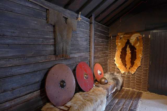
Viking-themed display at North Down Museum
Viking-themed display at North Down Museum. Source photograph: 12 May 2015 (according to Exif data). Appearance, displays and access may have changed. Photo: No machine-readable author provided. Notafly assumed (based on copyright claims). ↗ · CC BY-SA 3.0

heritage

North Down Museum

North Down Museum tells the history of Bangor and its surrounding area from a compact setting behind Bangor Castle. Its galleries occupy former service spaces of the castle complex, including laundry,…

Open place page →

External visitor reviews

Find the matching listing and reviews on Google Maps ↗

Part of a bigger journey

Location & access

Getting your bearings

The complete circuit includes roads; lighthouse accommodation is separate from public path access.

54.75887, -5.70174 · Reference point; confirm the correct entrance and access. Map © OpenStreetMap contributors.

Orientation only: a verified public entrance is not established by this pin. Use the operator arrival information before travel.

Sources & place context

Browse more Ireland places →