Skip to content
TheLazyNick

heritage · Down

Struell Wells

Struell Wells is a historic pilgrimage site near Downpatrick, arranged around a stream in a small valley. Roofed wells, separate bath houses and an unfinished church survive from later phases of a place with much older associations. The Department for Communities lists free public entry, subject to occasional works restrictions.

Add to planSaved trips & places

Saved on this browser. No account needed.

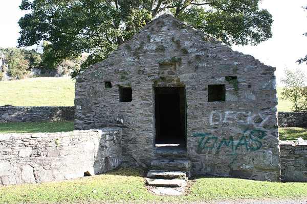
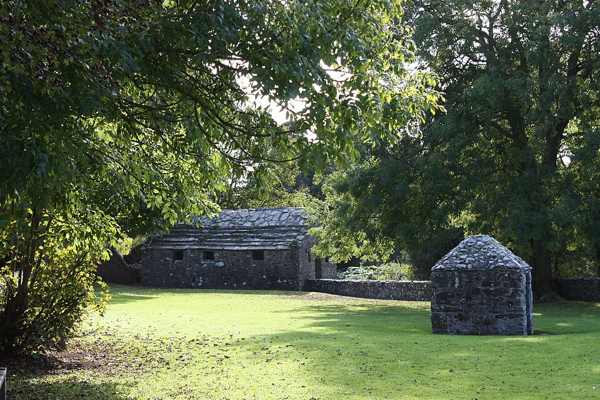
Historic buildings at Struell Wells, photographed in October 2009.
Historic buildings at Struell Wells, photographed in October 2009. Photo: Ardfern ↗ · CC BY-SA 3.0

From research

Is this worth your time?

Choose Struell for a compact heritage visit focused on water, buildings and the history of pilgrimage. The visible structures are later than the site’s earliest associations, so take time to distinguish them. Follow the permitted route and local signs; the historic uses of the wells are part of the story rather than instructions for present-day bathing.

Know before you book: Historic wells and bathing structures; view only the areas currently open to visitors.

Place highlights

What you will actually see

01

Roofed wells

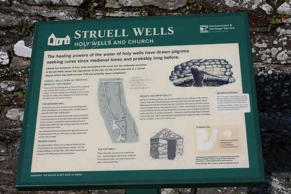
Two roofed wells are fed by the stream running through the site. Look at how the structures organise access to the water, without assuming every opening is intended for visitors to enter. Their form helps explain the practical setting of an old pilgrimage place.

02

Bath houses

Separate bath houses for men and women survive as part of the complex. Compare them from the permitted route and notice how water linked the different structures. A historical description of bathing does not establish that the buildings are operating as bathing facilities today.

03

Unfinished church

The mid-eighteenth-century church appears never to have been completed and may occupy an earlier church site. Its roofless walls add another phase to the valley. Observe masonry from ground level and avoid climbing or entering any section restricted for conservation.

The story behind the visit

The story behind the place

The site is strongly associated with Saint Patrick and is thought to have origins before 1000 AD, although the buildings visible today are much later. That difference is important: an early tradition can belong to a place without making every surviving wall early medieval. The stream provides the physical thread linking wells, bath houses and church across the site. Source ↗

Pilgrimage was especially popular here from the seventeenth century into the 1840 s, when the waters were believed to possess curative powers. Present that belief as part of the historical experience of pilgrims, not as an established property of the water. Looking at the separate structures helps make the history concrete: people approached, washed and worshipped within a setting shaped around a flowing stream. The unfinished church also shows that a religious site can contain plans and changes as well as completed buildings. A short, careful circuit can reveal those layers without adding unsupported stories or treating fragile remains as recreational equipment. Source ↗

Visitor information

Tickets, timing and access

Opening
DfC lists public entry, with possible temporary works restrictions.Confirm with the operator ↗
Admission
Entry is free.Confirm with the operator ↗
Booking
No ordinary timed admission is listed.Confirm with the operator ↗
Access
Historic masonry and water features; follow the permitted route.Confirm with the operator ↗
Duration
Allow 30–45 minutes for the complex.Confirm with the operator ↗
Seasonal
Wet ground and short daylight may affect the visit.Confirm with the operator ↗

Getting to the entrance

The official location is off the Ardglass Road near Downpatrick; use the signed approach to the wells. Official visitor information ↗

Your questions, answered

Confirm current access and visitor arrangements with the operator.

Are all the buildings from Saint Patrick’s time?

No. The surviving buildings are much later than the earliest associations. Source ↗

What connects the different structures?

The stream feeds the roofed wells and bath-house complex. Source ↗

Nearby options

Nearby places to explore

Explore other places in the area, then use live directions to plan your journey.

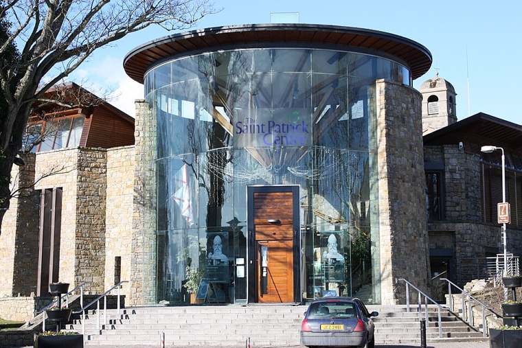
The Saint Patrick Centre entrance in Downpatrick.
The Saint Patrick Centre entrance in Downpatrick. Photo: Ardfern ↗ · CC BY-SA 3.0

heritage

The Saint Patrick Centre

The Saint Patrick Centre introduces Patrick through an audiovisual exhibition that draws on his writings and examines how later storytellers shaped his reputation. It provides useful context before exploring…

Open place page →
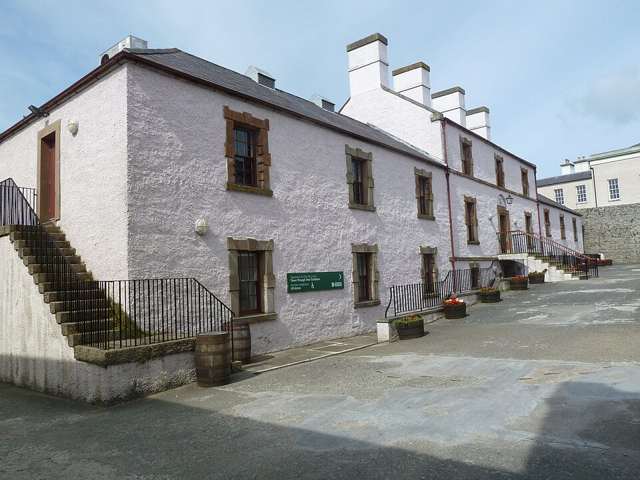
Historic building at Down County Museum
Historic building at Down County Museum. Source photograph: 2010-02-28 20:12:28. Appearance, displays and access may have changed. Photo: Notafly ↗ · CC BY-SA 3.0

heritage

Down County Museum

Down County Museum occupies Downpatrick’s former county gaol, combining local history with the evidence of a historic prison. It gives a broader view of County Down than a single monument can offer, with…

Open place page →
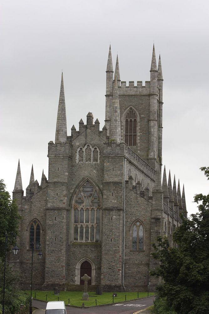
Down Cathedral in Downpatrick
Down Cathedral in Downpatrick. Credited source photograph; appearance and access may have changed. Resized from the original. Photo: Ardfern ↗ · CC BY-SA 3.0

heritage

Down Cathedral

Down Cathedral sits above Downpatrick, where the hill, churchyard and association with Saint Patrick create a quieter stop than a conventional museum visit. It remains a working place of worship.

Open place page →
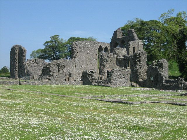
The stone ruins of Inch Abbey
The stone ruins of Inch Abbey. Credited source photograph; appearance and access may have changed. Resized from the original. Photo: Brian Shaw ↗ · CC BY-SA 2.0

heritage

Inch Abbey

Inch Abbey is an open-air ruin where the surviving church walls do much of the storytelling. The surrounding landscape helps you imagine a monastic precinct, provided you take time to read what remains.

Open place page →
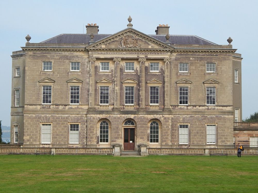
Castle Ward house
Castle Ward house. Credited source photograph; appearance and access may have changed. Resized from the original. Photo: Irishdeltaforce ↗ · CC BY-SA 3.0

heritage

Castle Ward

Castle Ward rewards visitors who notice differences: the house presents contrasting architectural faces, while its estate stretches towards Strangford Lough. The better visit leaves room for both the domestic…

Open place page →

External visitor reviews

Find the matching listing and reviews on Google Maps ↗

Part of a bigger journey

Location & access

Getting your bearings

Historic wells and bathing structures; view only the areas currently open to visitors.

54.32433, -5.67726 · Reference point; confirm the correct entrance and access. Map © OpenStreetMap contributors.

Orientation only: a verified public entrance is not established by this pin. Use the operator arrival information before travel.

Sources & place context

Browse more Ireland places →