Skip to content
TheLazyNick

coast · Donegal

Árainn Mhór (Arranmore Island)

Árainn Mhór, or Arranmore, is an inhabited island reached by ferry from Burtonport. Beaches, rocky uplands and sea views make it an outing to plan around transport rather than a quick roadside stop. Give the island ample time and keep the confirmed return sailing central to your plans.

Add to planSaved trips & places

Saved on this browser. No account needed.

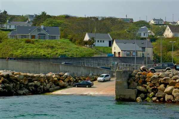
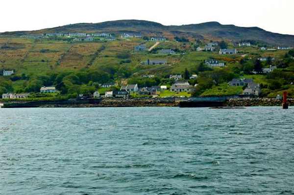
Leabgarrow on Arranmore Island seen from the water
Leabgarrow on Arranmore Island seen from the water. Resized for display. Photo: Joseph Mischyshyn ↗ · CC BY-SA 2.0

From research

Is this worth your time?

Choose Arranmore if the ferry journey and time on an inhabited island appeal as much as a list of sights. A modest outing need not tackle the full island route. Decide what you can comfortably reach before sailing, and leave spare time instead of building an itinerary around the last possible return.

Know before you book: Published timetables do not include every cancellation or last-minute change. Confirm outward and return travel with the same operator and respect private land.

Place highlights

What you will actually see

01

The arrival shore

Begin by getting your bearings near the arrival point. Look at the relationship between island settlement and the sheltered landing, then choose a realistic walking plan. Public roads serve residents as well as visitors, so keep vehicles and local access clear.

02

Beaches and rocky scenery

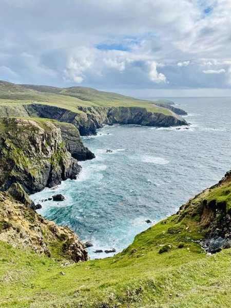
Choose an accessible beach or a permitted viewpoint that fits your time and conditions. The island combines sandy shore with rugged ground, and a short coastal look can be rewarding without approaching exposed edges or committing to a long route.

03

The mainland view

Pause to look back towards Donegal when visibility permits. The sea separates the island from the mainland physically, but regular travel connects the communities. Keep that practical relationship in mind as you plan the return rather than treating the island as an empty wilderness.

The story behind the visit

The story behind the place

Arranmore is Donegal’s largest inhabited offshore island and forms part of its Gaeltacht landscape. Fáilte Ireland describes a rugged coast with beaches, cliffs, sea caves and upland views. These features belong to a community rather than an unrestricted outdoor playground. Roads, homes and working places are part of the setting, so a considerate visit combines interest in the landscape with attention to local movement and privacy. Select a few accessible places rather than assuming every headland can be reached. Source ↗

The island has a long history of occupation, and its surviving archaeological sites add depth to the natural scenery. Fáilte Ireland also records a waymarked walking route, but a day visit need not become a full island circuit. The ferry timetable creates a clear practical boundary: choose a route that leaves a comfortable margin for the return. Winter services are published, while weather and operational changes remain separate considerations. A scheduled sailing is a planning reference rather than a promise that conditions cannot interrupt travel. Source ↗

Visitor information

Tickets, timing and access

Opening
Use the operator’s date-specific timetable; winter services are published.Confirm with the operator ↗
Admission
Buy the appropriate passenger or vehicle ticket; confirm current fares directly.Confirm with the operator ↗
Booking
Book outward and return travel and check the operator’s latest service messages.Confirm with the operator ↗
Access
Choose public roads and signed routes; ferry accessibility needs advance discussion with the operator.Confirm with the operator ↗
Duration
Allow 4–5 hours on the island, plus separate ferry and mainland transfer time.Confirm with the operator ↗
Seasonal
Sea conditions may disrupt sailings. Keep plans flexible and reconfirm the return.Confirm with the operator ↗

Getting to the entrance

Ferries leave Burtonport. Check the exact operator, departure point and arrival instructions on your booking; different services publish separate timetables. Official visitor information ↗

Your questions, answered

Confirm current access and visitor arrangements with the operator.

Is the ferry guaranteed in winter?

No. Published winter sailings remain subject to weather and operational changes. Source ↗

Must I walk the whole island route?

No. Choose a shorter permitted outing that leaves ample return-sailing time. Source ↗

Nearby options

Nearby places to explore

Explore other places in the area, then use live directions to plan your journey.

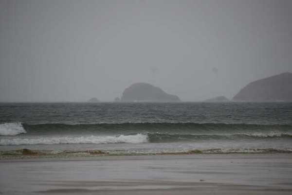
Sea and distant headlands from Carrickfinn Beach
Sea and distant headlands from Carrickfinn Beach. Resized for display. Photo: N Chadwick ↗ · CC BY-SA 2.0

coast

Carrickfinn Beach

Carrickfinn combines a broad sandy shore with a substantial dune system beside Gweedore Bay. The attraction is the meeting of open sand, sheltered landward habitats and the changing Atlantic edge. Make the…

Open place page →
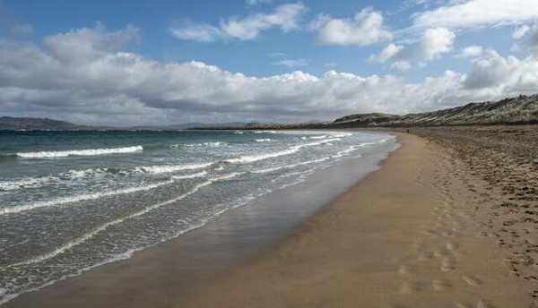
Waves along Narin Strand
Waves along Narin Strand. Resized for display. Photo: Rossographer ↗ · CC BY-SA 2.0

coast

Narin Beach

Narin Beach, also recorded as Naran, is an extensive sandy shore beside Portnoo on Donegal’s Atlantic coast. A substantial dune system and a wide coastal setting give it more interest than a simple waterside…

Open place page →

External visitor reviews

Find the matching listing and reviews on Google Maps ↗

Part of a bigger journey

Location & access

Getting your bearings

Published timetables do not include every cancellation or last-minute change. Confirm outward and return travel with the same operator and respect private land.

54.98743, -8.53506 · Reference point; confirm the correct entrance and access. Map © OpenStreetMap contributors.

Orientation only: a verified public entrance is not established by this pin. Use the operator arrival information before travel.

Sources & place context

Browse more Ireland places →